Идентификатор сделки: 685343
Тип объекта сделки | Тип объекта сделки: Земля |
|---|---|
Объект | Объект: Земля |
Кадастровый номер объекта | |
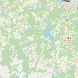
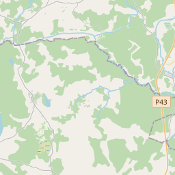
Административная территория | Административная территория: Kalncempju pag., Alūksnes nov. |
Дата сделки | Дата сделки: |
Административная территория | |
|---|---|
Идентификатор адреса | Идентификатор адреса: 100010283 |
Kомпании, зарегистрированные по адресу
| |
Подразделения, зарегистрированные по адресу
| |
Учреждения, зарегистрированные по адресу
| |
Недвижимость по адресу
| |
Сделки по адресу
|
|
{"7201070000":{"name":"<div class='color_dot' style='background-color: #00ff00'><\/div><span>\u0422\u0435\u0440\u0440\u0438\u0442\u043e\u0440\u0438\u0438 \u0441 \u043d\u0430\u0447\u0430\u0442\u044b\u043c \u0438\u0437\u043c\u0435\u0440\u0435\u043d\u0438\u0435\u043c \u0437\u0435\u043c\u043b\u0438<\/span>","featureColor":"#00ff00","features":{"type":"FeatureCollection","features":[{"type":"Feature","geometry":{"type":"Polygon","coordinates":[[[26.943776941,57.343689239],[26.943740389,57.343098886],[26.943730921,57.342941611],[26.944505951,57.342913545],[26.947236864,57.342784267],[26.947785796,57.343512989],[26.946546476,57.343864997],[26.94581771,57.343835188],[26.943776941,57.343689239]]]},"crs":{"type":"name","properties":{"name":"urn:ogc:def:crs:EPSG:3059"}},"properties":{"style":{"color":"#00ff00","dashArray":"0","weight":1},"name":"\u0422\u0435\u0440\u0440\u0438\u0442\u043e\u0440\u0438\u0438 \u0441 \u043d\u0430\u0447\u0430\u0442\u044b\u043c \u0438\u0437\u043c\u0435\u0440\u0435\u043d\u0438\u0435\u043c \u0437\u0435\u043c\u043b\u0438","object_type":"SurveyingStatus","parcel_code":"36640030024","code":null,"surveyor":"Ametrs SIA, 24.11.2022.","address":"","ownership":"<span>\u0412\u043b\u0430\u0434\u0435\u043b\u0435\u0446 - \u042e\u0440\u0438\u0434\u0438\u0447\u0435\u0441\u043a\u043e\u0435 \u043b\u0438\u0446\u043e<br><\/span>","pro_cadastre_nr":"36640030023"}},{"type":"Feature","geometry":{"type":"Polygon","coordinates":[[[26.923430881,57.341999284],[26.923534357,57.341958887],[26.923714866,57.341888413],[26.924258611,57.341665652],[26.92401395,57.340900225],[26.924420164,57.340395808],[26.925765355,57.340561632],[26.927965922,57.34005925],[26.930297159,57.339576406],[26.931406936,57.339349752],[26.931784164,57.338271063],[26.931934946,57.337704176],[26.933219554,57.337213417],[26.933928626,57.336498684],[26.935456905,57.337077647],[26.93569482,57.337261487],[26.936188121,57.337714861],[26.9365681,57.338082376],[26.938171584,57.338288358],[26.938521063,57.339346683],[26.937674112,57.339175199],[26.936730378,57.339979713],[26.936261798,57.339886332],[26.935225664,57.339844927],[26.934665069,57.340163671],[26.933848995,57.340385175],[26.93346301,57.341302354],[26.932860113,57.342075662],[26.934526829,57.342216386],[26.937967949,57.342718019],[26.939367159,57.342956067],[26.939339699,57.34324239],[26.939321188,57.343413189],[26.939375011,57.343684023],[26.939449332,57.343942801],[26.939584174,57.344153849],[26.933830243,57.343651606],[26.926668696,57.343051191],[26.925568259,57.342958892],[26.925347084,57.342940336],[26.925279377,57.342811866],[26.925156335,57.342678858],[26.925068597,57.342591963],[26.924889404,57.342413623],[26.924762993,57.342343761],[26.924542879,57.342304219],[26.924326727,57.342256792],[26.924070103,57.342195224],[26.923958619,57.342175275],[26.923430881,57.341999284]]]},"crs":{"type":"name","properties":{"name":"urn:ogc:def:crs:EPSG:3059"}},"properties":{"style":{"color":"#00ff00","dashArray":"0","weight":1},"name":"\u0422\u0435\u0440\u0440\u0438\u0442\u043e\u0440\u0438\u0438 \u0441 \u043d\u0430\u0447\u0430\u0442\u044b\u043c \u0438\u0437\u043c\u0435\u0440\u0435\u043d\u0438\u0435\u043c \u0437\u0435\u043c\u043b\u0438","object_type":"SurveyingStatus","parcel_code":"36640030023","code":null,"surveyor":"Ametrs SIA, 24.11.2022.","address":"","ownership":"<span>\u0412\u043b\u0430\u0434\u0435\u043b\u0435\u0446 - \u042e\u0440\u0438\u0434\u0438\u0447\u0435\u0441\u043a\u043e\u0435 \u043b\u0438\u0446\u043e<br><\/span>","pro_cadastre_nr":"36640030023"}}]}},"7201060510":{"name":"<div class='color_dot' style='background-color: #ff00ff'><\/div><span>\u041e\u0448\u0438\u0431\u043e\u0447\u043d\u044b\u0435 \u0437\u0435\u043c\u0435\u043b\u044c\u043d\u044b\u0435 \u0435\u0434\u0438\u043d\u0438\u0446\u044b<\/span>","featureColor":"#ff00ff","features":{"type":"FeatureCollection","features":[{"type":"Feature","geometry":{"type":"Polygon","coordinates":[[[26.943680982,57.342624993],[26.944464603,57.342614819],[26.947324654,57.342738654],[26.947878049,57.343535454],[26.946546476,57.343864997],[26.94581771,57.343835188],[26.943776941,57.343689239],[26.943740389,57.343098886],[26.943680982,57.342624993]]]},"crs":{"type":"name","properties":{"name":"urn:ogc:def:crs:EPSG:3059"}},"properties":{"style":{"color":"#ff00ff","dashArray":"0","weight":1},"name":"\u041e\u0448\u0438\u0431\u043e\u0447\u043d\u044b\u0435 \u0437\u0435\u043c\u0435\u043b\u044c\u043d\u044b\u0435 \u0435\u0434\u0438\u043d\u0438\u0446\u044b","object_type":"ParcelError","parcel_code":"36640030024","code":null,"surveyor":null,"address":"","ownership":"<span>\u0412\u043b\u0430\u0434\u0435\u043b\u0435\u0446 - \u042e\u0440\u0438\u0434\u0438\u0447\u0435\u0441\u043a\u043e\u0435 \u043b\u0438\u0446\u043e<br><\/span>","pro_cadastre_nr":"36640030023"}}]}},"7201060110":{"name":"<div class='color_dot' style='background-color: #00ffff'><\/div><span>\u0418\u0437\u043c\u0435\u0440\u0435\u043d\u043d\u0430\u044f \u0437\u0435\u043c\u0435\u043b\u044c\u043d\u0430\u044f \u0435\u0434\u0438\u043d\u0438\u0446\u0430<\/span>","featureColor":"#00ffff","features":{"type":"FeatureCollection","features":[{"type":"Feature","geometry":{"type":"Polygon","coordinates":[[[26.943675553,57.343488314],[26.943730921,57.342941611],[26.944505951,57.342913545],[26.947236864,57.342784267],[26.947785796,57.343512989],[26.946443225,57.343747831],[26.945881454,57.343707495],[26.943675553,57.343488314]]]},"crs":{"type":"name","properties":{"name":"urn:ogc:def:crs:EPSG:3059"}},"properties":{"style":{"color":"#00ffff","dashArray":"0","weight":1},"name":"\u0417\u0435\u043c\u043b\u044f","object_type":"Parcel","parcel_code":"36640030024","code":null,"surveyor":null,"address":"","ownership":"<span>\u0412\u043b\u0430\u0434\u0435\u043b\u0435\u0446 - \u042e\u0440\u0438\u0434\u0438\u0447\u0435\u0441\u043a\u043e\u0435 \u043b\u0438\u0446\u043e<br><\/span>","pro_cadastre_nr":"36640030023"}},{"type":"Feature","geometry":{"type":"Polygon","coordinates":[[[26.923430881,57.341999284],[26.923534357,57.341958887],[26.923714866,57.341888413],[26.92430293,57.341655436],[26.923988395,57.340879042],[26.924254101,57.340404945],[26.925608006,57.340539497],[26.927739662,57.340085388],[26.930188341,57.339541453],[26.931074096,57.339324317],[26.931849996,57.338323932],[26.932117964,57.337713346],[26.933166819,57.337254095],[26.934094424,57.336481262],[26.935468094,57.337002112],[26.935519679,57.336983283],[26.935623982,57.337066844],[26.93616145,57.337604824],[26.936358845,57.337815251],[26.936708401,57.338131481],[26.937044733,57.338174695],[26.937235014,57.338210652],[26.937495933,57.338266744],[26.937967579,57.338389565],[26.93798483,57.338370198],[26.938621172,57.339308544],[26.937726748,57.339219853],[26.936780099,57.340001201],[26.936228849,57.339890651],[26.935171026,57.339871368],[26.934727884,57.340128043],[26.933853092,57.340356111],[26.933534317,57.341265827],[26.932905221,57.342093268],[26.934594497,57.342232549],[26.937910148,57.342720726],[26.939361179,57.342941565],[26.939397159,57.342947043],[26.939406674,57.343090375],[26.939393949,57.343193396],[26.939458724,57.343386642],[26.939464831,57.343617282],[26.93948208,57.34372885],[26.939519395,57.343794678],[26.93957085,57.34388286],[26.939658029,57.343986206],[26.939700045,57.344143241],[26.939636397,57.344137915],[26.933830279,57.343651641],[26.926668696,57.343051191],[26.925568259,57.342958892],[26.925347084,57.342940336],[26.925279377,57.342811866],[26.925156335,57.342678858],[26.925068597,57.342591963],[26.924889404,57.342413623],[26.924762993,57.342343761],[26.924542879,57.342304219],[26.924326727,57.342256792],[26.924070103,57.342195224],[26.923958619,57.342175275],[26.923430881,57.341999284]]]},"crs":{"type":"name","properties":{"name":"urn:ogc:def:crs:EPSG:3059"}},"properties":{"style":{"color":"#00ffff","dashArray":"0","weight":1},"name":"\u0417\u0435\u043c\u043b\u044f","object_type":"Parcel","parcel_code":"36640030023","code":null,"surveyor":null,"address":"","ownership":"<span>\u0412\u043b\u0430\u0434\u0435\u043b\u0435\u0446 - \u042e\u0440\u0438\u0434\u0438\u0447\u0435\u0441\u043a\u043e\u0435 \u043b\u0438\u0446\u043e<br><\/span>","pro_cadastre_nr":"36640030023"}}]}},"7114100000":{"name":"<div class='color_dot' style='background-color: #b40000'><\/div><span>\u0422\u0435\u0440\u0440\u0438\u0442\u043e\u0440\u0438\u044f \u0441\u0435\u0440\u0432\u0438\u0442\u0443\u0442\u0430 \u0434\u043e\u0440\u043e\u0436\u043d\u044b\u0445 \u043e\u0431\u0440\u0435\u043c\u0435\u043d\u0435\u043d\u0438\u0439<\/span>","featureColor":"#b40000","features":{"type":"FeatureCollection","features":[{"type":"Feature","geometry":{"type":"Polygon","coordinates":[[[26.939665224,57.344139372],[26.939625979,57.343991835],[26.939539164,57.343888265],[26.939450317,57.343734114],[26.939448985,57.343730343],[26.939431619,57.343617537],[26.939426031,57.343389841],[26.939361256,57.343196596],[26.939360805,57.343192202],[26.939373478,57.343091017],[26.939363962,57.342947684],[26.939365381,57.342943183],[26.939397159,57.342947043],[26.939406674,57.343090375],[26.939393949,57.343193396],[26.939458724,57.343386642],[26.939464831,57.343617282],[26.93948208,57.34372885],[26.939519395,57.343794678],[26.93957085,57.34388286],[26.939658029,57.343986206],[26.939700045,57.344143241],[26.939665224,57.344139372]]]},"crs":{"type":"name","properties":{"name":"urn:ogc:def:crs:EPSG:3059"}},"properties":{"style":{"color":"#b40000","dashArray":"4,2,1,2","weight":1},"name":"\u0422\u0435\u0440\u0440\u0438\u0442\u043e\u0440\u0438\u044f \u0441\u0435\u0440\u0432\u0438\u0442\u0443\u0442\u0430 \u0434\u043e\u0440\u043e\u0436\u043d\u044b\u0445 \u043e\u0431\u0440\u0435\u043c\u0435\u043d\u0435\u043d\u0438\u0439","object_type":"WayRestriction","parcel_code":"36640030023","code":"7315030100004","surveyor":null,"address":"","ownership":"<span>\u0412\u043b\u0430\u0434\u0435\u043b\u0435\u0446 - \u042e\u0440\u0438\u0434\u0438\u0447\u0435\u0441\u043a\u043e\u0435 \u043b\u0438\u0446\u043e<br><\/span>","pro_cadastre_nr":"36640030023"}},{"type":"Feature","geometry":{"type":"Polygon","coordinates":[[[26.938621172,57.339308544],[26.938592761,57.339305586],[26.937970022,57.338387279],[26.93798483,57.338370198],[26.938621172,57.339308544]]]},"crs":{"type":"name","properties":{"name":"urn:ogc:def:crs:EPSG:3059"}},"properties":{"style":{"color":"#b40000","dashArray":"4,2,1,2","weight":1},"name":"\u0422\u0435\u0440\u0440\u0438\u0442\u043e\u0440\u0438\u044f \u0441\u0435\u0440\u0432\u0438\u0442\u0443\u0442\u0430 \u0434\u043e\u0440\u043e\u0436\u043d\u044b\u0445 \u043e\u0431\u0440\u0435\u043c\u0435\u043d\u0435\u043d\u0438\u0439","object_type":"WayRestriction","parcel_code":"36640030023","code":"7315030100005","surveyor":null,"address":"","ownership":"<span>\u0412\u043b\u0430\u0434\u0435\u043b\u0435\u0446 - \u042e\u0440\u0438\u0434\u0438\u0447\u0435\u0441\u043a\u043e\u0435 \u043b\u0438\u0446\u043e<br><\/span>","pro_cadastre_nr":"36640030023"}},{"type":"Feature","geometry":{"type":"Polygon","coordinates":[[[26.938521063,57.339346683],[26.938490672,57.339338917],[26.938154125,57.338286411],[26.938171584,57.338288358],[26.938521063,57.339346683]]]},"crs":{"type":"name","properties":{"name":"urn:ogc:def:crs:EPSG:3059"}},"properties":{"style":{"color":"#b40000","dashArray":"4,2,1,2","weight":1},"name":"\u0422\u0435\u0440\u0440\u0438\u0442\u043e\u0440\u0438\u044f \u0441\u0435\u0440\u0432\u0438\u0442\u0443\u0442\u0430 \u0434\u043e\u0440\u043e\u0436\u043d\u044b\u0445 \u043e\u0431\u0440\u0435\u043c\u0435\u043d\u0435\u043d\u0438\u0439","object_type":"WayRestriction","parcel_code":"36640030023","code":"7315030100002","surveyor":null,"address":"","ownership":"<span>\u0412\u043b\u0430\u0434\u0435\u043b\u0435\u0446 - \u042e\u0440\u0438\u0434\u0438\u0447\u0435\u0441\u043a\u043e\u0435 \u043b\u0438\u0446\u043e<br><\/span>","pro_cadastre_nr":"36640030023"}},{"type":"Feature","geometry":{"type":"Polygon","coordinates":[[[26.939584174,57.344153849],[26.939547671,57.344147872],[26.939418417,57.343956807],[26.939289228,57.343426384],[26.939337307,57.342953205],[26.939367159,57.342956067],[26.939339699,57.34324239],[26.939321188,57.343413189],[26.939375011,57.343684023],[26.939449332,57.343942801],[26.939584174,57.344153849]]]},"crs":{"type":"name","properties":{"name":"urn:ogc:def:crs:EPSG:3059"}},"properties":{"style":{"color":"#b40000","dashArray":"4,2,1,2","weight":1},"name":"\u0422\u0435\u0440\u0440\u0438\u0442\u043e\u0440\u0438\u044f \u0441\u0435\u0440\u0432\u0438\u0442\u0443\u0442\u0430 \u0434\u043e\u0440\u043e\u0436\u043d\u044b\u0445 \u043e\u0431\u0440\u0435\u043c\u0435\u043d\u0435\u043d\u0438\u0439","object_type":"WayRestriction","parcel_code":"36640030023","code":"7315030100001","surveyor":null,"address":"","ownership":"<span>\u0412\u043b\u0430\u0434\u0435\u043b\u0435\u0446 - \u042e\u0440\u0438\u0434\u0438\u0447\u0435\u0441\u043a\u043e\u0435 \u043b\u0438\u0446\u043e<br><\/span>","pro_cadastre_nr":"36640030023"}}]}}}
{"7201060210":{"name":"<div class='color_dot' style='background-color: #00ffff'><\/div><span>\u0423\u043a\u0430\u0437\u0430\u043d\u043d\u0430\u044f \u0437\u0435\u043c\u0435\u043b\u044c\u043d\u0430\u044f \u0435\u0434\u0438\u043d\u0438\u0446\u0430<\/span>","featureColor":"#00ffff","features":{"type":"FeatureCollection","features":[{"type":"Feature","geometry":{"type":"Polygon","coordinates":[[[26.943776941,57.343689239],[26.943740389,57.343098886],[26.943730921,57.342941611],[26.944505951,57.342913545],[26.947236864,57.342784267],[26.947785796,57.343512989],[26.946546476,57.343864997],[26.94581771,57.343835188],[26.943776941,57.343689239]]]},"crs":{"type":"name","properties":{"name":"urn:ogc:def:crs:EPSG:3059"}},"properties":{"style":{"color":"#00ffff","dashArray":"8,12","weight":1},"name":"\u0417\u0435\u043c\u043b\u044f","object_type":"Parcel","parcel_code":"36640030024","code":null,"surveyor":null,"address":"","ownership":null,"pro_cadastre_nr":null}},{"type":"Feature","geometry":{"type":"Polygon","coordinates":[[[26.923430881,57.341999284],[26.923534357,57.341958887],[26.923714866,57.341888413],[26.924258611,57.341665652],[26.92401395,57.340900225],[26.924420164,57.340395808],[26.925765355,57.340561632],[26.927965922,57.34005925],[26.930297159,57.339576406],[26.931406936,57.339349752],[26.931784164,57.338271063],[26.931934946,57.337704176],[26.933219554,57.337213417],[26.933928626,57.336498684],[26.935456905,57.337077647],[26.93569482,57.337261487],[26.936188121,57.337714861],[26.9365681,57.338082376],[26.938171584,57.338288358],[26.938521063,57.339346683],[26.937674112,57.339175199],[26.936730378,57.339979713],[26.936261798,57.339886332],[26.935225664,57.339844927],[26.934665069,57.340163671],[26.933848995,57.340385175],[26.93346301,57.341302354],[26.932860113,57.342075662],[26.934526829,57.342216386],[26.937967949,57.342718019],[26.939367159,57.342956067],[26.939339699,57.34324239],[26.939321188,57.343413189],[26.939375011,57.343684023],[26.939449332,57.343942801],[26.939584174,57.344153849],[26.933830243,57.343651606],[26.926668696,57.343051191],[26.925568259,57.342958892],[26.925347084,57.342940336],[26.925279377,57.342811866],[26.925156335,57.342678858],[26.925068597,57.342591963],[26.924889404,57.342413623],[26.924762993,57.342343761],[26.924542879,57.342304219],[26.924326727,57.342256792],[26.924070103,57.342195224],[26.923958619,57.342175275],[26.923430881,57.341999284]]]},"crs":{"type":"name","properties":{"name":"urn:ogc:def:crs:EPSG:3059"}},"properties":{"style":{"color":"#00ffff","dashArray":"8,12","weight":1},"name":"\u0417\u0435\u043c\u043b\u044f","object_type":"Parcel","parcel_code":"36640030023","code":null,"surveyor":null,"address":"","ownership":null,"pro_cadastre_nr":null}}]}}}
https://tile.openstreetmap.org/{z}/{x}/{y}.png|© OpenStreetMap contributors|minZoom: 7|maxZoom: 19
|
Источник данных: Открытые данные базы данных рынка, Открытые данные кадастровой информационной системы, Creative Commons Attribution, OpenStreetMap

