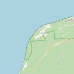
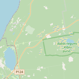
Land unit (cadastre designation: 98660080006)
Cadastre designation: 98660080006
Address: "Lagzdiņi", Tārgales pagasts, Ventspils novads, LV-3601
Cadastre designation of real estate | |
|---|---|
Cadastral object type | Cadastral object type: Land unit |
Address | Address: "Lagzdiņi", Tārgales pagasts, Ventspils novads, LV-3601 |
Cadastre number of the real estate in which this land unit is included | Cadastre number of the real estate in which this land unit is included: 98660080006 |
Address | |
|---|---|
Address ID | Address ID: 102797028 |
Companies registered at the address | Companies registered at the address: 0 |
Departments registered at the address | Departments registered at the address: 0 |
Institutions registered at the address | Institutions registered at the address: 0 |
Real estate registered at the address | |
Transactions with real estate at the address |
|
|
|
{"7201060210":{"name":"<div class='color_dot' style='background-color: #00ffff'><\/div><span>Specified land unit<\/span>","featureColor":"#00ffff","features":{"type":"FeatureCollection","features":[{"type":"Feature","geometry":{"type":"Polygon","coordinates":[[[21.683191828,57.48949042],[21.683523897,57.487878028],[21.685282475,57.488130134],[21.686687256,57.488686699],[21.686185046,57.489141309],[21.685058418,57.489092425],[21.684990972,57.489089498],[21.684911775,57.489500442],[21.684848271,57.489500076],[21.683191828,57.48949042]]]},"crs":{"type":"name","properties":{"name":"urn:ogc:def:crs:EPSG:3059"}},"properties":{"style":{"color":"#00ffff","dashArray":"8,12","weight":1},"name":"Land","object_type":"Parcel","parcel_code":"98660080054","code":null,"surveyor":null,"address":"","ownership":"<span>Owner - Legal entity<br><\/span>","pro_cadastre_nr":"98660080006"}},{"type":"Feature","geometry":{"type":"Polygon","coordinates":[[[21.682516614,57.485049434],[21.684468628,57.484244504],[21.683593843,57.483406533],[21.683860015,57.483336804],[21.684298617,57.483237802],[21.684592544,57.483181583],[21.684724798,57.483156281],[21.685398797,57.483083245],[21.685990994,57.483010707],[21.686786104,57.484851426],[21.686934987,57.48474213],[21.687397656,57.484545756],[21.687649469,57.484434511],[21.687835249,57.484337698],[21.68796537,57.484279645],[21.688495247,57.484048727],[21.688869129,57.483877579],[21.688959241,57.483840088],[21.689798337,57.483485939],[21.689855496,57.483431283],[21.689897835,57.483613366],[21.689933335,57.484291264],[21.690026714,57.485447336],[21.6873168,57.48517537],[21.687477501,57.485881363],[21.686228647,57.485812796],[21.685104482,57.485702637],[21.682516614,57.485049434]]]},"crs":{"type":"name","properties":{"name":"urn:ogc:def:crs:EPSG:3059"}},"properties":{"style":{"color":"#00ffff","dashArray":"8,12","weight":1},"name":"Land","object_type":"Parcel","parcel_code":"98660080006","code":null,"surveyor":null,"address":"\"Lagzdi\u0146i\", T\u0101rgales pag., Ventspils nov., LV-3601","ownership":"<span>Owner - Legal entity<br><\/span>","pro_cadastre_nr":"98660080006"}},{"type":"Feature","geometry":{"type":"Polygon","coordinates":[[[21.661204089,57.485200174],[21.661772717,57.484230613],[21.662838138,57.482008983],[21.664208188,57.482289357],[21.66476334,57.482360376],[21.665006159,57.482451255],[21.66571147,57.482994925],[21.666332298,57.483089582],[21.6659323,57.484297706],[21.665913266,57.484355169],[21.665576968,57.484038138],[21.664848134,57.483400344],[21.663790136,57.484183253],[21.665638913,57.485203835],[21.663658801,57.485079818],[21.663062868,57.485669638],[21.662184082,57.48576401],[21.661204089,57.485200174]]]},"crs":{"type":"name","properties":{"name":"urn:ogc:def:crs:EPSG:3059"}},"properties":{"style":{"color":"#00ffff","dashArray":"8,12","weight":1},"name":"Land","object_type":"Parcel","parcel_code":"98660070102","code":null,"surveyor":null,"address":"","ownership":"<span>Owner - Legal entity<br><\/span>","pro_cadastre_nr":"98660080006"}}]}},"7114100000":{"name":"<div class='color_dot' style='background-color: #b40000'><\/div><span>Burdened access road servitude area<\/span>","featureColor":"#b40000","features":{"type":"FeatureCollection","features":[{"type":"Feature","geometry":{"type":"Polygon","coordinates":[[[21.684911775,57.489500442],[21.684861538,57.489500152],[21.684941236,57.489086578],[21.685147699,57.488110814],[21.685197144,57.488117901],[21.685246013,57.488124907],[21.685040868,57.489091664],[21.684990972,57.489089498],[21.684911775,57.489500442]]]},"crs":{"type":"name","properties":{"name":"urn:ogc:def:crs:EPSG:3059"}},"properties":{"style":{"color":"#b40000","dashArray":"4,2,1,2","weight":1},"name":"Burdened access road servitude area","object_type":"WayRestriction","parcel_code":"98660080054","code":"7315030100003","surveyor":null,"address":"","ownership":"<span>Owner - Legal entity<br><\/span>","pro_cadastre_nr":"98660080006"}},{"type":"Feature","geometry":{"type":"Polygon","coordinates":[[[21.689855496,57.483431283],[21.689865939,57.483476196],[21.689837034,57.483503836],[21.688989959,57.483861352],[21.688900636,57.483898516],[21.688527183,57.484069467],[21.687997061,57.484300492],[21.687868648,57.484357783],[21.68768278,57.484454641],[21.687429004,57.484566754],[21.686971296,57.484761022],[21.686826072,57.484867633],[21.685563697,57.485747637],[21.685452783,57.485736768],[21.686773415,57.48482205],[21.686786104,57.484851426],[21.686934987,57.48474213],[21.687397656,57.484545756],[21.687649469,57.484434511],[21.687835249,57.484337698],[21.68796537,57.484279645],[21.688495247,57.484048727],[21.688869129,57.483877579],[21.688959241,57.483840088],[21.689798337,57.483485939],[21.689855496,57.483431283]]]},"crs":{"type":"name","properties":{"name":"urn:ogc:def:crs:EPSG:3059"}},"properties":{"style":{"color":"#b40000","dashArray":"4,2,1,2","weight":1},"name":"Burdened access road servitude area","object_type":"WayRestriction","parcel_code":"98660080006","code":"7315030100002","surveyor":null,"address":"\"Lagzdi\u0146i\", T\u0101rgales pag., Ventspils nov., LV-3601","ownership":"<span>Owner - Legal entity<br><\/span>","pro_cadastre_nr":"98660080006"}},{"type":"Feature","geometry":{"type":"Polygon","coordinates":[[[21.661921109,57.485612514],[21.661880237,57.485589196],[21.661843316,57.485567611],[21.662597332,57.484642901],[21.663753936,57.484164257],[21.664788665,57.483398567],[21.663449767,57.482134711],[21.66352316,57.482149172],[21.663591469,57.482163335],[21.664849691,57.483350944],[21.665655876,57.482952072],[21.66571147,57.482994925],[21.664912962,57.483407974],[21.664876865,57.483424195],[21.664848134,57.483400344],[21.663790136,57.484183253],[21.663824589,57.484202971],[21.662678623,57.484677214],[21.661921109,57.485612514]]]},"crs":{"type":"name","properties":{"name":"urn:ogc:def:crs:EPSG:3059"}},"properties":{"style":{"color":"#b40000","dashArray":"4,2,1,2","weight":1},"name":"Burdened access road servitude area","object_type":"WayRestriction","parcel_code":"98660070102","code":"7315030100004","surveyor":null,"address":"","ownership":"<span>Owner - Legal entity<br><\/span>","pro_cadastre_nr":"98660080006"}}]}},"5201011110":{"name":"<div class='color_dot' style='background-color: #ff0000'><\/div><span>Measured building<\/span>","featureColor":"#ff0000","features":{"type":"FeatureCollection","features":[{"type":"Feature","geometry":{"type":"Polygon","coordinates":[[[21.684999515,57.48516862],[21.685038234,57.485205885],[21.684928133,57.485239061],[21.68488943,57.485201796],[21.684999515,57.48516862]]]},"crs":{"type":"name","properties":{"name":"urn:ogc:def:crs:EPSG:3059"}},"properties":{"style":{"color":"#ff0000","dashArray":"0","weight":1},"name":"Building","object_type":"Building","parcel_code":"98660080006","code":"98660080006002","surveyor":null,"address":"\"Lagzdi\u0146i\", T\u0101rgales pag., Ventspils nov., LV-3601","ownership":"<span>Owner - Legal entity<br><\/span>","pro_cadastre_nr":"98660080006"}},{"type":"Feature","geometry":{"type":"Polygon","coordinates":[[[21.685050126,57.485183028],[21.685065364,57.485197703],[21.685038234,57.485205885],[21.685022979,57.48519121],[21.685050126,57.485183028]]]},"crs":{"type":"name","properties":{"name":"urn:ogc:def:crs:EPSG:3059"}},"properties":{"style":{"color":"#ff0000","dashArray":"0","weight":1},"name":"Building","object_type":"Building","parcel_code":"98660080006","code":"98660080006003","surveyor":null,"address":"\"Lagzdi\u0146i\", T\u0101rgales pag., Ventspils nov., LV-3601","ownership":"<span>Owner - Legal entity<br><\/span>","pro_cadastre_nr":"98660080006"}},{"type":"Feature","geometry":{"type":"Polygon","coordinates":[[[21.684987353,57.485034956],[21.685045954,57.485082597],[21.684967618,57.485110551],[21.684984835,57.485124544],[21.684942108,57.48513979],[21.684924891,57.485125798],[21.684866697,57.485146565],[21.684808096,57.485098924],[21.684987353,57.485034956]]]},"crs":{"type":"name","properties":{"name":"urn:ogc:def:crs:EPSG:3059"}},"properties":{"style":{"color":"#ff0000","dashArray":"0","weight":1},"name":"Building","object_type":"Building","parcel_code":"98660080006","code":"98660080006001","surveyor":null,"address":"\"Lagzdi\u0146i\", T\u0101rgales pag., Ventspils nov., LV-3601","ownership":"<span>Owner - Legal entity<br><\/span>","pro_cadastre_nr":"98660080006"}},{"type":"Feature","geometry":{"type":"Polygon","coordinates":[[[21.68437257,57.485392781],[21.684321154,57.485397138],[21.684305456,57.485343339],[21.684356872,57.485338981],[21.68437257,57.485392781]]]},"crs":{"type":"name","properties":{"name":"urn:ogc:def:crs:EPSG:3059"}},"properties":{"style":{"color":"#ff0000","dashArray":"0","weight":1},"name":"Building","object_type":"Building","parcel_code":"98660080006","code":"98660080006004","surveyor":null,"address":"\"Lagzdi\u0146i\", T\u0101rgales pag., Ventspils nov., LV-3601","ownership":"<span>Owner - Legal entity<br><\/span>","pro_cadastre_nr":"98660080006"}},{"type":"Feature","geometry":{"type":"Polygon","coordinates":[[[21.685398341,57.485712381],[21.685314498,57.485633563],[21.68540807,57.485602419],[21.685490523,57.48568291],[21.685398341,57.485712381]]]},"crs":{"type":"name","properties":{"name":"urn:ogc:def:crs:EPSG:3059"}},"properties":{"style":{"color":"#ff0000","dashArray":"0","weight":1},"name":"Building","object_type":"Building","parcel_code":"98660080006","code":"98660080006009","surveyor":null,"address":"\"Lagzdi\u0146i\", T\u0101rgales pag., Ventspils nov., LV-3601","ownership":"<span>Owner - Legal entity<br><\/span>","pro_cadastre_nr":"98660080006"}},{"type":"Feature","geometry":{"type":"Polygon","coordinates":[[[21.684999515,57.48516862],[21.685038234,57.485205885],[21.684928133,57.485239061],[21.68488943,57.485201796],[21.684999515,57.48516862]]]},"crs":{"type":"name","properties":{"name":"urn:ogc:def:crs:EPSG:3059"}},"properties":{"style":{"color":"#ff0000","dashArray":"0","weight":1},"name":"Building","object_type":"Building","parcel_code":"98660080006","code":"98660080006002","surveyor":null,"address":"\"Lagzdi\u0146i\", T\u0101rgales pag., Ventspils nov., LV-3601","ownership":"<span>Owner - Legal entity<br><\/span>","pro_cadastre_nr":"98660080006"}}]}}}
{"5201011310":{"name":"<div class='color_dot' style='background-color: #960096'><\/div><span>Vectorized building<\/span>","featureColor":"#960096","features":{"type":"FeatureCollection","features":[{"type":"Feature","geometry":{"type":"Polygon","coordinates":[[[21.68499685,57.485181196],[21.685019799,57.485171059],[21.685037885,57.485182929],[21.685014936,57.485193066],[21.68499685,57.485181196]]]},"crs":{"type":"name","properties":{"name":"urn:ogc:def:crs:EPSG:3059"}},"properties":{"style":{"color":"#960096","dashArray":"0","weight":2},"name":"Building","object_type":"Building","parcel_code":"98660080006","code":"98660080006003","surveyor":null,"address":"\"Lagzdi\u0146i\", T\u0101rgales pag., Ventspils nov., LV-3601","ownership":"<span>Owner - Legal entity<br><\/span>","pro_cadastre_nr":"98660080006"}},{"type":"Feature","geometry":{"type":"Polygon","coordinates":[[[21.684870457,57.485204997],[21.684967646,57.485162032],[21.685014936,57.485193066],[21.684917747,57.485236022],[21.684870457,57.485204997]]]},"crs":{"type":"name","properties":{"name":"urn:ogc:def:crs:EPSG:3059"}},"properties":{"style":{"color":"#960096","dashArray":"0","weight":2},"name":"Building","object_type":"Building","parcel_code":"98660080006","code":"98660080006002","surveyor":null,"address":"\"Lagzdi\u0146i\", T\u0101rgales pag., Ventspils nov., LV-3601","ownership":"<span>Owner - Legal entity<br><\/span>","pro_cadastre_nr":"98660080006"}},{"type":"Feature","geometry":{"type":"Polygon","coordinates":[[[21.684747455,57.485100111],[21.684923795,57.485034247],[21.684983003,57.485080219],[21.684806645,57.485146091],[21.684747455,57.485100111]]]},"crs":{"type":"name","properties":{"name":"urn:ogc:def:crs:EPSG:3059"}},"properties":{"style":{"color":"#960096","dashArray":"0","weight":2},"name":"Building","object_type":"Building","parcel_code":"98660080006","code":"98660080006001","surveyor":null,"address":"\"Lagzdi\u0146i\", T\u0101rgales pag., Ventspils nov., LV-3601","ownership":"<span>Owner - Legal entity<br><\/span>","pro_cadastre_nr":"98660080006"}},{"type":"Feature","geometry":{"type":"Polygon","coordinates":[[[21.685392585,57.485533366],[21.685477863,57.485498817],[21.685578615,57.485570945],[21.68549332,57.485605494],[21.685392585,57.485533366]]]},"crs":{"type":"name","properties":{"name":"urn:ogc:def:crs:EPSG:3059"}},"properties":{"style":{"color":"#960096","dashArray":"0","weight":2},"name":"Building","object_type":"Building","parcel_code":"98660080006","code":"98660080006009","surveyor":null,"address":"\"Lagzdi\u0146i\", T\u0101rgales pag., Ventspils nov., LV-3601","ownership":"<span>Owner - Legal entity<br><\/span>","pro_cadastre_nr":"98660080006"}},{"type":"Feature","geometry":{"type":"Polygon","coordinates":[[[21.684626,57.485226712],[21.684672997,57.485237854],[21.684632811,57.485287006],[21.684585798,57.485275854],[21.684626,57.485226712]]]},"crs":{"type":"name","properties":{"name":"urn:ogc:def:crs:EPSG:3059"}},"properties":{"style":{"color":"#960096","dashArray":"0","weight":2},"name":"Building","object_type":"Building","parcel_code":"98660080006","code":"98660080006004","surveyor":null,"address":"\"Lagzdi\u0146i\", T\u0101rgales pag., Ventspils nov., LV-3601","ownership":"<span>Owner - Legal entity<br><\/span>","pro_cadastre_nr":"98660080006"}}]}}}
https://tile.openstreetmap.org/{z}/{x}/{y}.png|© OpenStreetMap contributors|minZoom: 7|maxZoom: 19
|
Land unit data updated: 20.12.2024.
Data source and license: Cadastre Information System open text and spatial data, Real Estate Market Database open data, open data license Creative Commons Attribution, OpenStreetMap

