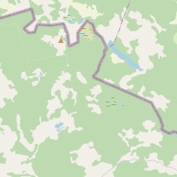
Land unit (cadastre designation: 96720020001)
Cadastre designation: 96720020001
Address: "Apsītes", Naukšēnu pagasts, Valmieras novads, LV-4244
Cadastre designation of real estate | |
|---|---|
Cadastral object type | Cadastral object type: Land unit |
Address | Address: "Apsītes", Naukšēnu pagasts, Valmieras novads, LV-4244 |
Cadastre number of the real estate in which this land unit is included | Cadastre number of the real estate in which this land unit is included: 96720020001 |
Address | |
|---|---|
Address ID | Address ID: 103308656 |
Companies registered at the address | |
Departments registered at the address | Departments registered at the address: 0 |
Institutions registered at the address | Institutions registered at the address: 0 |
Real estate registered at the address | |
Transactions with real estate at the address |
|
|
|
{"7201060210":{"name":"<div class='color_dot' style='background-color: #00ffff'><\/div><span>Specified land unit<\/span>","featureColor":"#00ffff","features":{"type":"FeatureCollection","features":[{"type":"Feature","geometry":{"type":"Polygon","coordinates":[[[25.535075661,57.941376132],[25.535584675,57.9411586],[25.535968834,57.940980719],[25.536188076,57.94101015],[25.536255598,57.940969087],[25.536436886,57.940925122],[25.536643944,57.940809839],[25.536782721,57.940900432],[25.53694208,57.941021543],[25.536851469,57.941155919],[25.537026132,57.941184566],[25.537084364,57.941194112],[25.537107573,57.941286102],[25.537225775,57.941346191],[25.537419704,57.941374605],[25.537555417,57.941393464],[25.537888569,57.941522722],[25.537952063,57.941655234],[25.538070706,57.941725568],[25.538248443,57.941825946],[25.538445462,57.941926082],[25.538603059,57.942006194],[25.538645537,57.942097958],[25.538649485,57.942190181],[25.538788712,57.942291024],[25.539443192,57.94227284],[25.539560962,57.942322682],[25.539679187,57.942382761],[25.539878831,57.942544381],[25.540000554,57.942686446],[25.540158072,57.942769692],[25.54013874,57.942807801],[25.539330402,57.944318574],[25.535874715,57.942115885],[25.535075661,57.941376132]]]},"crs":{"type":"name","properties":{"name":"urn:ogc:def:crs:EPSG:3059"}},"properties":{"style":{"color":"#00ffff","dashArray":"8,12","weight":1},"name":"Land","object_type":"Parcel","parcel_code":"96720020013","code":null,"surveyor":null,"address":"","ownership":"<span>Owner - Natural person<br><\/span>","pro_cadastre_nr":"96720020001"}},{"type":"Feature","geometry":{"type":"Polygon","coordinates":[[[25.54597167,57.932399287],[25.551176869,57.929876481],[25.552934622,57.930339784],[25.557129352,57.93291469],[25.554049763,57.93308071],[25.551721322,57.933143382],[25.547613288,57.93332179],[25.547709096,57.933679903],[25.547552706,57.933706711],[25.547479328,57.933634253],[25.547350441,57.933515236],[25.547085894,57.933285755],[25.546814323,57.933119056],[25.546659409,57.933016022],[25.546072006,57.932509265],[25.54597167,57.932399287]]]},"crs":{"type":"name","properties":{"name":"urn:ogc:def:crs:EPSG:3059"}},"properties":{"style":{"color":"#00ffff","dashArray":"8,12","weight":1},"name":"Land","object_type":"Parcel","parcel_code":"96720020001","code":null,"surveyor":null,"address":"\"Aps\u012btes\", Nauk\u0161\u0113nu pag., Valmieras nov., LV-4244","ownership":"<span>Owner - Natural person<br><\/span>","pro_cadastre_nr":"96720020001"}}]}},"7114100000":{"name":"<div class='color_dot' style='background-color: #b40000'><\/div><span>Burdened access road servitude area<\/span>","featureColor":"#b40000","features":{"type":"FeatureCollection","features":[{"type":"Feature","geometry":{"type":"Polygon","coordinates":[[[25.54597167,57.932399287],[25.546001143,57.932400509],[25.546122637,57.932505693],[25.546698262,57.933004033],[25.547134056,57.933269933],[25.547567153,57.93369862],[25.547552706,57.933706711],[25.547479328,57.933634253],[25.547350441,57.933515236],[25.547085894,57.933285755],[25.546659409,57.933016022],[25.546072006,57.932509265],[25.54597167,57.932399287]]]},"crs":{"type":"name","properties":{"name":"urn:ogc:def:crs:EPSG:3059"}},"properties":{"style":{"color":"#b40000","dashArray":"4,2,1,2","weight":1},"name":"Burdened access road servitude area","object_type":"WayRestriction","parcel_code":"96720020001","code":"7315030100005","surveyor":null,"address":"\"Aps\u012btes\", Nauk\u0161\u0113nu pag., Valmieras nov., LV-4244","ownership":"<span>Owner - Natural person<br><\/span>","pro_cadastre_nr":"96720020001"}}]}},"5201011310":{"name":"<div class='color_dot' style='background-color: #960096'><\/div><span>Vectorized building<\/span>","featureColor":"#960096","features":{"type":"FeatureCollection","features":[{"type":"Feature","geometry":{"type":"Polygon","coordinates":[[[25.549715389,57.932740915],[25.54978691,57.93277728],[25.549716203,57.932816628],[25.549728652,57.932822953],[25.549633568,57.932875867],[25.549537148,57.932826843],[25.549632232,57.932773929],[25.549644682,57.932780263],[25.549715389,57.932740915]]]},"crs":{"type":"name","properties":{"name":"urn:ogc:def:crs:EPSG:3059"}},"properties":{"style":{"color":"#960096","dashArray":"0","weight":2},"name":"Building","object_type":"Building","parcel_code":"96720020001","code":"96720020001002","surveyor":null,"address":"\"Aps\u012btes\", Nauk\u0161\u0113nu pag., Valmieras nov., LV-4244","ownership":"<span>Owner - Natural person<br><\/span>","pro_cadastre_nr":"96720020001"}},{"type":"Feature","geometry":{"type":"Polygon","coordinates":[[[25.548994494,57.932390613],[25.549036717,57.932347121],[25.549196483,57.932391007],[25.549154277,57.932434499],[25.548994494,57.932390613]]]},"crs":{"type":"name","properties":{"name":"urn:ogc:def:crs:EPSG:3059"}},"properties":{"style":{"color":"#960096","dashArray":"0","weight":2},"name":"Building","object_type":"Building","parcel_code":"96720020001","code":"96720020001005","surveyor":null,"address":"\"Aps\u012btes\", Nauk\u0161\u0113nu pag., Valmieras nov., LV-4244","ownership":"<span>Owner - Natural person<br><\/span>","pro_cadastre_nr":"96720020001"}},{"type":"Feature","geometry":{"type":"Polygon","coordinates":[[[25.549404167,57.932475337],[25.549432952,57.932453165],[25.549464905,57.932464912],[25.549518733,57.932423453],[25.549636831,57.932466841],[25.549529355,57.932549605],[25.549411256,57.932506217],[25.549436119,57.932487076],[25.549404167,57.932475337]]]},"crs":{"type":"name","properties":{"name":"urn:ogc:def:crs:EPSG:3059"}},"properties":{"style":{"color":"#960096","dashArray":"0","weight":2},"name":"Building","object_type":"Building","parcel_code":"96720020001","code":"96720020001001","surveyor":null,"address":"\"Aps\u012btes\", Nauk\u0161\u0113nu pag., Valmieras nov., LV-4244","ownership":"<span>Owner - Natural person<br><\/span>","pro_cadastre_nr":"96720020001"}},{"type":"Feature","geometry":{"type":"Polygon","coordinates":[[[25.54913281,57.932459142],[25.54907149,57.932534085],[25.549060657,57.932531576],[25.549036736,57.932560813],[25.548963194,57.932543787],[25.548987116,57.93251455],[25.548976284,57.932512041],[25.549037604,57.932437098],[25.54913281,57.932459142]]]},"crs":{"type":"name","properties":{"name":"urn:ogc:def:crs:EPSG:3059"}},"properties":{"style":{"color":"#960096","dashArray":"0","weight":2},"name":"Building","object_type":"Building","parcel_code":"96720020001","code":"96720020001004","surveyor":null,"address":"\"Aps\u012btes\", Nauk\u0161\u0113nu pag., Valmieras nov., LV-4244","ownership":null,"pro_cadastre_nr":null}},{"type":"Feature","geometry":{"type":"Polygon","coordinates":[[[25.54983509,57.932715676],[25.54985394,57.93270357],[25.549828581,57.932692398],[25.549856567,57.932674413],[25.549924536,57.932703975],[25.549896204,57.93272218],[25.549869537,57.93271044],[25.549850704,57.932722546],[25.54983509,57.932715676]]]},"crs":{"type":"name","properties":{"name":"urn:ogc:def:crs:EPSG:3059"}},"properties":{"style":{"color":"#960096","dashArray":"0","weight":2},"name":"Building","object_type":"Building","parcel_code":"96720020001","code":"96720020001003","surveyor":null,"address":"\"Aps\u012btes\", Nauk\u0161\u0113nu pag., Valmieras nov., LV-4244","ownership":null,"pro_cadastre_nr":null}},{"type":"Feature","geometry":{"type":"Polygon","coordinates":[[[25.54904195,57.93225847],[25.549106103,57.932186178],[25.54932261,57.93224054],[25.549265673,57.932304703],[25.549140474,57.932273268],[25.549133258,57.932281388],[25.54904195,57.93225847]]]},"crs":{"type":"name","properties":{"name":"urn:ogc:def:crs:EPSG:3059"}},"properties":{"style":{"color":"#960096","dashArray":"0","weight":2},"name":"Building","object_type":"Building","parcel_code":"96720020001","code":"96720020001006","surveyor":null,"address":"\"Aps\u012btes\", Nauk\u0161\u0113nu pag., Valmieras nov., LV-4244","ownership":"<span>Owner - Natural person<br><\/span>","pro_cadastre_nr":"96720020001"}},{"type":"Feature","geometry":{"type":"Polygon","coordinates":[[[25.54904195,57.93225847],[25.549106103,57.932186178],[25.54932261,57.93224054],[25.549265673,57.932304703],[25.549140474,57.932273268],[25.549133258,57.932281388],[25.54904195,57.93225847]]]},"crs":{"type":"name","properties":{"name":"urn:ogc:def:crs:EPSG:3059"}},"properties":{"style":{"color":"#960096","dashArray":"0","weight":2},"name":"Building","object_type":"Building","parcel_code":"96720020001","code":"96720020001006","surveyor":null,"address":"\"Aps\u012btes\", Nauk\u0161\u0113nu pag., Valmieras nov., LV-4244","ownership":"<span>Owner - Natural person<br><\/span>","pro_cadastre_nr":"96720020001"}},{"type":"Feature","geometry":{"type":"Polygon","coordinates":[[[25.548994494,57.932390613],[25.549036717,57.932347121],[25.549196483,57.932391007],[25.549154277,57.932434499],[25.548994494,57.932390613]]]},"crs":{"type":"name","properties":{"name":"urn:ogc:def:crs:EPSG:3059"}},"properties":{"style":{"color":"#960096","dashArray":"0","weight":2},"name":"Building","object_type":"Building","parcel_code":"96720020001","code":"96720020001005","surveyor":null,"address":"\"Aps\u012btes\", Nauk\u0161\u0113nu pag., Valmieras nov., LV-4244","ownership":"<span>Owner - Natural person<br><\/span>","pro_cadastre_nr":"96720020001"}},{"type":"Feature","geometry":{"type":"Polygon","coordinates":[[[25.549715389,57.932740915],[25.54978691,57.93277728],[25.549716203,57.932816628],[25.549728652,57.932822953],[25.549633568,57.932875867],[25.549537148,57.932826843],[25.549632232,57.932773929],[25.549644682,57.932780263],[25.549715389,57.932740915]]]},"crs":{"type":"name","properties":{"name":"urn:ogc:def:crs:EPSG:3059"}},"properties":{"style":{"color":"#960096","dashArray":"0","weight":2},"name":"Building","object_type":"Building","parcel_code":"96720020001","code":"96720020001002","surveyor":null,"address":"\"Aps\u012btes\", Nauk\u0161\u0113nu pag., Valmieras nov., LV-4244","ownership":"<span>Owner - Natural person<br><\/span>","pro_cadastre_nr":"96720020001"}},{"type":"Feature","geometry":{"type":"Polygon","coordinates":[[[25.549404167,57.932475337],[25.549432952,57.932453165],[25.549464905,57.932464912],[25.549518733,57.932423453],[25.549636831,57.932466841],[25.549529355,57.932549605],[25.549411256,57.932506217],[25.549436119,57.932487076],[25.549404167,57.932475337]]]},"crs":{"type":"name","properties":{"name":"urn:ogc:def:crs:EPSG:3059"}},"properties":{"style":{"color":"#960096","dashArray":"0","weight":2},"name":"Building","object_type":"Building","parcel_code":"96720020001","code":"96720020001001","surveyor":null,"address":"\"Aps\u012btes\", Nauk\u0161\u0113nu pag., Valmieras nov., LV-4244","ownership":"<span>Owner - Natural person<br><\/span>","pro_cadastre_nr":"96720020001"}}]}}}
[]
https://tile.openstreetmap.org/{z}/{x}/{y}.png|© OpenStreetMap contributors|minZoom: 7|maxZoom: 19
|
Land unit data updated: 10.01.2025.
Data source and license: Cadastre Information System open text and spatial data, Real Estate Market Database open data, open data license Creative Commons Attribution, OpenStreetMap
