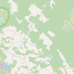
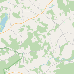
Land unit (cadastre designation: 88940100029)
Cadastre designation: 88940100029
Address: "Salnas", Vandzene, Vandzenes pagasts, Talsu novads, LV-3281
Cadastre designation of real estate | |
|---|---|
Cadastral object type | Cadastral object type: Land unit |
Address | Address: "Salnas", Vandzene, Vandzenes pagasts, Talsu novads, LV-3281 |
Cadastre number of the real estate in which this land unit is included | Cadastre number of the real estate in which this land unit is included: 88940100029 |
Address | |
|---|---|
Address ID | Address ID: 102914281 |
Companies registered at the address | |
Departments registered at the address | Departments registered at the address: 0 |
Institutions registered at the address | Institutions registered at the address: 0 |
Real estate registered at the address | |
Transactions with real estate at the address | Transactions with real estate at the address: 0 |
|
|
|
{"7201060210":{"name":"<div class='color_dot' style='background-color: #00ffff'><\/div><span>Specified land unit<\/span>","featureColor":"#00ffff","features":{"type":"FeatureCollection","features":[{"type":"Feature","geometry":{"type":"Polygon","coordinates":[[[22.79447676,57.345727367],[22.79484145,57.344707198],[22.794780436,57.344700523],[22.794823379,57.344682607],[22.794880826,57.344677992],[22.795069631,57.344670771],[22.795266077,57.344659598],[22.795330709,57.344643587],[22.795423378,57.344583816],[22.79549133,57.344549627],[22.795544415,57.344532068],[22.795643235,57.344520913],[22.795805449,57.344506177],[22.795965699,57.344496094],[22.796051894,57.344487881],[22.796123775,57.344472227],[22.796328133,57.34443503],[22.796502703,57.344425084],[22.796621634,57.344424415],[22.796785867,57.344491702],[22.799411264,57.34548699],[22.799551341,57.34554373],[22.799296008,57.345623406],[22.799099466,57.345684732],[22.798723302,57.345771636],[22.798210565,57.345816098],[22.797804625,57.345820451],[22.797318627,57.345791129],[22.796961512,57.34579183],[22.796135083,57.345997824],[22.795751568,57.346068846],[22.795540793,57.346136292],[22.79526845,57.346263565],[22.795095916,57.34635265],[22.795039442,57.346324457],[22.795248148,57.345736254],[22.79447676,57.345727367]]]},"crs":{"type":"name","properties":{"name":"urn:ogc:def:crs:EPSG:3059"}},"properties":{"style":{"color":"#00ffff","dashArray":"8,12","weight":1},"name":"Land","object_type":"Parcel","parcel_code":"88940030065","code":null,"surveyor":null,"address":"","ownership":"<span>Owner - Natural person<br><\/span>","pro_cadastre_nr":"88940100029"}}]}},"7201060110":{"name":"<div class='color_dot' style='background-color: #00ffff'><\/div><span>Measured land unit<\/span>","featureColor":"#00ffff","features":{"type":"FeatureCollection","features":[{"type":"Feature","geometry":{"type":"Polygon","coordinates":[[[22.770400083,57.308351782],[22.770407594,57.308336124],[22.770705845,57.307714137],[22.771681194,57.307386599],[22.771781042,57.307382687],[22.772008024,57.307794793],[22.772358001,57.308430164],[22.772372558,57.30845662],[22.772411614,57.308521021],[22.772415973,57.308528215],[22.770400083,57.308351782]]]},"crs":{"type":"name","properties":{"name":"urn:ogc:def:crs:EPSG:3059"}},"properties":{"style":{"color":"#00ffff","dashArray":"0","weight":1},"name":"Land","object_type":"Parcel","parcel_code":"88940100029","code":null,"surveyor":null,"address":"\"Salnas\", Vandzene, Vandzenes pag., Talsu nov., LV-3281","ownership":"<span>Owner - Natural person<br><\/span>","pro_cadastre_nr":"88940100029"}}]}},"7114100000":{"name":"<div class='color_dot' style='background-color: #b40000'><\/div><span>Burdened access road servitude area<\/span>","featureColor":"#b40000","features":{"type":"FeatureCollection","features":[{"type":"Feature","geometry":{"type":"Polygon","coordinates":[[[22.772358001,57.308430164],[22.772372558,57.30845662],[22.772415973,57.308528215],[22.772360547,57.308523137],[22.772325028,57.308464664],[22.771730245,57.307385191],[22.771781042,57.307382687],[22.772008024,57.307794793],[22.772358001,57.308430164]]]},"crs":{"type":"name","properties":{"name":"urn:ogc:def:crs:EPSG:3059"}},"properties":{"style":{"color":"#b40000","dashArray":"4,2,1,2","weight":1},"name":"Burdened access road servitude area","object_type":"WayRestriction","parcel_code":"88940100029","code":"7315030100002","surveyor":null,"address":"\"Salnas\", Vandzene, Vandzenes pag., Talsu nov., LV-3281","ownership":"<span>Owner - Natural person<br><\/span>","pro_cadastre_nr":"88940100029"}},{"type":"Feature","geometry":{"type":"Polygon","coordinates":[[[22.795095916,57.34635265],[22.795054304,57.346331876],[22.795298282,57.345689074],[22.795152367,57.345365329],[22.794699709,57.345103761],[22.794723072,57.345038367],[22.795242904,57.345338759],[22.79540041,57.345688147],[22.795178531,57.34627273],[22.795234921,57.346243614],[22.795511567,57.346114326],[22.795730571,57.346044245],[22.796116526,57.345972779],[22.796950494,57.345764908],[22.797321303,57.345764176],[22.797806903,57.345793476],[22.79820611,57.345789194],[22.798709348,57.345745558],[22.79907714,57.345660586],[22.799271095,57.345600071],[22.799501763,57.345526152],[22.799545176,57.345543716],[22.799296008,57.345623406],[22.799099466,57.345684732],[22.798723302,57.345771636],[22.798210565,57.345816098],[22.797804625,57.345820451],[22.797318627,57.345791129],[22.796961512,57.34579183],[22.796135083,57.345997824],[22.795751568,57.346068846],[22.795540793,57.346136292],[22.79526845,57.346263565],[22.795095916,57.34635265]]]},"crs":{"type":"name","properties":{"name":"urn:ogc:def:crs:EPSG:3059"}},"properties":{"style":{"color":"#b40000","dashArray":"4,2,1,2","weight":1},"name":"Burdened access road servitude area","object_type":"WayRestriction","parcel_code":"88940030065","code":"7315030100002","surveyor":null,"address":"","ownership":"<span>Owner - Natural person<br><\/span>","pro_cadastre_nr":"88940100029"}}]}},"5201011110":{"name":"<div class='color_dot' style='background-color: #ff0000'><\/div><span>Measured building<\/span>","featureColor":"#ff0000","features":{"type":"FeatureCollection","features":[{"type":"Feature","geometry":{"type":"Polygon","coordinates":[[[22.771409637,57.308075842],[22.771432007,57.308004899],[22.771497738,57.308011066],[22.771476034,57.30808198],[22.771409637,57.308075842]]]},"crs":{"type":"name","properties":{"name":"urn:ogc:def:crs:EPSG:3059"}},"properties":{"style":{"color":"#ff0000","dashArray":"0","weight":1},"name":"Building","object_type":"Building","parcel_code":"88940100029","code":"88940100029004","surveyor":null,"address":"\"Salnas\", Vandzene, Vandzenes pag., Talsu nov., LV-3281","ownership":"<span>Owner - Natural person<br><\/span>","pro_cadastre_nr":"88940100029"}},{"type":"Feature","geometry":{"type":"Polygon","coordinates":[[[22.771398463,57.308111264],[22.771409637,57.308075842],[22.771476034,57.30808198],[22.771464859,57.308117402],[22.771398463,57.308111264]]]},"crs":{"type":"name","properties":{"name":"urn:ogc:def:crs:EPSG:3059"}},"properties":{"style":{"color":"#ff0000","dashArray":"0","weight":1},"name":"Building","object_type":"Building","parcel_code":"88940100029","code":"88940100029003","surveyor":null,"address":"\"Salnas\", Vandzene, Vandzenes pag., Talsu nov., LV-3281","ownership":"<span>Owner - Natural person<br><\/span>","pro_cadastre_nr":"88940100029"}},{"type":"Feature","geometry":{"type":"Polygon","coordinates":[[[22.770916951,57.308335604],[22.770941177,57.308241393],[22.771115443,57.308254524],[22.771091217,57.308348735],[22.770916951,57.308335604]]]},"crs":{"type":"name","properties":{"name":"urn:ogc:def:crs:EPSG:3059"}},"properties":{"style":{"color":"#ff0000","dashArray":"0","weight":1},"name":"Building","object_type":"Building","parcel_code":"88940100029","code":"88940100029001","surveyor":null,"address":"\"Salnas\", Vandzene, Vandzenes pag., Talsu nov., LV-3281","ownership":"<span>Owner - Natural person<br><\/span>","pro_cadastre_nr":"88940100029"}},{"type":"Feature","geometry":{"type":"Polygon","coordinates":[[[22.771283631,57.308110457],[22.771295177,57.30806689],[22.771390466,57.308074289],[22.77137892,57.308117856],[22.771283631,57.308110457]]]},"crs":{"type":"name","properties":{"name":"urn:ogc:def:crs:EPSG:3059"}},"properties":{"style":{"color":"#ff0000","dashArray":"0","weight":1},"name":"Building","object_type":"Building","parcel_code":"88940100029","code":"88940100029005","surveyor":null,"address":"\"Salnas\", Vandzene, Vandzenes pag., Talsu nov., LV-3281","ownership":"<span>Owner - Natural person<br><\/span>","pro_cadastre_nr":"88940100029"}},{"type":"Feature","geometry":{"type":"Polygon","coordinates":[[[22.771245739,57.30826452],[22.771263652,57.308198807],[22.771519879,57.30821926],[22.771501967,57.308284973],[22.771245739,57.30826452]]]},"crs":{"type":"name","properties":{"name":"urn:ogc:def:crs:EPSG:3059"}},"properties":{"style":{"color":"#ff0000","dashArray":"0","weight":1},"name":"Building","object_type":"Building","parcel_code":"88940100029","code":"88940100029002","surveyor":null,"address":"\"Salnas\", Vandzene, Vandzenes pag., Talsu nov., LV-3281","ownership":"<span>Owner - Natural person<br><\/span>","pro_cadastre_nr":"88940100029"}},{"type":"Feature","geometry":{"type":"Polygon","coordinates":[[[22.771283631,57.308110457],[22.771295177,57.30806689],[22.771390466,57.308074289],[22.77137892,57.308117856],[22.771283631,57.308110457]]]},"crs":{"type":"name","properties":{"name":"urn:ogc:def:crs:EPSG:3059"}},"properties":{"style":{"color":"#ff0000","dashArray":"0","weight":1},"name":"Building","object_type":"Building","parcel_code":"88940100029","code":"88940100029005","surveyor":null,"address":"\"Salnas\", Vandzene, Vandzenes pag., Talsu nov., LV-3281","ownership":"<span>Owner - Natural person<br><\/span>","pro_cadastre_nr":"88940100029"}},{"type":"Feature","geometry":{"type":"Polygon","coordinates":[[[22.771409637,57.308075842],[22.771432007,57.308004899],[22.771497738,57.308011066],[22.771476034,57.30808198],[22.771409637,57.308075842]]]},"crs":{"type":"name","properties":{"name":"urn:ogc:def:crs:EPSG:3059"}},"properties":{"style":{"color":"#ff0000","dashArray":"0","weight":1},"name":"Building","object_type":"Building","parcel_code":"88940100029","code":"88940100029004","surveyor":null,"address":"\"Salnas\", Vandzene, Vandzenes pag., Talsu nov., LV-3281","ownership":"<span>Owner - Natural person<br><\/span>","pro_cadastre_nr":"88940100029"}},{"type":"Feature","geometry":{"type":"Polygon","coordinates":[[[22.771398463,57.308111264],[22.771409637,57.308075842],[22.771476034,57.30808198],[22.771464859,57.308117402],[22.771398463,57.308111264]]]},"crs":{"type":"name","properties":{"name":"urn:ogc:def:crs:EPSG:3059"}},"properties":{"style":{"color":"#ff0000","dashArray":"0","weight":1},"name":"Building","object_type":"Building","parcel_code":"88940100029","code":"88940100029003","surveyor":null,"address":"\"Salnas\", Vandzene, Vandzenes pag., Talsu nov., LV-3281","ownership":"<span>Owner - Natural person<br><\/span>","pro_cadastre_nr":"88940100029"}},{"type":"Feature","geometry":{"type":"Polygon","coordinates":[[[22.771245739,57.30826452],[22.771263652,57.308198807],[22.771519879,57.30821926],[22.771501967,57.308284973],[22.771245739,57.30826452]]]},"crs":{"type":"name","properties":{"name":"urn:ogc:def:crs:EPSG:3059"}},"properties":{"style":{"color":"#ff0000","dashArray":"0","weight":1},"name":"Building","object_type":"Building","parcel_code":"88940100029","code":"88940100029002","surveyor":null,"address":"\"Salnas\", Vandzene, Vandzenes pag., Talsu nov., LV-3281","ownership":"<span>Owner - Natural person<br><\/span>","pro_cadastre_nr":"88940100029"}},{"type":"Feature","geometry":{"type":"Polygon","coordinates":[[[22.770916951,57.308335604],[22.770941177,57.308241393],[22.771115443,57.308254524],[22.771091217,57.308348735],[22.770916951,57.308335604]]]},"crs":{"type":"name","properties":{"name":"urn:ogc:def:crs:EPSG:3059"}},"properties":{"style":{"color":"#ff0000","dashArray":"0","weight":1},"name":"Building","object_type":"Building","parcel_code":"88940100029","code":"88940100029001","surveyor":null,"address":"\"Salnas\", Vandzene, Vandzenes pag., Talsu nov., LV-3281","ownership":"<span>Owner - Natural person<br><\/span>","pro_cadastre_nr":"88940100029"}}]}}}
[]
https://tile.openstreetmap.org/{z}/{x}/{y}.png|© OpenStreetMap contributors|minZoom: 7|maxZoom: 19
|
Land unit data updated: 10.01.2025.
Data source and license: Cadastre Information System open text and spatial data, Real Estate Market Database open data, open data license Creative Commons Attribution, OpenStreetMap

