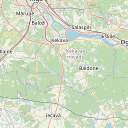
Land unit (cadastre designation: 80520050757)
Cadastre designation: 80520050757
Administrative area: Ādažu novads
Cadastre designation of real estate | |
|---|---|
Cadastral object type | Cadastral object type: Land unit |
Administrative area | |
Cadastre number of the real estate in which this land unit is included | Cadastre number of the real estate in which this land unit is included: 80520080490 |
|
|
|
{"7201060210":{"name":"<div class='color_dot' style='background-color: #00ffff'><\/div><span>Specified land unit<\/span>","featureColor":"#00ffff","features":{"type":"FeatureCollection","features":[{"type":"Feature","geometry":{"type":"Polygon","coordinates":[[[24.184966507,57.101385607],[24.18549174,57.099775749],[24.185597901,57.099474524],[24.188206396,57.099465174],[24.188289279,57.09951249],[24.188125304,57.100123461],[24.187926954,57.100384663],[24.187751586,57.100660445],[24.18770293,57.100801683],[24.187668782,57.101001596],[24.18760183,57.101115506],[24.187188868,57.101637904],[24.187183376,57.101681436],[24.187205658,57.101717121],[24.187111162,57.101776992],[24.187027397,57.10189621],[24.186999845,57.101892298],[24.186876514,57.101887137],[24.186321923,57.101729127],[24.184966507,57.101385607]]]},"crs":{"type":"name","properties":{"name":"urn:ogc:def:crs:EPSG:3059"}},"properties":{"style":{"color":"#00ffff","dashArray":"8,12","weight":1},"name":"Land","object_type":"Parcel","parcel_code":"80520080490","code":null,"surveyor":null,"address":"","ownership":"<span>Owner - Natural person<br><\/span>","pro_cadastre_nr":"80520080490"}},{"type":"Feature","geometry":{"type":"Polygon","coordinates":[[[24.269889968,57.106988559],[24.269955405,57.107001615],[24.272318723,57.106591121],[24.27262687,57.107359221],[24.272681912,57.107386214],[24.270938352,57.1076423],[24.270556841,57.107604001],[24.270453004,57.107564078],[24.269889968,57.106988559]]]},"crs":{"type":"name","properties":{"name":"urn:ogc:def:crs:EPSG:3059"}},"properties":{"style":{"color":"#00ffff","dashArray":"8,12","weight":1},"name":"Land","object_type":"Parcel","parcel_code":"80520050757","code":null,"surveyor":null,"address":"","ownership":"<span>Owner - Natural person<br><\/span>","pro_cadastre_nr":"80520080490"}}]}},"7201060110":{"name":"<div class='color_dot' style='background-color: #00ffff'><\/div><span>Measured land unit<\/span>","featureColor":"#00ffff","features":{"type":"FeatureCollection","features":[{"type":"Feature","geometry":{"type":"Polygon","coordinates":[[[24.192280372,57.106629376],[24.192314326,57.105841187],[24.192493793,57.105647688],[24.192498813,57.105905952],[24.192582501,57.10609195],[24.192904527,57.106395784],[24.19297746,57.106557381],[24.192924473,57.106758681],[24.192673914,57.106735521],[24.192280372,57.106629376]]]},"crs":{"type":"name","properties":{"name":"urn:ogc:def:crs:EPSG:3059"}},"properties":{"style":{"color":"#00ffff","dashArray":"0","weight":1},"name":"Land","object_type":"Parcel","parcel_code":"80520080492","code":null,"surveyor":null,"address":"","ownership":"<span>Owner - Natural person<br><\/span>","pro_cadastre_nr":"80520080490"}},{"type":"Feature","geometry":{"type":"Polygon","coordinates":[[[24.192603504,57.105663106],[24.192654369,57.105673143],[24.193530708,57.105846089],[24.194596685,57.106056455],[24.194649766,57.106066928],[24.194528541,57.106239669],[24.19444612,57.106237802],[24.194405818,57.10623685],[24.193591761,57.106217591],[24.193795883,57.105994875],[24.193706142,57.105978825],[24.193062304,57.106025095],[24.192726943,57.106049183],[24.192619616,57.105774394],[24.192603504,57.105663106]]]},"crs":{"type":"name","properties":{"name":"urn:ogc:def:crs:EPSG:3059"}},"properties":{"style":{"color":"#00ffff","dashArray":"0","weight":1},"name":"Land","object_type":"Parcel","parcel_code":"80520080491","code":null,"surveyor":null,"address":"","ownership":"<span>Owner - Natural person<br><\/span>","pro_cadastre_nr":"80520080490"}}]}}}
[]
https://tile.openstreetmap.org/{z}/{x}/{y}.png|© OpenStreetMap contributors|minZoom: 7|maxZoom: 19
|
Land unit data updated: 23.01.2025.
Data source and license: Cadastre Information System open text and spatial data, Real Estate Market Database open data, open data license Creative Commons Attribution, OpenStreetMap

