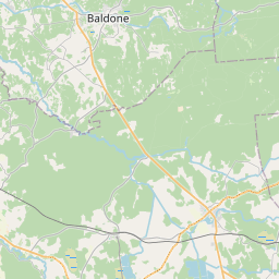
Land unit (cadastre designation: 80250080072)
Cadastre designation: 80250080072
Administrative area: Ķekavas novads
Cadastre designation of real estate | |
|---|---|
Cadastral object type | Cadastral object type: Land unit |
Administrative area | |
Cadastre number of the real estate in which this land unit is included | Cadastre number of the real estate in which this land unit is included: 80250090089 |
|
|
|
{"7201060210":{"name":"<div class='color_dot' style='background-color: #00ffff'><\/div><span>Specified land unit<\/span>","featureColor":"#00ffff","features":{"type":"FeatureCollection","features":[{"type":"Feature","geometry":{"type":"Polygon","coordinates":[[[24.425244366,56.729775114],[24.427155772,56.729777823],[24.427223402,56.729777915],[24.427144371,56.729985905],[24.426974399,56.730329127],[24.426810966,56.730684239],[24.426556189,56.731254911],[24.426527245,56.731419542],[24.4265528,56.731521342],[24.426658161,56.731683556],[24.425729752,56.732115149],[24.425700467,56.732086626],[24.425349549,56.731744761],[24.426149109,56.730529769],[24.425244366,56.729775114]]]},"crs":{"type":"name","properties":{"name":"urn:ogc:def:crs:EPSG:3059"}},"properties":{"style":{"color":"#00ffff","dashArray":"8,12","weight":1},"name":"Land","object_type":"Parcel","parcel_code":"80250100015","code":null,"surveyor":null,"address":"","ownership":"<span>Owner - Natural person<br><\/span>","pro_cadastre_nr":"80250090089"}},{"type":"Feature","geometry":{"type":"Polygon","coordinates":[[[24.366386787,56.708720937],[24.366731532,56.708619652],[24.368695977,56.706084235],[24.369813321,56.706120705],[24.369432204,56.707267528],[24.368709301,56.708926513],[24.366435517,56.708750045],[24.366386787,56.708720937]]]},"crs":{"type":"name","properties":{"name":"urn:ogc:def:crs:EPSG:3059"}},"properties":{"style":{"color":"#00ffff","dashArray":"8,12","weight":1},"name":"Land","object_type":"Parcel","parcel_code":"80250080072","code":null,"surveyor":null,"address":"","ownership":"<span>Owner - Natural person<br><\/span>","pro_cadastre_nr":"80250090089"}},{"type":"Feature","geometry":{"type":"Polygon","coordinates":[[[24.415927785,56.73666781],[24.416008711,56.736631838],[24.416778121,56.736416519],[24.416877266,56.736383027],[24.417027851,56.736340542],[24.417088366,56.736283048],[24.417198074,56.736242496],[24.417885506,56.736247785],[24.418070206,56.736236358],[24.418281071,56.736208358],[24.418861646,56.736091504],[24.419210387,56.73603393],[24.419464618,56.735970834],[24.420219265,56.735926679],[24.420305218,56.735891999],[24.420413945,56.735876746],[24.420629479,56.735879235],[24.420925312,56.735850171],[24.4215419,56.735804919],[24.422071481,56.735778934],[24.422433737,56.735720273],[24.422465095,56.735744216],[24.424410424,56.737228939],[24.42445552,56.737263356],[24.424416855,56.737297725],[24.424317747,56.737647566],[24.424217193,56.737757396],[24.423107052,56.738872458],[24.42307105,56.738896657],[24.423028286,56.73888364],[24.421106965,56.738298766],[24.42102728,56.738274509],[24.420023369,56.737791979],[24.419573044,56.737953186],[24.419462131,56.737891641],[24.419334778,56.737815832],[24.41918231,56.737720288],[24.419004945,56.737626094],[24.418838838,56.737527002],[24.418625912,56.737408509],[24.418353475,56.73724932],[24.418119982,56.737124337],[24.417170998,56.737606909],[24.417081401,56.737538904],[24.416492266,56.737140045],[24.415927785,56.73666781]]]},"crs":{"type":"name","properties":{"name":"urn:ogc:def:crs:EPSG:3059"}},"properties":{"style":{"color":"#00ffff","dashArray":"8,12","weight":1},"name":"Land","object_type":"Parcel","parcel_code":"80250060105","code":null,"surveyor":null,"address":"","ownership":"<span>Owner - Natural person<br><\/span>","pro_cadastre_nr":"80250090089"}}]}},"7201060110":{"name":"<div class='color_dot' style='background-color: #00ffff'><\/div><span>Measured land unit<\/span>","featureColor":"#00ffff","features":{"type":"FeatureCollection","features":[{"type":"Feature","geometry":{"type":"Polygon","coordinates":[[[24.370627955,56.725339769],[24.372140208,56.724201676],[24.372484283,56.723704221],[24.372587986,56.723554302],[24.372840173,56.72266276],[24.373431026,56.721021094],[24.373625911,56.721003324],[24.373830284,56.72095533],[24.37516199,56.721054078],[24.375459779,56.721155716],[24.375743681,56.721252606],[24.37646889,56.721387333],[24.377352713,56.721996685],[24.377880774,56.722516622],[24.378244006,56.722826518],[24.378206262,56.722841385],[24.375348779,56.723958562],[24.375610772,56.724238962],[24.374905253,56.724620102],[24.372397375,56.72567735],[24.370627955,56.725339769]]]},"crs":{"type":"name","properties":{"name":"urn:ogc:def:crs:EPSG:3059"}},"properties":{"style":{"color":"#00ffff","dashArray":"0","weight":1},"name":"Land","object_type":"Parcel","parcel_code":"80250090281","code":null,"surveyor":null,"address":"","ownership":"<span>Owner - Natural person<br><\/span>","pro_cadastre_nr":"80250090089"}}]}},"7114100000":{"name":"<div class='color_dot' style='background-color: #b40000'><\/div><span>Burdened access road servitude area<\/span>","featureColor":"#b40000","features":{"type":"FeatureCollection","features":[{"type":"Feature","geometry":{"type":"Polygon","coordinates":[[[24.378242993,56.722826521],[24.378206258,56.722840917],[24.378190762,56.722846903],[24.377824716,56.722535137],[24.377298273,56.722016785],[24.376429769,56.721417997],[24.375715626,56.72128532],[24.375139394,56.721088663],[24.373737309,56.72098469],[24.373712261,56.720983148],[24.373830286,56.720955509],[24.375161992,56.721054276],[24.37545978,56.721155895],[24.375743685,56.72125301],[24.376468895,56.721387809],[24.377351814,56.721996687],[24.377880038,56.722516624],[24.378242993,56.722826521]]]},"crs":{"type":"name","properties":{"name":"urn:ogc:def:crs:EPSG:3059"}},"properties":{"style":{"color":"#b40000","dashArray":"4,2,1,2","weight":1},"name":"Burdened access road servitude area","object_type":"WayRestriction","parcel_code":"80250090281","code":"7315030100007","surveyor":null,"address":"","ownership":"<span>Owner - Natural person<br><\/span>","pro_cadastre_nr":"80250090089"}},{"type":"Feature","geometry":{"type":"Polygon","coordinates":[[[24.372832642,56.722689402],[24.372840173,56.72266276],[24.372849847,56.722636426],[24.372944175,56.722645838],[24.372683259,56.723568211],[24.372231857,56.724220835],[24.372140208,56.724201676],[24.372587986,56.723554302],[24.372832642,56.722689402]]]},"crs":{"type":"name","properties":{"name":"urn:ogc:def:crs:EPSG:3059"}},"properties":{"style":{"color":"#b40000","dashArray":"4,2,1,2","weight":1},"name":"Burdened access road servitude area","object_type":"WayRestriction","parcel_code":"80250090281","code":"7315030100006","surveyor":null,"address":"","ownership":"<span>Owner - Natural person<br><\/span>","pro_cadastre_nr":"80250090089"}},{"type":"Feature","geometry":{"type":"Polygon","coordinates":[[[24.368695977,56.706084235],[24.368730598,56.706085372],[24.366757089,56.708632514],[24.366409657,56.708734588],[24.366386787,56.708720937],[24.366731532,56.708619652],[24.368695977,56.706084235]]]},"crs":{"type":"name","properties":{"name":"urn:ogc:def:crs:EPSG:3059"}},"properties":{"style":{"color":"#b40000","dashArray":"4,2,1,2","weight":1},"name":"Burdened access road servitude area","object_type":"WayRestriction","parcel_code":"80250080072","code":"7315030100012","surveyor":null,"address":"","ownership":"<span>Owner - Natural person<br><\/span>","pro_cadastre_nr":"80250090089"}}]}}}
[]
https://tile.openstreetmap.org/{z}/{x}/{y}.png|© OpenStreetMap contributors|minZoom: 7|maxZoom: 19
|
Land unit data updated: 23.01.2025.
Data source and license: Cadastre Information System open text and spatial data, Real Estate Market Database open data, open data license Creative Commons Attribution, OpenStreetMap

