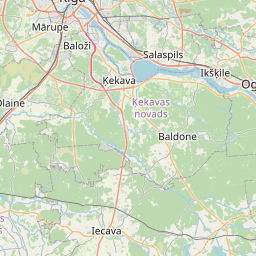
Land unit (cadastre designation: 80250080057)
Cadastre designation: 80250080057
Administrative area: Ķekavas novads
Cadastre designation of real estate | |
|---|---|
Cadastral object type | Cadastral object type: Land unit |
Administrative area | |
Cadastre number of the real estate in which this land unit is included | Cadastre number of the real estate in which this land unit is included: 80250070050 |
|
|
|
{"7201060210":{"name":"<div class='color_dot' style='background-color: #00ffff'><\/div><span>Specified land unit<\/span>","featureColor":"#00ffff","features":{"type":"FeatureCollection","features":[{"type":"Feature","geometry":{"type":"Polygon","coordinates":[[[24.312822563,56.72043838],[24.313652806,56.720072839],[24.314537089,56.719776584],[24.315098095,56.720183973],[24.313473657,56.720824204],[24.312822563,56.72043838]]]},"crs":{"type":"name","properties":{"name":"urn:ogc:def:crs:EPSG:3059"}},"properties":{"style":{"color":"#00ffff","dashArray":"8,12","weight":1},"name":"Land","object_type":"Parcel","parcel_code":"80250080057","code":null,"surveyor":null,"address":"","ownership":"<span>Owner - Municipality<br><\/span>","pro_cadastre_nr":"80250070050"}},{"type":"Feature","geometry":{"type":"Polygon","coordinates":[[[24.236848395,56.715383343],[24.238222538,56.714944465],[24.238290276,56.71489354],[24.238581099,56.714928938],[24.238581568,56.714956571],[24.238586571,56.715248863],[24.238542484,56.715314449],[24.238461213,56.715279091],[24.238092282,56.715355217],[24.237598057,56.715469555],[24.236988666,56.715619866],[24.236848395,56.715383343]]]},"crs":{"type":"name","properties":{"name":"urn:ogc:def:crs:EPSG:3059"}},"properties":{"style":{"color":"#00ffff","dashArray":"8,12","weight":1},"name":"Land","object_type":"Parcel","parcel_code":"80250070051","code":null,"surveyor":null,"address":"","ownership":"<span>Owner - Municipality<br><\/span>","pro_cadastre_nr":"80250070050"}},{"type":"Feature","geometry":{"type":"Polygon","coordinates":[[[24.264023488,56.738279121],[24.264085352,56.738277705],[24.264554136,56.737966272],[24.265035553,56.738233779],[24.265986436,56.738804927],[24.265581673,56.738957097],[24.264721661,56.739280424],[24.264613553,56.739235823],[24.264309772,56.739110513],[24.264107692,56.73878727],[24.264062009,56.73878831],[24.264023488,56.738279121]]]},"crs":{"type":"name","properties":{"name":"urn:ogc:def:crs:EPSG:3059"}},"properties":{"style":{"color":"#00ffff","dashArray":"8,12","weight":1},"name":"Land","object_type":"Parcel","parcel_code":"80250070050","code":null,"surveyor":null,"address":"","ownership":"<span>Owner - Municipality<br><\/span>","pro_cadastre_nr":"80250070050"}},{"type":"Feature","geometry":{"type":"Polygon","coordinates":[[[24.376387929,56.761849913],[24.376759592,56.761488203],[24.3781192,56.761822216],[24.379182826,56.762073268],[24.379103904,56.762325111],[24.378263041,56.762353736],[24.377319683,56.762425104],[24.376387929,56.761849913]]]},"crs":{"type":"name","properties":{"name":"urn:ogc:def:crs:EPSG:3059"}},"properties":{"style":{"color":"#00ffff","dashArray":"8,12","weight":1},"name":"Land","object_type":"Parcel","parcel_code":"80250030036","code":null,"surveyor":null,"address":"","ownership":"<span>Owner - Municipality<br><\/span>","pro_cadastre_nr":"80250070050"}}]}},"7114100000":{"name":"<div class='color_dot' style='background-color: #b40000'><\/div><span>Burdened access road servitude area<\/span>","featureColor":"#b40000","features":{"type":"FeatureCollection","features":[{"type":"Feature","geometry":{"type":"Polygon","coordinates":[[[24.238516847,56.715300771],[24.238553845,56.715245727],[24.238548362,56.714926655],[24.238579162,56.7149301],[24.23858595,56.715248864],[24.238542475,56.715313021],[24.238516847,56.715300771]]]},"crs":{"type":"name","properties":{"name":"urn:ogc:def:crs:EPSG:3059"}},"properties":{"style":{"color":"#b40000","dashArray":"4,2,1,2","weight":1},"name":"Burdened access road servitude area","object_type":"WayRestriction","parcel_code":"80250070051","code":"7315030100004","surveyor":null,"address":"","ownership":"<span>Owner - Municipality<br><\/span>","pro_cadastre_nr":"80250070050"}},{"type":"Feature","geometry":{"type":"Polygon","coordinates":[[[24.377320888,56.762424517],[24.376390895,56.761850407],[24.376414139,56.761839053],[24.377344132,56.762413163],[24.377320888,56.762424517]]]},"crs":{"type":"name","properties":{"name":"urn:ogc:def:crs:EPSG:3059"}},"properties":{"style":{"color":"#b40000","dashArray":"4,2,1,2","weight":1},"name":"Burdened access road servitude area","object_type":"WayRestriction","parcel_code":"80250030036","code":"7315030100001","surveyor":null,"address":"","ownership":"<span>Owner - Municipality<br><\/span>","pro_cadastre_nr":"80250070050"}},{"type":"Feature","geometry":{"type":"Polygon","coordinates":[[[24.378137377,56.761827561],[24.379182826,56.762073268],[24.379176659,56.762091075],[24.378154845,56.761850201],[24.378137377,56.761827561]]]},"crs":{"type":"name","properties":{"name":"urn:ogc:def:crs:EPSG:3059"}},"properties":{"style":{"color":"#b40000","dashArray":"4,2,1,2","weight":1},"name":"Burdened access road servitude area","object_type":"WayRestriction","parcel_code":"80250030036","code":"7315030100002","surveyor":null,"address":"","ownership":"<span>Owner - Municipality<br><\/span>","pro_cadastre_nr":"80250070050"}},{"type":"Feature","geometry":{"type":"Polygon","coordinates":[[[24.378034032,56.761803087],[24.378134364,56.761827174],[24.378156414,56.761856512],[24.378170367,56.761890725],[24.378170861,56.761949694],[24.378168358,56.761996804],[24.378170105,56.762029069],[24.378175825,56.762051323],[24.378195179,56.762082591],[24.378221051,56.762108072],[24.378256348,56.76212896],[24.378293775,56.762143778],[24.378362729,56.762162336],[24.378486182,56.762190378],[24.378568755,56.762211581],[24.378676443,56.76224798],[24.37878611,56.762294157],[24.378875514,56.762322787],[24.378920923,56.762330977],[24.378764895,56.762336509],[24.378758709,56.762334524],[24.378649237,56.762289883],[24.378557947,56.762255922],[24.378469393,56.762230425],[24.378337775,56.762202139],[24.378276179,56.762186505],[24.378212343,56.762164419],[24.378171529,56.762141382],[24.378136471,56.762116558],[24.378112007,56.762081397],[24.378096247,56.762028539],[24.378097885,56.761976705],[24.378098861,56.761925701],[24.378091058,56.761888181],[24.378082557,56.761869161],[24.37807645,56.761857222],[24.378058943,56.761832371],[24.378034032,56.761803087]]]},"crs":{"type":"name","properties":{"name":"urn:ogc:def:crs:EPSG:3059"}},"properties":{"style":{"color":"#b40000","dashArray":"4,2,1,2","weight":1},"name":"Burdened access road servitude area","object_type":"WayRestriction","parcel_code":"80250030036","code":"7315030100003","surveyor":null,"address":"","ownership":"<span>Owner - Municipality<br><\/span>","pro_cadastre_nr":"80250070050"}}]}}}
{"7114100000":{"name":"<div class='color_dot' style='background-color: #b40000'><\/div><span>Burdened access road servitude area<\/span>","featureColor":"#b40000","features":{"type":"FeatureCollection","features":[{"type":"Feature","geometry":{"type":"Polygon","coordinates":[[[24.37810628,56.761838723],[24.378178312,56.761857766],[24.378173481,56.762045913],[24.37911122,56.762299557],[24.379103881,56.762322865],[24.379076019,56.762325555],[24.378108681,56.762077625],[24.37810628,56.761838723]]]},"crs":{"type":"name","properties":{"name":"urn:ogc:def:crs:EPSG:3059"}},"properties":{"style":{"color":"#b40000","dashArray":"4,2,1,2","weight":1},"name":"Burdened access road servitude area","object_type":"WayRestriction","parcel_code":"80250030036","code":"7315030100003","surveyor":null,"address":"","ownership":"<span>Owner - Municipality<br><\/span>","pro_cadastre_nr":"80250070050"}}]}}}
https://tile.openstreetmap.org/{z}/{x}/{y}.png|© OpenStreetMap contributors|minZoom: 7|maxZoom: 19
|
Land unit data updated: 23.01.2025.
Data source and license: Cadastre Information System open text and spatial data, Real Estate Market Database open data, open data license Creative Commons Attribution, OpenStreetMap
