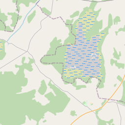
Land unit (cadastre designation: 76480020072)
Cadastre designation: 76480020072
Address: "Roziņi", Voveres, Galēnu pagasts, Preiļu novads, LV-5311
Cadastre designation of real estate | |
|---|---|
Cadastral object type | Cadastral object type: Land unit |
Address | Address: "Roziņi", Voveres, Galēnu pagasts, Preiļu novads, LV-5311 |
Cadastre number of the real estate in which this land unit is included | Cadastre number of the real estate in which this land unit is included: 76480020072 |
Address | |
|---|---|
Address ID | Address ID: 103920102 |
Companies registered at the address | Companies registered at the address: 0 |
Departments registered at the address | Departments registered at the address: 0 |
Institutions registered at the address | Institutions registered at the address: 0 |
Real estate registered at the address | |
Transactions with real estate at the address | Transactions with real estate at the address: 0 |
|
|
|
{"7201060210":{"name":"<div class='color_dot' style='background-color: #00ffff'><\/div><span>Specified land unit<\/span>","featureColor":"#00ffff","features":{"type":"FeatureCollection","features":[{"type":"Feature","geometry":{"type":"Polygon","coordinates":[[[26.815868366,56.467228934],[26.818248632,56.466018897],[26.820045107,56.465086138],[26.822340417,56.466448135],[26.822376596,56.466469594],[26.822350064,56.466485559],[26.821019147,56.467276857],[26.820210707,56.4677676],[26.81846606,56.468809687],[26.815868366,56.467228934]]]},"crs":{"type":"name","properties":{"name":"urn:ogc:def:crs:EPSG:3059"}},"properties":{"style":{"color":"#00ffff","dashArray":"8,12","weight":1},"name":"Land","object_type":"Parcel","parcel_code":"76480020072","code":null,"surveyor":null,"address":"\"Rozi\u0146i\", Voveres, Gal\u0113nu pag., Prei\u013cu nov., LV-5311","ownership":"<span>Legal owner - Natural person<br><\/span>","pro_cadastre_nr":"76480020072"}},{"type":"Feature","geometry":{"type":"Polygon","coordinates":[[[26.788190671,56.476574051],[26.788758931,56.47500885],[26.788794726,56.475012827],[26.791971194,56.476320148],[26.793754158,56.477190492],[26.788319273,56.476731218],[26.788190671,56.476574051]]]},"crs":{"type":"name","properties":{"name":"urn:ogc:def:crs:EPSG:3059"}},"properties":{"style":{"color":"#00ffff","dashArray":"8,12","weight":1},"name":"Land","object_type":"Parcel","parcel_code":"76480010178","code":null,"surveyor":null,"address":"","ownership":"<span>Legal owner - Natural person<br><\/span>","pro_cadastre_nr":"76480020072"}}]}},"5201011310":{"name":"<div class='color_dot' style='background-color: #960096'><\/div><span>Vectorized building<\/span>","featureColor":"#960096","features":{"type":"FeatureCollection","features":[{"type":"Feature","geometry":{"type":"Polygon","coordinates":[[[26.819859847,56.46588505],[26.819798556,56.465835424],[26.819840142,56.465819684],[26.819901448,56.4658693],[26.819859847,56.46588505]]]},"crs":{"type":"name","properties":{"name":"urn:ogc:def:crs:EPSG:3059"}},"properties":{"style":{"color":"#960096","dashArray":"0","weight":2},"name":"Building","object_type":"Building","parcel_code":"76480020072","code":"76480020072010","surveyor":null,"address":"\"Rozi\u0146i\", Voveres, Gal\u0113nu pag., Prei\u013cu nov., LV-5311","ownership":null,"pro_cadastre_nr":null}},{"type":"Feature","geometry":{"type":"Polygon","coordinates":[[[26.820157289,56.466187665],[26.820111711,56.466139291],[26.820235231,56.46610363],[26.820280809,56.466151995],[26.820157289,56.466187665]]]},"crs":{"type":"name","properties":{"name":"urn:ogc:def:crs:EPSG:3059"}},"properties":{"style":{"color":"#960096","dashArray":"0","weight":2},"name":"Building","object_type":"Building","parcel_code":"76480020072","code":"76480020072007","surveyor":null,"address":"\"Rozi\u0146i\", Voveres, Gal\u0113nu pag., Prei\u013cu nov., LV-5311","ownership":null,"pro_cadastre_nr":null}},{"type":"Feature","geometry":{"type":"Polygon","coordinates":[[[26.82010926,56.466408121],[26.820067904,56.466356029],[26.820163107,56.466332859],[26.820204464,56.466384951],[26.82010926,56.466408121]]]},"crs":{"type":"name","properties":{"name":"urn:ogc:def:crs:EPSG:3059"}},"properties":{"style":{"color":"#960096","dashArray":"0","weight":2},"name":"Building","object_type":"Building","parcel_code":"76480020072","code":"76480020072005","surveyor":null,"address":"\"Rozi\u0146i\", Voveres, Gal\u0113nu pag., Prei\u013cu nov., LV-5311","ownership":null,"pro_cadastre_nr":null}},{"type":"Feature","geometry":{"type":"Polygon","coordinates":[[[26.820609285,56.46627336],[26.820502052,56.466176169],[26.820594796,56.466144812],[26.820702029,56.466242003],[26.820609285,56.46627336]]]},"crs":{"type":"name","properties":{"name":"urn:ogc:def:crs:EPSG:3059"}},"properties":{"style":{"color":"#960096","dashArray":"0","weight":2},"name":"Building","object_type":"Building","parcel_code":"76480020072","code":"76480020072001","surveyor":null,"address":"\"Rozi\u0146i\", Voveres, Gal\u0113nu pag., Prei\u013cu nov., LV-5311","ownership":null,"pro_cadastre_nr":null}},{"type":"Feature","geometry":{"type":"Polygon","coordinates":[[[26.820067904,56.466356029],[26.820023145,56.466299663],[26.820118349,56.466276502],[26.820163107,56.466332859],[26.820067904,56.466356029]]]},"crs":{"type":"name","properties":{"name":"urn:ogc:def:crs:EPSG:3059"}},"properties":{"style":{"color":"#960096","dashArray":"0","weight":2},"name":"Building","object_type":"Building","parcel_code":"76480020072","code":"76480020072006","surveyor":null,"address":"\"Rozi\u0146i\", Voveres, Gal\u0113nu pag., Prei\u013cu nov., LV-5311","ownership":null,"pro_cadastre_nr":null}},{"type":"Feature","geometry":{"type":"Polygon","coordinates":[[[26.820686,56.466373069],[26.820511682,56.466426361],[26.820455038,56.466369583],[26.820629373,56.466316291],[26.820686,56.466373069]]]},"crs":{"type":"name","properties":{"name":"urn:ogc:def:crs:EPSG:3059"}},"properties":{"style":{"color":"#960096","dashArray":"0","weight":2},"name":"Building","object_type":"Building","parcel_code":"76480020072","code":"76480020072002","surveyor":null,"address":"\"Rozi\u0146i\", Voveres, Gal\u0113nu pag., Prei\u013cu nov., LV-5311","ownership":null,"pro_cadastre_nr":null}},{"type":"Feature","geometry":{"type":"Polygon","coordinates":[[[26.820280809,56.466151995],[26.820235231,56.46610363],[26.820372295,56.466064057],[26.820417857,56.466112431],[26.820280809,56.466151995]]]},"crs":{"type":"name","properties":{"name":"urn:ogc:def:crs:EPSG:3059"}},"properties":{"style":{"color":"#960096","dashArray":"0","weight":2},"name":"Building","object_type":"Building","parcel_code":"76480020072","code":"76480020072008","surveyor":null,"address":"\"Rozi\u0146i\", Voveres, Gal\u0113nu pag., Prei\u013cu nov., LV-5311","ownership":null,"pro_cadastre_nr":null}},{"type":"Feature","geometry":{"type":"Polygon","coordinates":[[[26.820511682,56.466426361],[26.820426451,56.466452415],[26.820369808,56.466395637],[26.820455038,56.466369583],[26.820511682,56.466426361]]]},"crs":{"type":"name","properties":{"name":"urn:ogc:def:crs:EPSG:3059"}},"properties":{"style":{"color":"#960096","dashArray":"0","weight":2},"name":"Building","object_type":"Building","parcel_code":"76480020072","code":"76480020072003","surveyor":null,"address":"\"Rozi\u0146i\", Voveres, Gal\u0113nu pag., Prei\u013cu nov., LV-5311","ownership":null,"pro_cadastre_nr":null}},{"type":"Feature","geometry":{"type":"Polygon","coordinates":[[[26.820426451,56.466452415],[26.820306353,56.466489121],[26.82024971,56.466432343],[26.820369808,56.466395637],[26.820426451,56.466452415]]]},"crs":{"type":"name","properties":{"name":"urn:ogc:def:crs:EPSG:3059"}},"properties":{"style":{"color":"#960096","dashArray":"0","weight":2},"name":"Building","object_type":"Building","parcel_code":"76480020072","code":"76480020072004","surveyor":null,"address":"\"Rozi\u0146i\", Voveres, Gal\u0113nu pag., Prei\u013cu nov., LV-5311","ownership":null,"pro_cadastre_nr":null}}]}}}
[]
https://tile.openstreetmap.org/{z}/{x}/{y}.png|© OpenStreetMap contributors|minZoom: 7|maxZoom: 19
|
Land unit data updated: 23.01.2025.
Data source and license: Cadastre Information System open text and spatial data, Real Estate Market Database open data, open data license Creative Commons Attribution, OpenStreetMap

