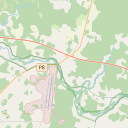
Land unit (cadastre designation: 74480020266)
Cadastre designation: 74480020266
Address: "Madaras", Jumpravas pagasts, Ogres novads, LV-5022
Cadastre designation of real estate | |
|---|---|
Cadastral object type | Cadastral object type: Land unit |
Address | Address: "Madaras", Jumpravas pagasts, Ogres novads, LV-5022 |
Cadastre number of the real estate in which this land unit is included | Cadastre number of the real estate in which this land unit is included: 74480020266 |
Address | |
|---|---|
Address ID | Address ID: 106423566 |
Companies registered at the address | Companies registered at the address: 0 |
Departments registered at the address | Departments registered at the address: 0 |
Institutions registered at the address | Institutions registered at the address: 0 |
Real estate registered at the address | |
Transactions with real estate at the address | Transactions with real estate at the address: 0 |
|
|
|
{"7201060210":{"name":"<div class='color_dot' style='background-color: #00ffff'><\/div><span>Specified land unit<\/span>","featureColor":"#00ffff","features":{"type":"FeatureCollection","features":[{"type":"Feature","geometry":{"type":"Polygon","coordinates":[[[24.957792327,56.685037266],[24.957810475,56.685004917],[24.957995718,56.68467468],[24.958168257,56.684428661],[24.958537932,56.684355065],[24.958546354,56.684368513],[24.95909074,56.685237377],[24.959606052,56.685096907],[24.959870845,56.685021365],[24.960134859,56.684955721],[24.960181676,56.684944085],[24.959865141,56.684573876],[24.959877871,56.684568603],[24.960295458,56.684395624],[24.961532425,56.686066155],[24.961558381,56.686100715],[24.95851566,56.687125706],[24.958449082,56.687148131],[24.958368556,56.686804637],[24.958285663,56.686252193],[24.958040033,56.685649115],[24.9578847,56.685357785],[24.957817227,56.685217536],[24.957792327,56.685037266]]]},"crs":{"type":"name","properties":{"name":"urn:ogc:def:crs:EPSG:3059"}},"properties":{"style":{"color":"#00ffff","dashArray":"8,12","weight":1},"name":"Land","object_type":"Parcel","parcel_code":"74480020271","code":null,"surveyor":null,"address":"","ownership":"<span>Owner - Natural person<br><\/span>","pro_cadastre_nr":"74480020266"}},{"type":"Feature","geometry":{"type":"Polygon","coordinates":[[[24.958305734,56.683349821],[24.958406195,56.683319094],[24.95846232,56.683303137],[24.959423764,56.683030083],[24.959435093,56.683047417],[24.959697073,56.683448495],[24.959377699,56.68353858],[24.959452254,56.683650401],[24.958703556,56.683806215],[24.958646267,56.683818138],[24.958556477,56.683708653],[24.958406873,56.683431897],[24.958305734,56.683349821]]]},"crs":{"type":"name","properties":{"name":"urn:ogc:def:crs:EPSG:3059"}},"properties":{"style":{"color":"#00ffff","dashArray":"8,12","weight":1},"name":"Land","object_type":"Parcel","parcel_code":"74480020266","code":null,"surveyor":null,"address":"\"Madaras\", Jumpravas pag., Ogres nov., LV-5022","ownership":"<span>Owner - Natural person<br><\/span>","pro_cadastre_nr":"74480020266"}},{"type":"Feature","geometry":{"type":"Polygon","coordinates":[[[24.952573617,56.739984055],[24.952661182,56.739965399],[24.958234561,56.74106451],[24.962629391,56.741925802],[24.963947463,56.741955814],[24.962296632,56.743680385],[24.960392063,56.743147608],[24.959699357,56.74293818],[24.95751053,56.742105322],[24.957164673,56.741946475],[24.957280674,56.741729232],[24.955334668,56.74139172],[24.953990433,56.741155887],[24.952728822,56.741043329],[24.952573617,56.739984055]]]},"crs":{"type":"name","properties":{"name":"urn:ogc:def:crs:EPSG:3059"}},"properties":{"style":{"color":"#00ffff","dashArray":"8,12","weight":1},"name":"Land","object_type":"Parcel","parcel_code":"74480010075","code":null,"surveyor":null,"address":"","ownership":"<span>Owner - Natural person<br><\/span>","pro_cadastre_nr":"74480020266"}}]}},"7114100000":{"name":"<div class='color_dot' style='background-color: #b40000'><\/div><span>Burdened access road servitude area<\/span>","featureColor":"#b40000","features":{"type":"FeatureCollection","features":[{"type":"Feature","geometry":{"type":"Polygon","coordinates":[[[24.961441718,56.686086495],[24.960231932,56.684456911],[24.959926286,56.68458194],[24.960225983,56.684932611],[24.960182434,56.684943728],[24.959869468,56.684573915],[24.96029538,56.684396415],[24.961531365,56.686065588],[24.961441718,56.686086495]]]},"crs":{"type":"name","properties":{"name":"urn:ogc:def:crs:EPSG:3059"}},"properties":{"style":{"color":"#b40000","dashArray":"4,2,1,2","weight":1},"name":"Burdened access road servitude area","object_type":"WayRestriction","parcel_code":"74480020271","code":"7315030100005","surveyor":null,"address":"","ownership":"<span>Owner - Natural person<br><\/span>","pro_cadastre_nr":"74480020266"}},{"type":"Feature","geometry":{"type":"Polygon","coordinates":[[[24.958496742,56.687131646],[24.958449628,56.687147138],[24.95837227,56.68680752],[24.958287655,56.686252178],[24.958040266,56.685648655],[24.957818827,56.685217523],[24.957796791,56.685037564],[24.958016854,56.684655219],[24.958170147,56.684430462],[24.958257501,56.684411884],[24.957873701,56.685033864],[24.957896127,56.68520604],[24.958118349,56.685636464],[24.958367,56.686248494],[24.958496742,56.687131646]]]},"crs":{"type":"name","properties":{"name":"urn:ogc:def:crs:EPSG:3059"}},"properties":{"style":{"color":"#b40000","dashArray":"4,2,1,2","weight":1},"name":"Burdened access road servitude area","object_type":"WayRestriction","parcel_code":"74480020271","code":"7315030100004","surveyor":null,"address":"","ownership":"<span>Owner - Natural person<br><\/span>","pro_cadastre_nr":"74480020266"}},{"type":"Feature","geometry":{"type":"Polygon","coordinates":[[[24.958725767,56.683791867],[24.958658105,56.683807985],[24.958568466,56.683705695],[24.958436049,56.683419885],[24.958379581,56.683340071],[24.958485556,56.683314988],[24.958646715,56.683695057],[24.958725767,56.683791867]]]},"crs":{"type":"name","properties":{"name":"urn:ogc:def:crs:EPSG:3059"}},"properties":{"style":{"color":"#b40000","dashArray":"4,2,1,2","weight":1},"name":"Burdened access road servitude area","object_type":"WayRestriction","parcel_code":"74480020266","code":"7315030100003","surveyor":null,"address":"\"Madaras\", Jumpravas pag., Ogres nov., LV-5022","ownership":"<span>Owner - Natural person<br><\/span>","pro_cadastre_nr":"74480020266"}}]}},"5201011310":{"name":"<div class='color_dot' style='background-color: #960096'><\/div><span>Vectorized building<\/span>","featureColor":"#960096","features":{"type":"FeatureCollection","features":[{"type":"Feature","geometry":{"type":"Polygon","coordinates":[[[24.95903065,56.683611215],[24.958857037,56.683616109],[24.958850395,56.683544878],[24.959024007,56.683539974],[24.95903065,56.683611215]]]},"crs":{"type":"name","properties":{"name":"urn:ogc:def:crs:EPSG:3059"}},"properties":{"style":{"color":"#960096","dashArray":"0","weight":2},"name":"Building","object_type":"Building","parcel_code":"74480020266","code":"74480020266001","surveyor":null,"address":"\"Madaras\", Jumpravas pag., Ogres nov., LV-5022","ownership":"<span>Owner - Natural person<br><\/span>","pro_cadastre_nr":"74480020266"}},{"type":"Feature","geometry":{"type":"Polygon","coordinates":[[[24.959270685,56.683684611],[24.959201465,56.683701738],[24.959167667,56.683660365],[24.959236903,56.683643237],[24.959270685,56.683684611]]]},"crs":{"type":"name","properties":{"name":"urn:ogc:def:crs:EPSG:3059"}},"properties":{"style":{"color":"#960096","dashArray":"0","weight":2},"name":"Building","object_type":"Building","parcel_code":"74480020266","code":"74480020266003","surveyor":null,"address":"\"Madaras\", Jumpravas pag., Ogres nov., LV-5022","ownership":"<span>Owner - Natural person<br><\/span>","pro_cadastre_nr":"74480020266"}},{"type":"Feature","geometry":{"type":"Polygon","coordinates":[[[24.959390347,56.683652765],[24.95930802,56.683673129],[24.959278383,56.683636835],[24.95936071,56.683616463],[24.959390347,56.683652765]]]},"crs":{"type":"name","properties":{"name":"urn:ogc:def:crs:EPSG:3059"}},"properties":{"style":{"color":"#960096","dashArray":"0","weight":2},"name":"Building","object_type":"Building","parcel_code":"74480020266","code":"74480020266002","surveyor":null,"address":"\"Madaras\", Jumpravas pag., Ogres nov., LV-5022","ownership":"<span>Owner - Natural person<br><\/span>","pro_cadastre_nr":"74480020266"}},{"type":"Feature","geometry":{"type":"Polygon","coordinates":[[[24.959270685,56.683684611],[24.959201465,56.683701738],[24.959167667,56.683660365],[24.959236903,56.683643237],[24.959270685,56.683684611]]]},"crs":{"type":"name","properties":{"name":"urn:ogc:def:crs:EPSG:3059"}},"properties":{"style":{"color":"#960096","dashArray":"0","weight":2},"name":"Building","object_type":"Building","parcel_code":"74480020266","code":"74480020266003","surveyor":null,"address":"\"Madaras\", Jumpravas pag., Ogres nov., LV-5022","ownership":"<span>Owner - Natural person<br><\/span>","pro_cadastre_nr":"74480020266"}},{"type":"Feature","geometry":{"type":"Polygon","coordinates":[[[24.959390347,56.683652765],[24.95930802,56.683673129],[24.959278383,56.683636835],[24.95936071,56.683616463],[24.959390347,56.683652765]]]},"crs":{"type":"name","properties":{"name":"urn:ogc:def:crs:EPSG:3059"}},"properties":{"style":{"color":"#960096","dashArray":"0","weight":2},"name":"Building","object_type":"Building","parcel_code":"74480020266","code":"74480020266002","surveyor":null,"address":"\"Madaras\", Jumpravas pag., Ogres nov., LV-5022","ownership":"<span>Owner - Natural person<br><\/span>","pro_cadastre_nr":"74480020266"}},{"type":"Feature","geometry":{"type":"Polygon","coordinates":[[[24.95903065,56.683611215],[24.958857037,56.683616109],[24.958850395,56.683544878],[24.959024007,56.683539974],[24.95903065,56.683611215]]]},"crs":{"type":"name","properties":{"name":"urn:ogc:def:crs:EPSG:3059"}},"properties":{"style":{"color":"#960096","dashArray":"0","weight":2},"name":"Building","object_type":"Building","parcel_code":"74480020266","code":"74480020266001","surveyor":null,"address":"\"Madaras\", Jumpravas pag., Ogres nov., LV-5022","ownership":"<span>Owner - Natural person<br><\/span>","pro_cadastre_nr":"74480020266"}}]}}}
[]
https://tile.openstreetmap.org/{z}/{x}/{y}.png|© OpenStreetMap contributors|minZoom: 7|maxZoom: 19
|
Land unit data updated: 10.01.2025.
Data source and license: Cadastre Information System open text and spatial data, Real Estate Market Database open data, open data license Creative Commons Attribution, OpenStreetMap


