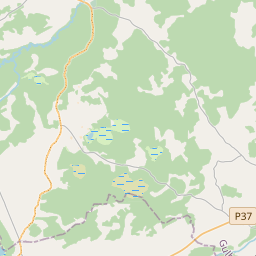
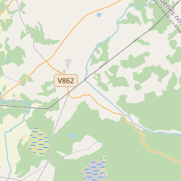
Land unit (cadastre designation: 70500040056)
Cadastre designation: 70500040056
Address: "Nogāzes", Dzelzavas pagasts, Madonas novads, LV-4873
Cadastre designation of real estate | |
|---|---|
Cadastral object type | Cadastral object type: Land unit |
Address | Address: "Nogāzes", Dzelzavas pagasts, Madonas novads, LV-4873 |
Cadastre number of the real estate in which this land unit is included | Cadastre number of the real estate in which this land unit is included: 70500040056 |
Address | |
|---|---|
Address ID | Address ID: 104684374 |
Companies registered at the address | Companies registered at the address: 0 |
Departments registered at the address | Departments registered at the address: 0 |
Institutions registered at the address | Institutions registered at the address: 0 |
Real estate registered at the address | |
Transactions with real estate at the address | Transactions with real estate at the address: 0 |
|
|
|
{"7201060210":{"name":"<div class='color_dot' style='background-color: #00ffff'><\/div><span>Specified land unit<\/span>","featureColor":"#00ffff","features":{"type":"FeatureCollection","features":[{"type":"Feature","geometry":{"type":"Polygon","coordinates":[[[26.40233982,57.011088799],[26.402520395,57.010880005],[26.402645597,57.010740284],[26.402759073,57.010637131],[26.402872373,57.010530997],[26.40311461,57.010352786],[26.403438892,57.010138084],[26.403759975,57.009929518],[26.40390893,57.009829475],[26.404454405,57.009507938],[26.406089274,57.010101528],[26.403918769,57.011758468],[26.40233982,57.011088799]]]},"crs":{"type":"name","properties":{"name":"urn:ogc:def:crs:EPSG:3059"}},"properties":{"style":{"color":"#00ffff","dashArray":"8,12","weight":1},"name":"Land","object_type":"Parcel","parcel_code":"70500040056","code":null,"surveyor":null,"address":"\"Nog\u0101zes\", Dzelzavas pag., Madonas nov., LV-4873","ownership":"<span>Owner - Natural person<br><\/span>","pro_cadastre_nr":"70500040056"}},{"type":"Feature","geometry":{"type":"Polygon","coordinates":[[[26.377369283,57.031767531],[26.37813617,57.030923555],[26.378156302,57.030903824],[26.380383973,57.031878513],[26.381179316,57.032282944],[26.381034719,57.032361442],[26.379548897,57.032523722],[26.378916414,57.032325969],[26.377369283,57.031767531]]]},"crs":{"type":"name","properties":{"name":"urn:ogc:def:crs:EPSG:3059"}},"properties":{"style":{"color":"#00ffff","dashArray":"8,12","weight":1},"name":"Land","object_type":"Parcel","parcel_code":"70500010031","code":null,"surveyor":null,"address":"","ownership":"<span>Owner - Natural person<br><\/span>","pro_cadastre_nr":"70500040056"}}]}},"5201011310":{"name":"<div class='color_dot' style='background-color: #960096'><\/div><span>Vectorized building<\/span>","featureColor":"#960096","features":{"type":"FeatureCollection","features":[{"type":"Feature","geometry":{"type":"Polygon","coordinates":[[[26.404776047,57.009730181],[26.404700806,57.009692193],[26.404778614,57.009651561],[26.404853871,57.009689548],[26.404776047,57.009730181]]]},"crs":{"type":"name","properties":{"name":"urn:ogc:def:crs:EPSG:3059"}},"properties":{"style":{"color":"#960096","dashArray":"0","weight":2},"name":"Building","object_type":"Building","parcel_code":"70500040056","code":"70500040056002","surveyor":null,"address":"\"Nog\u0101zes\", Dzelzavas pag., Madonas nov., LV-4873","ownership":"<span>Owner - Natural person<br><\/span>","pro_cadastre_nr":"70500040056"}},{"type":"Feature","geometry":{"type":"Polygon","coordinates":[[[26.404922066,57.009838567],[26.404851869,57.009801911],[26.404956406,57.009742325],[26.405026603,57.009778989],[26.404922066,57.009838567]]]},"crs":{"type":"name","properties":{"name":"urn:ogc:def:crs:EPSG:3059"}},"properties":{"style":{"color":"#960096","dashArray":"0","weight":2},"name":"Building","object_type":"Building","parcel_code":"70500040056","code":"70500040056003","surveyor":null,"address":"\"Nog\u0101zes\", Dzelzavas pag., Madonas nov., LV-4873","ownership":"<span>Owner - Natural person<br><\/span>","pro_cadastre_nr":"70500040056"}},{"type":"Feature","geometry":{"type":"Polygon","coordinates":[[[26.404384832,57.009684821],[26.404507903,57.009622479],[26.404615132,57.009685482],[26.404492045,57.009747834],[26.404384832,57.009684821]]]},"crs":{"type":"name","properties":{"name":"urn:ogc:def:crs:EPSG:3059"}},"properties":{"style":{"color":"#960096","dashArray":"0","weight":2},"name":"Building","object_type":"Building","parcel_code":"70500040056","code":"70500040056001","surveyor":null,"address":"\"Nog\u0101zes\", Dzelzavas pag., Madonas nov., LV-4873","ownership":"<span>Owner - Natural person<br><\/span>","pro_cadastre_nr":"70500040056"}},{"type":"Feature","geometry":{"type":"Polygon","coordinates":[[[26.404922066,57.009838567],[26.404851869,57.009801911],[26.404956406,57.009742325],[26.405026603,57.009778989],[26.404922066,57.009838567]]]},"crs":{"type":"name","properties":{"name":"urn:ogc:def:crs:EPSG:3059"}},"properties":{"style":{"color":"#960096","dashArray":"0","weight":2},"name":"Building","object_type":"Building","parcel_code":"70500040056","code":"70500040056003","surveyor":null,"address":"\"Nog\u0101zes\", Dzelzavas pag., Madonas nov., LV-4873","ownership":"<span>Owner - Natural person<br><\/span>","pro_cadastre_nr":"70500040056"}},{"type":"Feature","geometry":{"type":"Polygon","coordinates":[[[26.404776047,57.009730181],[26.404700806,57.009692193],[26.404778614,57.009651561],[26.404853871,57.009689548],[26.404776047,57.009730181]]]},"crs":{"type":"name","properties":{"name":"urn:ogc:def:crs:EPSG:3059"}},"properties":{"style":{"color":"#960096","dashArray":"0","weight":2},"name":"Building","object_type":"Building","parcel_code":"70500040056","code":"70500040056002","surveyor":null,"address":"\"Nog\u0101zes\", Dzelzavas pag., Madonas nov., LV-4873","ownership":"<span>Owner - Natural person<br><\/span>","pro_cadastre_nr":"70500040056"}},{"type":"Feature","geometry":{"type":"Polygon","coordinates":[[[26.404384832,57.009684821],[26.404507903,57.009622479],[26.404615132,57.009685482],[26.404492045,57.009747834],[26.404384832,57.009684821]]]},"crs":{"type":"name","properties":{"name":"urn:ogc:def:crs:EPSG:3059"}},"properties":{"style":{"color":"#960096","dashArray":"0","weight":2},"name":"Building","object_type":"Building","parcel_code":"70500040056","code":"70500040056001","surveyor":null,"address":"\"Nog\u0101zes\", Dzelzavas pag., Madonas nov., LV-4873","ownership":"<span>Owner - Natural person<br><\/span>","pro_cadastre_nr":"70500040056"}}]}}}
[]
https://tile.openstreetmap.org/{z}/{x}/{y}.png|© OpenStreetMap contributors|minZoom: 7|maxZoom: 19
|
Land unit data updated: 10.01.2025.
Data source and license: Cadastre Information System open text and spatial data, Real Estate Market Database open data, open data license Creative Commons Attribution, OpenStreetMap

