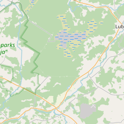
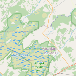
Land unit (cadastre designation: 70440020123)
Cadastre designation: 70440020123
Administrative area: Madonas novads
Cadastre designation of real estate | |
|---|---|
Cadastral object type | Cadastral object type: Land unit |
Administrative area | |
Cadastre number of the real estate in which this land unit is included | Cadastre number of the real estate in which this land unit is included: 70440020123 |
|
|
|
{"7201060210":{"name":"<div class='color_dot' style='background-color: #00ffff'><\/div><span>Specified land unit<\/span>","featureColor":"#00ffff","features":{"type":"FeatureCollection","features":[{"type":"Feature","geometry":{"type":"Polygon","coordinates":[[[26.49073157,56.741041348],[26.490802127,56.740927031],[26.490895296,56.740737515],[26.491023203,56.740514204],[26.4911044,56.740366457],[26.491184121,56.740238916],[26.491525012,56.739650463],[26.491556098,56.739582006],[26.491662949,56.739398435],[26.491762945,56.739223476],[26.491853437,56.739084556],[26.491961247,56.738954296],[26.492100658,56.738798437],[26.492320536,56.738630651],[26.492551479,56.738474902],[26.492813804,56.738313509],[26.493008148,56.73819853],[26.493296153,56.738039741],[26.493548398,56.737894384],[26.493949551,56.737670068],[26.49420515,56.737524796],[26.494433378,56.737395663],[26.494712109,56.737246395],[26.494966728,56.737103701],[26.495282413,56.736909573],[26.495410561,56.736943513],[26.495602619,56.737036944],[26.495772018,56.737144023],[26.495938794,56.7372818],[26.496236657,56.737514777],[26.496775443,56.73789775],[26.497676399,56.738487026],[26.498569089,56.739109238],[26.498856816,56.73929993],[26.49899239,56.739369181],[26.497777307,56.741228447],[26.49073157,56.741041348]]]},"crs":{"type":"name","properties":{"name":"urn:ogc:def:crs:EPSG:3059"}},"properties":{"style":{"color":"#00ffff","dashArray":"8,12","weight":1},"name":"Land","object_type":"Parcel","parcel_code":"70440060071","code":null,"surveyor":null,"address":"","ownership":"<span>User - Natural person<br><\/span>","pro_cadastre_nr":"70440020123"}},{"type":"Feature","geometry":{"type":"Polygon","coordinates":[[[26.534531876,56.778371836],[26.536930995,56.776964822],[26.535666186,56.776455052],[26.538867971,56.774573315],[26.541066877,56.77314636],[26.541071882,56.773126693],[26.542574012,56.772829986],[26.543890876,56.773826502],[26.543901079,56.773834086],[26.546107122,56.775473452],[26.543574334,56.776877148],[26.540465655,56.778599793],[26.537103339,56.780462724],[26.536690262,56.780661265],[26.536204674,56.780357091],[26.535915536,56.780097801],[26.535633439,56.779708438],[26.535222705,56.77909733],[26.534885505,56.778733477],[26.534531876,56.778371836]]]},"crs":{"type":"name","properties":{"name":"urn:ogc:def:crs:EPSG:3059"}},"properties":{"style":{"color":"#00ffff","dashArray":"8,12","weight":1},"name":"Land","object_type":"Parcel","parcel_code":"70440020124","code":null,"surveyor":null,"address":"","ownership":"<span>User - Natural person<br><\/span>","pro_cadastre_nr":"70440020123"}},{"type":"Feature","geometry":{"type":"Polygon","coordinates":[[[26.540031722,56.770895464],[26.543113295,56.769848459],[26.543260795,56.770093743],[26.543463408,56.770435326],[26.542050987,56.771047298],[26.542013151,56.771059475],[26.54301493,56.772008518],[26.542693634,56.772756232],[26.542575223,56.772829746],[26.542574012,56.772829986],[26.542508757,56.772776845],[26.540031722,56.770895464]]]},"crs":{"type":"name","properties":{"name":"urn:ogc:def:crs:EPSG:3059"}},"properties":{"style":{"color":"#00ffff","dashArray":"8,12","weight":1},"name":"Land","object_type":"Parcel","parcel_code":"70440020123","code":null,"surveyor":null,"address":"","ownership":"<span>User - Natural person<br><\/span>","pro_cadastre_nr":"70440020123"}}]}}}
[]
https://tile.openstreetmap.org/{z}/{x}/{y}.png|© OpenStreetMap contributors|minZoom: 7|maxZoom: 19
|
Land unit data updated: 23.01.2025.
Data source and license: Cadastre Information System open text and spatial data, Real Estate Market Database open data, open data license Creative Commons Attribution, OpenStreetMap

