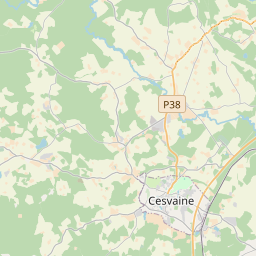
Land unit (cadastre designation: 70270100018)
Cadastre designation: 70270100018
Administrative area: Madonas novads
Cadastre designation of real estate | |
|---|---|
Cadastral object type | Cadastral object type: Land unit |
Administrative area | |
Cadastre number of the real estate in which this land unit is included | Cadastre number of the real estate in which this land unit is included: 70270100018 |
|
|
|
{"7201060210":{"name":"<div class='color_dot' style='background-color: #00ffff'><\/div><span>Specified land unit<\/span>","featureColor":"#00ffff","features":{"type":"FeatureCollection","features":[{"type":"Feature","geometry":{"type":"Polygon","coordinates":[[[26.314780462,56.982801722],[26.315048296,56.982769769],[26.315591219,56.982765453],[26.315854434,56.982756932],[26.316004767,56.982752063],[26.316154798,56.982747614],[26.31640378,56.982740227],[26.316518997,56.982736808],[26.317385609,56.982715022],[26.317525612,56.982715295],[26.318023244,56.982640122],[26.318705702,56.982538587],[26.319033215,56.982492373],[26.31979386,56.982297631],[26.320875522,56.982042451],[26.320873319,56.982096968],[26.320644308,56.982645997],[26.320017702,56.983915192],[26.319876487,56.984255569],[26.318990056,56.985893539],[26.315814963,56.986400741],[26.315747973,56.986411444],[26.315245308,56.984440693],[26.314975618,56.983477183],[26.3149691,56.983473997],[26.314780462,56.982801722]]]},"crs":{"type":"name","properties":{"name":"urn:ogc:def:crs:EPSG:3059"}},"properties":{"style":{"color":"#00ffff","dashArray":"8,12","weight":1},"name":"Land","object_type":"Parcel","parcel_code":"70270100019","code":null,"surveyor":null,"address":"","ownership":"<span>Owner - Natural person<br><\/span>","pro_cadastre_nr":"70270100018"}},{"type":"Feature","geometry":{"type":"Polygon","coordinates":[[[26.30904778,56.984287803],[26.309534738,56.984056982],[26.309805963,56.983940074],[26.311045081,56.983423119],[26.311326453,56.983303558],[26.311647181,56.98354032],[26.313352972,56.98576069],[26.312294622,56.986510796],[26.30904778,56.984287803]]]},"crs":{"type":"name","properties":{"name":"urn:ogc:def:crs:EPSG:3059"}},"properties":{"style":{"color":"#00ffff","dashArray":"8,12","weight":1},"name":"Land","object_type":"Parcel","parcel_code":"70270100018","code":null,"surveyor":null,"address":"","ownership":"<span>Owner - Natural person<br><\/span>","pro_cadastre_nr":"70270100018"}},{"type":"Feature","geometry":{"type":"Polygon","coordinates":[[[26.325395236,57.004547482],[26.325712882,57.004237628],[26.327499743,57.002669437],[26.329005978,57.003066533],[26.330576445,57.003620354],[26.33100127,57.004634026],[26.33097331,57.005037349],[26.330196506,57.005715381],[26.327844435,57.005298306],[26.325395236,57.004547482]]]},"crs":{"type":"name","properties":{"name":"urn:ogc:def:crs:EPSG:3059"}},"properties":{"style":{"color":"#00ffff","dashArray":"8,12","weight":1},"name":"Land","object_type":"Parcel","parcel_code":"70270060163","code":null,"surveyor":null,"address":"","ownership":"<span>Owner - Natural person<br><\/span>","pro_cadastre_nr":"70270100018"}}]}}}
[]
https://tile.openstreetmap.org/{z}/{x}/{y}.png|© OpenStreetMap contributors|minZoom: 7|maxZoom: 19
|
Land unit data updated: 20.12.2024.
Data source and license: Cadastre Information System open text and spatial data, Real Estate Market Database open data, open data license Creative Commons Attribution, OpenStreetMap
