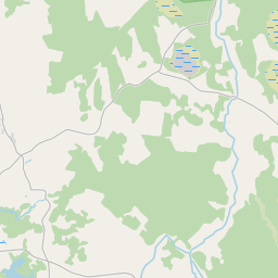
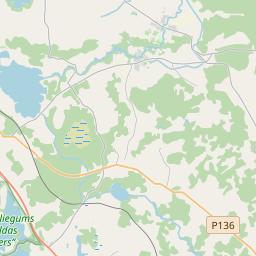
Land unit (cadastre designation: 68480030012)
Cadastre designation: 68480030012
Address: "Upmalas", Zeltiņi, Ciblas pagasts, Ludzas novads, LV-5709
Cadastre designation of real estate | |
|---|---|
Cadastral object type | Cadastral object type: Land unit |
Address | Address: "Upmalas", Zeltiņi, Ciblas pagasts, Ludzas novads, LV-5709 |
Cadastre number of the real estate in which this land unit is included | Cadastre number of the real estate in which this land unit is included: 68480030012 |
Address | |
|---|---|
Address ID | Address ID: 106469395 |
Companies registered at the address | Companies registered at the address: 0 |
Departments registered at the address | Departments registered at the address: 0 |
Institutions registered at the address | Institutions registered at the address: 0 |
Real estate registered at the address | |
Transactions with real estate at the address | Transactions with real estate at the address: 0 |
|
|
|
{"7201060510":{"name":"<div class='color_dot' style='background-color: #ff00ff'><\/div><span>Incorrect land units<\/span>","featureColor":"#ff00ff","features":{"type":"FeatureCollection","features":[{"type":"Feature","geometry":{"type":"Polygon","coordinates":[[[27.904038778,56.557542823],[27.905601587,56.556130617],[27.907655629,56.557101682],[27.907700238,56.557077779],[27.910892691,56.558558944],[27.910843522,56.55857748],[27.910722698,56.558623244],[27.907722649,56.55994906],[27.907271078,56.559074891],[27.906885297,56.558528428],[27.906729418,56.558356831],[27.906615015,56.558175126],[27.906150416,56.55810144],[27.906049329,56.55804876],[27.904112556,56.557543254],[27.904038778,56.557542823]]]},"crs":{"type":"name","properties":{"name":"urn:ogc:def:crs:EPSG:3059"}},"properties":{"style":{"color":"#ff00ff","dashArray":"0","weight":1},"name":"Incorrect land unit","object_type":"ParcelError","parcel_code":"68480030013","code":null,"surveyor":null,"address":"","ownership":"<span>Owner - Legal entity<br><\/span>","pro_cadastre_nr":"68480030012"}},{"type":"Feature","geometry":{"type":"Polygon","coordinates":[[[27.904038778,56.557542823],[27.905601587,56.556130617],[27.907655629,56.557101682],[27.907700238,56.557077779],[27.910892691,56.558558944],[27.910843522,56.55857748],[27.910722698,56.558623244],[27.907722649,56.55994906],[27.907271078,56.559074891],[27.906885297,56.558528428],[27.906729418,56.558356831],[27.906615015,56.558175126],[27.906150416,56.55810144],[27.906049329,56.55804876],[27.904112556,56.557543254],[27.904038778,56.557542823]]]},"crs":{"type":"name","properties":{"name":"urn:ogc:def:crs:EPSG:3059"}},"properties":{"style":{"color":"#ff00ff","dashArray":"0","weight":1},"name":"Incorrect land unit","object_type":"ParcelError","parcel_code":"68480030013","code":null,"surveyor":null,"address":"","ownership":"<span>Owner - Legal entity<br><\/span>","pro_cadastre_nr":"68480030012"}},{"type":"Feature","geometry":{"type":"Polygon","coordinates":[[[27.904038778,56.557542823],[27.905601587,56.556130617],[27.907655629,56.557101682],[27.907700238,56.557077779],[27.910892691,56.558558944],[27.910843522,56.55857748],[27.910722698,56.558623244],[27.907722649,56.55994906],[27.907271078,56.559074891],[27.906885297,56.558528428],[27.906729418,56.558356831],[27.906615015,56.558175126],[27.906150416,56.55810144],[27.906049329,56.55804876],[27.904112556,56.557543254],[27.904038778,56.557542823]]]},"crs":{"type":"name","properties":{"name":"urn:ogc:def:crs:EPSG:3059"}},"properties":{"style":{"color":"#ff00ff","dashArray":"0","weight":1},"name":"Incorrect land unit","object_type":"ParcelError","parcel_code":"68480030013","code":null,"surveyor":null,"address":"","ownership":"<span>Owner - Legal entity<br><\/span>","pro_cadastre_nr":"68480030012"}},{"type":"Feature","geometry":{"type":"Polygon","coordinates":[[[27.904038778,56.557542823],[27.905601587,56.556130617],[27.907655629,56.557101682],[27.907700238,56.557077779],[27.910892691,56.558558944],[27.910843522,56.55857748],[27.910722698,56.558623244],[27.907722649,56.55994906],[27.907271078,56.559074891],[27.906885297,56.558528428],[27.906729418,56.558356831],[27.906615015,56.558175126],[27.906150416,56.55810144],[27.906049329,56.55804876],[27.904112556,56.557543254],[27.904038778,56.557542823]]]},"crs":{"type":"name","properties":{"name":"urn:ogc:def:crs:EPSG:3059"}},"properties":{"style":{"color":"#ff00ff","dashArray":"0","weight":1},"name":"Incorrect land unit","object_type":"ParcelError","parcel_code":"68480030013","code":null,"surveyor":null,"address":"","ownership":"<span>Owner - Legal entity<br><\/span>","pro_cadastre_nr":"68480030012"}},{"type":"Feature","geometry":{"type":"Polygon","coordinates":[[[27.904038778,56.557542823],[27.905601587,56.556130617],[27.907655629,56.557101682],[27.907700238,56.557077779],[27.910892691,56.558558944],[27.910843522,56.55857748],[27.910722698,56.558623244],[27.907722649,56.55994906],[27.907271078,56.559074891],[27.906885297,56.558528428],[27.906729418,56.558356831],[27.906615015,56.558175126],[27.906150416,56.55810144],[27.906049329,56.55804876],[27.904112556,56.557543254],[27.904038778,56.557542823]]]},"crs":{"type":"name","properties":{"name":"urn:ogc:def:crs:EPSG:3059"}},"properties":{"style":{"color":"#ff00ff","dashArray":"0","weight":1},"name":"Incorrect land unit","object_type":"ParcelError","parcel_code":"68480030013","code":null,"surveyor":null,"address":"","ownership":"<span>Owner - Legal entity<br><\/span>","pro_cadastre_nr":"68480030012"}},{"type":"Feature","geometry":{"type":"Polygon","coordinates":[[[27.904038778,56.557542823],[27.905601587,56.556130617],[27.907655629,56.557101682],[27.907700238,56.557077779],[27.910892691,56.558558944],[27.910843522,56.55857748],[27.910722698,56.558623244],[27.907722649,56.55994906],[27.907271078,56.559074891],[27.906885297,56.558528428],[27.906729418,56.558356831],[27.906615015,56.558175126],[27.906150416,56.55810144],[27.906049329,56.55804876],[27.904112556,56.557543254],[27.904038778,56.557542823]]]},"crs":{"type":"name","properties":{"name":"urn:ogc:def:crs:EPSG:3059"}},"properties":{"style":{"color":"#ff00ff","dashArray":"0","weight":1},"name":"Incorrect land unit","object_type":"ParcelError","parcel_code":"68480030013","code":null,"surveyor":null,"address":"","ownership":"<span>Owner - Legal entity<br><\/span>","pro_cadastre_nr":"68480030012"}}]}},"7201060210":{"name":"<div class='color_dot' style='background-color: #00ffff'><\/div><span>Specified land unit<\/span>","featureColor":"#00ffff","features":{"type":"FeatureCollection","features":[{"type":"Feature","geometry":{"type":"Polygon","coordinates":[[[27.904023528,56.557525363],[27.905563591,56.556164958],[27.905606278,56.556185242],[27.906069637,56.556407675],[27.906664042,56.556687463],[27.907266862,56.556968396],[27.907612687,56.557135425],[27.907700238,56.557077779],[27.910892691,56.558558944],[27.910843522,56.55857748],[27.910722698,56.558623244],[27.907722649,56.55994906],[27.907271078,56.559074891],[27.906885297,56.558528428],[27.906729418,56.558356831],[27.906615015,56.558175126],[27.906150416,56.55810144],[27.906049329,56.55804876],[27.904112556,56.557543254],[27.904023528,56.557525363]]]},"crs":{"type":"name","properties":{"name":"urn:ogc:def:crs:EPSG:3059"}},"properties":{"style":{"color":"#00ffff","dashArray":"8,12","weight":1},"name":"Land","object_type":"Parcel","parcel_code":"68480030013","code":null,"surveyor":null,"address":"","ownership":"<span>Owner - Legal entity<br><\/span>","pro_cadastre_nr":"68480030012"}},{"type":"Feature","geometry":{"type":"Polygon","coordinates":[[[27.885601026,56.549851615],[27.885656245,56.549828575],[27.886091144,56.549663289],[27.887988018,56.549586203],[27.889393054,56.550200513],[27.890059238,56.550061696],[27.891365124,56.549786166],[27.895675124,56.551672108],[27.892549214,56.552301764],[27.892132354,56.552107014],[27.889009411,56.552105038],[27.888841413,56.552146351],[27.888799254,56.552065905],[27.888767016,56.551995337],[27.888776701,56.551934758],[27.888790271,56.551867772],[27.888808849,56.55180357],[27.888799436,56.551756143],[27.888757653,56.551703453],[27.888669419,56.551640915],[27.88859062,56.551602253],[27.888497315,56.551578801],[27.888467303,56.551552108],[27.888441891,56.551503932],[27.88846045,56.551352658],[27.88850785,56.551259965],[27.888496966,56.551176165],[27.888447589,56.551026039],[27.888433549,56.550933544],[27.888385657,56.550843377],[27.888258231,56.550642668],[27.888226194,56.550549945],[27.888140393,56.550444635],[27.888052491,56.550363248],[27.887991676,56.550321477],[27.887702909,56.550186204],[27.88761822,56.550136108],[27.887562529,56.550102692],[27.887278001,56.550025187],[27.886664978,56.55003057],[27.88614291,56.550080815],[27.886014657,56.550071018],[27.885937325,56.550048324],[27.8857492,56.549939112],[27.885601026,56.549851615]]]},"crs":{"type":"name","properties":{"name":"urn:ogc:def:crs:EPSG:3059"}},"properties":{"style":{"color":"#00ffff","dashArray":"8,12","weight":1},"name":"Land","object_type":"Parcel","parcel_code":"68480030012","code":null,"surveyor":null,"address":"\"Upmalas\", Zelti\u0146i, Ciblas pag., Ludzas nov., LV-5709","ownership":"<span>Owner - Legal entity<br><\/span>","pro_cadastre_nr":"68480030012"}}]}}}
{"7201060210":{"name":"<div class='color_dot' style='background-color: #00ffff'><\/div><span>Specified land unit<\/span>","featureColor":"#00ffff","features":{"type":"FeatureCollection","features":[{"type":"Feature","geometry":{"type":"Polygon","coordinates":[[[27.904038778,56.557542823],[27.905563591,56.556164958],[27.905606278,56.556185242],[27.906069637,56.556407675],[27.906664042,56.556687463],[27.907266862,56.556968396],[27.907612687,56.557135425],[27.907700238,56.557077779],[27.910892691,56.558558944],[27.910843522,56.55857748],[27.910722698,56.558623244],[27.907722649,56.55994906],[27.907271078,56.559074891],[27.906885297,56.558528428],[27.906729418,56.558356831],[27.906615015,56.558175126],[27.906150416,56.55810144],[27.906049329,56.55804876],[27.904112556,56.557543254],[27.904038778,56.557542823]]]},"crs":{"type":"name","properties":{"name":"urn:ogc:def:crs:EPSG:3059"}},"properties":{"style":{"color":"#00ffff","dashArray":"8,12","weight":1},"name":"Land","object_type":"Parcel","parcel_code":"68480030013","code":null,"surveyor":null,"address":"","ownership":null,"pro_cadastre_nr":null}}]}}}
https://tile.openstreetmap.org/{z}/{x}/{y}.png|© OpenStreetMap contributors|minZoom: 7|maxZoom: 19
|
Land unit data updated: 23.01.2025.
Data source and license: Cadastre Information System open text and spatial data, Real Estate Market Database open data, open data license Creative Commons Attribution, OpenStreetMap

