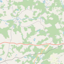
Land unit (cadastre designation: 64660030002)
Cadastre designation: 64660030002
Address: "Dobeļi", Kalvenes pagasts, Dienvidkurzemes novads, LV-3442
Cadastre designation of real estate | |
|---|---|
Cadastral object type | Cadastral object type: Land unit |
Address | Address: "Dobeļi", Kalvenes pagasts, Dienvidkurzemes novads, LV-3442 |
Cadastre number of the real estate in which this land unit is included | Cadastre number of the real estate in which this land unit is included: 64660030002 |
Address | |
|---|---|
Address ID | Address ID: 103846216 |
Companies registered at the address | |
Departments registered at the address | |
Institutions registered at the address | Institutions registered at the address: 0 |
Real estate registered at the address | |
Transactions with real estate at the address | Transactions with real estate at the address: 0 |
|
|
|
{"7201060110":{"name":"<div class='color_dot' style='background-color: #00ffff'><\/div><span>Measured land unit<\/span>","featureColor":"#00ffff","features":{"type":"FeatureCollection","features":[{"type":"Feature","geometry":{"type":"Polygon","coordinates":[[[21.6100775,56.61212407],[21.610091073,56.612062742],[21.610977625,56.611784206],[21.611075406,56.611732692],[21.611075803,56.611645911],[21.611398362,56.611412482],[21.611605745,56.611515782],[21.611608081,56.611447561],[21.611482963,56.611329907],[21.611542905,56.611338697],[21.611663999,56.611356462],[21.612127511,56.611424471],[21.613426429,56.611721255],[21.616479988,56.612200752],[21.618128822,56.612583925],[21.620256882,56.613025254],[21.623194949,56.613621282],[21.624099384,56.613789168],[21.626180966,56.614379464],[21.628631395,56.614750409],[21.629517663,56.61487531],[21.629537618,56.614879124],[21.627868255,56.61553124],[21.627072143,56.615829991],[21.62305482,56.617394136],[21.622992892,56.617342338],[21.620805044,56.615512101],[21.620483841,56.614908718],[21.618391921,56.614379681],[21.617364698,56.614116133],[21.616246209,56.613904399],[21.614115644,56.613166882],[21.613872616,56.612781543],[21.61295768,56.612530878],[21.611855158,56.612299432],[21.610844125,56.612211487],[21.610546004,56.612181279],[21.610121879,56.612129488],[21.6100775,56.61212407]]]},"crs":{"type":"name","properties":{"name":"urn:ogc:def:crs:EPSG:3059"}},"properties":{"style":{"color":"#00ffff","dashArray":"0","weight":1},"name":"Land","object_type":"Parcel","parcel_code":"64660030056","code":null,"surveyor":null,"address":"","ownership":"<span>Owner - Natural person<br><\/span>","pro_cadastre_nr":"64660030002"}},{"type":"Feature","geometry":{"type":"Polygon","coordinates":[[[21.623296821,56.61743186],[21.627183517,56.615918563],[21.627979664,56.615619803],[21.629186282,56.615149661],[21.629540798,56.615011447],[21.63009946,56.614785805],[21.630565612,56.614614388],[21.630695505,56.615237797],[21.631029313,56.615655872],[21.631835636,56.616412543],[21.632133694,56.616707152],[21.632525047,56.617202905],[21.63090067,56.618462466],[21.629842058,56.618989844],[21.628583872,56.61928805],[21.627345916,56.619316306],[21.627431199,56.619639239],[21.62569129,56.619781889],[21.625319668,56.619930145],[21.624472809,56.619775673],[21.623764916,56.619782381],[21.623169995,56.619768273],[21.62444112,56.618469172],[21.624810527,56.61805812],[21.624153127,56.61781874],[21.623310341,56.617437969],[21.623296821,56.61743186]]]},"crs":{"type":"name","properties":{"name":"urn:ogc:def:crs:EPSG:3059"}},"properties":{"style":{"color":"#00ffff","dashArray":"0","weight":1},"name":"Land","object_type":"Parcel","parcel_code":"64660030002","code":null,"surveyor":null,"address":"\"Dobe\u013ci\", Kalvenes pag., Dienvidkurzemes nov., LV-3442","ownership":"<span>Owner - Natural person<br><\/span>","pro_cadastre_nr":"64660030002"}}]}},"5201011110":{"name":"<div class='color_dot' style='background-color: #ff0000'><\/div><span>Measured building<\/span>","featureColor":"#ff0000","features":{"type":"FeatureCollection","features":[{"type":"Feature","geometry":{"type":"Polygon","coordinates":[[[21.628627768,56.616665765],[21.62894086,56.616555208],[21.629023891,56.616626692],[21.628774374,56.616714799],[21.628797031,56.616734292],[21.628733455,56.616756743],[21.628627768,56.616665765]]]},"crs":{"type":"name","properties":{"name":"urn:ogc:def:crs:EPSG:3059"}},"properties":{"style":{"color":"#ff0000","dashArray":"0","weight":1},"name":"Building","object_type":"Building","parcel_code":"64660030002","code":"64660030002005","surveyor":null,"address":"\"Dobe\u013ci\", Kalvenes pag., Dienvidkurzemes nov., LV-3442","ownership":"<span>Owner - Natural person<br><\/span>","pro_cadastre_nr":"64660030002"}},{"type":"Feature","geometry":{"type":"Polygon","coordinates":[[[21.628627768,56.616665765],[21.62894086,56.616555208],[21.629023891,56.616626692],[21.628774374,56.616714799],[21.628797031,56.616734292],[21.628733455,56.616756743],[21.628627768,56.616665765]]]},"crs":{"type":"name","properties":{"name":"urn:ogc:def:crs:EPSG:3059"}},"properties":{"style":{"color":"#ff0000","dashArray":"0","weight":1},"name":"Building","object_type":"Building","parcel_code":"64660030002","code":"64660030002005","surveyor":null,"address":"\"Dobe\u013ci\", Kalvenes pag., Dienvidkurzemes nov., LV-3442","ownership":"<span>Owner - Natural person<br><\/span>","pro_cadastre_nr":"64660030002"}}]}}}
[]
https://tile.openstreetmap.org/{z}/{x}/{y}.png|© OpenStreetMap contributors|minZoom: 7|maxZoom: 19
|
Land unit data updated: 20.12.2024.
Data source and license: Cadastre Information System open text and spatial data, Real Estate Market Database open data, open data license Creative Commons Attribution, OpenStreetMap


