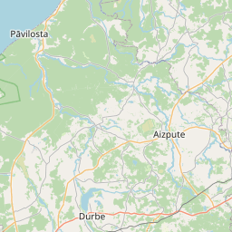
Land unit (cadastre designation: 64560010235)
Cadastre designation: 64560010235
Administrative area: Dienvidkurzemes novads
Cadastre designation of real estate | |
|---|---|
Cadastral object type | Cadastral object type: Land unit |
Administrative area | |
Cadastre number of the real estate in which this land unit is included | Cadastre number of the real estate in which this land unit is included: 64560010235 |
|
|
|
{"7201060110":{"name":"<div class='color_dot' style='background-color: #00ffff'><\/div><span>Measured land unit<\/span>","featureColor":"#00ffff","features":{"type":"FeatureCollection","features":[{"type":"Feature","geometry":{"type":"Polygon","coordinates":[[[21.395541589,56.457149437],[21.396936349,56.456060238],[21.397615025,56.455412284],[21.397618307,56.455409153],[21.39768581,56.455344697],[21.398578936,56.455509291],[21.399908223,56.455755032],[21.399924481,56.455741109],[21.400532591,56.455220224],[21.398643717,56.454624184],[21.399356586,56.454127458],[21.39978973,56.45382472],[21.400249746,56.453503193],[21.40033328,56.453534172],[21.401201944,56.453856333],[21.401890654,56.454140412],[21.402862293,56.45454541],[21.404193433,56.455107607],[21.404365881,56.455157979],[21.404160258,56.455387532],[21.403817839,56.455559648],[21.403660103,56.455587176],[21.403319428,56.455646655],[21.403023817,56.455648269],[21.402880312,56.455706994],[21.402565052,56.455996598],[21.402458376,56.456528325],[21.402317004,56.457057268],[21.401935907,56.458413413],[21.401852353,56.458479054],[21.401839248,56.458489341],[21.401536597,56.458490795],[21.401292395,56.458563632],[21.401092319,56.458711444],[21.400914557,56.4587389],[21.400663745,56.458702466],[21.400291149,56.458491992],[21.399957814,56.458236088],[21.399543183,56.45812606],[21.399082401,56.458073529],[21.398772734,56.458074838],[21.398502019,56.458123728],[21.398337485,56.458207226],[21.398238438,56.458167733],[21.395549811,56.457151677],[21.395541589,56.457149437]]]},"crs":{"type":"name","properties":{"name":"urn:ogc:def:crs:EPSG:3059"}},"properties":{"style":{"color":"#00ffff","dashArray":"0","weight":1},"name":"Land","object_type":"Parcel","parcel_code":"64560070092","code":null,"surveyor":null,"address":"","ownership":"<span>Owner - Legal entity<br><\/span>","pro_cadastre_nr":"64560010235"}},{"type":"Feature","geometry":{"type":"Polygon","coordinates":[[[21.312795825,56.489735833],[21.31316334,56.488061093],[21.313376008,56.487111979],[21.313479234,56.486898778],[21.314149536,56.485463569],[21.314964203,56.483724843],[21.316188626,56.48388106],[21.316224455,56.483886212],[21.316234834,56.4838531],[21.316584985,56.482735839],[21.31740134,56.482846901],[21.316815492,56.483951257],[21.316806394,56.483969909],[21.316681163,56.484276571],[21.315356666,56.487139844],[21.315293671,56.48726276],[21.315283503,56.48728181],[21.315867994,56.487388503],[21.315938454,56.487401361],[21.315816419,56.48748294],[21.314894642,56.489808442],[21.312795825,56.489735833]]]},"crs":{"type":"name","properties":{"name":"urn:ogc:def:crs:EPSG:3059"}},"properties":{"style":{"color":"#00ffff","dashArray":"0","weight":1},"name":"Land","object_type":"Parcel","parcel_code":"64560010410","code":null,"surveyor":null,"address":"","ownership":"<span>Owner - Legal entity<br><\/span>","pro_cadastre_nr":"64560010235"}},{"type":"Feature","geometry":{"type":"Polygon","coordinates":[[[21.293305393,56.463613746],[21.293656415,56.463539764],[21.294280527,56.463410482],[21.295888945,56.462992247],[21.296633978,56.462861813],[21.297067536,56.462816261],[21.297638457,56.462814855],[21.299369737,56.462908799],[21.299383431,56.463506037],[21.299428339,56.465429985],[21.299972304,56.465773288],[21.296541402,56.465860449],[21.296529756,56.465860735],[21.296464139,56.465485622],[21.296490514,56.465446703],[21.296494353,56.46527922],[21.295619551,56.464622635],[21.293324951,56.463622271],[21.293305393,56.463613746]]]},"crs":{"type":"name","properties":{"name":"urn:ogc:def:crs:EPSG:3059"}},"properties":{"style":{"color":"#00ffff","dashArray":"0","weight":1},"name":"Land","object_type":"Parcel","parcel_code":"64560010235","code":null,"surveyor":null,"address":"","ownership":"<span>Owner - Legal entity<br><\/span>","pro_cadastre_nr":"64560010235"}}]}}}
[]
https://tile.openstreetmap.org/{z}/{x}/{y}.png|© OpenStreetMap contributors|minZoom: 7|maxZoom: 19
|
Land unit data updated: 23.01.2025.
Data source and license: Cadastre Information System open text and spatial data, Real Estate Market Database open data, open data license Creative Commons Attribution, OpenStreetMap

