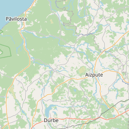
Land unit (cadastre designation: 62420090076)
Cadastre designation: 62420090076
Address: "Vīnkalni", Alsungas pagasts, Kuldīgas novads, LV-3306
Cadastre designation of real estate | |
|---|---|
Cadastral object type | Cadastral object type: Land unit |
Address | Address: "Vīnkalni", Alsungas pagasts, Kuldīgas novads, LV-3306 |
Cadastre number of the real estate in which this land unit is included | Cadastre number of the real estate in which this land unit is included: 62420090076 |
Address | |
|---|---|
Address ID | Address ID: 103233711 |
Companies registered at the address | |
Departments registered at the address | Departments registered at the address: 0 |
Institutions registered at the address | Institutions registered at the address: 0 |
Real estate registered at the address | |
Transactions with real estate at the address | Transactions with real estate at the address: 0 |
|
|
|
{"7201060210":{"name":"<div class='color_dot' style='background-color: #00ffff'><\/div><span>Specified land unit<\/span>","featureColor":"#00ffff","features":{"type":"FeatureCollection","features":[{"type":"Feature","geometry":{"type":"Polygon","coordinates":[[[21.654615186,56.976196283],[21.655399406,56.97545234],[21.655049218,56.97515682],[21.65675692,56.974429129],[21.658287166,56.973771396],[21.659389056,56.973367605],[21.659172894,56.972067642],[21.657510968,56.971998969],[21.656310621,56.971409589],[21.657847633,56.97089067],[21.659599222,56.970310973],[21.660242454,56.97086507],[21.66150263,56.972943347],[21.661739004,56.973307481],[21.662010082,56.973699789],[21.662663154,56.974530833],[21.662922252,56.974547879],[21.663200246,56.974566167],[21.663605168,56.974592801],[21.663617347,56.97489672],[21.663362904,56.976151783],[21.661740747,56.976143457],[21.659898026,56.976119102],[21.660109751,56.974984699],[21.658321347,56.975809507],[21.657753862,56.976412241],[21.657184961,56.977027267],[21.656499038,56.977470116],[21.655703359,56.977184368],[21.654615186,56.976196283]]]},"crs":{"type":"name","properties":{"name":"urn:ogc:def:crs:EPSG:3059"}},"properties":{"style":{"color":"#00ffff","dashArray":"8,12","weight":1},"name":"Land","object_type":"Parcel","parcel_code":"62420090076","code":null,"surveyor":null,"address":"\"V\u012bnkalni\", Alsungas pag., Kuld\u012bgas nov., LV-3306","ownership":"<span>Owner - Natural person<br><\/span>","pro_cadastre_nr":"62420090076"}},{"type":"Feature","geometry":{"type":"Polygon","coordinates":[[[21.53545505,57.011913261],[21.53555713,57.011889407],[21.537706433,57.011391636],[21.537794455,57.011378054],[21.537822576,57.011416388],[21.538313414,57.012128637],[21.53871052,57.012693606],[21.539259421,57.01349545],[21.539274325,57.013517222],[21.53976499,57.014184284],[21.539725918,57.014191208],[21.537491068,57.014587246],[21.535806369,57.012370601],[21.53545505,57.011913261]]]},"crs":{"type":"name","properties":{"name":"urn:ogc:def:crs:EPSG:3059"}},"properties":{"style":{"color":"#00ffff","dashArray":"8,12","weight":1},"name":"Land","object_type":"Parcel","parcel_code":"62420030027","code":null,"surveyor":null,"address":"","ownership":"<span>Owner - Natural person<br><\/span>","pro_cadastre_nr":"62420090076"}}]}},"7114100000":{"name":"<div class='color_dot' style='background-color: #b40000'><\/div><span>Burdened access road servitude area<\/span>","featureColor":"#b40000","features":{"type":"FeatureCollection","features":[{"type":"Feature","geometry":{"type":"Polygon","coordinates":[[[21.658854472,56.970559441],[21.658927155,56.970994323],[21.658920181,56.971286095],[21.659187137,56.971802652],[21.65927359,56.972069338],[21.659523963,56.973410507],[21.660051425,56.97427606],[21.660072837,56.974386698],[21.660037729,56.974608998],[21.659926382,56.974732637],[21.659750225,56.974823062],[21.659574362,56.974851359],[21.658423647,56.974959873],[21.658161478,56.975038369],[21.657686335,56.975293712],[21.657307784,56.975518655],[21.656499068,56.977469632],[21.65641107,56.977437707],[21.657220291,56.975491072],[21.65759663,56.975265189],[21.658097717,56.974997122],[21.658398537,56.974908207],[21.659553658,56.974798948],[21.659706936,56.974774973],[21.659852956,56.974698022],[21.659936894,56.974607318],[21.65997388,56.97438526],[21.659952025,56.974275647],[21.659421297,56.973408172],[21.659175793,56.972067607],[21.659081457,56.971812231],[21.658821429,56.971287553],[21.658825509,56.970993661],[21.658762252,56.970589509],[21.658854472,56.970559441]]]},"crs":{"type":"name","properties":{"name":"urn:ogc:def:crs:EPSG:3059"}},"properties":{"style":{"color":"#b40000","dashArray":"4,2,1,2","weight":1},"name":"Burdened access road servitude area","object_type":"WayRestriction","parcel_code":"62420090076","code":"7315030100001","surveyor":null,"address":"\"V\u012bnkalni\", Alsungas pag., Kuld\u012bgas nov., LV-3306","ownership":"<span>Owner - Natural person<br><\/span>","pro_cadastre_nr":"62420090076"}}]}},"5201011310":{"name":"<div class='color_dot' style='background-color: #960096'><\/div><span>Vectorized building<\/span>","featureColor":"#960096","features":{"type":"FeatureCollection","features":[{"type":"Feature","geometry":{"type":"Polygon","coordinates":[[[21.661040127,56.974827997],[21.661214644,56.974748188],[21.661304726,56.974806938],[21.661168972,56.974869021],[21.661156925,56.974861166],[21.661118162,56.974878891],[21.661040127,56.974827997]]]},"crs":{"type":"name","properties":{"name":"urn:ogc:def:crs:EPSG:3059"}},"properties":{"style":{"color":"#960096","dashArray":"0","weight":2},"name":"Building","object_type":"Building","parcel_code":"62420090076","code":"62420090076002","surveyor":null,"address":"\"V\u012bnkalni\", Alsungas pag., Kuld\u012bgas nov., LV-3306","ownership":"<span>Owner - Natural person<br><\/span>","pro_cadastre_nr":"62420090076"}},{"type":"Feature","geometry":{"type":"Polygon","coordinates":[[[21.660195263,56.974851078],[21.660239936,56.974904404],[21.66014966,56.974926952],[21.660104986,56.974873626],[21.660195263,56.974851078]]]},"crs":{"type":"name","properties":{"name":"urn:ogc:def:crs:EPSG:3059"}},"properties":{"style":{"color":"#960096","dashArray":"0","weight":2},"name":"Building","object_type":"Building","parcel_code":"62420090076","code":"62420090076007","surveyor":null,"address":"\"V\u012bnkalni\", Alsungas pag., Kuld\u012bgas nov., LV-3306","ownership":"<span>Owner - Natural person<br><\/span>","pro_cadastre_nr":"62420090076"}},{"type":"Feature","geometry":{"type":"Polygon","coordinates":[[[21.6614247,56.974940636],[21.661543668,56.974907705],[21.661593225,56.974961114],[21.661474241,56.974994035],[21.6614247,56.974940636]]]},"crs":{"type":"name","properties":{"name":"urn:ogc:def:crs:EPSG:3059"}},"properties":{"style":{"color":"#960096","dashArray":"0","weight":2},"name":"Building","object_type":"Building","parcel_code":"62420090076","code":"62420090076003","surveyor":null,"address":"\"V\u012bnkalni\", Alsungas pag., Kuld\u012bgas nov., LV-3306","ownership":"<span>Owner - Natural person<br><\/span>","pro_cadastre_nr":"62420090076"}},{"type":"Feature","geometry":{"type":"Polygon","coordinates":[[[21.66191809,56.974809266],[21.661876313,56.974786891],[21.661942932,56.97474979],[21.661984726,56.974772166],[21.66191809,56.974809266]]]},"crs":{"type":"name","properties":{"name":"urn:ogc:def:crs:EPSG:3059"}},"properties":{"style":{"color":"#960096","dashArray":"0","weight":2},"name":"Building","object_type":"Building","parcel_code":"62420090076","code":"62420090076005","surveyor":null,"address":"\"V\u012bnkalni\", Alsungas pag., Kuld\u012bgas nov., LV-3306","ownership":"<span>Owner - Natural person<br><\/span>","pro_cadastre_nr":"62420090076"}},{"type":"Feature","geometry":{"type":"Polygon","coordinates":[[[21.661593225,56.974961114],[21.661543668,56.974907705],[21.661638888,56.974881358],[21.66168843,56.974934757],[21.661593225,56.974961114]]]},"crs":{"type":"name","properties":{"name":"urn:ogc:def:crs:EPSG:3059"}},"properties":{"style":{"color":"#960096","dashArray":"0","weight":2},"name":"Building","object_type":"Building","parcel_code":"62420090076","code":"62420090076004","surveyor":null,"address":"\"V\u012bnkalni\", Alsungas pag., Kuld\u012bgas nov., LV-3306","ownership":"<span>Owner - Natural person<br><\/span>","pro_cadastre_nr":"62420090076"}},{"type":"Feature","geometry":{"type":"Polygon","coordinates":[[[21.661650432,56.974608247],[21.661583215,56.974631533],[21.661605993,56.97464959],[21.661547842,56.974669738],[21.661463812,56.974598971],[21.661439001,56.974607565],[21.661418876,56.974590231],[21.661443721,56.974581619],[21.661420973,56.974562044],[21.661546307,56.974518619],[21.661650432,56.974608247]]]},"crs":{"type":"name","properties":{"name":"urn:ogc:def:crs:EPSG:3059"}},"properties":{"style":{"color":"#960096","dashArray":"0","weight":2},"name":"Building","object_type":"Building","parcel_code":"62420090076","code":"62420090076001","surveyor":null,"address":"\"V\u012bnkalni\", Alsungas pag., Kuld\u012bgas nov., LV-3306","ownership":"<span>Owner - Natural person<br><\/span>","pro_cadastre_nr":"62420090076"}},{"type":"Feature","geometry":{"type":"Polygon","coordinates":[[[21.661176896,56.974486],[21.661261045,56.974451978],[21.661316409,56.974492815],[21.661228224,56.974528478],[21.661212307,56.974516732],[21.661177787,56.974531633],[21.661160815,56.974519121],[21.661199372,56.974502579],[21.661176896,56.974486]]]},"crs":{"type":"name","properties":{"name":"urn:ogc:def:crs:EPSG:3059"}},"properties":{"style":{"color":"#960096","dashArray":"0","weight":2},"name":"Building","object_type":"Building","parcel_code":"62420090076","code":"62420090076006","surveyor":null,"address":"\"V\u012bnkalni\", Alsungas pag., Kuld\u012bgas nov., LV-3306","ownership":"<span>Owner - Natural person<br><\/span>","pro_cadastre_nr":"62420090076"}},{"type":"Feature","geometry":{"type":"Polygon","coordinates":[[[21.660195263,56.974851078],[21.660239936,56.974904404],[21.66014966,56.974926952],[21.660104986,56.974873626],[21.660195263,56.974851078]]]},"crs":{"type":"name","properties":{"name":"urn:ogc:def:crs:EPSG:3059"}},"properties":{"style":{"color":"#960096","dashArray":"0","weight":2},"name":"Building","object_type":"Building","parcel_code":"62420090076","code":"62420090076007","surveyor":null,"address":"\"V\u012bnkalni\", Alsungas pag., Kuld\u012bgas nov., LV-3306","ownership":"<span>Owner - Natural person<br><\/span>","pro_cadastre_nr":"62420090076"}},{"type":"Feature","geometry":{"type":"Polygon","coordinates":[[[21.661176896,56.974486],[21.661261045,56.974451978],[21.661316409,56.974492815],[21.661228224,56.974528478],[21.661212307,56.974516732],[21.661177787,56.974531633],[21.661160815,56.974519121],[21.661199372,56.974502579],[21.661176896,56.974486]]]},"crs":{"type":"name","properties":{"name":"urn:ogc:def:crs:EPSG:3059"}},"properties":{"style":{"color":"#960096","dashArray":"0","weight":2},"name":"Building","object_type":"Building","parcel_code":"62420090076","code":"62420090076006","surveyor":null,"address":"\"V\u012bnkalni\", Alsungas pag., Kuld\u012bgas nov., LV-3306","ownership":"<span>Owner - Natural person<br><\/span>","pro_cadastre_nr":"62420090076"}},{"type":"Feature","geometry":{"type":"Polygon","coordinates":[[[21.66191809,56.974809266],[21.661876313,56.974786891],[21.661942932,56.97474979],[21.661984726,56.974772166],[21.66191809,56.974809266]]]},"crs":{"type":"name","properties":{"name":"urn:ogc:def:crs:EPSG:3059"}},"properties":{"style":{"color":"#960096","dashArray":"0","weight":2},"name":"Building","object_type":"Building","parcel_code":"62420090076","code":"62420090076005","surveyor":null,"address":"\"V\u012bnkalni\", Alsungas pag., Kuld\u012bgas nov., LV-3306","ownership":"<span>Owner - Natural person<br><\/span>","pro_cadastre_nr":"62420090076"}},{"type":"Feature","geometry":{"type":"Polygon","coordinates":[[[21.661593225,56.974961114],[21.661543668,56.974907705],[21.661638888,56.974881358],[21.66168843,56.974934757],[21.661593225,56.974961114]]]},"crs":{"type":"name","properties":{"name":"urn:ogc:def:crs:EPSG:3059"}},"properties":{"style":{"color":"#960096","dashArray":"0","weight":2},"name":"Building","object_type":"Building","parcel_code":"62420090076","code":"62420090076004","surveyor":null,"address":"\"V\u012bnkalni\", Alsungas pag., Kuld\u012bgas nov., LV-3306","ownership":"<span>Owner - Natural person<br><\/span>","pro_cadastre_nr":"62420090076"}},{"type":"Feature","geometry":{"type":"Polygon","coordinates":[[[21.6614247,56.974940636],[21.661543668,56.974907705],[21.661593225,56.974961114],[21.661474241,56.974994035],[21.6614247,56.974940636]]]},"crs":{"type":"name","properties":{"name":"urn:ogc:def:crs:EPSG:3059"}},"properties":{"style":{"color":"#960096","dashArray":"0","weight":2},"name":"Building","object_type":"Building","parcel_code":"62420090076","code":"62420090076003","surveyor":null,"address":"\"V\u012bnkalni\", Alsungas pag., Kuld\u012bgas nov., LV-3306","ownership":"<span>Owner - Natural person<br><\/span>","pro_cadastre_nr":"62420090076"}},{"type":"Feature","geometry":{"type":"Polygon","coordinates":[[[21.661040127,56.974827997],[21.661214644,56.974748188],[21.661304726,56.974806938],[21.661168972,56.974869021],[21.661156925,56.974861166],[21.661118162,56.974878891],[21.661040127,56.974827997]]]},"crs":{"type":"name","properties":{"name":"urn:ogc:def:crs:EPSG:3059"}},"properties":{"style":{"color":"#960096","dashArray":"0","weight":2},"name":"Building","object_type":"Building","parcel_code":"62420090076","code":"62420090076002","surveyor":null,"address":"\"V\u012bnkalni\", Alsungas pag., Kuld\u012bgas nov., LV-3306","ownership":"<span>Owner - Natural person<br><\/span>","pro_cadastre_nr":"62420090076"}},{"type":"Feature","geometry":{"type":"Polygon","coordinates":[[[21.661650432,56.974608247],[21.661583215,56.974631533],[21.661605993,56.97464959],[21.661547842,56.974669738],[21.661463812,56.974598971],[21.661439001,56.974607565],[21.661418876,56.974590231],[21.661443721,56.974581619],[21.661420973,56.974562044],[21.661546307,56.974518619],[21.661650432,56.974608247]]]},"crs":{"type":"name","properties":{"name":"urn:ogc:def:crs:EPSG:3059"}},"properties":{"style":{"color":"#960096","dashArray":"0","weight":2},"name":"Building","object_type":"Building","parcel_code":"62420090076","code":"62420090076001","surveyor":null,"address":"\"V\u012bnkalni\", Alsungas pag., Kuld\u012bgas nov., LV-3306","ownership":"<span>Owner - Natural person<br><\/span>","pro_cadastre_nr":"62420090076"}}]}}}
[]
https://tile.openstreetmap.org/{z}/{x}/{y}.png|© OpenStreetMap contributors|minZoom: 7|maxZoom: 19
|
Land unit data updated: 10.01.2025.
Data source and license: Cadastre Information System open text and spatial data, Real Estate Market Database open data, open data license Creative Commons Attribution, OpenStreetMap

