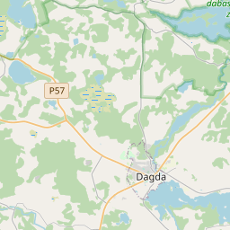
Land unit (cadastre designation: 60760053091)
Cadastre designation: 60760053091
Administrative area: Krāslavas novads
Cadastre designation of real estate | |
|---|---|
Cadastral object type | Cadastral object type: Land unit |
Administrative area | |
Cadastre number of the real estate in which this land unit is included | Cadastre number of the real estate in which this land unit is included: 60760053091 |
|
|
|
{"7201060310":{"name":"<div class='color_dot' style='background-color: #00ffff'><\/div><span>Projected land unit<\/span>","featureColor":"#00ffff","features":{"type":"FeatureCollection","features":[{"type":"Feature","geometry":{"type":"Polygon","coordinates":[[[27.453518748,56.04448569],[27.456500908,56.044148849],[27.458520756,56.04393625],[27.459900923,56.043762946],[27.460311049,56.043740572],[27.460789474,56.043873065],[27.463081295,56.044652739],[27.463750095,56.044859191],[27.467104579,56.045963335],[27.467591468,56.046030109],[27.467768244,56.046100481],[27.468487097,56.045919504],[27.469192447,56.045831834],[27.470051552,56.045765726],[27.470435075,56.045797672],[27.470633374,56.045825068],[27.471071834,56.045917737],[27.471731878,56.046064117],[27.47236474,56.046206673],[27.472468097,56.04622739],[27.472685448,56.046259749],[27.472901767,56.046276707],[27.473008633,56.046278749],[27.473111434,56.046275061],[27.473282555,56.046259756],[27.474423967,56.046105533],[27.474581589,56.046080905],[27.474797899,56.046037953],[27.474875494,56.045992851],[27.47493503,56.046088025],[27.474627222,56.046133152],[27.474262678,56.04618761],[27.473999418,56.046231165],[27.473654354,56.046290035],[27.4733485,56.04633175],[27.473085723,56.04635034],[27.472800942,56.046366483],[27.472711027,56.046362147],[27.472614745,56.046351687],[27.472453111,56.046328162],[27.472213903,56.046274255],[27.470897026,56.045971185],[27.47067958,56.045927901],[27.470466368,56.045903479],[27.470284836,56.045898736],[27.470124138,56.045909356],[27.469713966,56.045953414],[27.469242848,56.04599016],[27.468669704,56.04604942],[27.468436876,56.046089706],[27.468165702,56.046163799],[27.468029015,56.046193512],[27.46788519,56.046211018],[27.467795936,56.046203837],[27.467689501,56.046185486],[27.467642927,56.046168626],[27.467528043,56.046124151],[27.467568569,56.046082434],[27.467067952,56.046013781],[27.463661166,56.044892313],[27.463157329,56.044748084],[27.462660553,56.044569353],[27.461942678,56.044333183],[27.461246048,56.04410205],[27.460826528,56.04395547],[27.460525119,56.043890224],[27.460221369,56.043856566],[27.459817038,56.043886437],[27.458337422,56.044062467],[27.457377001,56.044182459],[27.453632179,56.044613125],[27.453518748,56.04448569]]]},"crs":{"type":"name","properties":{"name":"urn:ogc:def:crs:EPSG:3059"}},"properties":{"style":{"color":"#00ffff","dashArray":"2,4","weight":1},"name":"Land","object_type":"Parcel","parcel_code":"60760053091","code":null,"surveyor":null,"address":"","ownership":"<span>Legal owner - Municipality<br><\/span>","pro_cadastre_nr":"60760053091"}}]}}}
[]
https://tile.openstreetmap.org/{z}/{x}/{y}.png|© OpenStreetMap contributors|minZoom: 7|maxZoom: 19
|
Land unit data updated: 23.01.2025.
Data source and license: Cadastre Information System open text and spatial data, Real Estate Market Database open data, open data license Creative Commons Attribution, OpenStreetMap

