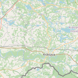
Land unit (cadastre designation: 60580040122)
Cadastre designation: 60580040122
Address: Ezeru iela 10, Grāveri, Grāveru pagasts, Krāslavas novads, LV-5655
Cadastre designation of real estate | |
|---|---|
Cadastral object type | Cadastral object type: Land unit |
Address | Address: Ezeru iela 10, Grāveri, Grāveru pagasts, Krāslavas novads, LV-5655 |
Cadastre number of the real estate in which this land unit is included | Cadastre number of the real estate in which this land unit is included: 60580040122 |
Address | |
|---|---|
Address ID | Address ID: 102767831 |
Companies registered at the address | Companies registered at the address: 0 |
Departments registered at the address | Departments registered at the address: 0 |
Institutions registered at the address | Institutions registered at the address: 0 |
Real estate registered at the address | |
Transactions with real estate at the address | Transactions with real estate at the address: 0 |
|
|
|
{"7201060210":{"name":"<div class='color_dot' style='background-color: #00ffff'><\/div><span>Specified land unit<\/span>","featureColor":"#00ffff","features":{"type":"FeatureCollection","features":[{"type":"Feature","geometry":{"type":"Polygon","coordinates":[[[27.134145856,56.053644191],[27.134322232,56.053116341],[27.136246798,56.05337618],[27.136359168,56.053393909],[27.136290034,56.053542563],[27.136281693,56.053562499],[27.13621057,56.053732366],[27.136233239,56.053855797],[27.136294941,56.053992403],[27.136445229,56.054151756],[27.136375255,56.054177755],[27.134829038,56.053919347],[27.134145856,56.053644191]]]},"crs":{"type":"name","properties":{"name":"urn:ogc:def:crs:EPSG:3059"}},"properties":{"style":{"color":"#00ffff","dashArray":"8,12","weight":1},"name":"Land","object_type":"Parcel","parcel_code":"60580040129","code":null,"surveyor":null,"address":"","ownership":"<span>Owner - Natural person<br><\/span>","pro_cadastre_nr":"60580040122"}},{"type":"Feature","geometry":{"type":"Polygon","coordinates":[[[27.129943625,56.054935795],[27.130056563,56.054496009],[27.131052861,56.05349805],[27.131604658,56.053889743],[27.131358257,56.054132121],[27.130942429,56.054541132],[27.13049335,56.054958249],[27.129943625,56.054935795]]]},"crs":{"type":"name","properties":{"name":"urn:ogc:def:crs:EPSG:3059"}},"properties":{"style":{"color":"#00ffff","dashArray":"8,12","weight":1},"name":"Land","object_type":"Parcel","parcel_code":"60580040128","code":null,"surveyor":null,"address":"","ownership":"<span>Owner - Natural person<br><\/span>","pro_cadastre_nr":"60580040122"}},{"type":"Feature","geometry":{"type":"Polygon","coordinates":[[[27.134300519,56.055482952],[27.134658917,56.05464728],[27.134671497,56.054593471],[27.135408503,56.054729134],[27.137399337,56.055119514],[27.137491125,56.055302623],[27.135286255,56.054980733],[27.135215143,56.055127081],[27.13510016,56.055363707],[27.134968326,56.055635013],[27.134300519,56.055482952]]]},"crs":{"type":"name","properties":{"name":"urn:ogc:def:crs:EPSG:3059"}},"properties":{"style":{"color":"#00ffff","dashArray":"8,12","weight":1},"name":"Land","object_type":"Parcel","parcel_code":"60580040127","code":null,"surveyor":null,"address":"","ownership":"<span>Owner - Natural person<br><\/span>","pro_cadastre_nr":"60580040122"}},{"type":"Feature","geometry":{"type":"Polygon","coordinates":[[[27.140397005,56.057788976],[27.140630461,56.057585781],[27.141058252,56.057219018],[27.141288986,56.057021744],[27.141781098,56.057004846],[27.141791004,56.057071102],[27.141968911,56.058260704],[27.142066691,56.058914451],[27.142074025,56.058963493],[27.141682383,56.059036375],[27.141345417,56.058391723],[27.140397005,56.057788976]]]},"crs":{"type":"name","properties":{"name":"urn:ogc:def:crs:EPSG:3059"}},"properties":{"style":{"color":"#00ffff","dashArray":"8,12","weight":1},"name":"Land","object_type":"Parcel","parcel_code":"60580040122","code":null,"surveyor":null,"address":"Ezeru iela 10, Gr\u0101veri, Gr\u0101veru pag., Kr\u0101slavas nov., LV-5655","ownership":"<span>Owner - Natural person<br><\/span>","pro_cadastre_nr":"60580040122"}},{"type":"Feature","geometry":{"type":"Polygon","coordinates":[[[27.145372571,56.049633751],[27.146165289,56.049732283],[27.147268263,56.04987906],[27.147061505,56.049182454],[27.147134957,56.048954913],[27.148654444,56.049076175],[27.148622165,56.049137951],[27.148406537,56.049569331],[27.148210558,56.049947402],[27.147997565,56.050341854],[27.147887441,56.050540018],[27.147114447,56.050419463],[27.147145535,56.050377333],[27.147335908,56.050119523],[27.145392514,56.049851582],[27.145372571,56.049633751]]]},"crs":{"type":"name","properties":{"name":"urn:ogc:def:crs:EPSG:3059"}},"properties":{"style":{"color":"#00ffff","dashArray":"8,12","weight":1},"name":"Land","object_type":"Parcel","parcel_code":"60580040087","code":null,"surveyor":null,"address":"","ownership":"<span>Owner - Natural person<br><\/span>","pro_cadastre_nr":"60580040122"}},{"type":"Feature","geometry":{"type":"Polygon","coordinates":[[[27.209232141,56.075943869],[27.210180591,56.075329531],[27.210690592,56.074962358],[27.210911636,56.074772548],[27.211030528,56.074559981],[27.211114768,56.074368725],[27.211156218,56.074199305],[27.211198116,56.074182212],[27.213466826,56.073167843],[27.217139112,56.074168232],[27.216770316,56.074916727],[27.215496801,56.075058951],[27.213376418,56.07621435],[27.212333956,56.076782345],[27.211422399,56.077066699],[27.210221367,56.076451007],[27.209259024,56.075957652],[27.209232141,56.075943869]]]},"crs":{"type":"name","properties":{"name":"urn:ogc:def:crs:EPSG:3059"}},"properties":{"style":{"color":"#00ffff","dashArray":"8,12","weight":1},"name":"Land","object_type":"Parcel","parcel_code":"60580030012","code":null,"surveyor":null,"address":"","ownership":"<span>Owner - Natural person<br><\/span>","pro_cadastre_nr":"60580040122"}}]}},"7114100000":{"name":"<div class='color_dot' style='background-color: #b40000'><\/div><span>Burdened access road servitude area<\/span>","featureColor":"#b40000","features":{"type":"FeatureCollection","features":[{"type":"Feature","geometry":{"type":"Polygon","coordinates":[[[27.136445229,56.054151756],[27.136404932,56.054166725],[27.136248261,56.053999002],[27.136185347,56.053858552],[27.13616369,56.053726223],[27.136244971,56.053533065],[27.136317175,56.053387399],[27.136359168,56.053393909],[27.136290034,56.053542563],[27.136281693,56.053562499],[27.13621057,56.053732366],[27.136233239,56.053855797],[27.136294941,56.053992403],[27.136445229,56.054151756]]]},"crs":{"type":"name","properties":{"name":"urn:ogc:def:crs:EPSG:3059"}},"properties":{"style":{"color":"#b40000","dashArray":"4,2,1,2","weight":1},"name":"Burdened access road servitude area","object_type":"WayRestriction","parcel_code":"60580040129","code":"7315030100001","surveyor":null,"address":"","ownership":"<span>Owner - Natural person<br><\/span>","pro_cadastre_nr":"60580040122"}},{"type":"Feature","geometry":{"type":"Polygon","coordinates":[[[27.137436495,56.055294645],[27.137346752,56.05510921],[27.137399337,56.055119514],[27.137491125,56.055302623],[27.137436495,56.055294645]]]},"crs":{"type":"name","properties":{"name":"urn:ogc:def:crs:EPSG:3059"}},"properties":{"style":{"color":"#b40000","dashArray":"4,2,1,2","weight":1},"name":"Burdened access road servitude area","object_type":"WayRestriction","parcel_code":"60580040127","code":"7315030100001","surveyor":null,"address":"","ownership":"<span>Owner - Natural person<br><\/span>","pro_cadastre_nr":"60580040122"}}]}},"5201011310":{"name":"<div class='color_dot' style='background-color: #960096'><\/div><span>Vectorized building<\/span>","featureColor":"#960096","features":{"type":"FeatureCollection","features":[{"type":"Feature","geometry":{"type":"Polygon","coordinates":[[[27.141906433,56.058526312],[27.141916406,56.058561793],[27.141868851,56.05856599],[27.141858861,56.0585305],[27.141906433,56.058526312]]]},"crs":{"type":"name","properties":{"name":"urn:ogc:def:crs:EPSG:3059"}},"properties":{"style":{"color":"#960096","dashArray":"0","weight":2},"name":"Building","object_type":"Building","parcel_code":"60580040122","code":"60580040122006","surveyor":null,"address":"Ezeru iela 10, Gr\u0101veri, Gr\u0101veru pag., Kr\u0101slavas nov., LV-5655","ownership":null,"pro_cadastre_nr":null}},{"type":"Feature","geometry":{"type":"Polygon","coordinates":[[[27.141723277,56.058803833],[27.141737717,56.058848001],[27.141674552,56.058854465],[27.141660112,56.058810297],[27.141723277,56.058803833]]]},"crs":{"type":"name","properties":{"name":"urn:ogc:def:crs:EPSG:3059"}},"properties":{"style":{"color":"#960096","dashArray":"0","weight":2},"name":"Building","object_type":"Building","parcel_code":"60580040122","code":"60580040122005","surveyor":null,"address":"Ezeru iela 10, Gr\u0101veri, Gr\u0101veru pag., Kr\u0101slavas nov., LV-5655","ownership":null,"pro_cadastre_nr":null}},{"type":"Feature","geometry":{"type":"Polygon","coordinates":[[[27.142009542,56.05870583],[27.142028642,56.058788483],[27.141863253,56.058800446],[27.141844155,56.058717794],[27.142009542,56.05870583]]]},"crs":{"type":"name","properties":{"name":"urn:ogc:def:crs:EPSG:3059"}},"properties":{"style":{"color":"#960096","dashArray":"0","weight":2},"name":"Building","object_type":"Building","parcel_code":"60580040122","code":"60580040122001","surveyor":null,"address":"Ezeru iela 10, Gr\u0101veri, Gr\u0101veru pag., Kr\u0101slavas nov., LV-5655","ownership":"<span>Owner - Natural person<br><\/span>","pro_cadastre_nr":"60585040122"}},{"type":"Feature","geometry":{"type":"Polygon","coordinates":[[[27.141741002,56.058716404],[27.141750991,56.058751884],[27.141703419,56.058756072],[27.141693445,56.058720591],[27.141741002,56.058716404]]]},"crs":{"type":"name","properties":{"name":"urn:ogc:def:crs:EPSG:3059"}},"properties":{"style":{"color":"#960096","dashArray":"0","weight":2},"name":"Building","object_type":"Building","parcel_code":"60580040122","code":"60580040122004","surveyor":null,"address":"Ezeru iela 10, Gr\u0101veri, Gr\u0101veru pag., Kr\u0101slavas nov., LV-5655","ownership":null,"pro_cadastre_nr":null}},{"type":"Feature","geometry":{"type":"Polygon","coordinates":[[[27.141775288,56.058584906],[27.141782463,56.058629628],[27.141697732,56.058633872],[27.141690557,56.05858915],[27.141775288,56.058584906]]]},"crs":{"type":"name","properties":{"name":"urn:ogc:def:crs:EPSG:3059"}},"properties":{"style":{"color":"#960096","dashArray":"0","weight":2},"name":"Building","object_type":"Building","parcel_code":"60580040122","code":"60580040122002","surveyor":null,"address":"Ezeru iela 10, Gr\u0101veri, Gr\u0101veru pag., Kr\u0101slavas nov., LV-5655","ownership":"<span>Owner - Natural person<br><\/span>","pro_cadastre_nr":"60585040122"}},{"type":"Feature","geometry":{"type":"Polygon","coordinates":[[[27.141799249,56.058628787],[27.141805263,56.058666355],[27.141703745,56.058671441],[27.141697732,56.058633872],[27.141782463,56.058629628],[27.141799249,56.058628787]]]},"crs":{"type":"name","properties":{"name":"urn:ogc:def:crs:EPSG:3059"}},"properties":{"style":{"color":"#960096","dashArray":"0","weight":2},"name":"Building","object_type":"Building","parcel_code":"60580040122","code":"60580040122003","surveyor":null,"address":"Ezeru iela 10, Gr\u0101veri, Gr\u0101veru pag., Kr\u0101slavas nov., LV-5655","ownership":"<span>Owner - Natural person<br><\/span>","pro_cadastre_nr":"60585040122"}}]}}}
[]
https://tile.openstreetmap.org/{z}/{x}/{y}.png|© OpenStreetMap contributors|minZoom: 7|maxZoom: 19
|
Land unit data updated: 10.01.2025.
Data source and license: Cadastre Information System open text and spatial data, Real Estate Market Database open data, open data license Creative Commons Attribution, OpenStreetMap

