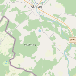
Land unit (cadastre designation: 56620030047)
Cadastre designation: 56620030047
Administrative area: Jēkabpils novads
Cadastre designation of real estate | |
|---|---|
Cadastral object type | Cadastral object type: Land unit |
Administrative area | |
Cadastre number of the real estate in which this land unit is included | Cadastre number of the real estate in which this land unit is included: 56620030045 |
|
|
|
{"7201060210":{"name":"<div class='color_dot' style='background-color: #00ffff'><\/div><span>Specified land unit<\/span>","featureColor":"#00ffff","features":{"type":"FeatureCollection","features":[{"type":"Feature","geometry":{"type":"Polygon","coordinates":[[[25.790725014,56.075846544],[25.790806977,56.075772016],[25.791188315,56.075541128],[25.791527725,56.075362502],[25.791785696,56.075229828],[25.791912689,56.075174254],[25.7925354,56.074958505],[25.792816098,56.074868688],[25.792957292,56.074842139],[25.793034501,56.074853266],[25.793133896,56.0748702],[25.793200438,56.074887601],[25.793300118,56.07491065],[25.794035708,56.075414392],[25.791829568,56.076592568],[25.79170545,56.076506616],[25.791591794,56.07642728],[25.79147539,56.076364195],[25.791255964,56.07622719],[25.791059152,56.076105188],[25.790837193,56.075965811],[25.790759121,56.075907373],[25.790725014,56.075846544]]]},"crs":{"type":"name","properties":{"name":"urn:ogc:def:crs:EPSG:3059"}},"properties":{"style":{"color":"#00ffff","dashArray":"8,12","weight":1},"name":"Land","object_type":"Parcel","parcel_code":"56620050010","code":null,"surveyor":null,"address":"","ownership":"<span>Owner - Natural person<br><\/span>","pro_cadastre_nr":"56620030045"}},{"type":"Feature","geometry":{"type":"Polygon","coordinates":[[[25.809023437,56.108187491],[25.809782533,56.108181652],[25.810001869,56.108158595],[25.810040268,56.108218098],[25.810370356,56.108729613],[25.809265696,56.108896606],[25.809023437,56.108187491]]]},"crs":{"type":"name","properties":{"name":"urn:ogc:def:crs:EPSG:3059"}},"properties":{"style":{"color":"#00ffff","dashArray":"8,12","weight":1},"name":"Land","object_type":"Parcel","parcel_code":"56620030047","code":null,"surveyor":null,"address":"","ownership":"<span>Owner - Natural person<br><\/span>","pro_cadastre_nr":"56620030045"}},{"type":"Feature","geometry":{"type":"Polygon","coordinates":[[[25.810454423,56.104797504],[25.811740392,56.104961041],[25.812054969,56.106130887],[25.811205778,56.106255506],[25.811083813,56.106062971],[25.810893817,56.105727758],[25.810685462,56.105282999],[25.810454423,56.104797504]]]},"crs":{"type":"name","properties":{"name":"urn:ogc:def:crs:EPSG:3059"}},"properties":{"style":{"color":"#00ffff","dashArray":"8,12","weight":1},"name":"Land","object_type":"Parcel","parcel_code":"56620030046","code":null,"surveyor":null,"address":"","ownership":"<span>Owner - Natural person<br><\/span>","pro_cadastre_nr":"56620030045"}},{"type":"Feature","geometry":{"type":"Polygon","coordinates":[[[25.809412031,56.104993709],[25.810302905,56.1048857],[25.810471826,56.105283598],[25.809663216,56.105368718],[25.809641449,56.105372281],[25.809447519,56.10539634],[25.809412031,56.104993709]]]},"crs":{"type":"name","properties":{"name":"urn:ogc:def:crs:EPSG:3059"}},"properties":{"style":{"color":"#00ffff","dashArray":"8,12","weight":1},"name":"Land","object_type":"Parcel","parcel_code":"56620030045","code":null,"surveyor":null,"address":"\"Gundegas\", G\u0101rsene, G\u0101rsenes pag., J\u0113kabpils nov., LV-5218","ownership":"<span>Owner - Natural person<br><\/span>","pro_cadastre_nr":"56620030045"}}]}},"5201011310":{"name":"<div class='color_dot' style='background-color: #960096'><\/div><span>Vectorized building<\/span>","featureColor":"#960096","features":{"type":"FeatureCollection","features":[{"type":"Feature","geometry":{"type":"Polygon","coordinates":[[[25.809575886,56.105035395],[25.809685513,56.105021118],[25.809712202,56.105085106],[25.809602576,56.105099383],[25.809575886,56.105035395]]]},"crs":{"type":"name","properties":{"name":"urn:ogc:def:crs:EPSG:3059"}},"properties":{"style":{"color":"#960096","dashArray":"0","weight":2},"name":"Building","object_type":"Building","parcel_code":"56620030045","code":"56620030045002","surveyor":null,"address":"\"Gundegas\", G\u0101rsene, G\u0101rsenes pag., J\u0113kabpils nov., LV-5218","ownership":null,"pro_cadastre_nr":null}},{"type":"Feature","geometry":{"type":"Polygon","coordinates":[[[25.809986042,56.105146154],[25.809943108,56.105055741],[25.810073195,56.105036446],[25.810116129,56.105126858],[25.809986042,56.105146154]]]},"crs":{"type":"name","properties":{"name":"urn:ogc:def:crs:EPSG:3059"}},"properties":{"style":{"color":"#960096","dashArray":"0","weight":2},"name":"Building","object_type":"Building","parcel_code":"56620030045","code":"56620030045001","surveyor":null,"address":"\"Gundegas\", G\u0101rsene, G\u0101rsenes pag., J\u0113kabpils nov., LV-5218","ownership":null,"pro_cadastre_nr":null}},{"type":"Feature","geometry":{"type":"Polygon","coordinates":[[[25.809834985,56.105226766],[25.8099185,56.105217697],[25.809935064,56.105265334],[25.809851549,56.105274404],[25.809834985,56.105226766]]]},"crs":{"type":"name","properties":{"name":"urn:ogc:def:crs:EPSG:3059"}},"properties":{"style":{"color":"#960096","dashArray":"0","weight":2},"name":"Building","object_type":"Building","parcel_code":"56620030045","code":"56620030045006","surveyor":null,"address":"\"Gundegas\", G\u0101rsene, G\u0101rsenes pag., J\u0113kabpils nov., LV-5218","ownership":null,"pro_cadastre_nr":null}},{"type":"Feature","geometry":{"type":"Polygon","coordinates":[[[25.809740904,56.105153926],[25.809754856,56.105187376],[25.809645213,56.105201654],[25.809631261,56.105168204],[25.809740904,56.105153926]]]},"crs":{"type":"name","properties":{"name":"urn:ogc:def:crs:EPSG:3059"}},"properties":{"style":{"color":"#960096","dashArray":"0","weight":2},"name":"Building","object_type":"Building","parcel_code":"56620030045","code":"56620030045004","surveyor":null,"address":"\"Gundegas\", G\u0101rsene, G\u0101rsenes pag., J\u0113kabpils nov., LV-5218","ownership":null,"pro_cadastre_nr":null}},{"type":"Feature","geometry":{"type":"Polygon","coordinates":[[[25.809780352,56.105282124],[25.809763805,56.105234487],[25.809835001,56.105226766],[25.809851549,56.105274404],[25.809780352,56.105282124]]]},"crs":{"type":"name","properties":{"name":"urn:ogc:def:crs:EPSG:3059"}},"properties":{"style":{"color":"#960096","dashArray":"0","weight":2},"name":"Building","object_type":"Building","parcel_code":"56620030045","code":"56620030045005","surveyor":null,"address":"\"Gundegas\", G\u0101rsene, G\u0101rsenes pag., J\u0113kabpils nov., LV-5218","ownership":null,"pro_cadastre_nr":null}},{"type":"Feature","geometry":{"type":"Polygon","coordinates":[[[25.809712219,56.105085106],[25.809740904,56.105153926],[25.809631261,56.105168204],[25.809602576,56.105099383],[25.809712219,56.105085106]]]},"crs":{"type":"name","properties":{"name":"urn:ogc:def:crs:EPSG:3059"}},"properties":{"style":{"color":"#960096","dashArray":"0","weight":2},"name":"Building","object_type":"Building","parcel_code":"56620030045","code":"56620030045003","surveyor":null,"address":"\"Gundegas\", G\u0101rsene, G\u0101rsenes pag., J\u0113kabpils nov., LV-5218","ownership":null,"pro_cadastre_nr":null}}]}}}
[]
https://tile.openstreetmap.org/{z}/{x}/{y}.png|© OpenStreetMap contributors|minZoom: 7|maxZoom: 19
|
Land unit data updated: 10.01.2025.
Data source and license: Cadastre Information System open text and spatial data, Real Estate Market Database open data, open data license Creative Commons Attribution, OpenStreetMap

