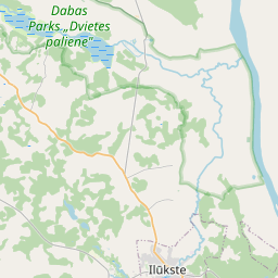
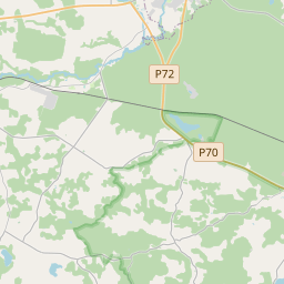
Land unit (cadastre designation: 44800060083)
Cadastre designation: 44800060083
Address: "Tāles", Pilskalnes pagasts, Augšdaugavas novads, LV-5447
Cadastre designation of real estate | |
|---|---|
Cadastral object type | Cadastral object type: Land unit |
Address | Address: "Tāles", Pilskalnes pagasts, Augšdaugavas novads, LV-5447 |
Cadastre number of the real estate in which this land unit is included | Cadastre number of the real estate in which this land unit is included: 44800060083 |
Address | |
|---|---|
Address ID | Address ID: 101576902 |
Companies registered at the address | Companies registered at the address: 0 |
Departments registered at the address | Departments registered at the address: 0 |
Institutions registered at the address | Institutions registered at the address: 0 |
Real estate registered at the address | |
Transactions with real estate at the address | Transactions with real estate at the address: 0 |
|
|
|
{"7201060110":{"name":"<div class='color_dot' style='background-color: #00ffff'><\/div><span>Measured land unit<\/span>","featureColor":"#00ffff","features":{"type":"FeatureCollection","features":[{"type":"Feature","geometry":{"type":"Polygon","coordinates":[[[26.346304556,56.001378956],[26.346315894,56.00136728],[26.347770479,55.999870282],[26.35047459,56.000217076],[26.350459893,56.000233354],[26.348986868,56.001523371],[26.348902265,56.001606458],[26.348883001,56.001623892],[26.348801624,56.001615835],[26.346304556,56.001378956]]]},"crs":{"type":"name","properties":{"name":"urn:ogc:def:crs:EPSG:3059"}},"properties":{"style":{"color":"#00ffff","dashArray":"0","weight":1},"name":"Land","object_type":"Parcel","parcel_code":"44800060086","code":null,"surveyor":null,"address":"","ownership":"<span>Owner - Natural person<br><\/span>","pro_cadastre_nr":"44800060083"}},{"type":"Feature","geometry":{"type":"Polygon","coordinates":[[[26.343746026,55.982141287],[26.343766755,55.982088036],[26.344605149,55.979934513],[26.345657026,55.980153094],[26.346416033,55.980336501],[26.347191755,55.980530541],[26.34617657,55.982166471],[26.346099579,55.982288625],[26.346041061,55.982403174],[26.343746026,55.982141287]]]},"crs":{"type":"name","properties":{"name":"urn:ogc:def:crs:EPSG:3059"}},"properties":{"style":{"color":"#00ffff","dashArray":"0","weight":1},"name":"Land","object_type":"Parcel","parcel_code":"44800060085","code":null,"surveyor":null,"address":"","ownership":"<span>Owner - Natural person<br><\/span>","pro_cadastre_nr":"44800060083"}},{"type":"Feature","geometry":{"type":"Polygon","coordinates":[[[26.335986523,55.988023441],[26.339410607,55.987896898],[26.340184304,55.989473367],[26.337307664,55.990037157],[26.337086218,55.989689306],[26.33671962,55.989117006],[26.336517058,55.988834272],[26.336269376,55.988492498],[26.336077964,55.988226224],[26.336013435,55.988100639],[26.335986523,55.988023441]]]},"crs":{"type":"name","properties":{"name":"urn:ogc:def:crs:EPSG:3059"}},"properties":{"style":{"color":"#00ffff","dashArray":"0","weight":1},"name":"Land","object_type":"Parcel","parcel_code":"44800060084","code":null,"surveyor":null,"address":"","ownership":"<span>Owner - Natural person<br><\/span>","pro_cadastre_nr":"44800060083"}},{"type":"Feature","geometry":{"type":"Polygon","coordinates":[[[26.329648966,55.997442194],[26.331634635,55.996944998],[26.333720189,55.996830705],[26.33444299,55.996899103],[26.334262316,55.997864653],[26.331794037,55.997928844],[26.330036704,55.998068482],[26.329648966,55.997442194]]]},"crs":{"type":"name","properties":{"name":"urn:ogc:def:crs:EPSG:3059"}},"properties":{"style":{"color":"#00ffff","dashArray":"0","weight":1},"name":"Land","object_type":"Parcel","parcel_code":"44800060083","code":null,"surveyor":null,"address":"\"T\u0101les\", Pilskalnes pag., Aug\u0161daugavas nov., LV-5447","ownership":"<span>Owner - Natural person<br><\/span>","pro_cadastre_nr":"44800060083"}}]}}}
[]
https://tile.openstreetmap.org/{z}/{x}/{y}.png|© OpenStreetMap contributors|minZoom: 7|maxZoom: 19
|
Land unit data updated: 23.01.2025.
Data source and license: Cadastre Information System open text and spatial data, Real Estate Market Database open data, open data license Creative Commons Attribution, OpenStreetMap

