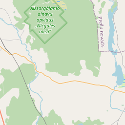
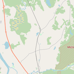
Land unit (cadastre designation: 44620030209)
Cadastre designation: 44620030209
Address: "Piekrastes", Ķeiši, Kalupes pagasts, Augšdaugavas novads, LV-5450
Cadastre designation of real estate | |
|---|---|
Cadastral object type | Cadastral object type: Land unit |
Address | Address: "Piekrastes", Ķeiši, Kalupes pagasts, Augšdaugavas novads, LV-5450 |
Cadastre number of the real estate in which this land unit is included | Cadastre number of the real estate in which this land unit is included: 44620030209 |
Address | |
|---|---|
Address ID | Address ID: 104567824 |
Companies registered at the address | Companies registered at the address: 0 |
Departments registered at the address | Departments registered at the address: 0 |
Institutions registered at the address | Institutions registered at the address: 0 |
Real estate registered at the address | |
Transactions with real estate at the address | Transactions with real estate at the address: 0 |
|
|
|
{"7201060210":{"name":"<div class='color_dot' style='background-color: #00ffff'><\/div><span>Specified land unit<\/span>","featureColor":"#00ffff","features":{"type":"FeatureCollection","features":[{"type":"Feature","geometry":{"type":"Polygon","coordinates":[[[26.572320878,56.109834153],[26.572351178,56.109708505],[26.572400888,56.109392621],[26.572428346,56.109214756],[26.572456342,56.109173897],[26.572638841,56.109019343],[26.572683161,56.108961326],[26.573843937,56.107740267],[26.574149652,56.107543602],[26.574662496,56.107337934],[26.575398729,56.107245106],[26.57545467,56.107217415],[26.575947793,56.106546158],[26.576049438,56.106573491],[26.57635122,56.106675402],[26.576412223,56.106702028],[26.5767314,56.107039345],[26.577143059,56.10747272],[26.577547759,56.107903417],[26.577968085,56.108338639],[26.578514222,56.1089157],[26.578162499,56.109624578],[26.576828117,56.109856023],[26.576779939,56.109915677],[26.576647185,56.109911365],[26.572460192,56.109836742],[26.572320878,56.109834153]]]},"crs":{"type":"name","properties":{"name":"urn:ogc:def:crs:EPSG:3059"}},"properties":{"style":{"color":"#00ffff","dashArray":"8,12","weight":1},"name":"Land","object_type":"Parcel","parcel_code":"44620030211","code":null,"surveyor":null,"address":"","ownership":"<span>Owner - Natural person<br><\/span>","pro_cadastre_nr":"44620030209"}},{"type":"Feature","geometry":{"type":"Polygon","coordinates":[[[26.540808808,56.107533617],[26.540870094,56.107306753],[26.540822276,56.107084967],[26.54084769,56.10696687],[26.540814183,56.106794296],[26.540843421,56.106589286],[26.542598062,56.10659469],[26.544123682,56.10659937],[26.545537751,56.10660368],[26.545435667,56.107160281],[26.545306373,56.107782266],[26.545242677,56.108051183],[26.541444771,56.107920694],[26.541101942,56.10790583],[26.541001859,56.107772799],[26.54083651,56.107621292],[26.540808808,56.107533617]]]},"crs":{"type":"name","properties":{"name":"urn:ogc:def:crs:EPSG:3059"}},"properties":{"style":{"color":"#00ffff","dashArray":"8,12","weight":1},"name":"Land","object_type":"Parcel","parcel_code":"44620030210","code":null,"surveyor":null,"address":"","ownership":"<span>Owner - Natural person<br><\/span>","pro_cadastre_nr":"44620030209"}},{"type":"Feature","geometry":{"type":"Polygon","coordinates":[[[26.545764754,56.107262557],[26.545807251,56.107039269],[26.547498679,56.107176199],[26.547456452,56.107269325],[26.546662098,56.107205452],[26.546645785,56.107303274],[26.54626195,56.107285828],[26.546174513,56.107280674],[26.545764754,56.107262557]]]},"crs":{"type":"name","properties":{"name":"urn:ogc:def:crs:EPSG:3059"}},"properties":{"style":{"color":"#00ffff","dashArray":"8,12","weight":1},"name":"Land","object_type":"Parcel","parcel_code":"44620030209","code":null,"surveyor":null,"address":"\"Piekrastes\", \u0136ei\u0161i, Kalupes pag., Aug\u0161daugavas nov., LV-5450","ownership":"<span>Owner - Natural person<br><\/span>","pro_cadastre_nr":"44620030209"}}]}},"5201011310":{"name":"<div class='color_dot' style='background-color: #960096'><\/div><span>Vectorized building<\/span>","featureColor":"#960096","features":{"type":"FeatureCollection","features":[{"type":"Feature","geometry":{"type":"Polygon","coordinates":[[[26.545853697,56.107304135],[26.545874485,56.10722364],[26.546017382,56.107232926],[26.546008005,56.107277979],[26.546004294,56.107295825],[26.545919681,56.107290335],[26.54591597,56.107308181],[26.545853697,56.107304135]]]},"crs":{"type":"name","properties":{"name":"urn:ogc:def:crs:EPSG:3059"}},"properties":{"style":{"color":"#960096","dashArray":"0","weight":2},"name":"Building","object_type":"Building","parcel_code":"44620030209","code":"44620030209001","surveyor":null,"address":"\"Piekrastes\", \u0136ei\u0161i, Kalupes pag., Aug\u0161daugavas nov., LV-5450","ownership":"<span>Owner - Natural person<br><\/span>","pro_cadastre_nr":"44620030209"}},{"type":"Feature","geometry":{"type":"Polygon","coordinates":[[[26.546174513,56.107280674],[26.546179147,56.107256113],[26.546266585,56.107261266],[26.54626195,56.107285828],[26.546174513,56.107280674]]]},"crs":{"type":"name","properties":{"name":"urn:ogc:def:crs:EPSG:3059"}},"properties":{"style":{"color":"#960096","dashArray":"0","weight":2},"name":"Building","object_type":"Building","parcel_code":"44620030209","code":"44620030209002","surveyor":null,"address":"\"Piekrastes\", \u0136ei\u0161i, Kalupes pag., Aug\u0161daugavas nov., LV-5450","ownership":"<span>Owner - Natural person<br><\/span>","pro_cadastre_nr":"44620030209"}},{"type":"Feature","geometry":{"type":"Polygon","coordinates":[[[26.546179147,56.107256113],[26.546190359,56.107196713],[26.546277796,56.107201866],[26.546266585,56.107261266],[26.546179147,56.107256113]]]},"crs":{"type":"name","properties":{"name":"urn:ogc:def:crs:EPSG:3059"}},"properties":{"style":{"color":"#960096","dashArray":"0","weight":2},"name":"Building","object_type":"Building","parcel_code":"44620030209","code":"44620030209003","surveyor":null,"address":"\"Piekrastes\", \u0136ei\u0161i, Kalupes pag., Aug\u0161daugavas nov., LV-5450","ownership":"<span>Owner - Natural person<br><\/span>","pro_cadastre_nr":"44620030209"}},{"type":"Feature","geometry":{"type":"Polygon","coordinates":[[[26.546346311,56.107152852],[26.546274714,56.10714863],[26.546281457,56.107112898],[26.546353055,56.107117119],[26.546346311,56.107152852]]]},"crs":{"type":"name","properties":{"name":"urn:ogc:def:crs:EPSG:3059"}},"properties":{"style":{"color":"#960096","dashArray":"0","weight":2},"name":"Building","object_type":"Building","parcel_code":"44620030209","code":"44620030209004","surveyor":null,"address":"\"Piekrastes\", \u0136ei\u0161i, Kalupes pag., Aug\u0161daugavas nov., LV-5450","ownership":"<span>Owner - Natural person<br><\/span>","pro_cadastre_nr":"44620030209"}},{"type":"Feature","geometry":{"type":"Polygon","coordinates":[[[26.546346311,56.107152852],[26.546274714,56.10714863],[26.546281457,56.107112898],[26.546353055,56.107117119],[26.546346311,56.107152852]]]},"crs":{"type":"name","properties":{"name":"urn:ogc:def:crs:EPSG:3059"}},"properties":{"style":{"color":"#960096","dashArray":"0","weight":2},"name":"Building","object_type":"Building","parcel_code":"44620030209","code":"44620030209004","surveyor":null,"address":"\"Piekrastes\", \u0136ei\u0161i, Kalupes pag., Aug\u0161daugavas nov., LV-5450","ownership":"<span>Owner - Natural person<br><\/span>","pro_cadastre_nr":"44620030209"}},{"type":"Feature","geometry":{"type":"Polygon","coordinates":[[[26.546179147,56.107256113],[26.546190359,56.107196713],[26.546277796,56.107201866],[26.546266585,56.107261266],[26.546179147,56.107256113]]]},"crs":{"type":"name","properties":{"name":"urn:ogc:def:crs:EPSG:3059"}},"properties":{"style":{"color":"#960096","dashArray":"0","weight":2},"name":"Building","object_type":"Building","parcel_code":"44620030209","code":"44620030209003","surveyor":null,"address":"\"Piekrastes\", \u0136ei\u0161i, Kalupes pag., Aug\u0161daugavas nov., LV-5450","ownership":"<span>Owner - Natural person<br><\/span>","pro_cadastre_nr":"44620030209"}},{"type":"Feature","geometry":{"type":"Polygon","coordinates":[[[26.546174513,56.107280674],[26.546179147,56.107256113],[26.546266585,56.107261266],[26.54626195,56.107285828],[26.546174513,56.107280674]]]},"crs":{"type":"name","properties":{"name":"urn:ogc:def:crs:EPSG:3059"}},"properties":{"style":{"color":"#960096","dashArray":"0","weight":2},"name":"Building","object_type":"Building","parcel_code":"44620030209","code":"44620030209002","surveyor":null,"address":"\"Piekrastes\", \u0136ei\u0161i, Kalupes pag., Aug\u0161daugavas nov., LV-5450","ownership":"<span>Owner - Natural person<br><\/span>","pro_cadastre_nr":"44620030209"}},{"type":"Feature","geometry":{"type":"Polygon","coordinates":[[[26.545853697,56.107304135],[26.545874485,56.10722364],[26.546017382,56.107232926],[26.546008005,56.107277979],[26.546004294,56.107295825],[26.545919681,56.107290335],[26.54591597,56.107308181],[26.545853697,56.107304135]]]},"crs":{"type":"name","properties":{"name":"urn:ogc:def:crs:EPSG:3059"}},"properties":{"style":{"color":"#960096","dashArray":"0","weight":2},"name":"Building","object_type":"Building","parcel_code":"44620030209","code":"44620030209001","surveyor":null,"address":"\"Piekrastes\", \u0136ei\u0161i, Kalupes pag., Aug\u0161daugavas nov., LV-5450","ownership":"<span>Owner - Natural person<br><\/span>","pro_cadastre_nr":"44620030209"}}]}}}
{"7201060210":{"name":"<div class='color_dot' style='background-color: #00ffff'><\/div><span>Specified land unit<\/span>","featureColor":"#00ffff","features":{"type":"FeatureCollection","features":[{"type":"Feature","geometry":{"type":"Polygon","coordinates":[[[26.572340855,56.109834609],[26.572478087,56.10922278],[26.572683161,56.108961326],[26.573843937,56.107740267],[26.574149652,56.107543602],[26.574662496,56.107337934],[26.575398729,56.107245106],[26.57545467,56.107217415],[26.575947793,56.106546158],[26.576049438,56.106573491],[26.57635122,56.106675402],[26.576412223,56.106702028],[26.5767314,56.107039345],[26.577143059,56.10747272],[26.577547759,56.107903417],[26.577968085,56.108338639],[26.578514222,56.1089157],[26.578162499,56.109624578],[26.576828117,56.109856023],[26.576779939,56.109915677],[26.576647185,56.109911365],[26.572460192,56.109836742],[26.572340855,56.109834609]]]},"crs":{"type":"name","properties":{"name":"urn:ogc:def:crs:EPSG:3059"}},"properties":{"style":{"color":"#00ffff","dashArray":"8,12","weight":1},"name":"Land","object_type":"Parcel","parcel_code":"44620030211","code":null,"surveyor":null,"address":"","ownership":"<span>Owner - Natural person<br><\/span>","pro_cadastre_nr":"44620030209"}}]}}}
https://tile.openstreetmap.org/{z}/{x}/{y}.png|© OpenStreetMap contributors|minZoom: 7|maxZoom: 19
|
Land unit data updated: 10.01.2025.
Data source and license: Cadastre Information System open text and spatial data, Real Estate Market Database open data, open data license Creative Commons Attribution, OpenStreetMap


