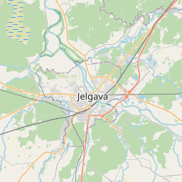
Land unit (cadastre designation: 09000290837)
Cadastre designation: 09000290837
Address: Ciedru iela 17A, Jelgava, LV-3008
Cadastre designation of real estate | |
|---|---|
Cadastral object type | Cadastral object type: Land unit |
Address | Address: Ciedru iela 17A, Jelgava, LV-3008 |
Cadastre number of the real estate in which this land unit is included | Cadastre number of the real estate in which this land unit is included: 09000010746 |
Address | |
|---|---|
Address ID | Address ID: 106988193 |
Companies registered at the address | Companies registered at the address: 0 |
Departments registered at the address | Departments registered at the address: 0 |
Institutions registered at the address | Institutions registered at the address: 0 |
Real estate registered at the address | |
Transactions with real estate at the address | Transactions with real estate at the address: 0 |
|
|
|
{"7201060310":{"name":"<div class='color_dot' style='background-color: #00ffff'><\/div><span>Projected land unit<\/span>","featureColor":"#00ffff","features":{"type":"FeatureCollection","features":[{"type":"Feature","geometry":{"type":"Polygon","coordinates":[[[23.681525656,56.61491107],[23.681839881,56.61486822],[23.682143477,56.614820096],[23.682467346,56.614769524],[23.682782722,56.614727142],[23.683095848,56.614679013],[23.683414895,56.614629972],[23.683750821,56.614567344],[23.684085373,56.614513032],[23.684100087,56.614534442],[23.68165177,56.61493229],[23.681525656,56.61491107]]]},"crs":{"type":"name","properties":{"name":"urn:ogc:def:crs:EPSG:3059"}},"properties":{"style":{"color":"#00ffff","dashArray":"2,4","weight":1},"name":"Land","object_type":"Parcel","parcel_code":"09000290838","code":null,"surveyor":null,"address":"","ownership":null,"pro_cadastre_nr":"09000010746"}},{"type":"Feature","geometry":{"type":"Polygon","coordinates":[[[23.681172733,56.614880357],[23.681477797,56.614826434],[23.681525656,56.61491107],[23.681276065,56.614869078],[23.681172733,56.614880357]]]},"crs":{"type":"name","properties":{"name":"urn:ogc:def:crs:EPSG:3059"}},"properties":{"style":{"color":"#00ffff","dashArray":"2,4","weight":1},"name":"Land","object_type":"Parcel","parcel_code":"09000290837","code":null,"surveyor":null,"address":"Ciedru iela 17A, Jelgava, LV-3008","ownership":null,"pro_cadastre_nr":"09000010746"}},{"type":"Feature","geometry":{"type":"Polygon","coordinates":[[[23.73167886,56.648641317],[23.732158672,56.648688375],[23.732147411,56.648721709],[23.731693446,56.648679459],[23.73167886,56.648641317]]]},"crs":{"type":"name","properties":{"name":"urn:ogc:def:crs:EPSG:3059"}},"properties":{"style":{"color":"#00ffff","dashArray":"2,4","weight":1},"name":"Land","object_type":"Parcel","parcel_code":"09000060435","code":null,"surveyor":null,"address":"","ownership":null,"pro_cadastre_nr":"09000010746"}},{"type":"Feature","geometry":{"type":"Polygon","coordinates":[[[23.731078647,56.649006724],[23.731104883,56.648952193],[23.731532894,56.648998271],[23.731543583,56.648971971],[23.731639211,56.648984018],[23.731723596,56.648994648],[23.731807965,56.649005278],[23.732041306,56.649034997],[23.732023516,56.649087641],[23.731276734,56.649005777],[23.731078647,56.649006724]]]},"crs":{"type":"name","properties":{"name":"urn:ogc:def:crs:EPSG:3059"}},"properties":{"style":{"color":"#00ffff","dashArray":"2,4","weight":1},"name":"Land","object_type":"Parcel","parcel_code":"09000060434","code":null,"surveyor":null,"address":"","ownership":null,"pro_cadastre_nr":"09000010746"}},{"type":"Feature","geometry":{"type":"Polygon","coordinates":[[[23.723303107,56.640956038],[23.723318993,56.640924099],[23.723427009,56.640940169],[23.723562421,56.640960324],[23.723546984,56.64098876],[23.72348896,56.640979198],[23.723404425,56.640971671],[23.723303107,56.640956038]]]},"crs":{"type":"name","properties":{"name":"urn:ogc:def:crs:EPSG:3059"}},"properties":{"style":{"color":"#00ffff","dashArray":"2,4","weight":1},"name":"Land","object_type":"Parcel","parcel_code":"09000010745","code":null,"surveyor":null,"address":"","ownership":null,"pro_cadastre_nr":"09000010746"}},{"type":"Feature","geometry":{"type":"Polygon","coordinates":[[[23.722613472,56.641745288],[23.722700883,56.641567662],[23.722824238,56.641586848],[23.722738425,56.641760103],[23.722720326,56.641757933],[23.722613472,56.641745288]]]},"crs":{"type":"name","properties":{"name":"urn:ogc:def:crs:EPSG:3059"}},"properties":{"style":{"color":"#00ffff","dashArray":"2,4","weight":1},"name":"Land","object_type":"Parcel","parcel_code":"09000010744","code":null,"surveyor":null,"address":"","ownership":null,"pro_cadastre_nr":"09000010746"}},{"type":"Feature","geometry":{"type":"Polygon","coordinates":[[[23.722574588,56.642397965],[23.722584022,56.642378912],[23.722702434,56.64239648],[23.722795851,56.642369394],[23.722906713,56.642389154],[23.722897516,56.642404838],[23.722878132,56.642437847],[23.722574588,56.642397965]]]},"crs":{"type":"name","properties":{"name":"urn:ogc:def:crs:EPSG:3059"}},"properties":{"style":{"color":"#00ffff","dashArray":"2,4","weight":1},"name":"Land","object_type":"Parcel","parcel_code":"09000010743","code":null,"surveyor":null,"address":"","ownership":null,"pro_cadastre_nr":"09000010746"}}]}}}
[]
https://tile.openstreetmap.org/{z}/{x}/{y}.png|© OpenStreetMap contributors|minZoom: 7|maxZoom: 19
|
Land unit data updated: 20.12.2024.
Data source and license: Cadastre Information System open text and spatial data, Real Estate Market Database open data, open data license Creative Commons Attribution, OpenStreetMap

