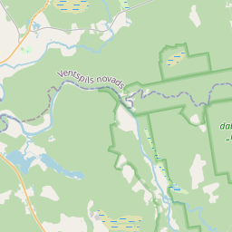
Building (cadastre designation: 98940050145001)
Cadastre designation: 98940050145001
Administrative area: Ventspils novads
Cadastre designation of real estate | Cadastre designation of real estate: 98940050145001 |
|---|---|
Cadastral object type | Cadastral object type: Building |
Administrative area |
|
|
|
{"7201060110":{"name":"<div class='color_dot' style='background-color: #00ffff'><\/div><span>Measured land unit<\/span>","featureColor":"#00ffff","features":{"type":"FeatureCollection","features":[{"type":"Feature","geometry":{"type":"Polygon","coordinates":[[[21.824878998,57.110018193],[21.82580237,57.107042798],[21.826841375,57.104127719],[21.827862632,57.101432356],[21.833760541,57.102293557],[21.839885821,57.103203802],[21.840271176,57.10312779],[21.840423213,57.103327112],[21.840588845,57.103453424],[21.840769425,57.103534543],[21.841050296,57.103647258],[21.841237701,57.103752153],[21.841303175,57.103819121],[21.84132997,57.103885341],[21.841251217,57.104094112],[21.841438179,57.105066989],[21.846065481,57.103646916],[21.85210402,57.103878499],[21.85463676,57.104342581],[21.855695279,57.104402525],[21.857470384,57.105110546],[21.85752572,57.105119094],[21.856521302,57.107906181],[21.855398458,57.111058237],[21.854820268,57.112763169],[21.854536136,57.113552445],[21.852839084,57.113402769],[21.852561105,57.113386038],[21.852487992,57.113381946],[21.849661911,57.113121358],[21.848157469,57.112982615],[21.847951273,57.113014057],[21.845562561,57.112694945],[21.843247985,57.112468944],[21.842305584,57.113746],[21.841527267,57.114789382],[21.840221847,57.116586326],[21.837681088,57.116044694],[21.835373843,57.115592266],[21.833324691,57.115266735],[21.832636134,57.114688455],[21.831416686,57.113880302],[21.830436408,57.11321351],[21.827534546,57.111178141],[21.826084687,57.11025578],[21.824878998,57.110018193]]]},"crs":{"type":"name","properties":{"name":"urn:ogc:def:crs:EPSG:3059"}},"properties":{"style":{"color":"#00ffff","dashArray":"0","weight":1},"name":"Land","object_type":"Parcel","parcel_code":"98940050145","code":null,"surveyor":null,"address":"","ownership":"<span>User - Legal entity<br>Owner - State<br><\/span>","pro_cadastre_nr":"98940010026"}}]}},"6211003110":{"name":"<div class='color_dot' style='background-color: #878787'><\/div><span>Vectorized engineering structure<\/span>","featureColor":"#878787","features":{"type":"FeatureCollection","features":[{"type":"Feature","geometry":{"type":"Polygon","coordinates":[[[21.834135521,57.102350422],[21.834256182,57.102368358],[21.83487962,57.102721783],[21.835048797,57.102803369],[21.835600428,57.102998996],[21.835999635,57.103147436],[21.836420862,57.103273683],[21.837184314,57.10351425],[21.837445361,57.103622408],[21.839120181,57.104377082],[21.840212331,57.104831492],[21.840908935,57.105112822],[21.841254613,57.105238056],[21.841499317,57.105317869],[21.842045175,57.105486455],[21.848893839,57.107536456],[21.85031715,57.10799211],[21.851990519,57.108518304],[21.85212624,57.108549286],[21.852257254,57.10856917],[21.852435163,57.108574016],[21.852542123,57.108558092],[21.852757356,57.108513265],[21.854864227,57.108010302],[21.855049122,57.107979374],[21.855157005,57.107965729],[21.855229337,57.107964864],[21.855303807,57.107973578],[21.85544125,57.108001072],[21.856015111,57.108177498],[21.856379781,57.10830349],[21.85636628,57.108341386],[21.85598116,57.108208323],[21.855413449,57.108033782],[21.855285376,57.108008173],[21.855223028,57.108000879],[21.855165288,57.108001562],[21.855066322,57.108014075],[21.854887263,57.108044034],[21.852782433,57.108546511],[21.85256267,57.108592285],[21.852442401,57.108610183],[21.852246601,57.108604851],[21.852104505,57.108583285],[21.851961123,57.108550554],[21.851284795,57.108338063],[21.850283893,57.108023143],[21.848861181,57.107567679],[21.842012968,57.105517818],[21.841466055,57.1053489],[21.841219325,57.10526844],[21.840870946,57.105142216],[21.840172616,57.104860183],[21.839079062,57.1044052],[21.837404291,57.103650544],[21.837147645,57.103544205],[21.836388392,57.103304969],[21.835965006,57.103178074],[21.835563778,57.103028888],[21.835008654,57.102832015],[21.834833647,57.102747614],[21.834135521,57.102350422]]]},"crs":{"type":"name","properties":{"name":"urn:ogc:def:crs:EPSG:3059"}},"properties":{"style":{"color":"#878787","dashArray":"0","weight":1},"name":"Engineering buildings","object_type":"EngineeringStructurePoly","parcel_code":"98940050145","code":"98940050145001","surveyor":null,"address":"","ownership":"<span>User - Legal entity<br><\/span>","pro_cadastre_nr":null}}]}}}
[]
https://tile.openstreetmap.org/{z}/{x}/{y}.png|© OpenStreetMap contributors|minZoom: 7|maxZoom: 19
|
Building data updated: 30.12.2024.
Data source and license: Cadastre Information System open text and spatial data, Real Estate Market Database open data, open data license Creative Commons Attribution, OpenStreetMap

