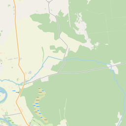
Building (cadastre designation: 98330050001005)
Cadastre designation: 98330050001005
Address: "Gārzdes ceplis", Piltenes pagasts, Ventspils novads, LV-3620
Cadastre designation of real estate | |
|---|---|
Cadastral object type | Cadastral object type: Building |
Address | Address: "Gārzdes ceplis", Piltenes pagasts, Ventspils novads, LV-3620 |
Address | |
|---|---|
Address ID | Address ID: 103142674 |
Companies registered at the address | Companies registered at the address: 0 |
Departments registered at the address | Departments registered at the address: 0 |
Institutions registered at the address | Institutions registered at the address: 0 |
Real estate registered at the address | |
Transactions with real estate at the address | Transactions with real estate at the address: 0 |
| Cadastral object type | Cadastre designation of the cadastral object | Person's property right status | Person status | Land Register |
|---|---|---|---|---|
| Cadastral object type: Building | 98330050001005 | Person's property right status: No data | Person status: No data | Land Register |
09.01.2025. State land service data
|
|
|
{"7201060210":{"name":"<div class='color_dot' style='background-color: #00ffff'><\/div><span>Specified land unit<\/span>","featureColor":"#00ffff","features":{"type":"FeatureCollection","features":[{"type":"Feature","geometry":{"type":"Polygon","coordinates":[[[21.789078724,57.283744516],[21.78937332,57.282818439],[21.791136551,57.282980184],[21.79154181,57.283019537],[21.792034791,57.283599968],[21.792082214,57.283622116],[21.792098533,57.283623921],[21.792086597,57.283655593],[21.793202369,57.284917887],[21.790595871,57.285317813],[21.790513271,57.285330486],[21.790519941,57.285302262],[21.790517824,57.285293293],[21.790436854,57.285183833],[21.789445372,57.283988704],[21.789326962,57.283875843],[21.789132149,57.283817073],[21.789083327,57.28378949],[21.789078724,57.283744516]]]},"crs":{"type":"name","properties":{"name":"urn:ogc:def:crs:EPSG:3059"}},"properties":{"style":{"color":"#00ffff","dashArray":"8,12","weight":1},"name":"Land","object_type":"Parcel","parcel_code":"98330050003","code":null,"surveyor":null,"address":"","ownership":"<span>Owner - Natural person<br><\/span>","pro_cadastre_nr":"98330050001"}},{"type":"Feature","geometry":{"type":"Polygon","coordinates":[[[21.772528712,57.280107342],[21.772580828,57.280099352],[21.776557562,57.279489986],[21.776725942,57.279464183],[21.77678093,57.279502069],[21.775592588,57.280406392],[21.775299056,57.280658391],[21.775174827,57.280817687],[21.775097452,57.280935748],[21.775021664,57.281122895],[21.774646698,57.280893738],[21.773937753,57.280378422],[21.773911481,57.280370571],[21.772528712,57.280107342]]]},"crs":{"type":"name","properties":{"name":"urn:ogc:def:crs:EPSG:3059"}},"properties":{"style":{"color":"#00ffff","dashArray":"8,12","weight":1},"name":"Land","object_type":"Parcel","parcel_code":"98330050002","code":null,"surveyor":null,"address":"","ownership":"<span>Owner - Natural person<br><\/span>","pro_cadastre_nr":"98330050001"}}]}},"7201060110":{"name":"<div class='color_dot' style='background-color: #00ffff'><\/div><span>Measured land unit<\/span>","featureColor":"#00ffff","features":{"type":"FeatureCollection","features":[{"type":"Feature","geometry":{"type":"Polygon","coordinates":[[[21.775287537,57.28117892],[21.775310948,57.281057396],[21.775347454,57.280975399],[21.775411665,57.280876145],[21.775586827,57.280702331],[21.775785352,57.280529011],[21.776042136,57.280350881],[21.77629248,57.280128183],[21.776654163,57.2798343],[21.776819871,57.279708122],[21.776965261,57.279609611],[21.778880798,57.278177449],[21.778909013,57.278156346],[21.77899662,57.278171346],[21.779304943,57.278251431],[21.779676681,57.278378024],[21.780104754,57.278523501],[21.7800775,57.278546033],[21.779644892,57.278903658],[21.779516335,57.279115655],[21.77944925,57.279246904],[21.779159351,57.280579133],[21.780929013,57.280577593],[21.781196476,57.280686659],[21.783173203,57.282455402],[21.783091006,57.282457583],[21.775653188,57.282655017],[21.775549318,57.282657771],[21.775486886,57.282436053],[21.775392185,57.282047138],[21.775326036,57.281648953],[21.775293032,57.281455441],[21.775287537,57.28117892]]]},"crs":{"type":"name","properties":{"name":"urn:ogc:def:crs:EPSG:3059"}},"properties":{"style":{"color":"#00ffff","dashArray":"0","weight":1},"name":"Land","object_type":"Parcel","parcel_code":"98330050001","code":null,"surveyor":null,"address":"\"G\u0101rzdes ceplis\", Piltenes pag., Ventspils nov., LV-3620","ownership":"<span>Owner - Natural person<br><\/span>","pro_cadastre_nr":"98330050001"}}]}},"7114100000":{"name":"<div class='color_dot' style='background-color: #b40000'><\/div><span>Burdened access road servitude area<\/span>","featureColor":"#b40000","features":{"type":"FeatureCollection","features":[{"type":"Feature","geometry":{"type":"Polygon","coordinates":[[[21.772624638,57.280101683],[21.7727074,57.280085421],[21.77401045,57.280338968],[21.774736965,57.280876574],[21.775040633,57.281048585],[21.775015302,57.281088914],[21.77468687,57.280893407],[21.773953784,57.280362693],[21.772624638,57.280101683]]]},"crs":{"type":"name","properties":{"name":"urn:ogc:def:crs:EPSG:3059"}},"properties":{"style":{"color":"#b40000","dashArray":"4,2,1,2","weight":1},"name":"Burdened access road servitude area","object_type":"WayRestriction","parcel_code":"98330050002","code":"7315030100003","surveyor":null,"address":"","ownership":"<span>Owner - Natural person<br><\/span>","pro_cadastre_nr":"98330050001"}},{"type":"Feature","geometry":{"type":"Polygon","coordinates":[[[21.780077087,57.278545998],[21.779650222,57.278400839],[21.779280874,57.278275061],[21.778977418,57.278196239],[21.778881997,57.278177371],[21.778909589,57.278157245],[21.778994538,57.278172576],[21.779304943,57.278251431],[21.779676681,57.278378024],[21.780104133,57.278523634],[21.780077087,57.278545998]]]},"crs":{"type":"name","properties":{"name":"urn:ogc:def:crs:EPSG:3059"}},"properties":{"style":{"color":"#b40000","dashArray":"4,2,1,2","weight":1},"name":"Burdened access road servitude area","object_type":"WayRestriction","parcel_code":"98330050001","code":"7315030100002","surveyor":null,"address":"\"G\u0101rzdes ceplis\", Piltenes pag., Ventspils nov., LV-3620","ownership":"<span>Owner - Natural person<br><\/span>","pro_cadastre_nr":"98330050001"}}]}},"5201011310":{"name":"<div class='color_dot' style='background-color: #960096'><\/div><span>Vectorized building<\/span>","featureColor":"#960096","features":{"type":"FeatureCollection","features":[{"type":"Feature","geometry":{"type":"Polygon","coordinates":[[[21.777075501,57.281012229],[21.77713351,57.281013255],[21.777130155,57.281068908],[21.777072145,57.281067882],[21.777075501,57.281012229]]]},"crs":{"type":"name","properties":{"name":"urn:ogc:def:crs:EPSG:3059"}},"properties":{"style":{"color":"#960096","dashArray":"0","weight":2},"name":"Building","object_type":"Building","parcel_code":"98330050001","code":"98330050001003","surveyor":null,"address":"\"G\u0101rzdes ceplis\", Piltenes pag., Ventspils nov., LV-3620","ownership":"<span>Owner - Natural person<br><\/span>","pro_cadastre_nr":"98330050001"}},{"type":"Feature","geometry":{"type":"Polygon","coordinates":[[[21.777114906,57.280931064],[21.777159656,57.280931855],[21.777155651,57.28099828],[21.777110901,57.280997489],[21.777114906,57.280931064]]]},"crs":{"type":"name","properties":{"name":"urn:ogc:def:crs:EPSG:3059"}},"properties":{"style":{"color":"#960096","dashArray":"0","weight":2},"name":"Building","object_type":"Building","parcel_code":"98330050001","code":"98330050001004","surveyor":null,"address":"\"G\u0101rzdes ceplis\", Piltenes pag., Ventspils nov., LV-3620","ownership":"<span>Owner - Natural person<br><\/span>","pro_cadastre_nr":"98330050001"}},{"type":"Feature","geometry":{"type":"Polygon","coordinates":[[[21.777114906,57.280931064],[21.777159656,57.280931855],[21.777155651,57.28099828],[21.777110901,57.280997489],[21.777114906,57.280931064]]]},"crs":{"type":"name","properties":{"name":"urn:ogc:def:crs:EPSG:3059"}},"properties":{"style":{"color":"#960096","dashArray":"0","weight":2},"name":"Building","object_type":"Building","parcel_code":"98330050001","code":"98330050001004","surveyor":null,"address":"\"G\u0101rzdes ceplis\", Piltenes pag., Ventspils nov., LV-3620","ownership":"<span>Owner - Natural person<br><\/span>","pro_cadastre_nr":"98330050001"}},{"type":"Feature","geometry":{"type":"Polygon","coordinates":[[[21.777075501,57.281012229],[21.77713351,57.281013255],[21.777130155,57.281068908],[21.777072145,57.281067882],[21.777075501,57.281012229]]]},"crs":{"type":"name","properties":{"name":"urn:ogc:def:crs:EPSG:3059"}},"properties":{"style":{"color":"#960096","dashArray":"0","weight":2},"name":"Building","object_type":"Building","parcel_code":"98330050001","code":"98330050001003","surveyor":null,"address":"\"G\u0101rzdes ceplis\", Piltenes pag., Ventspils nov., LV-3620","ownership":"<span>Owner - Natural person<br><\/span>","pro_cadastre_nr":"98330050001"}}]}},"5201011110":{"name":"<div class='color_dot' style='background-color: #ff0000'><\/div><span>Measured building<\/span>","featureColor":"#ff0000","features":{"type":"FeatureCollection","features":[{"type":"Feature","geometry":{"type":"Polygon","coordinates":[[[21.776772381,57.280794377],[21.7770121,57.280802895],[21.777002712,57.280880439],[21.776962993,57.280879027],[21.77696049,57.280899632],[21.776895953,57.28089734],[21.776898456,57.280876735],[21.776762992,57.280871921],[21.776772381,57.280794377]]]},"crs":{"type":"name","properties":{"name":"urn:ogc:def:crs:EPSG:3059"}},"properties":{"style":{"color":"#ff0000","dashArray":"0","weight":1},"name":"Building","object_type":"Building","parcel_code":"98330050001","code":"98330050001001","surveyor":null,"address":"\"G\u0101rzdes ceplis\", Piltenes pag., Ventspils nov., LV-3620","ownership":"<span>Owner - Natural person<br><\/span>","pro_cadastre_nr":"98330050001"}},{"type":"Feature","geometry":{"type":"Polygon","coordinates":[[[21.778030707,57.280720535],[21.778039148,57.280685918],[21.778162473,57.280694739],[21.778154032,57.280729356],[21.778030707,57.280720535]]]},"crs":{"type":"name","properties":{"name":"urn:ogc:def:crs:EPSG:3059"}},"properties":{"style":{"color":"#ff0000","dashArray":"0","weight":1},"name":"Building","object_type":"Building","parcel_code":"98330050001","code":"98330050001005","surveyor":null,"address":"\"G\u0101rzdes ceplis\", Piltenes pag., Ventspils nov., LV-3620","ownership":"<span>Owner - Natural person<br><\/span>","pro_cadastre_nr":"98330050001"}},{"type":"Feature","geometry":{"type":"Polygon","coordinates":[[[21.776670303,57.281088271],[21.776989603,57.281087925],[21.776989841,57.281153302],[21.776670541,57.281153647],[21.776670303,57.281088271]]]},"crs":{"type":"name","properties":{"name":"urn:ogc:def:crs:EPSG:3059"}},"properties":{"style":{"color":"#ff0000","dashArray":"0","weight":1},"name":"Building","object_type":"Building","parcel_code":"98330050001","code":"98330050001002","surveyor":null,"address":"\"G\u0101rzdes ceplis\", Piltenes pag., Ventspils nov., LV-3620","ownership":"<span>Owner - Natural person<br><\/span>","pro_cadastre_nr":"98330050001"}},{"type":"Feature","geometry":{"type":"Polygon","coordinates":[[[21.778030707,57.280720535],[21.778039148,57.280685918],[21.778162473,57.280694739],[21.778154032,57.280729356],[21.778030707,57.280720535]]]},"crs":{"type":"name","properties":{"name":"urn:ogc:def:crs:EPSG:3059"}},"properties":{"style":{"color":"#ff0000","dashArray":"0","weight":1},"name":"Building","object_type":"Building","parcel_code":"98330050001","code":"98330050001005","surveyor":null,"address":"\"G\u0101rzdes ceplis\", Piltenes pag., Ventspils nov., LV-3620","ownership":"<span>Owner - Natural person<br><\/span>","pro_cadastre_nr":"98330050001"}},{"type":"Feature","geometry":{"type":"Polygon","coordinates":[[[21.776670303,57.281088271],[21.776989603,57.281087925],[21.776989841,57.281153302],[21.776670541,57.281153647],[21.776670303,57.281088271]]]},"crs":{"type":"name","properties":{"name":"urn:ogc:def:crs:EPSG:3059"}},"properties":{"style":{"color":"#ff0000","dashArray":"0","weight":1},"name":"Building","object_type":"Building","parcel_code":"98330050001","code":"98330050001002","surveyor":null,"address":"\"G\u0101rzdes ceplis\", Piltenes pag., Ventspils nov., LV-3620","ownership":"<span>Owner - Natural person<br><\/span>","pro_cadastre_nr":"98330050001"}},{"type":"Feature","geometry":{"type":"Polygon","coordinates":[[[21.776772381,57.280794377],[21.7770121,57.280802895],[21.777002712,57.280880439],[21.776962993,57.280879027],[21.77696049,57.280899632],[21.776895953,57.28089734],[21.776898456,57.280876735],[21.776762992,57.280871921],[21.776772381,57.280794377]]]},"crs":{"type":"name","properties":{"name":"urn:ogc:def:crs:EPSG:3059"}},"properties":{"style":{"color":"#ff0000","dashArray":"0","weight":1},"name":"Building","object_type":"Building","parcel_code":"98330050001","code":"98330050001001","surveyor":null,"address":"\"G\u0101rzdes ceplis\", Piltenes pag., Ventspils nov., LV-3620","ownership":"<span>Owner - Natural person<br><\/span>","pro_cadastre_nr":"98330050001"}}]}}}
[]
https://tile.openstreetmap.org/{z}/{x}/{y}.png|© OpenStreetMap contributors|minZoom: 7|maxZoom: 19
|
Building data updated: 30.12.2024.
Data source and license: Cadastre Information System open text and spatial data, Real Estate Market Database open data, open data license Creative Commons Attribution, OpenStreetMap

