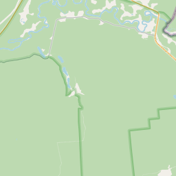
Building (cadastre designation: 94880140001003)
Cadastre designation: 94880140001003
Address: "Birzmalnieki", Valkas pagasts, Valkas novads, LV-4723
Cadastre designation of real estate | |
|---|---|
Cadastral object type | Cadastral object type: Building |
Address | Address: "Birzmalnieki", Valkas pagasts, Valkas novads, LV-4723 |
Address | |
|---|---|
Address ID | Address ID: 103897770 |
Companies registered at the address | |
Departments registered at the address | Departments registered at the address: 0 |
Institutions registered at the address | Institutions registered at the address: 0 |
Real estate registered at the address | |
Transactions with real estate at the address | Transactions with real estate at the address: 0 |
| Cadastral object type | Cadastre designation of the cadastral object | Person's property right status | Person status | Land Register |
|---|---|---|---|---|
| Cadastral object type: Building | 94880140001003 | Person's property right status: No data | Person status: No data | Land Register |
17.12.2024. State land service data
|
|
|
{"7201060210":{"name":"<div class='color_dot' style='background-color: #00ffff'><\/div><span>Specified land unit<\/span>","featureColor":"#00ffff","features":{"type":"FeatureCollection","features":[{"type":"Feature","geometry":{"type":"Polygon","coordinates":[[[26.10693778,57.735721649],[26.108490466,57.73580199],[26.110159874,57.735917673],[26.110557455,57.735937157],[26.110797967,57.735922384],[26.111473921,57.736672311],[26.108387589,57.737131693],[26.10693778,57.735721649]]]},"crs":{"type":"name","properties":{"name":"urn:ogc:def:crs:EPSG:3059"}},"properties":{"style":{"color":"#00ffff","dashArray":"8,12","weight":1},"name":"Land","object_type":"Parcel","parcel_code":"94880140003","code":null,"surveyor":null,"address":"","ownership":"<span>Owner - Natural person<br><\/span>","pro_cadastre_nr":"94880140001"}},{"type":"Feature","geometry":{"type":"Polygon","coordinates":[[[26.12581439,57.734658067],[26.128305905,57.734300757],[26.128316879,57.734319127],[26.130702323,57.738274783],[26.130363524,57.738405879],[26.129618781,57.738708301],[26.129263687,57.738865276],[26.128833127,57.738580732],[26.128030765,57.738467511],[26.126851937,57.736722482],[26.12581439,57.734658067]]]},"crs":{"type":"name","properties":{"name":"urn:ogc:def:crs:EPSG:3059"}},"properties":{"style":{"color":"#00ffff","dashArray":"8,12","weight":1},"name":"Land","object_type":"Parcel","parcel_code":"94880140002","code":null,"surveyor":null,"address":"","ownership":"<span>Owner - Natural person<br><\/span>","pro_cadastre_nr":"94880140001"}},{"type":"Feature","geometry":{"type":"Polygon","coordinates":[[[26.12669748,57.74002042],[26.127022562,57.739917337],[26.127970588,57.739572206],[26.129128302,57.739158157],[26.129827392,57.738849111],[26.13057404,57.738545919],[26.131396533,57.738171677],[26.131794066,57.738007],[26.132416355,57.737674919],[26.132879853,57.737417237],[26.13325636,57.73804395],[26.131943439,57.738502242],[26.132721779,57.739232716],[26.132713188,57.739841772],[26.132399155,57.740246664],[26.128971388,57.740410154],[26.128928533,57.741111074],[26.12892835,57.741113961],[26.12866753,57.74105297],[26.127482302,57.740803864],[26.12669748,57.74002042]]]},"crs":{"type":"name","properties":{"name":"urn:ogc:def:crs:EPSG:3059"}},"properties":{"style":{"color":"#00ffff","dashArray":"8,12","weight":1},"name":"Land","object_type":"Parcel","parcel_code":"94880140001","code":null,"surveyor":null,"address":"\"Birzmalnieki\", Valkas pag., Valkas nov., LV-4723","ownership":"<span>Owner - Natural person<br><\/span>","pro_cadastre_nr":"94880140001"}}]}},"7114100000":{"name":"<div class='color_dot' style='background-color: #b40000'><\/div><span>Burdened access road servitude area<\/span>","featureColor":"#b40000","features":{"type":"FeatureCollection","features":[{"type":"Feature","geometry":{"type":"Polygon","coordinates":[[[26.12892835,57.741113961],[26.12866753,57.74105297],[26.127482302,57.740803864],[26.127506044,57.740771559],[26.128699044,57.741022295],[26.128908113,57.741087544],[26.12892835,57.741113961]]]},"crs":{"type":"name","properties":{"name":"urn:ogc:def:crs:EPSG:3059"}},"properties":{"style":{"color":"#b40000","dashArray":"4,2,1,2","weight":1},"name":"Burdened access road servitude area","object_type":"WayRestriction","parcel_code":"94880140001","code":"7315030100004","surveyor":null,"address":"\"Birzmalnieki\", Valkas pag., Valkas nov., LV-4723","ownership":"<span>Owner - Natural person<br><\/span>","pro_cadastre_nr":"94880140001"}}]}},"5201011310":{"name":"<div class='color_dot' style='background-color: #960096'><\/div><span>Vectorized building<\/span>","featureColor":"#960096","features":{"type":"FeatureCollection","features":[{"type":"Feature","geometry":{"type":"Polygon","coordinates":[[[26.129727907,57.739449003],[26.129604542,57.739451078],[26.129599396,57.739363559],[26.129722761,57.739361485],[26.129724056,57.739398077],[26.129757037,57.739397523],[26.129758187,57.739417073],[26.129726381,57.739417608],[26.129727907,57.739449003]]]},"crs":{"type":"name","properties":{"name":"urn:ogc:def:crs:EPSG:3059"}},"properties":{"style":{"color":"#960096","dashArray":"0","weight":2},"name":"Building","object_type":"Building","parcel_code":"94880140001","code":"94880140001001","surveyor":null,"address":"\"Birzmalnieki\", Valkas pag., Valkas nov., LV-4723","ownership":"<span>Owner - Natural person<br><\/span>","pro_cadastre_nr":"94880140001"}},{"type":"Feature","geometry":{"type":"Polygon","coordinates":[[[26.130116989,57.739461633],[26.129980364,57.739463931],[26.129971495,57.739313131],[26.13010812,57.739310833],[26.130116989,57.739461633]]]},"crs":{"type":"name","properties":{"name":"urn:ogc:def:crs:EPSG:3059"}},"properties":{"style":{"color":"#960096","dashArray":"0","weight":2},"name":"Building","object_type":"Building","parcel_code":"94880140001","code":"94880140001003","surveyor":null,"address":"\"Birzmalnieki\", Valkas pag., Valkas nov., LV-4723","ownership":"<span>Owner - Natural person<br><\/span>","pro_cadastre_nr":"94880140001"}},{"type":"Feature","geometry":{"type":"Polygon","coordinates":[[[26.129764292,57.739600607],[26.129761326,57.739550161],[26.129870424,57.739548326],[26.129870203,57.739544556],[26.129932305,57.739543512],[26.129935494,57.739597728],[26.129764292,57.739600607]]]},"crs":{"type":"name","properties":{"name":"urn:ogc:def:crs:EPSG:3059"}},"properties":{"style":{"color":"#960096","dashArray":"0","weight":2},"name":"Building","object_type":"Building","parcel_code":"94880140001","code":"94880140001002","surveyor":null,"address":"\"Birzmalnieki\", Valkas pag., Valkas nov., LV-4723","ownership":"<span>Owner - Natural person<br><\/span>","pro_cadastre_nr":"94880140001"}},{"type":"Feature","geometry":{"type":"Polygon","coordinates":[[[26.130116989,57.739461633],[26.129980364,57.739463931],[26.129971495,57.739313131],[26.13010812,57.739310833],[26.130116989,57.739461633]]]},"crs":{"type":"name","properties":{"name":"urn:ogc:def:crs:EPSG:3059"}},"properties":{"style":{"color":"#960096","dashArray":"0","weight":2},"name":"Building","object_type":"Building","parcel_code":"94880140001","code":"94880140001003","surveyor":null,"address":"\"Birzmalnieki\", Valkas pag., Valkas nov., LV-4723","ownership":"<span>Owner - Natural person<br><\/span>","pro_cadastre_nr":"94880140001"}},{"type":"Feature","geometry":{"type":"Polygon","coordinates":[[[26.129764292,57.739600607],[26.129761326,57.739550161],[26.129870424,57.739548326],[26.129870203,57.739544556],[26.129932305,57.739543512],[26.129935494,57.739597728],[26.129764292,57.739600607]]]},"crs":{"type":"name","properties":{"name":"urn:ogc:def:crs:EPSG:3059"}},"properties":{"style":{"color":"#960096","dashArray":"0","weight":2},"name":"Building","object_type":"Building","parcel_code":"94880140001","code":"94880140001002","surveyor":null,"address":"\"Birzmalnieki\", Valkas pag., Valkas nov., LV-4723","ownership":"<span>Owner - Natural person<br><\/span>","pro_cadastre_nr":"94880140001"}},{"type":"Feature","geometry":{"type":"Polygon","coordinates":[[[26.129727907,57.739449003],[26.129604542,57.739451078],[26.129599396,57.739363559],[26.129722761,57.739361485],[26.129724056,57.739398077],[26.129757037,57.739397523],[26.129758187,57.739417073],[26.129726381,57.739417608],[26.129727907,57.739449003]]]},"crs":{"type":"name","properties":{"name":"urn:ogc:def:crs:EPSG:3059"}},"properties":{"style":{"color":"#960096","dashArray":"0","weight":2},"name":"Building","object_type":"Building","parcel_code":"94880140001","code":"94880140001001","surveyor":null,"address":"\"Birzmalnieki\", Valkas pag., Valkas nov., LV-4723","ownership":"<span>Owner - Natural person<br><\/span>","pro_cadastre_nr":"94880140001"}}]}}}
[]
https://tile.openstreetmap.org/{z}/{x}/{y}.png|© OpenStreetMap contributors|minZoom: 7|maxZoom: 19
|
Building data updated: 24.11.2024.
Data source and license: Cadastre Information System open text and spatial data, Real Estate Market Database open data, open data license Creative Commons Attribution, OpenStreetMap

