Building (cadastre designation: 90580020077001)
Cadastre designation: 90580020077001
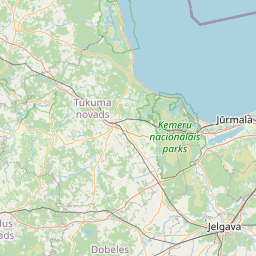
Address: Kalna iela 7, Abavnieki, Jaunsātu pagasts, Tukuma novads, LV-3128
Cadastre designation of real estate | |
|---|---|
Cadastral object type | Cadastral object type: Building |
Address | Address: Kalna iela 7, Abavnieki, Jaunsātu pagasts, Tukuma novads, LV-3128 |
Address | |
|---|---|
Address ID | Address ID: 102085647 |
Companies registered at the address | Companies registered at the address: 0 |
Departments registered at the address | Departments registered at the address: 0 |
Institutions registered at the address | Institutions registered at the address: 0 |
Real estate registered at the address | |
Transactions with real estate at the address | Transactions with real estate at the address: 0 |
| Cadastral object type | Cadastre designation of the cadastral object | Person's property right status | Person status | Land Register |
|---|---|---|---|---|
| Cadastral object type: Building | 90580020077001 | Person's property right status: No data | Person status: No data | Land Register |
22.01.2025. State land service data
|
|
    Leaflet | © OpenStreetMap contributors {"7201060110":{"name":"<div class='color_dot' style='background-color: #00ffff'><\/div><span>Measured land unit<\/span>","featureColor":"#00ffff","features":{"type":"FeatureCollection","features":[{"type":"Feature","geometry":{"type":"Polygon","coordinates":[[[22.933950997,56.975099144],[22.934185012,56.974824174],[22.934275333,56.974843675],[22.934367607,56.974868556],[22.934981422,56.974977199],[22.934644967,56.975418143],[22.933950997,56.975099144]]]},"crs":{"type":"name","properties":{"name":"urn:ogc:def:crs:EPSG:3059"}},"properties":{"style":{"color":"#00ffff","dashArray":"0","weight":1},"name":"Land","object_type":"Parcel","parcel_code":"90580020077","code":null,"surveyor":null,"address":"Kalna iela 7, Abavnieki, Jauns\u0101tu pag., Tukuma nov., LV-3128","ownership":"<span>Owner - Natural person<br><\/span>","pro_cadastre_nr":"90580020077"}}]}},"5201011110":{"name":"<div class='color_dot' style='background-color: #ff0000'><\/div><span>Measured building<\/span>","featureColor":"#ff0000","features":{"type":"FeatureCollection","features":[{"type":"Feature","geometry":{"type":"Polygon","coordinates":[[[22.934325153,56.974915514],[22.934232879,56.974890633],[22.934275333,56.974843675],[22.934367607,56.974868556],[22.934325153,56.974915514]]]},"crs":{"type":"name","properties":{"name":"urn:ogc:def:crs:EPSG:3059"}},"properties":{"style":{"color":"#ff0000","dashArray":"0","weight":1},"name":"Building","object_type":"Building","parcel_code":"90580020077","code":"90580020077002","surveyor":null,"address":"Kalna iela 7, Abavnieki, Jauns\u0101tu pag., Tukuma nov., LV-3128","ownership":"<span>Owner - Natural person<br><\/span>","pro_cadastre_nr":"90580020077"}},{"type":"Feature","geometry":{"type":"Polygon","coordinates":[[[22.93420537,56.974925293],[22.934235949,56.974891459],[22.934321937,56.974914642],[22.934291358,56.974948477],[22.93420537,56.974925293]]]},"crs":{"type":"name","properties":{"name":"urn:ogc:def:crs:EPSG:3059"}},"properties":{"style":{"color":"#ff0000","dashArray":"0","weight":1},"name":"Building","object_type":"Building","parcel_code":"90580020077","code":"90580020077003","surveyor":null,"address":"Kalna iela 7, Abavnieki, Jauns\u0101tu pag., Tukuma nov., LV-3128","ownership":"<span>Owner - Natural person<br><\/span>","pro_cadastre_nr":"90580020077"}},{"type":"Feature","geometry":{"type":"Polygon","coordinates":[[[22.93458355,56.975065037],[22.934631336,56.974990893],[22.934796116,56.975022564],[22.93474833,56.975096708],[22.93458355,56.975065037]]]},"crs":{"type":"name","properties":{"name":"urn:ogc:def:crs:EPSG:3059"}},"properties":{"style":{"color":"#ff0000","dashArray":"0","weight":1},"name":"Building","object_type":"Building","parcel_code":"90580020077","code":"90580020077001","surveyor":null,"address":"Kalna iela 7, Abavnieki, Jauns\u0101tu pag., Tukuma nov., LV-3128","ownership":"<span>Owner - Natural person<br><\/span>","pro_cadastre_nr":"90580020077"}},{"type":"Feature","geometry":{"type":"Polygon","coordinates":[[[22.93420537,56.974925293],[22.934235949,56.974891459],[22.934321937,56.974914642],[22.934291358,56.974948477],[22.93420537,56.974925293]]]},"crs":{"type":"name","properties":{"name":"urn:ogc:def:crs:EPSG:3059"}},"properties":{"style":{"color":"#ff0000","dashArray":"0","weight":1},"name":"Building","object_type":"Building","parcel_code":"90580020077","code":"90580020077003","surveyor":null,"address":"Kalna iela 7, Abavnieki, Jauns\u0101tu pag., Tukuma nov., LV-3128","ownership":"<span>Owner - Natural person<br><\/span>","pro_cadastre_nr":"90580020077"}},{"type":"Feature","geometry":{"type":"Polygon","coordinates":[[[22.934325153,56.974915514],[22.934232879,56.974890633],[22.934275333,56.974843675],[22.934367607,56.974868556],[22.934325153,56.974915514]]]},"crs":{"type":"name","properties":{"name":"urn:ogc:def:crs:EPSG:3059"}},"properties":{"style":{"color":"#ff0000","dashArray":"0","weight":1},"name":"Building","object_type":"Building","parcel_code":"90580020077","code":"90580020077002","surveyor":null,"address":"Kalna iela 7, Abavnieki, Jauns\u0101tu pag., Tukuma nov., LV-3128","ownership":"<span>Owner - Natural person<br><\/span>","pro_cadastre_nr":"90580020077"}},{"type":"Feature","geometry":{"type":"Polygon","coordinates":[[[22.93458355,56.975065037],[22.934631336,56.974990893],[22.934796116,56.975022564],[22.93474833,56.975096708],[22.93458355,56.975065037]]]},"crs":{"type":"name","properties":{"name":"urn:ogc:def:crs:EPSG:3059"}},"properties":{"style":{"color":"#ff0000","dashArray":"0","weight":1},"name":"Building","object_type":"Building","parcel_code":"90580020077","code":"90580020077001","surveyor":null,"address":"Kalna iela 7, Abavnieki, Jauns\u0101tu pag., Tukuma nov., LV-3128","ownership":"<span>Owner - Natural person<br><\/span>","pro_cadastre_nr":"90580020077"}}]}}}
[]
https://tile.openstreetmap.org/{z}/{x}/{y}.png|© OpenStreetMap contributors|minZoom: 7|maxZoom: 19
|
Building data updated: 24.01.2025.
Data source and license: Cadastre Information System open text and spatial data, Real Estate Market Database open data, open data license Creative Commons Attribution, OpenStreetMap