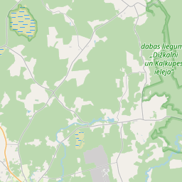
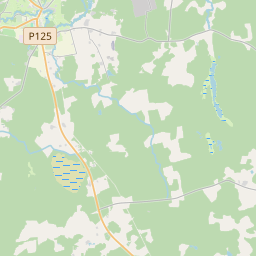
Building (cadastre designation: 88500210041001)
Cadastre designation: 88500210041001
Address: "Bieriņi", Mazpiltene, Dundagas pagasts, Talsu novads, LV-3270
Cadastre designation of real estate | |
|---|---|
Cadastral object type | Cadastral object type: Building |
Address | Address: "Bieriņi", Mazpiltene, Dundagas pagasts, Talsu novads, LV-3270 |
Address | |
|---|---|
Address ID | Address ID: 103466370 |
Companies registered at the address | Companies registered at the address: 0 |
Departments registered at the address | Departments registered at the address: 0 |
Institutions registered at the address | Institutions registered at the address: 0 |
Real estate registered at the address | |
Transactions with real estate at the address | Transactions with real estate at the address: 0 |
| Cadastral object type | Cadastre designation of the cadastral object | Person's property right status | Person status | Land Register |
|---|---|---|---|---|
| Cadastral object type: Building | 88500210041001 | Person's property right status: No data | Person status: No data | Land Register |
17.12.2024. State land service data
|
|
|
{"7201060210":{"name":"<div class='color_dot' style='background-color: #00ffff'><\/div><span>Specified land unit<\/span>","featureColor":"#00ffff","features":{"type":"FeatureCollection","features":[{"type":"Feature","geometry":{"type":"Polygon","coordinates":[[[22.367715002,57.51590944],[22.369073345,57.515259569],[22.369444858,57.515157798],[22.372076346,57.517686259],[22.372018655,57.517691228],[22.370502471,57.517829639],[22.368989192,57.516445826],[22.368959563,57.516418733],[22.368513809,57.516011095],[22.36830896,57.515985024],[22.367715002,57.51590944]]]},"crs":{"type":"name","properties":{"name":"urn:ogc:def:crs:EPSG:3059"}},"properties":{"style":{"color":"#00ffff","dashArray":"8,12","weight":1},"name":"Land","object_type":"Parcel","parcel_code":"88500210042","code":null,"surveyor":null,"address":"","ownership":"<span>Owner - Natural person<br><\/span>","pro_cadastre_nr":"88500210041"}},{"type":"Feature","geometry":{"type":"Polygon","coordinates":[[[22.394179002,57.51972503],[22.395110803,57.517830779],[22.396250926,57.518537221],[22.396369587,57.520033138],[22.394179002,57.51972503]]]},"crs":{"type":"name","properties":{"name":"urn:ogc:def:crs:EPSG:3059"}},"properties":{"style":{"color":"#00ffff","dashArray":"8,12","weight":1},"name":"Land","object_type":"Parcel","parcel_code":"88500210041","code":null,"surveyor":null,"address":"\"Bieri\u0146i\", Mazpiltene, Dundagas pag., Talsu nov., LV-3270","ownership":"<span>Owner - Natural person<br><\/span>","pro_cadastre_nr":"88500210041"}}]}},"7114100000":{"name":"<div class='color_dot' style='background-color: #b40000'><\/div><span>Burdened access road servitude area<\/span>","featureColor":"#b40000","features":{"type":"FeatureCollection","features":[{"type":"Feature","geometry":{"type":"Polygon","coordinates":[[[22.396249461,57.520015315],[22.396112947,57.518591457],[22.396035259,57.518509225],[22.395072845,57.517908091],[22.395103904,57.517844913],[22.396119053,57.518478998],[22.396211867,57.518577243],[22.396351124,57.520029616],[22.396249461,57.520015315]]]},"crs":{"type":"name","properties":{"name":"urn:ogc:def:crs:EPSG:3059"}},"properties":{"style":{"color":"#b40000","dashArray":"4,2,1,2","weight":1},"name":"Burdened access road servitude area","object_type":"WayRestriction","parcel_code":"88500210041","code":"7315030100002","surveyor":null,"address":"\"Bieri\u0146i\", Mazpiltene, Dundagas pag., Talsu nov., LV-3270","ownership":"<span>Owner - Natural person<br><\/span>","pro_cadastre_nr":"88500210041"}}]}},"5201011310":{"name":"<div class='color_dot' style='background-color: #960096'><\/div><span>Vectorized building<\/span>","featureColor":"#960096","features":{"type":"FeatureCollection","features":[{"type":"Feature","geometry":{"type":"Polygon","coordinates":[[[22.395704861,57.519509975],[22.395674407,57.519523989],[22.395647288,57.519506925],[22.395677725,57.51949291],[22.395704861,57.519509975]]]},"crs":{"type":"name","properties":{"name":"urn:ogc:def:crs:EPSG:3059"}},"properties":{"style":{"color":"#960096","dashArray":"0","weight":2},"name":"Building","object_type":"Building","parcel_code":"88500210041","code":"88500210041005","surveyor":null,"address":"\"Bieri\u0146i\", Mazpiltene, Dundagas pag., Talsu nov., LV-3270","ownership":null,"pro_cadastre_nr":null}},{"type":"Feature","geometry":{"type":"Polygon","coordinates":[[[22.395515574,57.519418427],[22.395574392,57.519449002],[22.395532645,57.519472261],[22.395473811,57.519441677],[22.395515574,57.519418427]]]},"crs":{"type":"name","properties":{"name":"urn:ogc:def:crs:EPSG:3059"}},"properties":{"style":{"color":"#960096","dashArray":"0","weight":2},"name":"Building","object_type":"Building","parcel_code":"88500210041","code":"88500210041004","surveyor":null,"address":"\"Bieri\u0146i\", Mazpiltene, Dundagas pag., Talsu nov., LV-3270","ownership":null,"pro_cadastre_nr":null}},{"type":"Feature","geometry":{"type":"Polygon","coordinates":[[[22.395618219,57.519361253],[22.395677037,57.519391838],[22.395574392,57.519449002],[22.395515574,57.519418427],[22.395618219,57.519361253]]]},"crs":{"type":"name","properties":{"name":"urn:ogc:def:crs:EPSG:3059"}},"properties":{"style":{"color":"#960096","dashArray":"0","weight":2},"name":"Building","object_type":"Building","parcel_code":"88500210041","code":"88500210041002","surveyor":null,"address":"\"Bieri\u0146i\", Mazpiltene, Dundagas pag., Talsu nov., LV-3270","ownership":"<span>Owner - Natural person<br><\/span>","pro_cadastre_nr":"88500210041"}},{"type":"Feature","geometry":{"type":"Polygon","coordinates":[[[22.395786297,57.519564682],[22.395701657,57.519511443],[22.395802495,57.519465028],[22.395887135,57.519518257],[22.395786297,57.519564682]]]},"crs":{"type":"name","properties":{"name":"urn:ogc:def:crs:EPSG:3059"}},"properties":{"style":{"color":"#960096","dashArray":"0","weight":2},"name":"Building","object_type":"Building","parcel_code":"88500210041","code":"88500210041006","surveyor":null,"address":"\"Bieri\u0146i\", Mazpiltene, Dundagas pag., Talsu nov., LV-3270","ownership":null,"pro_cadastre_nr":null}},{"type":"Feature","geometry":{"type":"Polygon","coordinates":[[[22.395301963,57.519422961],[22.395195265,57.519368633],[22.395332935,57.519290343],[22.39543965,57.519344671],[22.395378839,57.519379242],[22.395405509,57.519392824],[22.395377972,57.519408483],[22.395351301,57.519394902],[22.395301963,57.519422961]]]},"crs":{"type":"name","properties":{"name":"urn:ogc:def:crs:EPSG:3059"}},"properties":{"style":{"color":"#960096","dashArray":"0","weight":2},"name":"Building","object_type":"Building","parcel_code":"88500210041","code":"88500210041001","surveyor":null,"address":"\"Bieri\u0146i\", Mazpiltene, Dundagas pag., Talsu nov., LV-3270","ownership":"<span>Owner - Natural person<br><\/span>","pro_cadastre_nr":"88500210041"}},{"type":"Feature","geometry":{"type":"Polygon","coordinates":[[[22.395585856,57.519564757],[22.395701657,57.519511443],[22.395766766,57.519552394],[22.395650965,57.519605708],[22.395585856,57.519564757]]]},"crs":{"type":"name","properties":{"name":"urn:ogc:def:crs:EPSG:3059"}},"properties":{"style":{"color":"#960096","dashArray":"0","weight":2},"name":"Building","object_type":"Building","parcel_code":"88500210041","code":"88500210041003","surveyor":null,"address":"\"Bieri\u0146i\", Mazpiltene, Dundagas pag., Talsu nov., LV-3270","ownership":"<span>Owner - Natural person<br><\/span>","pro_cadastre_nr":"88500210041"}},{"type":"Feature","geometry":{"type":"Polygon","coordinates":[[[22.395585856,57.519564757],[22.395701657,57.519511443],[22.395766766,57.519552394],[22.395650965,57.519605708],[22.395585856,57.519564757]]]},"crs":{"type":"name","properties":{"name":"urn:ogc:def:crs:EPSG:3059"}},"properties":{"style":{"color":"#960096","dashArray":"0","weight":2},"name":"Building","object_type":"Building","parcel_code":"88500210041","code":"88500210041003","surveyor":null,"address":"\"Bieri\u0146i\", Mazpiltene, Dundagas pag., Talsu nov., LV-3270","ownership":"<span>Owner - Natural person<br><\/span>","pro_cadastre_nr":"88500210041"}},{"type":"Feature","geometry":{"type":"Polygon","coordinates":[[[22.395618219,57.519361253],[22.395677037,57.519391838],[22.395574392,57.519449002],[22.395515574,57.519418427],[22.395618219,57.519361253]]]},"crs":{"type":"name","properties":{"name":"urn:ogc:def:crs:EPSG:3059"}},"properties":{"style":{"color":"#960096","dashArray":"0","weight":2},"name":"Building","object_type":"Building","parcel_code":"88500210041","code":"88500210041002","surveyor":null,"address":"\"Bieri\u0146i\", Mazpiltene, Dundagas pag., Talsu nov., LV-3270","ownership":"<span>Owner - Natural person<br><\/span>","pro_cadastre_nr":"88500210041"}},{"type":"Feature","geometry":{"type":"Polygon","coordinates":[[[22.395301963,57.519422961],[22.395195265,57.519368633],[22.395332935,57.519290343],[22.39543965,57.519344671],[22.395378839,57.519379242],[22.395405509,57.519392824],[22.395377972,57.519408483],[22.395351301,57.519394902],[22.395301963,57.519422961]]]},"crs":{"type":"name","properties":{"name":"urn:ogc:def:crs:EPSG:3059"}},"properties":{"style":{"color":"#960096","dashArray":"0","weight":2},"name":"Building","object_type":"Building","parcel_code":"88500210041","code":"88500210041001","surveyor":null,"address":"\"Bieri\u0146i\", Mazpiltene, Dundagas pag., Talsu nov., LV-3270","ownership":"<span>Owner - Natural person<br><\/span>","pro_cadastre_nr":"88500210041"}}]}}}
[]
https://tile.openstreetmap.org/{z}/{x}/{y}.png|© OpenStreetMap contributors|minZoom: 7|maxZoom: 19
|
Building data updated: 24.11.2024.
Data source and license: Cadastre Information System open text and spatial data, Real Estate Market Database open data, open data license Creative Commons Attribution, OpenStreetMap

