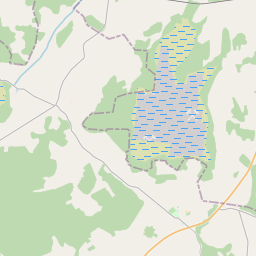
Building (cadastre designation: 76480040180006)
Cadastre designation: 76480040180006
Address: Ziedu iela 4, Lomi-Bortnieki, Galēnu pagasts, Preiļu novads, LV-5311
Cadastre designation of real estate | |
|---|---|
Cadastral object type | Cadastral object type: Building |
Address | Address: Ziedu iela 4, Lomi-Bortnieki, Galēnu pagasts, Preiļu novads, LV-5311 |
Address | |
|---|---|
Address ID | Address ID: 104811403 |
Companies registered at the address | Companies registered at the address: 0 |
Departments registered at the address | Departments registered at the address: 0 |
Institutions registered at the address | Institutions registered at the address: 0 |
Real estate registered at the address | |
Transactions with real estate at the address | Transactions with real estate at the address: 0 |
| Cadastral object type | Cadastre designation of the cadastral object | Person's property right status | Person status | Land Register |
|---|---|---|---|---|
| Cadastral object type: Building | 76480040180006 | Person's property right status: No data | Person status: No data | Land Register |
17.12.2024. State land service data
|
|
|
{"7201070000":{"name":"<div class='color_dot' style='background-color: #00ff00'><\/div><span>Areas with initiated surveying<\/span>","featureColor":"#00ff00","features":{"type":"FeatureCollection","features":[{"type":"Feature","geometry":{"type":"Polygon","coordinates":[[[26.886585555,56.439017472],[26.887258967,56.437894688],[26.888169856,56.436375827],[26.894228632,56.437487676],[26.89877712,56.438322131],[26.897846039,56.439831057],[26.897139798,56.44097554],[26.892620357,56.440752361],[26.889481826,56.440639953],[26.888505907,56.440624584],[26.888424294,56.440556282],[26.886585555,56.439017472]]]},"crs":{"type":"name","properties":{"name":"urn:ogc:def:crs:EPSG:3059"}},"properties":{"style":{"color":"#00ff00","dashArray":"0","weight":1},"name":"Areas with initiated surveying","object_type":"SurveyingStatus","parcel_code":"76480040181","code":null,"surveyor":"Preime SIA 28.10.2024.","address":"","ownership":"<span>Owner - Natural person<br><\/span>","pro_cadastre_nr":"76480040180"}}]}},"7201060210":{"name":"<div class='color_dot' style='background-color: #00ffff'><\/div><span>Specified land unit<\/span>","featureColor":"#00ffff","features":{"type":"FeatureCollection","features":[{"type":"Feature","geometry":{"type":"Polygon","coordinates":[[[26.881640572,56.437159421],[26.881659399,56.43715928],[26.883810543,56.437143334],[26.883889954,56.437142746],[26.883893054,56.437192858],[26.883931324,56.437228111],[26.88396504,56.437239462],[26.883909682,56.437297963],[26.88378495,56.43742978],[26.881744842,56.43744986],[26.881699821,56.437447571],[26.881640572,56.437159421]]]},"crs":{"type":"name","properties":{"name":"urn:ogc:def:crs:EPSG:3059"}},"properties":{"style":{"color":"#00ffff","dashArray":"8,12","weight":1},"name":"Land","object_type":"Parcel","parcel_code":"76480040211","code":null,"surveyor":null,"address":"","ownership":"<span>Owner - Natural person<br><\/span>","pro_cadastre_nr":"76480040180"}},{"type":"Feature","geometry":{"type":"Polygon","coordinates":[[[26.886585555,56.439017472],[26.887258967,56.437894688],[26.888169856,56.436375827],[26.894228632,56.437487676],[26.89877712,56.438322131],[26.897846039,56.439831057],[26.897139798,56.44097554],[26.892620357,56.440752361],[26.889481826,56.440639953],[26.888505907,56.440624584],[26.888424294,56.440556282],[26.886585555,56.439017472]]]},"crs":{"type":"name","properties":{"name":"urn:ogc:def:crs:EPSG:3059"}},"properties":{"style":{"color":"#00ffff","dashArray":"8,12","weight":1},"name":"Land","object_type":"Parcel","parcel_code":"76480040181","code":null,"surveyor":null,"address":"","ownership":"<span>Owner - Natural person<br><\/span>","pro_cadastre_nr":"76480040180"}},{"type":"Feature","geometry":{"type":"Polygon","coordinates":[[[26.881699821,56.437447571],[26.881744842,56.43744986],[26.88378495,56.43742978],[26.883909682,56.437297963],[26.88396504,56.437239462],[26.883967838,56.437240404],[26.88405913,56.437271134],[26.884202734,56.437287516],[26.884452649,56.437298135],[26.884944578,56.437293262],[26.885092585,56.437289819],[26.885182346,56.437613024],[26.885224082,56.437694201],[26.885285826,56.437804486],[26.885337911,56.43786571],[26.88541419,56.437932932],[26.885447856,56.437974414],[26.885278907,56.437966848],[26.883619852,56.43789252],[26.883535563,56.437901788],[26.882594062,56.437904548],[26.881795036,56.437923118],[26.8817716,56.437939969],[26.881747771,56.437796262],[26.881748733,56.437643108],[26.881725694,56.437550988],[26.881699821,56.437447571]]]},"crs":{"type":"name","properties":{"name":"urn:ogc:def:crs:EPSG:3059"}},"properties":{"style":{"color":"#00ffff","dashArray":"8,12","weight":1},"name":"Land","object_type":"Parcel","parcel_code":"76480040180","code":null,"surveyor":null,"address":"Ziedu iela 4, Lomi-Bortnieki, Gal\u0113nu pag., Prei\u013cu nov., LV-5311","ownership":"<span>Owner - Natural person<br><\/span>","pro_cadastre_nr":"76480040180"}},{"type":"Feature","geometry":{"type":"Polygon","coordinates":[[[26.883569283,56.43845862],[26.885581435,56.438536293],[26.885812514,56.438541055],[26.885900026,56.43868834],[26.886652283,56.439836437],[26.886514722,56.439854093],[26.884734709,56.440031285],[26.884678112,56.440038148],[26.884432352,56.439796359],[26.884274024,56.439637858],[26.88406448,56.439375416],[26.883910657,56.439204791],[26.883840097,56.439131673],[26.883773771,56.439043112],[26.883742421,56.438986781],[26.883717145,56.438939306],[26.883702691,56.438891588],[26.883717337,56.438782304],[26.883569283,56.43845862]]]},"crs":{"type":"name","properties":{"name":"urn:ogc:def:crs:EPSG:3059"}},"properties":{"style":{"color":"#00ffff","dashArray":"8,12","weight":1},"name":"Land","object_type":"Parcel","parcel_code":"76480040164","code":null,"surveyor":null,"address":"","ownership":"<span>Owner - Natural person<br><\/span>","pro_cadastre_nr":"76480040180"}},{"type":"Feature","geometry":{"type":"Polygon","coordinates":[[[26.868876643,56.448632805],[26.868894094,56.448450551],[26.868965363,56.448161328],[26.869130314,56.448133855],[26.870714398,56.447870138],[26.870945523,56.448925201],[26.869403835,56.449305924],[26.869248418,56.449344306],[26.868998893,56.448971169],[26.868885739,56.448684558],[26.868876643,56.448632805]]]},"crs":{"type":"name","properties":{"name":"urn:ogc:def:crs:EPSG:3059"}},"properties":{"style":{"color":"#00ffff","dashArray":"8,12","weight":1},"name":"Land","object_type":"Parcel","parcel_code":"76480030153","code":null,"surveyor":null,"address":"","ownership":"<span>Owner - Natural person<br><\/span>","pro_cadastre_nr":"76480040180"}}]}},"7114100000":{"name":"<div class='color_dot' style='background-color: #b40000'><\/div><span>Burdened access road servitude area<\/span>","featureColor":"#b40000","features":{"type":"FeatureCollection","features":[{"type":"Feature","geometry":{"type":"Polygon","coordinates":[[[26.881672948,56.437159927],[26.881732568,56.437448473],[26.881700938,56.437447105],[26.881641232,56.437159999],[26.881672948,56.437159927]]]},"crs":{"type":"name","properties":{"name":"urn:ogc:def:crs:EPSG:3059"}},"properties":{"style":{"color":"#b40000","dashArray":"4,2,1,2","weight":1},"name":"Burdened access road servitude area","object_type":"WayRestriction","parcel_code":"76480040211","code":"7315030100001","surveyor":null,"address":"","ownership":"<span>Owner - Natural person<br><\/span>","pro_cadastre_nr":"76480040180"}},{"type":"Feature","geometry":{"type":"Polygon","coordinates":[[[26.892781273,56.440758451],[26.89285502,56.440037747],[26.888597355,56.438584202],[26.887851685,56.438685973],[26.887624228,56.438576267],[26.887370749,56.437913973],[26.887298976,56.43783817],[26.887342608,56.437764615],[26.887463202,56.437895767],[26.887712632,56.438547458],[26.887877469,56.438626964],[26.888613678,56.438526474],[26.892955366,56.440008709],[26.892878808,56.440762863],[26.892781273,56.440758451]]]},"crs":{"type":"name","properties":{"name":"urn:ogc:def:crs:EPSG:3059"}},"properties":{"style":{"color":"#b40000","dashArray":"4,2,1,2","weight":1},"name":"Burdened access road servitude area","object_type":"WayRestriction","parcel_code":"76480040181","code":"7315030100007","surveyor":null,"address":"","ownership":"<span>Owner - Natural person<br><\/span>","pro_cadastre_nr":"76480040180"}},{"type":"Feature","geometry":{"type":"Polygon","coordinates":[[[26.88179805,56.437896064],[26.882593806,56.437877606],[26.883535307,56.437874846],[26.883534618,56.437901298],[26.882594247,56.437903987],[26.881801893,56.437922815],[26.88179805,56.437896064]]]},"crs":{"type":"name","properties":{"name":"urn:ogc:def:crs:EPSG:3059"}},"properties":{"style":{"color":"#b40000","dashArray":"4,2,1,2","weight":1},"name":"Burdened access road servitude area","object_type":"WayRestriction","parcel_code":"76480040180","code":"7315030100006","surveyor":null,"address":"Ziedu iela 4, Lomi-Bortnieki, Gal\u0113nu pag., Prei\u013cu nov., LV-5311","ownership":"<span>Owner - Natural person<br><\/span>","pro_cadastre_nr":"76480040180"}},{"type":"Feature","geometry":{"type":"Polygon","coordinates":[[[26.881732532,56.437449499],[26.881781157,56.437643173],[26.881780195,56.437796327],[26.881801264,56.43792265],[26.881794667,56.437922749],[26.881771714,56.437939759],[26.881748563,56.437796226],[26.881749195,56.437642783],[26.881700339,56.437447982],[26.881732532,56.437449499]]]},"crs":{"type":"name","properties":{"name":"urn:ogc:def:crs:EPSG:3059"}},"properties":{"style":{"color":"#b40000","dashArray":"4,2,1,2","weight":1},"name":"Burdened access road servitude area","object_type":"WayRestriction","parcel_code":"76480040180","code":"7315030100005","surveyor":null,"address":"Ziedu iela 4, Lomi-Bortnieki, Gal\u0113nu pag., Prei\u013cu nov., LV-5311","ownership":"<span>Owner - Natural person<br><\/span>","pro_cadastre_nr":"76480040180"}},{"type":"Feature","geometry":{"type":"Polygon","coordinates":[[[26.883693283,56.438519026],[26.883901104,56.438583245],[26.885880745,56.438666236],[26.885917077,56.438723826],[26.883872549,56.438636169],[26.883713229,56.438587173],[26.883693283,56.438519026]]]},"crs":{"type":"name","properties":{"name":"urn:ogc:def:crs:EPSG:3059"}},"properties":{"style":{"color":"#b40000","dashArray":"4,2,1,2","weight":1},"name":"Burdened access road servitude area","object_type":"WayRestriction","parcel_code":"76480040164","code":"7315030100003","surveyor":null,"address":"","ownership":"<span>Owner - Natural person<br><\/span>","pro_cadastre_nr":"76480040180"}},{"type":"Feature","geometry":{"type":"Polygon","coordinates":[[[26.883674237,56.438686956],[26.883605609,56.438460499],[26.883672363,56.438463279],[26.883743166,56.438697245],[26.883754564,56.438780854],[26.883721761,56.438782228],[26.883674237,56.438686956]]]},"crs":{"type":"name","properties":{"name":"urn:ogc:def:crs:EPSG:3059"}},"properties":{"style":{"color":"#b40000","dashArray":"4,2,1,2","weight":1},"name":"Burdened access road servitude area","object_type":"WayRestriction","parcel_code":"76480040164","code":"7315030100002","surveyor":null,"address":"","ownership":"<span>Owner - Natural person<br><\/span>","pro_cadastre_nr":"76480040180"}},{"type":"Feature","geometry":{"type":"Polygon","coordinates":[[[26.883752295,56.438781968],[26.883734674,56.438888615],[26.883749129,56.438936333],[26.883803723,56.439036231],[26.883872786,56.439124728],[26.883939661,56.439196764],[26.884093485,56.439367388],[26.884302395,56.439629162],[26.88471055,56.440033879],[26.884678181,56.440037778],[26.884274603,56.439637782],[26.884071063,56.439374067],[26.883842522,56.439130915],[26.883775264,56.439042898],[26.883718778,56.438939007],[26.883704288,56.438891901],[26.883719058,56.43878274],[26.883752295,56.438781968]]]},"crs":{"type":"name","properties":{"name":"urn:ogc:def:crs:EPSG:3059"}},"properties":{"style":{"color":"#b40000","dashArray":"4,2,1,2","weight":1},"name":"Burdened access road servitude area","object_type":"WayRestriction","parcel_code":"76480040164","code":"7315030100004","surveyor":null,"address":"","ownership":"<span>Owner - Natural person<br><\/span>","pro_cadastre_nr":"76480040180"}}]}},"5201011310":{"name":"<div class='color_dot' style='background-color: #960096'><\/div><span>Vectorized building<\/span>","featureColor":"#960096","features":{"type":"FeatureCollection","features":[{"type":"Feature","geometry":{"type":"Polygon","coordinates":[[[26.883521845,56.437659052],[26.883518629,56.437616601],[26.883626534,56.437614092],[26.883629751,56.437656543],[26.883521845,56.437659052]]]},"crs":{"type":"name","properties":{"name":"urn:ogc:def:crs:EPSG:3059"}},"properties":{"style":{"color":"#960096","dashArray":"0","weight":2},"name":"Building","object_type":"Building","parcel_code":"76480040180","code":"76480040180006","surveyor":null,"address":"Ziedu iela 4, Lomi-Bortnieki, Gal\u0113nu pag., Prei\u013cu nov., LV-5311","ownership":"<span>Owner - Natural person<br><\/span>","pro_cadastre_nr":"76480040180"}},{"type":"Feature","geometry":{"type":"Polygon","coordinates":[[[26.883626534,56.437614092],[26.883518629,56.437616601],[26.883514389,56.437560637],[26.883622294,56.437558128],[26.883626534,56.437614092]]]},"crs":{"type":"name","properties":{"name":"urn:ogc:def:crs:EPSG:3059"}},"properties":{"style":{"color":"#960096","dashArray":"0","weight":2},"name":"Building","object_type":"Building","parcel_code":"76480040180","code":"76480040180007","surveyor":null,"address":"Ziedu iela 4, Lomi-Bortnieki, Gal\u0113nu pag., Prei\u013cu nov., LV-5311","ownership":"<span>Owner - Natural person<br><\/span>","pro_cadastre_nr":"76480040180"}},{"type":"Feature","geometry":{"type":"Polygon","coordinates":[[[26.882498951,56.437475911],[26.882496612,56.437445035],[26.882601034,56.437442608],[26.882603373,56.437473484],[26.882498951,56.437475911]]]},"crs":{"type":"name","properties":{"name":"urn:ogc:def:crs:EPSG:3059"}},"properties":{"style":{"color":"#960096","dashArray":"0","weight":2},"name":"Building","object_type":"Building","parcel_code":"76480040180","code":"76480040180002","surveyor":null,"address":"Ziedu iela 4, Lomi-Bortnieki, Gal\u0113nu pag., Prei\u013cu nov., LV-5311","ownership":"<span>Owner - Natural person<br><\/span>","pro_cadastre_nr":"76480040180"}},{"type":"Feature","geometry":{"type":"Polygon","coordinates":[[[26.883516093,56.437721046],[26.88351584,56.437680441],[26.883607145,56.437680268],[26.883607397,56.437720865],[26.883516093,56.437721046]]]},"crs":{"type":"name","properties":{"name":"urn:ogc:def:crs:EPSG:3059"}},"properties":{"style":{"color":"#960096","dashArray":"0","weight":2},"name":"Building","object_type":"Building","parcel_code":"76480040180","code":"76480040180005","surveyor":null,"address":"Ziedu iela 4, Lomi-Bortnieki, Gal\u0113nu pag., Prei\u013cu nov., LV-5311","ownership":"<span>Owner - Natural person<br><\/span>","pro_cadastre_nr":"76480040180"}},{"type":"Feature","geometry":{"type":"Polygon","coordinates":[[[26.883145547,56.437681203],[26.883397698,56.437677399],[26.883401596,56.437756697],[26.883287189,56.437758422],[26.88328429,56.437699371],[26.883146545,56.437701449],[26.883145547,56.437681203]]]},"crs":{"type":"name","properties":{"name":"urn:ogc:def:crs:EPSG:3059"}},"properties":{"style":{"color":"#960096","dashArray":"0","weight":2},"name":"Building","object_type":"Building","parcel_code":"76480040180","code":"76480040180004","surveyor":null,"address":"Ziedu iela 4, Lomi-Bortnieki, Gal\u0113nu pag., Prei\u013cu nov., LV-5311","ownership":"<span>Owner - Natural person<br><\/span>","pro_cadastre_nr":"76480040180"}},{"type":"Feature","geometry":{"type":"Polygon","coordinates":[[[26.883362588,56.437627959],[26.883358349,56.437572004],[26.883476684,56.437569253],[26.883480924,56.437625208],[26.883362588,56.437627959]]]},"crs":{"type":"name","properties":{"name":"urn:ogc:def:crs:EPSG:3059"}},"properties":{"style":{"color":"#960096","dashArray":"0","weight":2},"name":"Building","object_type":"Building","parcel_code":"76480040180","code":"76480040180008","surveyor":null,"address":"Ziedu iela 4, Lomi-Bortnieki, Gal\u0113nu pag., Prei\u013cu nov., LV-5311","ownership":"<span>Owner - Natural person<br><\/span>","pro_cadastre_nr":"76480040180"}},{"type":"Feature","geometry":{"type":"Polygon","coordinates":[[[26.883149445,56.437760501],[26.883146545,56.437701449],[26.88328429,56.437699371],[26.883287189,56.437758422],[26.883149445,56.437760501]]]},"crs":{"type":"name","properties":{"name":"urn:ogc:def:crs:EPSG:3059"}},"properties":{"style":{"color":"#960096","dashArray":"0","weight":2},"name":"Building","object_type":"Building","parcel_code":"76480040180","code":"76480040180003","surveyor":null,"address":"Ziedu iela 4, Lomi-Bortnieki, Gal\u0113nu pag., Prei\u013cu nov., LV-5311","ownership":"<span>Owner - Natural person<br><\/span>","pro_cadastre_nr":"76480040180"}},{"type":"Feature","geometry":{"type":"Polygon","coordinates":[[[26.883126614,56.437643109],[26.883122875,56.437542558],[26.883296679,56.437540575],[26.883300435,56.437641126],[26.883126614,56.437643109]]]},"crs":{"type":"name","properties":{"name":"urn:ogc:def:crs:EPSG:3059"}},"properties":{"style":{"color":"#960096","dashArray":"0","weight":2},"name":"Building","object_type":"Building","parcel_code":"76480040180","code":"76480040180001","surveyor":null,"address":"Ziedu iela 4, Lomi-Bortnieki, Gal\u0113nu pag., Prei\u013cu nov., LV-5311","ownership":"<span>Owner - Natural person<br><\/span>","pro_cadastre_nr":"76480040180"}},{"type":"Feature","geometry":{"type":"Polygon","coordinates":[[[26.883362588,56.437627959],[26.883358349,56.437572004],[26.883476684,56.437569253],[26.883480924,56.437625208],[26.883362588,56.437627959]]]},"crs":{"type":"name","properties":{"name":"urn:ogc:def:crs:EPSG:3059"}},"properties":{"style":{"color":"#960096","dashArray":"0","weight":2},"name":"Building","object_type":"Building","parcel_code":"76480040180","code":"76480040180008","surveyor":null,"address":"Ziedu iela 4, Lomi-Bortnieki, Gal\u0113nu pag., Prei\u013cu nov., LV-5311","ownership":"<span>Owner - Natural person<br><\/span>","pro_cadastre_nr":"76480040180"}},{"type":"Feature","geometry":{"type":"Polygon","coordinates":[[[26.883626534,56.437614092],[26.883518629,56.437616601],[26.883514389,56.437560637],[26.883622294,56.437558128],[26.883626534,56.437614092]]]},"crs":{"type":"name","properties":{"name":"urn:ogc:def:crs:EPSG:3059"}},"properties":{"style":{"color":"#960096","dashArray":"0","weight":2},"name":"Building","object_type":"Building","parcel_code":"76480040180","code":"76480040180007","surveyor":null,"address":"Ziedu iela 4, Lomi-Bortnieki, Gal\u0113nu pag., Prei\u013cu nov., LV-5311","ownership":"<span>Owner - Natural person<br><\/span>","pro_cadastre_nr":"76480040180"}},{"type":"Feature","geometry":{"type":"Polygon","coordinates":[[[26.883521845,56.437659052],[26.883518629,56.437616601],[26.883626534,56.437614092],[26.883629751,56.437656543],[26.883521845,56.437659052]]]},"crs":{"type":"name","properties":{"name":"urn:ogc:def:crs:EPSG:3059"}},"properties":{"style":{"color":"#960096","dashArray":"0","weight":2},"name":"Building","object_type":"Building","parcel_code":"76480040180","code":"76480040180006","surveyor":null,"address":"Ziedu iela 4, Lomi-Bortnieki, Gal\u0113nu pag., Prei\u013cu nov., LV-5311","ownership":"<span>Owner - Natural person<br><\/span>","pro_cadastre_nr":"76480040180"}},{"type":"Feature","geometry":{"type":"Polygon","coordinates":[[[26.883516093,56.437721046],[26.88351584,56.437680441],[26.883607145,56.437680268],[26.883607397,56.437720865],[26.883516093,56.437721046]]]},"crs":{"type":"name","properties":{"name":"urn:ogc:def:crs:EPSG:3059"}},"properties":{"style":{"color":"#960096","dashArray":"0","weight":2},"name":"Building","object_type":"Building","parcel_code":"76480040180","code":"76480040180005","surveyor":null,"address":"Ziedu iela 4, Lomi-Bortnieki, Gal\u0113nu pag., Prei\u013cu nov., LV-5311","ownership":"<span>Owner - Natural person<br><\/span>","pro_cadastre_nr":"76480040180"}},{"type":"Feature","geometry":{"type":"Polygon","coordinates":[[[26.883145547,56.437681203],[26.883397698,56.437677399],[26.883401596,56.437756697],[26.883287189,56.437758422],[26.88328429,56.437699371],[26.883146545,56.437701449],[26.883145547,56.437681203]]]},"crs":{"type":"name","properties":{"name":"urn:ogc:def:crs:EPSG:3059"}},"properties":{"style":{"color":"#960096","dashArray":"0","weight":2},"name":"Building","object_type":"Building","parcel_code":"76480040180","code":"76480040180004","surveyor":null,"address":"Ziedu iela 4, Lomi-Bortnieki, Gal\u0113nu pag., Prei\u013cu nov., LV-5311","ownership":"<span>Owner - Natural person<br><\/span>","pro_cadastre_nr":"76480040180"}},{"type":"Feature","geometry":{"type":"Polygon","coordinates":[[[26.883149445,56.437760501],[26.883146545,56.437701449],[26.88328429,56.437699371],[26.883287189,56.437758422],[26.883149445,56.437760501]]]},"crs":{"type":"name","properties":{"name":"urn:ogc:def:crs:EPSG:3059"}},"properties":{"style":{"color":"#960096","dashArray":"0","weight":2},"name":"Building","object_type":"Building","parcel_code":"76480040180","code":"76480040180003","surveyor":null,"address":"Ziedu iela 4, Lomi-Bortnieki, Gal\u0113nu pag., Prei\u013cu nov., LV-5311","ownership":"<span>Owner - Natural person<br><\/span>","pro_cadastre_nr":"76480040180"}},{"type":"Feature","geometry":{"type":"Polygon","coordinates":[[[26.882498951,56.437475911],[26.882496612,56.437445035],[26.882601034,56.437442608],[26.882603373,56.437473484],[26.882498951,56.437475911]]]},"crs":{"type":"name","properties":{"name":"urn:ogc:def:crs:EPSG:3059"}},"properties":{"style":{"color":"#960096","dashArray":"0","weight":2},"name":"Building","object_type":"Building","parcel_code":"76480040180","code":"76480040180002","surveyor":null,"address":"Ziedu iela 4, Lomi-Bortnieki, Gal\u0113nu pag., Prei\u013cu nov., LV-5311","ownership":"<span>Owner - Natural person<br><\/span>","pro_cadastre_nr":"76480040180"}},{"type":"Feature","geometry":{"type":"Polygon","coordinates":[[[26.883126614,56.437643109],[26.883122875,56.437542558],[26.883296679,56.437540575],[26.883300435,56.437641126],[26.883126614,56.437643109]]]},"crs":{"type":"name","properties":{"name":"urn:ogc:def:crs:EPSG:3059"}},"properties":{"style":{"color":"#960096","dashArray":"0","weight":2},"name":"Building","object_type":"Building","parcel_code":"76480040180","code":"76480040180001","surveyor":null,"address":"Ziedu iela 4, Lomi-Bortnieki, Gal\u0113nu pag., Prei\u013cu nov., LV-5311","ownership":"<span>Owner - Natural person<br><\/span>","pro_cadastre_nr":"76480040180"}}]}}}
[]
https://tile.openstreetmap.org/{z}/{x}/{y}.png|© OpenStreetMap contributors|minZoom: 7|maxZoom: 19
|
Building data updated: 24.11.2024.
Data source and license: Cadastre Information System open text and spatial data, Real Estate Market Database open data, open data license Creative Commons Attribution, OpenStreetMap


