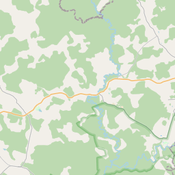
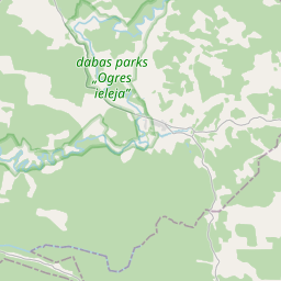
Building (cadastre designation: 74920110111007)
Cadastre designation: 74920110111007
Address: "Krievkalni", Taurupes pagasts, Ogres novads, LV-5064
Cadastre designation of real estate | |
|---|---|
Cadastral object type | Cadastral object type: Building |
Address | Address: "Krievkalni", Taurupes pagasts, Ogres novads, LV-5064 |
Address | |
|---|---|
Address ID | Address ID: 103651486 |
Companies registered at the address | Companies registered at the address: 0 |
Departments registered at the address | Departments registered at the address: 0 |
Institutions registered at the address | Institutions registered at the address: 0 |
Real estate registered at the address | |
Transactions with real estate at the address | Transactions with real estate at the address: 0 |
| Cadastral object type | Cadastre designation of the cadastral object | Person's property right status | Person status | Land Register |
|---|---|---|---|---|
| Cadastral object type: Building | 74920110111007 | Person's property right status: No data | Person status: No data | Land Register |
17.12.2024. State land service data
|
|
|
{"7201060210":{"name":"<div class='color_dot' style='background-color: #00ffff'><\/div><span>Specified land unit<\/span>","featureColor":"#00ffff","features":{"type":"FeatureCollection","features":[{"type":"Feature","geometry":{"type":"Polygon","coordinates":[[[25.376490456,56.857566317],[25.377397513,56.8562952],[25.378092342,56.856493249],[25.380341927,56.856932844],[25.381240493,56.855876285],[25.38437996,56.856395431],[25.386119986,56.85574364],[25.386780479,56.85652816],[25.383943194,56.857216429],[25.381512796,56.857295989],[25.378672278,56.858158199],[25.376490456,56.857566317]]]},"crs":{"type":"name","properties":{"name":"urn:ogc:def:crs:EPSG:3059"}},"properties":{"style":{"color":"#00ffff","dashArray":"8,12","weight":1},"name":"Land","object_type":"Parcel","parcel_code":"74920110113","code":null,"surveyor":null,"address":"","ownership":"<span>Owner - Legal entity<br><\/span>","pro_cadastre_nr":"74920110111"}},{"type":"Feature","geometry":{"type":"Polygon","coordinates":[[[25.34955343,56.843765233],[25.351514747,56.840368666],[25.35354154,56.840156206],[25.353068705,56.840621259],[25.352773089,56.840962234],[25.352234214,56.841495843],[25.352107151,56.841708325],[25.351830376,56.842038536],[25.351668635,56.842356954],[25.351494512,56.842865496],[25.350494536,56.843920097],[25.34955343,56.843765233]]]},"crs":{"type":"name","properties":{"name":"urn:ogc:def:crs:EPSG:3059"}},"properties":{"style":{"color":"#00ffff","dashArray":"8,12","weight":1},"name":"Land","object_type":"Parcel","parcel_code":"74920110112","code":null,"surveyor":null,"address":"","ownership":"<span>Owner - Legal entity<br><\/span>","pro_cadastre_nr":"74920110111"}},{"type":"Feature","geometry":{"type":"Polygon","coordinates":[[[25.350392627,56.844536087],[25.350956821,56.844001619],[25.350805643,56.843958313],[25.351415914,56.843348053],[25.351731206,56.843017659],[25.3518379,56.842773908],[25.351954314,56.842266358],[25.352045948,56.842138789],[25.352430559,56.841596691],[25.352950969,56.841084763],[25.353651909,56.841309214],[25.353093007,56.842683816],[25.354199796,56.84379745],[25.352633647,56.844062539],[25.352843275,56.84408353],[25.352916887,56.845003711],[25.352458418,56.845237545],[25.351728944,56.845100296],[25.350642858,56.844895949],[25.350392627,56.844536087]]]},"crs":{"type":"name","properties":{"name":"urn:ogc:def:crs:EPSG:3059"}},"properties":{"style":{"color":"#00ffff","dashArray":"8,12","weight":1},"name":"Land","object_type":"Parcel","parcel_code":"74920110111","code":null,"surveyor":null,"address":"\"Krievkalni\", Taurupes pag., Ogres nov., LV-5064","ownership":"<span>Owner - Legal entity<br><\/span>","pro_cadastre_nr":"74920110111"}}]}},"5201011310":{"name":"<div class='color_dot' style='background-color: #960096'><\/div><span>Vectorized building<\/span>","featureColor":"#960096","features":{"type":"FeatureCollection","features":[{"type":"Feature","geometry":{"type":"Polygon","coordinates":[[[25.352505773,56.843083108],[25.352452714,56.84306884],[25.35251476,56.842999551],[25.352567818,56.843013819],[25.352505773,56.843083108]]]},"crs":{"type":"name","properties":{"name":"urn:ogc:def:crs:EPSG:3059"}},"properties":{"style":{"color":"#960096","dashArray":"0","weight":2},"name":"Building","object_type":"Building","parcel_code":"74920110111","code":"74920110111014","surveyor":null,"address":"\"Krievkalni\", Taurupes pag., Ogres nov., LV-5064","ownership":"<span>Owner - Legal entity<br><\/span>","pro_cadastre_nr":"74920110111"}},{"type":"Feature","geometry":{"type":"Polygon","coordinates":[[[25.35205591,56.84283435],[25.352048565,56.842823882],[25.351973296,56.842839728],[25.351907689,56.842746108],[25.3519819,56.842730489],[25.351972117,56.842716534],[25.35225731,56.8426565],[25.352276477,56.842683831],[25.352366584,56.842664858],[25.352414684,56.842733475],[25.352326675,56.842751993],[25.352342161,56.84277409],[25.35205591,56.84283435]]]},"crs":{"type":"name","properties":{"name":"urn:ogc:def:crs:EPSG:3059"}},"properties":{"style":{"color":"#960096","dashArray":"0","weight":2},"name":"Building","object_type":"Building","parcel_code":"74920110111","code":"74920110111019","surveyor":null,"address":"\"Krievkalni\", Taurupes pag., Ogres nov., LV-5064","ownership":"<span>Owner - Legal entity<br><\/span>","pro_cadastre_nr":"74920110111"}},{"type":"Feature","geometry":{"type":"Polygon","coordinates":[[[25.352016091,56.843392373],[25.351918135,56.843366022],[25.351992191,56.843283324],[25.352090147,56.843309676],[25.352016091,56.843392373]]]},"crs":{"type":"name","properties":{"name":"urn:ogc:def:crs:EPSG:3059"}},"properties":{"style":{"color":"#960096","dashArray":"0","weight":2},"name":"Building","object_type":"Building","parcel_code":"74920110111","code":"74920110111007","surveyor":null,"address":"\"Krievkalni\", Taurupes pag., Ogres nov., LV-5064","ownership":"<span>Owner - Legal entity<br><\/span>","pro_cadastre_nr":"74920110111"}},{"type":"Feature","geometry":{"type":"Polygon","coordinates":[[[25.352210672,56.843069871],[25.352116789,56.843044625],[25.352152816,56.843004388],[25.352246699,56.843029643],[25.352210672,56.843069871]]]},"crs":{"type":"name","properties":{"name":"urn:ogc:def:crs:EPSG:3059"}},"properties":{"style":{"color":"#960096","dashArray":"0","weight":2},"name":"Building","object_type":"Building","parcel_code":"74920110111","code":"74920110111018","surveyor":null,"address":"\"Krievkalni\", Taurupes pag., Ogres nov., LV-5064","ownership":"<span>Owner - Legal entity<br><\/span>","pro_cadastre_nr":"74920110111"}},{"type":"Feature","geometry":{"type":"Polygon","coordinates":[[[25.351756199,56.843416769],[25.351730179,56.843445819],[25.351656724,56.843426057],[25.351682744,56.843397007],[25.351756199,56.843416769]]]},"crs":{"type":"name","properties":{"name":"urn:ogc:def:crs:EPSG:3059"}},"properties":{"style":{"color":"#960096","dashArray":"0","weight":2},"name":"Building","object_type":"Building","parcel_code":"74920110111","code":"74920110111002","surveyor":null,"address":"\"Krievkalni\", Taurupes pag., Ogres nov., LV-5064","ownership":"<span>Owner - Legal entity<br><\/span>","pro_cadastre_nr":"74920110111"}},{"type":"Feature","geometry":{"type":"Polygon","coordinates":[[[25.352299651,56.843171881],[25.35223843,56.843155419],[25.352326496,56.843057071],[25.352387716,56.843073542],[25.352299651,56.843171881]]]},"crs":{"type":"name","properties":{"name":"urn:ogc:def:crs:EPSG:3059"}},"properties":{"style":{"color":"#960096","dashArray":"0","weight":2},"name":"Building","object_type":"Building","parcel_code":"74920110111","code":"74920110111012","surveyor":null,"address":"\"Krievkalni\", Taurupes pag., Ogres nov., LV-5064","ownership":"<span>Owner - Legal entity<br><\/span>","pro_cadastre_nr":"74920110111"}},{"type":"Feature","geometry":{"type":"Polygon","coordinates":[[[25.351812688,56.843240587],[25.351641278,56.843194482],[25.351799415,56.843017918],[25.351970825,56.843064023],[25.351812688,56.843240587]]]},"crs":{"type":"name","properties":{"name":"urn:ogc:def:crs:EPSG:3059"}},"properties":{"style":{"color":"#960096","dashArray":"0","weight":2},"name":"Building","object_type":"Building","parcel_code":"74920110111","code":"74920110111001","surveyor":null,"address":"\"Krievkalni\", Taurupes pag., Ogres nov., LV-5064","ownership":"<span>Owner - Legal entity<br><\/span>","pro_cadastre_nr":"74920110111"}},{"type":"Feature","geometry":{"type":"Polygon","coordinates":[[[25.35205591,56.84283435],[25.352048565,56.842823882],[25.351973296,56.842839728],[25.351907689,56.842746108],[25.3519819,56.842730489],[25.351972117,56.842716534],[25.35225731,56.8426565],[25.352276477,56.842683831],[25.352366584,56.842664858],[25.352414684,56.842733475],[25.352326675,56.842751993],[25.352342161,56.84277409],[25.35205591,56.84283435]]]},"crs":{"type":"name","properties":{"name":"urn:ogc:def:crs:EPSG:3059"}},"properties":{"style":{"color":"#960096","dashArray":"0","weight":2},"name":"Building","object_type":"Building","parcel_code":"74920110111","code":"74920110111019","surveyor":null,"address":"\"Aderka\u0161u pareiztic\u012bg\u0101 bazn\u012bca\", Taurupes pag., Ogres nov., LV-5064","ownership":"<span>Owner - Legal entity<br><\/span>","pro_cadastre_nr":"74920110111"}},{"type":"Feature","geometry":{"type":"Polygon","coordinates":[[[25.352210672,56.843069871],[25.352116789,56.843044625],[25.352152816,56.843004388],[25.352246699,56.843029643],[25.352210672,56.843069871]]]},"crs":{"type":"name","properties":{"name":"urn:ogc:def:crs:EPSG:3059"}},"properties":{"style":{"color":"#960096","dashArray":"0","weight":2},"name":"Building","object_type":"Building","parcel_code":"74920110111","code":"74920110111018","surveyor":null,"address":"\"Krievkalni\", Taurupes pag., Ogres nov., LV-5064","ownership":"<span>Owner - Legal entity<br><\/span>","pro_cadastre_nr":"74920110111"}},{"type":"Feature","geometry":{"type":"Polygon","coordinates":[[[25.352505773,56.843083108],[25.352452714,56.84306884],[25.35251476,56.842999551],[25.352567818,56.843013819],[25.352505773,56.843083108]]]},"crs":{"type":"name","properties":{"name":"urn:ogc:def:crs:EPSG:3059"}},"properties":{"style":{"color":"#960096","dashArray":"0","weight":2},"name":"Building","object_type":"Building","parcel_code":"74920110111","code":"74920110111014","surveyor":null,"address":"\"Krievkalni\", Taurupes pag., Ogres nov., LV-5064","ownership":"<span>Owner - Legal entity<br><\/span>","pro_cadastre_nr":"74920110111"}},{"type":"Feature","geometry":{"type":"Polygon","coordinates":[[[25.352299651,56.843171881],[25.35223843,56.843155419],[25.352326496,56.843057071],[25.352387716,56.843073542],[25.352299651,56.843171881]]]},"crs":{"type":"name","properties":{"name":"urn:ogc:def:crs:EPSG:3059"}},"properties":{"style":{"color":"#960096","dashArray":"0","weight":2},"name":"Building","object_type":"Building","parcel_code":"74920110111","code":"74920110111012","surveyor":null,"address":"\"Krievkalni\", Taurupes pag., Ogres nov., LV-5064","ownership":"<span>Owner - Legal entity<br><\/span>","pro_cadastre_nr":"74920110111"}},{"type":"Feature","geometry":{"type":"Polygon","coordinates":[[[25.352016091,56.843392373],[25.351918135,56.843366022],[25.351992191,56.843283324],[25.352090147,56.843309676],[25.352016091,56.843392373]]]},"crs":{"type":"name","properties":{"name":"urn:ogc:def:crs:EPSG:3059"}},"properties":{"style":{"color":"#960096","dashArray":"0","weight":2},"name":"Building","object_type":"Building","parcel_code":"74920110111","code":"74920110111007","surveyor":null,"address":"\"Krievkalni\", Taurupes pag., Ogres nov., LV-5064","ownership":"<span>Owner - Legal entity<br><\/span>","pro_cadastre_nr":"74920110111"}},{"type":"Feature","geometry":{"type":"Polygon","coordinates":[[[25.351756199,56.843416769],[25.351730179,56.843445819],[25.351656724,56.843426057],[25.351682744,56.843397007],[25.351756199,56.843416769]]]},"crs":{"type":"name","properties":{"name":"urn:ogc:def:crs:EPSG:3059"}},"properties":{"style":{"color":"#960096","dashArray":"0","weight":2},"name":"Building","object_type":"Building","parcel_code":"74920110111","code":"74920110111002","surveyor":null,"address":"\"Krievkalni\", Taurupes pag., Ogres nov., LV-5064","ownership":"<span>Owner - Legal entity<br><\/span>","pro_cadastre_nr":"74920110111"}},{"type":"Feature","geometry":{"type":"Polygon","coordinates":[[[25.351812688,56.843240587],[25.351641278,56.843194482],[25.351799415,56.843017918],[25.351970825,56.843064023],[25.351812688,56.843240587]]]},"crs":{"type":"name","properties":{"name":"urn:ogc:def:crs:EPSG:3059"}},"properties":{"style":{"color":"#960096","dashArray":"0","weight":2},"name":"Building","object_type":"Building","parcel_code":"74920110111","code":"74920110111001","surveyor":null,"address":"\"Krievkalni\", Taurupes pag., Ogres nov., LV-5064","ownership":"<span>Owner - Legal entity<br><\/span>","pro_cadastre_nr":"74920110111"}}]}}}
[]
https://tile.openstreetmap.org/{z}/{x}/{y}.png|© OpenStreetMap contributors|minZoom: 7|maxZoom: 19
|
Building data updated: 29.12.2024.
Data source and license: Cadastre Information System open text and spatial data, Real Estate Market Database open data, open data license Creative Commons Attribution, OpenStreetMap

