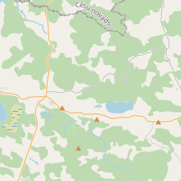
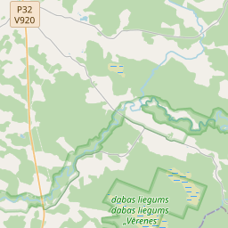
Building (cadastre designation: 74680010235007)
Cadastre designation: 74680010235007
Address: "Strausmaņi", Madliena, Madlienas pagasts, Ogres novads, LV-5045
Cadastre designation of real estate | |
|---|---|
Cadastral object type | Cadastral object type: Building |
Address | Address: "Strausmaņi", Madliena, Madlienas pagasts, Ogres novads, LV-5045 |
Address | |
|---|---|
Address ID | Address ID: 104408642 |
Companies registered at the address | Companies registered at the address: 0 |
Departments registered at the address | Departments registered at the address: 0 |
Institutions registered at the address | Institutions registered at the address: 0 |
Real estate registered at the address | |
Transactions with real estate at the address | Transactions with real estate at the address: 0 |
| Cadastral object type | Cadastre designation of the cadastral object | Person's property right status | Person status | Land Register |
|---|---|---|---|---|
| Cadastral object type: Building | 74680010235007 | Person's property right status: No data | Person status: No data | Land Register |
17.12.2024. State land service data
|
|
|
{"7201060210":{"name":"<div class='color_dot' style='background-color: #00ffff'><\/div><span>Specified land unit<\/span>","featureColor":"#00ffff","features":{"type":"FeatureCollection","features":[{"type":"Feature","geometry":{"type":"Polygon","coordinates":[[[25.153891257,56.850063048],[25.154752572,56.85001356],[25.155611256,56.851381566],[25.154655221,56.851541473],[25.153891257,56.850063048]]]},"crs":{"type":"name","properties":{"name":"urn:ogc:def:crs:EPSG:3059"}},"properties":{"style":{"color":"#00ffff","dashArray":"8,12","weight":1},"name":"Land","object_type":"Parcel","parcel_code":"74680010239","code":null,"surveyor":null,"address":"","ownership":"<span>Owner - Natural person<br><\/span>","pro_cadastre_nr":"74680010235"}},{"type":"Feature","geometry":{"type":"Polygon","coordinates":[[[25.150535001,56.850106836],[25.151143131,56.850195487],[25.151706033,56.850243836],[25.152443391,56.850210259],[25.153416521,56.850104243],[25.153891257,56.850063048],[25.154655221,56.851541473],[25.15360734,56.851726094],[25.152715543,56.851830821],[25.151002342,56.852067353],[25.150717117,56.852069981],[25.150535001,56.850106836]]]},"crs":{"type":"name","properties":{"name":"urn:ogc:def:crs:EPSG:3059"}},"properties":{"style":{"color":"#00ffff","dashArray":"8,12","weight":1},"name":"Land","object_type":"Parcel","parcel_code":"74680010237","code":null,"surveyor":null,"address":"","ownership":"<span>Owner - Natural person<br><\/span>","pro_cadastre_nr":"74680010235"}},{"type":"Feature","geometry":{"type":"Polygon","coordinates":[[[25.1684757,56.844894627],[25.16909076,56.844770382],[25.16965557,56.844657297],[25.170014333,56.845265769],[25.168782042,56.845535514],[25.168715412,56.845415557],[25.168577683,56.84520369],[25.168530899,56.845107626],[25.168490325,56.844969366],[25.1684757,56.844894627]]]},"crs":{"type":"name","properties":{"name":"urn:ogc:def:crs:EPSG:3059"}},"properties":{"style":{"color":"#00ffff","dashArray":"8,12","weight":1},"name":"Land","object_type":"Parcel","parcel_code":"74680010236","code":null,"surveyor":null,"address":"","ownership":"<span>Owner - Natural person<br><\/span>","pro_cadastre_nr":"74680010235"}},{"type":"Feature","geometry":{"type":"Polygon","coordinates":[[[25.158835149,56.845546329],[25.159467183,56.845438946],[25.159524347,56.845475881],[25.159643165,56.845682237],[25.159768584,56.845865568],[25.159722807,56.845951911],[25.1596536,56.846037691],[25.159178386,56.846093943],[25.158913097,56.845671208],[25.158835149,56.845546329]]]},"crs":{"type":"name","properties":{"name":"urn:ogc:def:crs:EPSG:3059"}},"properties":{"style":{"color":"#00ffff","dashArray":"8,12","weight":1},"name":"Land","object_type":"Parcel","parcel_code":"74680010235","code":null,"surveyor":null,"address":"\"Strausma\u0146i\", Madliena, Madlienas pag., Ogres nov., LV-5045","ownership":"<span>Owner - Natural person<br><\/span>","pro_cadastre_nr":"74680010235"}}]}},"7114100000":{"name":"<div class='color_dot' style='background-color: #b40000'><\/div><span>Burdened access road servitude area<\/span>","featureColor":"#b40000","features":{"type":"FeatureCollection","features":[{"type":"Feature","geometry":{"type":"Polygon","coordinates":[[[25.1684757,56.844894627],[25.168519251,56.844885829],[25.168539083,56.844965788],[25.168579057,56.845101997],[25.16862468,56.84519568],[25.168762123,56.845407107],[25.168827875,56.845525482],[25.168782042,56.845535514],[25.168715412,56.845415557],[25.168577683,56.84520369],[25.168530899,56.845107626],[25.168490325,56.844969366],[25.1684757,56.844894627]]]},"crs":{"type":"name","properties":{"name":"urn:ogc:def:crs:EPSG:3059"}},"properties":{"style":{"color":"#b40000","dashArray":"4,2,1,2","weight":1},"name":"Burdened access road servitude area","object_type":"WayRestriction","parcel_code":"74680010236","code":"7315030100002","surveyor":null,"address":"","ownership":"<span>Owner - Natural person<br><\/span>","pro_cadastre_nr":"74680010235"}}]}},"5201011310":{"name":"<div class='color_dot' style='background-color: #960096'><\/div><span>Vectorized building<\/span>","featureColor":"#960096","features":{"type":"FeatureCollection","features":[{"type":"Feature","geometry":{"type":"Polygon","coordinates":[[[25.159467998,56.845634431],[25.159552513,56.845624339],[25.159572247,56.845673974],[25.159487731,56.845684067],[25.159487394,56.845683252],[25.159467998,56.845634431]]]},"crs":{"type":"name","properties":{"name":"urn:ogc:def:crs:EPSG:3059"}},"properties":{"style":{"color":"#960096","dashArray":"0","weight":2},"name":"Building","object_type":"Building","parcel_code":"74680010235","code":"74680010235006","surveyor":null,"address":"\"Strausma\u0146i\", Madliena, Madlienas pag., Ogres nov., LV-5045","ownership":"<span>Owner - Natural person<br><\/span>","pro_cadastre_nr":"74680010235"}},{"type":"Feature","geometry":{"type":"Polygon","coordinates":[[[25.159487731,56.845684067],[25.159572247,56.845673974],[25.159581116,56.845672913],[25.159602237,56.845726048],[25.159508868,56.845737202],[25.159487731,56.845684067]]]},"crs":{"type":"name","properties":{"name":"urn:ogc:def:crs:EPSG:3059"}},"properties":{"style":{"color":"#960096","dashArray":"0","weight":2},"name":"Building","object_type":"Building","parcel_code":"74680010235","code":"74680010235007","surveyor":null,"address":"\"Strausma\u0146i\", Madliena, Madlienas pag., Ogres nov., LV-5045","ownership":"<span>Owner - Natural person<br><\/span>","pro_cadastre_nr":"74680010235"}},{"type":"Feature","geometry":{"type":"Polygon","coordinates":[[[25.158948146,56.845597875],[25.159153515,56.845549259],[25.159212096,56.845623555],[25.15900671,56.845672181],[25.158948146,56.845597875]]]},"crs":{"type":"name","properties":{"name":"urn:ogc:def:crs:EPSG:3059"}},"properties":{"style":{"color":"#960096","dashArray":"0","weight":2},"name":"Building","object_type":"Building","parcel_code":"74680010235","code":"74680010235001","surveyor":null,"address":"\"Strausma\u0146i\", Madliena, Madlienas pag., Ogres nov., LV-5045","ownership":"<span>Owner - Natural person<br><\/span>","pro_cadastre_nr":"74680010235"}},{"type":"Feature","geometry":{"type":"Polygon","coordinates":[[[25.159260731,56.845684782],[25.159310977,56.84577053],[25.15919662,56.845790648],[25.159196222,56.84578996],[25.159146374,56.8457049],[25.159260731,56.845684782]]]},"crs":{"type":"name","properties":{"name":"urn:ogc:def:crs:EPSG:3059"}},"properties":{"style":{"color":"#960096","dashArray":"0","weight":2},"name":"Building","object_type":"Building","parcel_code":"74680010235","code":"74680010235003","surveyor":null,"address":"\"Strausma\u0146i\", Madliena, Madlienas pag., Ogres nov., LV-5045","ownership":"<span>Owner - Natural person<br><\/span>","pro_cadastre_nr":"74680010235"}},{"type":"Feature","geometry":{"type":"Polygon","coordinates":[[[25.159363651,56.845646891],[25.159467998,56.845634431],[25.159487394,56.845683252],[25.159383048,56.845695712],[25.159363651,56.845646891]]]},"crs":{"type":"name","properties":{"name":"urn:ogc:def:crs:EPSG:3059"}},"properties":{"style":{"color":"#960096","dashArray":"0","weight":2},"name":"Building","object_type":"Building","parcel_code":"74680010235","code":"74680010235005","surveyor":null,"address":"\"Strausma\u0146i\", Madliena, Madlienas pag., Ogres nov., LV-5045","ownership":"<span>Owner - Natural person<br><\/span>","pro_cadastre_nr":"74680010235"}},{"type":"Feature","geometry":{"type":"Polygon","coordinates":[[[25.159047768,56.84581609],[25.159163609,56.845795698],[25.159182284,56.845827572],[25.159066444,56.845847955],[25.159047768,56.84581609]]]},"crs":{"type":"name","properties":{"name":"urn:ogc:def:crs:EPSG:3059"}},"properties":{"style":{"color":"#960096","dashArray":"0","weight":2},"name":"Building","object_type":"Building","parcel_code":"74680010235","code":"74680010235009","surveyor":null,"address":"\"Strausma\u0146i\", Madliena, Madlienas pag., Ogres nov., LV-5045","ownership":"<span>Owner - Natural person<br><\/span>","pro_cadastre_nr":"74680010235"}},{"type":"Feature","geometry":{"type":"Polygon","coordinates":[[[25.159146374,56.8457049],[25.159196222,56.84578996],[25.159163609,56.845795698],[25.159047768,56.84581609],[25.158997922,56.84573103],[25.159146374,56.8457049]]]},"crs":{"type":"name","properties":{"name":"urn:ogc:def:crs:EPSG:3059"}},"properties":{"style":{"color":"#960096","dashArray":"0","weight":2},"name":"Building","object_type":"Building","parcel_code":"74680010235","code":"74680010235002","surveyor":null,"address":"\"Strausma\u0146i\", Madliena, Madlienas pag., Ogres nov., LV-5045","ownership":"<span>Owner - Natural person<br><\/span>","pro_cadastre_nr":"74680010235"}},{"type":"Feature","geometry":{"type":"Polygon","coordinates":[[[25.159047768,56.84581609],[25.159163609,56.845795698],[25.159182284,56.845827572],[25.159066444,56.845847955],[25.159047768,56.84581609]]]},"crs":{"type":"name","properties":{"name":"urn:ogc:def:crs:EPSG:3059"}},"properties":{"style":{"color":"#960096","dashArray":"0","weight":2},"name":"Building","object_type":"Building","parcel_code":"74680010235","code":"74680010235009","surveyor":null,"address":"\"Strausma\u0146i\", Madliena, Madlienas pag., Ogres nov., LV-5045","ownership":"<span>Owner - Natural person<br><\/span>","pro_cadastre_nr":"74680010235"}},{"type":"Feature","geometry":{"type":"Polygon","coordinates":[[[25.159487731,56.845684067],[25.159572247,56.845673974],[25.159581116,56.845672913],[25.159602237,56.845726048],[25.159508868,56.845737202],[25.159487731,56.845684067]]]},"crs":{"type":"name","properties":{"name":"urn:ogc:def:crs:EPSG:3059"}},"properties":{"style":{"color":"#960096","dashArray":"0","weight":2},"name":"Building","object_type":"Building","parcel_code":"74680010235","code":"74680010235007","surveyor":null,"address":"\"Strausma\u0146i\", Madliena, Madlienas pag., Ogres nov., LV-5045","ownership":"<span>Owner - Natural person<br><\/span>","pro_cadastre_nr":"74680010235"}},{"type":"Feature","geometry":{"type":"Polygon","coordinates":[[[25.159467998,56.845634431],[25.159552513,56.845624339],[25.159572247,56.845673974],[25.159487731,56.845684067],[25.159487394,56.845683252],[25.159467998,56.845634431]]]},"crs":{"type":"name","properties":{"name":"urn:ogc:def:crs:EPSG:3059"}},"properties":{"style":{"color":"#960096","dashArray":"0","weight":2},"name":"Building","object_type":"Building","parcel_code":"74680010235","code":"74680010235006","surveyor":null,"address":"\"Strausma\u0146i\", Madliena, Madlienas pag., Ogres nov., LV-5045","ownership":"<span>Owner - Natural person<br><\/span>","pro_cadastre_nr":"74680010235"}},{"type":"Feature","geometry":{"type":"Polygon","coordinates":[[[25.159363651,56.845646891],[25.159467998,56.845634431],[25.159487394,56.845683252],[25.159383048,56.845695712],[25.159363651,56.845646891]]]},"crs":{"type":"name","properties":{"name":"urn:ogc:def:crs:EPSG:3059"}},"properties":{"style":{"color":"#960096","dashArray":"0","weight":2},"name":"Building","object_type":"Building","parcel_code":"74680010235","code":"74680010235005","surveyor":null,"address":"\"Strausma\u0146i\", Madliena, Madlienas pag., Ogres nov., LV-5045","ownership":"<span>Owner - Natural person<br><\/span>","pro_cadastre_nr":"74680010235"}},{"type":"Feature","geometry":{"type":"Polygon","coordinates":[[[25.159260731,56.845684782],[25.159310977,56.84577053],[25.15919662,56.845790648],[25.159196222,56.84578996],[25.159146374,56.8457049],[25.159260731,56.845684782]]]},"crs":{"type":"name","properties":{"name":"urn:ogc:def:crs:EPSG:3059"}},"properties":{"style":{"color":"#960096","dashArray":"0","weight":2},"name":"Building","object_type":"Building","parcel_code":"74680010235","code":"74680010235003","surveyor":null,"address":"\"Strausma\u0146i\", Madliena, Madlienas pag., Ogres nov., LV-5045","ownership":"<span>Owner - Natural person<br><\/span>","pro_cadastre_nr":"74680010235"}},{"type":"Feature","geometry":{"type":"Polygon","coordinates":[[[25.159146374,56.8457049],[25.159196222,56.84578996],[25.159163609,56.845795698],[25.159047768,56.84581609],[25.158997922,56.84573103],[25.159146374,56.8457049]]]},"crs":{"type":"name","properties":{"name":"urn:ogc:def:crs:EPSG:3059"}},"properties":{"style":{"color":"#960096","dashArray":"0","weight":2},"name":"Building","object_type":"Building","parcel_code":"74680010235","code":"74680010235002","surveyor":null,"address":"\"Strausma\u0146i\", Madliena, Madlienas pag., Ogres nov., LV-5045","ownership":"<span>Owner - Natural person<br><\/span>","pro_cadastre_nr":"74680010235"}},{"type":"Feature","geometry":{"type":"Polygon","coordinates":[[[25.158948146,56.845597875],[25.159153515,56.845549259],[25.159212096,56.845623555],[25.15900671,56.845672181],[25.158948146,56.845597875]]]},"crs":{"type":"name","properties":{"name":"urn:ogc:def:crs:EPSG:3059"}},"properties":{"style":{"color":"#960096","dashArray":"0","weight":2},"name":"Building","object_type":"Building","parcel_code":"74680010235","code":"74680010235001","surveyor":null,"address":"\"Strausma\u0146i\", Madliena, Madlienas pag., Ogres nov., LV-5045","ownership":"<span>Owner - Natural person<br><\/span>","pro_cadastre_nr":"74680010235"}}]}}}
{"7201060210":{"name":"<div class='color_dot' style='background-color: #00ffff'><\/div><span>Specified land unit<\/span>","featureColor":"#00ffff","features":{"type":"FeatureCollection","features":[{"type":"Feature","geometry":{"type":"Polygon","coordinates":[[[25.153891257,56.850063048],[25.154712429,56.849988434],[25.155612646,56.85140113],[25.154655221,56.851541473],[25.153891257,56.850063048]]]},"crs":{"type":"name","properties":{"name":"urn:ogc:def:crs:EPSG:3059"}},"properties":{"style":{"color":"#00ffff","dashArray":"8,12","weight":1},"name":"Land","object_type":"Parcel","parcel_code":"74680010239","code":null,"surveyor":null,"address":"","ownership":"<span>Owner - Natural person<br><\/span>","pro_cadastre_nr":"74680010235"}}]}}}
https://tile.openstreetmap.org/{z}/{x}/{y}.png|© OpenStreetMap contributors|minZoom: 7|maxZoom: 19
|
Building data updated: 29.12.2024.
Data source and license: Cadastre Information System open text and spatial data, Real Estate Market Database open data, open data license Creative Commons Attribution, OpenStreetMap

