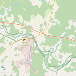
Building (cadastre designation: 74640020028003)
Cadastre designation: 74640020028003
Address: "Jaungaveņi", Lēdmanes pagasts, Ogres novads, LV-5011
Cadastre designation of real estate | |
|---|---|
Cadastral object type | Cadastral object type: Building |
Address | Address: "Jaungaveņi", Lēdmanes pagasts, Ogres novads, LV-5011 |
Address | |
|---|---|
Address ID | Address ID: 102713513 |
Companies registered at the address | Companies registered at the address: 0 |
Departments registered at the address | Departments registered at the address: 0 |
Institutions registered at the address | Institutions registered at the address: 0 |
Real estate registered at the address | |
Transactions with real estate at the address |
| Cadastral object type | Cadastre designation of the cadastral object | Person's property right status | Person status | Land Register |
|---|---|---|---|---|
| Cadastral object type: Building | 74640020028003 | Person's property right status: No data | Person status: No data | Land Register |
17.12.2024. State land service data
|
|
|
{"7201060210":{"name":"<div class='color_dot' style='background-color: #00ffff'><\/div><span>Specified land unit<\/span>","featureColor":"#00ffff","features":{"type":"FeatureCollection","features":[{"type":"Feature","geometry":{"type":"Polygon","coordinates":[[[24.928168357,56.789787323],[24.933029382,56.784925282],[24.933481826,56.783941883],[24.934131826,56.782913448],[24.935538781,56.781966446],[24.936173361,56.78191813],[24.936185291,56.782397164],[24.937230731,56.782890206],[24.938374741,56.782554937],[24.940366111,56.782735944],[24.9409821,56.782440271],[24.946683719,56.78303882],[24.939180153,56.787691641],[24.935519634,56.78618992],[24.934889013,56.785935065],[24.932846609,56.787847247],[24.930519269,56.789924557],[24.928168357,56.789787323]]]},"crs":{"type":"name","properties":{"name":"urn:ogc:def:crs:EPSG:3059"}},"properties":{"style":{"color":"#00ffff","dashArray":"8,12","weight":1},"name":"Land","object_type":"Parcel","parcel_code":"74640020039","code":null,"surveyor":null,"address":"","ownership":"<span>Owner - Natural person<br><\/span>","pro_cadastre_nr":"74640020028"}},{"type":"Feature","geometry":{"type":"Polygon","coordinates":[[[24.941971745,56.775820282],[24.946548583,56.775926052],[24.946435012,56.776278254],[24.946240243,56.77643233],[24.94474393,56.776966863],[24.942774531,56.776066182],[24.941971745,56.775820282]]]},"crs":{"type":"name","properties":{"name":"urn:ogc:def:crs:EPSG:3059"}},"properties":{"style":{"color":"#00ffff","dashArray":"8,12","weight":1},"name":"Land","object_type":"Parcel","parcel_code":"74640020029","code":null,"surveyor":null,"address":"","ownership":"<span>Owner - Natural person<br><\/span>","pro_cadastre_nr":"74640020028"}},{"type":"Feature","geometry":{"type":"Polygon","coordinates":[[[24.943687779,56.775677336],[24.944719018,56.774821915],[24.945981746,56.773379601],[24.946477124,56.772965592],[24.947064541,56.773261497],[24.947937818,56.773752226],[24.948670862,56.774156472],[24.949086293,56.774482497],[24.949401175,56.774858313],[24.949517748,56.775128455],[24.949384047,56.775464498],[24.949303803,56.775795237],[24.943687779,56.775677336]]]},"crs":{"type":"name","properties":{"name":"urn:ogc:def:crs:EPSG:3059"}},"properties":{"style":{"color":"#00ffff","dashArray":"8,12","weight":1},"name":"Land","object_type":"Parcel","parcel_code":"74640020028","code":null,"surveyor":null,"address":"","ownership":"<span>Owner - Natural person<br><\/span>","pro_cadastre_nr":"74640020028"}}]}},"5201011310":{"name":"<div class='color_dot' style='background-color: #960096'><\/div><span>Vectorized building<\/span>","featureColor":"#960096","features":{"type":"FeatureCollection","features":[{"type":"Feature","geometry":{"type":"Polygon","coordinates":[[[24.946992498,56.774941875],[24.947078508,56.774886715],[24.947164138,56.774926961],[24.947078129,56.774982122],[24.946992498,56.774941875]]]},"crs":{"type":"name","properties":{"name":"urn:ogc:def:crs:EPSG:3059"}},"properties":{"style":{"color":"#960096","dashArray":"0","weight":2},"name":"Building","object_type":"Building","parcel_code":"74640020028","code":"74640020028003","surveyor":null,"address":"","ownership":"<span>Owner - Natural person<br><\/span>","pro_cadastre_nr":"74640020028"}},{"type":"Feature","geometry":{"type":"Polygon","coordinates":[[[24.947293733,56.77492737],[24.947375433,56.774884361],[24.947375853,56.774884133],[24.947486845,56.774947681],[24.947404709,56.774990917],[24.947293733,56.77492737]]]},"crs":{"type":"name","properties":{"name":"urn:ogc:def:crs:EPSG:3059"}},"properties":{"style":{"color":"#960096","dashArray":"0","weight":2},"name":"Building","object_type":"Building","parcel_code":"74640020028","code":"74640020028007","surveyor":null,"address":"","ownership":"<span>Owner - Natural person<br><\/span>","pro_cadastre_nr":"74640020028"}},{"type":"Feature","geometry":{"type":"Polygon","coordinates":[[[24.947525966,56.775320205],[24.947595924,56.775319674],[24.947597216,56.775370929],[24.947527257,56.77537146],[24.947525966,56.775320205]]]},"crs":{"type":"name","properties":{"name":"urn:ogc:def:crs:EPSG:3059"}},"properties":{"style":{"color":"#960096","dashArray":"0","weight":2},"name":"Building","object_type":"Building","parcel_code":"74640020028","code":"74640020028009","surveyor":null,"address":"","ownership":"<span>Owner - Natural person<br><\/span>","pro_cadastre_nr":"74640020028"}},{"type":"Feature","geometry":{"type":"Polygon","coordinates":[[[24.94755641,56.775015289],[24.947501918,56.774984088],[24.947619857,56.774922009],[24.947674333,56.774953201],[24.94755641,56.775015289]]]},"crs":{"type":"name","properties":{"name":"urn:ogc:def:crs:EPSG:3059"}},"properties":{"style":{"color":"#960096","dashArray":"0","weight":2},"name":"Building","object_type":"Building","parcel_code":"74640020028","code":"74640020028008","surveyor":null,"address":"","ownership":"<span>Owner - Natural person<br><\/span>","pro_cadastre_nr":"74640020028"}},{"type":"Feature","geometry":{"type":"Polygon","coordinates":[[[24.947531297,56.77523697],[24.947325466,56.775119123],[24.947453919,56.775051493],[24.947659751,56.775169349],[24.947531297,56.77523697]]]},"crs":{"type":"name","properties":{"name":"urn:ogc:def:crs:EPSG:3059"}},"properties":{"style":{"color":"#960096","dashArray":"0","weight":2},"name":"Building","object_type":"Building","parcel_code":"74640020028","code":"74640020028001","surveyor":null,"address":"","ownership":"<span>Owner - Natural person<br><\/span>","pro_cadastre_nr":"74640020028"}},{"type":"Feature","geometry":{"type":"Polygon","coordinates":[[[24.947164138,56.774926961],[24.94707407,56.774884628],[24.947109498,56.774861916],[24.947199566,56.774904249],[24.947164138,56.774926961]]]},"crs":{"type":"name","properties":{"name":"urn:ogc:def:crs:EPSG:3059"}},"properties":{"style":{"color":"#960096","dashArray":"0","weight":2},"name":"Building","object_type":"Building","parcel_code":"74640020028","code":"74640020028004","surveyor":null,"address":"","ownership":"<span>Owner - Natural person<br><\/span>","pro_cadastre_nr":"74640020028"}},{"type":"Feature","geometry":{"type":"Polygon","coordinates":[[[24.947337333,56.775026396],[24.947226341,56.774962848],[24.947293733,56.77492737],[24.947404709,56.774990917],[24.947337333,56.775026396]]]},"crs":{"type":"name","properties":{"name":"urn:ogc:def:crs:EPSG:3059"}},"properties":{"style":{"color":"#960096","dashArray":"0","weight":2},"name":"Building","object_type":"Building","parcel_code":"74640020028","code":"74640020028006","surveyor":null,"address":"","ownership":"<span>Owner - Natural person<br><\/span>","pro_cadastre_nr":"74640020028"}},{"type":"Feature","geometry":{"type":"Polygon","coordinates":[[[24.947016364,56.77502338],[24.946929259,56.774982435],[24.946992498,56.774941875],[24.947079603,56.77498282],[24.947016364,56.77502338]]]},"crs":{"type":"name","properties":{"name":"urn:ogc:def:crs:EPSG:3059"}},"properties":{"style":{"color":"#960096","dashArray":"0","weight":2},"name":"Building","object_type":"Building","parcel_code":"74640020028","code":"74640020028002","surveyor":null,"address":"","ownership":"<span>Owner - Natural person<br><\/span>","pro_cadastre_nr":"74640020028"}},{"type":"Feature","geometry":{"type":"Polygon","coordinates":[[[24.947226341,56.774962848],[24.947197095,56.774945829],[24.947345698,56.774867373],[24.947375433,56.774884361],[24.947293733,56.77492737],[24.947226341,56.774962848]]]},"crs":{"type":"name","properties":{"name":"urn:ogc:def:crs:EPSG:3059"}},"properties":{"style":{"color":"#960096","dashArray":"0","weight":2},"name":"Building","object_type":"Building","parcel_code":"74640020028","code":"74640020028005","surveyor":null,"address":"","ownership":"<span>Owner - Natural person<br><\/span>","pro_cadastre_nr":"74640020028"}},{"type":"Feature","geometry":{"type":"Polygon","coordinates":[[[24.947525966,56.775320205],[24.947595924,56.775319674],[24.947597216,56.775370929],[24.947527257,56.77537146],[24.947525966,56.775320205]]]},"crs":{"type":"name","properties":{"name":"urn:ogc:def:crs:EPSG:3059"}},"properties":{"style":{"color":"#960096","dashArray":"0","weight":2},"name":"Building","object_type":"Building","parcel_code":"74640020028","code":"74640020028009","surveyor":null,"address":"\"Jaungave\u0146i\", L\u0113dmanes pag., Ogres nov., LV-5011","ownership":"<span>Owner - Natural person<br><\/span>","pro_cadastre_nr":"74640020028"}},{"type":"Feature","geometry":{"type":"Polygon","coordinates":[[[24.94755641,56.775015289],[24.947501918,56.774984088],[24.947619857,56.774922009],[24.947674333,56.774953201],[24.94755641,56.775015289]]]},"crs":{"type":"name","properties":{"name":"urn:ogc:def:crs:EPSG:3059"}},"properties":{"style":{"color":"#960096","dashArray":"0","weight":2},"name":"Building","object_type":"Building","parcel_code":"74640020028","code":"74640020028008","surveyor":null,"address":"\"Jaungave\u0146i\", L\u0113dmanes pag., Ogres nov., LV-5011","ownership":"<span>Owner - Natural person<br><\/span>","pro_cadastre_nr":"74640020028"}},{"type":"Feature","geometry":{"type":"Polygon","coordinates":[[[24.947293733,56.77492737],[24.947375433,56.774884361],[24.947375853,56.774884133],[24.947486845,56.774947681],[24.947404709,56.774990917],[24.947293733,56.77492737]]]},"crs":{"type":"name","properties":{"name":"urn:ogc:def:crs:EPSG:3059"}},"properties":{"style":{"color":"#960096","dashArray":"0","weight":2},"name":"Building","object_type":"Building","parcel_code":"74640020028","code":"74640020028007","surveyor":null,"address":"\"Jaungave\u0146i\", L\u0113dmanes pag., Ogres nov., LV-5011","ownership":"<span>Owner - Natural person<br><\/span>","pro_cadastre_nr":"74640020028"}},{"type":"Feature","geometry":{"type":"Polygon","coordinates":[[[24.947337333,56.775026396],[24.947226341,56.774962848],[24.947293733,56.77492737],[24.947404709,56.774990917],[24.947337333,56.775026396]]]},"crs":{"type":"name","properties":{"name":"urn:ogc:def:crs:EPSG:3059"}},"properties":{"style":{"color":"#960096","dashArray":"0","weight":2},"name":"Building","object_type":"Building","parcel_code":"74640020028","code":"74640020028006","surveyor":null,"address":"\"Jaungave\u0146i\", L\u0113dmanes pag., Ogres nov., LV-5011","ownership":"<span>Owner - Natural person<br><\/span>","pro_cadastre_nr":"74640020028"}},{"type":"Feature","geometry":{"type":"Polygon","coordinates":[[[24.947226341,56.774962848],[24.947197095,56.774945829],[24.947345698,56.774867373],[24.947375433,56.774884361],[24.947293733,56.77492737],[24.947226341,56.774962848]]]},"crs":{"type":"name","properties":{"name":"urn:ogc:def:crs:EPSG:3059"}},"properties":{"style":{"color":"#960096","dashArray":"0","weight":2},"name":"Building","object_type":"Building","parcel_code":"74640020028","code":"74640020028005","surveyor":null,"address":"\"Jaungave\u0146i\", L\u0113dmanes pag., Ogres nov., LV-5011","ownership":"<span>Owner - Natural person<br><\/span>","pro_cadastre_nr":"74640020028"}},{"type":"Feature","geometry":{"type":"Polygon","coordinates":[[[24.947164138,56.774926961],[24.94707407,56.774884628],[24.947109498,56.774861916],[24.947199566,56.774904249],[24.947164138,56.774926961]]]},"crs":{"type":"name","properties":{"name":"urn:ogc:def:crs:EPSG:3059"}},"properties":{"style":{"color":"#960096","dashArray":"0","weight":2},"name":"Building","object_type":"Building","parcel_code":"74640020028","code":"74640020028004","surveyor":null,"address":"\"Jaungave\u0146i\", L\u0113dmanes pag., Ogres nov., LV-5011","ownership":"<span>Owner - Natural person<br><\/span>","pro_cadastre_nr":"74640020028"}},{"type":"Feature","geometry":{"type":"Polygon","coordinates":[[[24.946992498,56.774941875],[24.947078508,56.774886715],[24.947164138,56.774926961],[24.947078129,56.774982122],[24.946992498,56.774941875]]]},"crs":{"type":"name","properties":{"name":"urn:ogc:def:crs:EPSG:3059"}},"properties":{"style":{"color":"#960096","dashArray":"0","weight":2},"name":"Building","object_type":"Building","parcel_code":"74640020028","code":"74640020028003","surveyor":null,"address":"\"Jaungave\u0146i\", L\u0113dmanes pag., Ogres nov., LV-5011","ownership":"<span>Owner - Natural person<br><\/span>","pro_cadastre_nr":"74640020028"}},{"type":"Feature","geometry":{"type":"Polygon","coordinates":[[[24.947016364,56.77502338],[24.946929259,56.774982435],[24.946992498,56.774941875],[24.947079603,56.77498282],[24.947016364,56.77502338]]]},"crs":{"type":"name","properties":{"name":"urn:ogc:def:crs:EPSG:3059"}},"properties":{"style":{"color":"#960096","dashArray":"0","weight":2},"name":"Building","object_type":"Building","parcel_code":"74640020028","code":"74640020028002","surveyor":null,"address":"\"Jaungave\u0146i\", L\u0113dmanes pag., Ogres nov., LV-5011","ownership":"<span>Owner - Natural person<br><\/span>","pro_cadastre_nr":"74640020028"}},{"type":"Feature","geometry":{"type":"Polygon","coordinates":[[[24.947531297,56.77523697],[24.947325466,56.775119123],[24.947453919,56.775051493],[24.947659751,56.775169349],[24.947531297,56.77523697]]]},"crs":{"type":"name","properties":{"name":"urn:ogc:def:crs:EPSG:3059"}},"properties":{"style":{"color":"#960096","dashArray":"0","weight":2},"name":"Building","object_type":"Building","parcel_code":"74640020028","code":"74640020028001","surveyor":null,"address":"\"Jaungave\u0146i\", L\u0113dmanes pag., Ogres nov., LV-5011","ownership":"<span>Owner - Natural person<br><\/span>","pro_cadastre_nr":"74640020028"}}]}}}
[]
https://tile.openstreetmap.org/{z}/{x}/{y}.png|© OpenStreetMap contributors|minZoom: 7|maxZoom: 19
|
Building data updated: 29.12.2024.
Data source and license: Cadastre Information System open text and spatial data, Real Estate Market Database open data, open data license Creative Commons Attribution, OpenStreetMap

