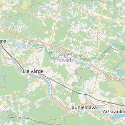
Building (cadastre designation: 74440030027007)
Cadastre designation: 74440030027007
Address: "Tīcēni", Birzgales pagasts, Ogres novads, LV-5033
Cadastre designation of real estate | |
|---|---|
Cadastral object type | Cadastral object type: Building |
Address | Address: "Tīcēni", Birzgales pagasts, Ogres novads, LV-5033 |
Address | |
|---|---|
Address ID | Address ID: 104328054 |
Companies registered at the address | Companies registered at the address: 0 |
Departments registered at the address | Departments registered at the address: 0 |
Institutions registered at the address | Institutions registered at the address: 0 |
Real estate registered at the address | |
Transactions with real estate at the address |
| Cadastral object type | Cadastre designation of the cadastral object | Person's property right status | Person status | Land Register |
|---|---|---|---|---|
| Cadastral object type: Building | 74440030027007 | Person's property right status: No data | Person status: No data | Land Register |
22.01.2025. State land service data
|
|
|
{"7201060210":{"name":"<div class='color_dot' style='background-color: #00ffff'><\/div><span>Specified land unit<\/span>","featureColor":"#00ffff","features":{"type":"FeatureCollection","features":[{"type":"Feature","geometry":{"type":"Polygon","coordinates":[[[24.706846522,56.622863985],[24.707307953,56.621250055],[24.709611011,56.621127381],[24.709713818,56.62120158],[24.713033602,56.617496421],[24.713493155,56.617715717],[24.708211018,56.623434385],[24.707897969,56.623273173],[24.70786391,56.623261166],[24.706846522,56.622863985]]]},"crs":{"type":"name","properties":{"name":"urn:ogc:def:crs:EPSG:3059"}},"properties":{"style":{"color":"#00ffff","dashArray":"8,12","weight":1},"name":"Land","object_type":"Parcel","parcel_code":"74440050026","code":null,"surveyor":null,"address":"","ownership":"<span>Owner - Natural person<br><\/span>","pro_cadastre_nr":"74440030027"}}]}},"7201060110":{"name":"<div class='color_dot' style='background-color: #00ffff'><\/div><span>Measured land unit<\/span>","featureColor":"#00ffff","features":{"type":"FeatureCollection","features":[{"type":"Feature","geometry":{"type":"Polygon","coordinates":[[[24.787357934,56.670642692],[24.788042929,56.670126245],[24.789208533,56.669325793],[24.790050492,56.669467753],[24.790764023,56.669588061],[24.790920247,56.669614399],[24.790973421,56.669722412],[24.791149155,56.669960261],[24.791304007,56.670224718],[24.791504415,56.670340223],[24.791449403,56.670371182],[24.790413385,56.670954275],[24.789533334,56.671598668],[24.788456457,56.671125441],[24.788371128,56.671087941],[24.788285783,56.671050442],[24.787357934,56.670642692]]]},"crs":{"type":"name","properties":{"name":"urn:ogc:def:crs:EPSG:3059"}},"properties":{"style":{"color":"#00ffff","dashArray":"0","weight":1},"name":"Land","object_type":"Parcel","parcel_code":"74440030027","code":null,"surveyor":null,"address":"\"T\u012bc\u0113ni\", Birzgales pag., Ogres nov., LV-5033","ownership":"<span>Owner - Natural person<br><\/span>","pro_cadastre_nr":"74440030027"}}]}},"7114100000":{"name":"<div class='color_dot' style='background-color: #b40000'><\/div><span>Burdened access road servitude area<\/span>","featureColor":"#b40000","features":{"type":"FeatureCollection","features":[{"type":"Feature","geometry":{"type":"Polygon","coordinates":[[[24.791260865,56.670238864],[24.791103119,56.669969483],[24.790926949,56.669731045],[24.790865307,56.669605144],[24.790920247,56.669614399],[24.790973421,56.669722412],[24.791149155,56.669960261],[24.791304007,56.670224718],[24.791504415,56.670340223],[24.79147016,56.670359496],[24.791260865,56.670238864]]]},"crs":{"type":"name","properties":{"name":"urn:ogc:def:crs:EPSG:3059"}},"properties":{"style":{"color":"#b40000","dashArray":"4,2,1,2","weight":1},"name":"Burdened access road servitude area","object_type":"WayRestriction","parcel_code":"74440030027","code":"7315030100002","surveyor":null,"address":"\"T\u012bc\u0113ni\", Birzgales pag., Ogres nov., LV-5033","ownership":"<span>Owner - Natural person<br><\/span>","pro_cadastre_nr":"74440030027"}}]}},"5201011310":{"name":"<div class='color_dot' style='background-color: #960096'><\/div><span>Vectorized building<\/span>","featureColor":"#960096","features":{"type":"FeatureCollection","features":[{"type":"Feature","geometry":{"type":"Polygon","coordinates":[[[24.791393438,56.670086573],[24.791345716,56.670091584],[24.791324786,56.67003119],[24.791372526,56.670026179],[24.791393438,56.670086573]]]},"crs":{"type":"name","properties":{"name":"urn:ogc:def:crs:EPSG:3059"}},"properties":{"style":{"color":"#960096","dashArray":"0","weight":2},"name":"Building","object_type":"Building","parcel_code":"74440030169","code":"74440030027007","surveyor":null,"address":"\"T\u012bc\u0113ni\", Birzgales pag., Ogres nov., LV-5033","ownership":"<span>Owner - Natural person<br><\/span>","pro_cadastre_nr":"74440030027"}},{"type":"Feature","geometry":{"type":"Polygon","coordinates":[[[24.791357614,56.67058295],[24.791276463,56.670591471],[24.791258277,56.670538947],[24.791339428,56.670530427],[24.791357614,56.67058295]]]},"crs":{"type":"name","properties":{"name":"urn:ogc:def:crs:EPSG:3059"}},"properties":{"style":{"color":"#960096","dashArray":"0","weight":2},"name":"Building","object_type":"Building","parcel_code":"74440030168","code":"74440030027006","surveyor":null,"address":"\"T\u012bc\u0113ni\", Birzgales pag., Ogres nov., LV-5033","ownership":"<span>Owner - Natural person<br><\/span>","pro_cadastre_nr":"74440030027"}},{"type":"Feature","geometry":{"type":"Polygon","coordinates":[[[24.791390372,56.67067749],[24.791309221,56.670686011],[24.791276463,56.670591471],[24.791357614,56.67058295],[24.791390372,56.67067749]]]},"crs":{"type":"name","properties":{"name":"urn:ogc:def:crs:EPSG:3059"}},"properties":{"style":{"color":"#960096","dashArray":"0","weight":2},"name":"Building","object_type":"Building","parcel_code":"74440030168","code":"74440030027005","surveyor":null,"address":"\"T\u012bc\u0113ni\", Birzgales pag., Ogres nov., LV-5033","ownership":"<span>Owner - Natural person<br><\/span>","pro_cadastre_nr":"74440030027"}},{"type":"Feature","geometry":{"type":"Polygon","coordinates":[[[24.791132369,56.670718193],[24.791051217,56.670726714],[24.791033015,56.67067419],[24.791114167,56.67066567],[24.791132369,56.670718193]]]},"crs":{"type":"name","properties":{"name":"urn:ogc:def:crs:EPSG:3059"}},"properties":{"style":{"color":"#960096","dashArray":"0","weight":2},"name":"Building","object_type":"Building","parcel_code":"74440030168","code":"74440030027004","surveyor":null,"address":"\"T\u012bc\u0113ni\", Birzgales pag., Ogres nov., LV-5033","ownership":"<span>Owner - Natural person<br><\/span>","pro_cadastre_nr":"74440030027"}}]}},"5201011110":{"name":"<div class='color_dot' style='background-color: #ff0000'><\/div><span>Measured building<\/span>","featureColor":"#ff0000","features":{"type":"FeatureCollection","features":[{"type":"Feature","geometry":{"type":"Polygon","coordinates":[[[24.790085865,56.670765059],[24.790124675,56.670771533],[24.790100025,56.670816315],[24.790061027,56.670810192],[24.790085865,56.670765059]]]},"crs":{"type":"name","properties":{"name":"urn:ogc:def:crs:EPSG:3059"}},"properties":{"style":{"color":"#ff0000","dashArray":"0","weight":1},"name":"Building","object_type":"Building","parcel_code":"74440030027","code":"74440030027003","surveyor":null,"address":"\"T\u012bc\u0113ni\", Birzgales pag., Ogres nov., LV-5033","ownership":"<span>Owner - Natural person<br><\/span>","pro_cadastre_nr":"74440030027"}},{"type":"Feature","geometry":{"type":"Polygon","coordinates":[[[24.791003504,56.670519587],[24.791066835,56.670575687],[24.79102296,56.6705907],[24.79100078,56.670571049],[24.790955852,56.670586428],[24.790940555,56.670572878],[24.790986015,56.670557971],[24.790959629,56.6705346],[24.791003504,56.670519587]]]},"crs":{"type":"name","properties":{"name":"urn:ogc:def:crs:EPSG:3059"}},"properties":{"style":{"color":"#ff0000","dashArray":"0","weight":1},"name":"Building","object_type":"Building","parcel_code":"74440030027","code":"74440030027002","surveyor":null,"address":"\"T\u012bc\u0113ni\", Birzgales pag., Ogres nov., LV-5033","ownership":"<span>Owner - Natural person<br><\/span>","pro_cadastre_nr":"74440030027"}},{"type":"Feature","geometry":{"type":"Polygon","coordinates":[[[24.790349947,56.67063427],[24.790541949,56.670606314],[24.790611921,56.670751991],[24.790419321,56.670778693],[24.790349947,56.67063427]]]},"crs":{"type":"name","properties":{"name":"urn:ogc:def:crs:EPSG:3059"}},"properties":{"style":{"color":"#ff0000","dashArray":"0","weight":1},"name":"Building","object_type":"Building","parcel_code":"74440030027","code":"74440030027001","surveyor":null,"address":"\"T\u012bc\u0113ni\", Birzgales pag., Ogres nov., LV-5033","ownership":"<span>Owner - Natural person<br><\/span>","pro_cadastre_nr":"74440030027"}},{"type":"Feature","geometry":{"type":"Polygon","coordinates":[[[24.790085865,56.670765059],[24.790124675,56.670771533],[24.790100025,56.670816315],[24.790061027,56.670810192],[24.790085865,56.670765059]]]},"crs":{"type":"name","properties":{"name":"urn:ogc:def:crs:EPSG:3059"}},"properties":{"style":{"color":"#ff0000","dashArray":"0","weight":1},"name":"Building","object_type":"Building","parcel_code":"74440030027","code":"74440030027003","surveyor":null,"address":"\"T\u012bc\u0113ni\", Birzgales pag., Ogres nov., LV-5033","ownership":"<span>Owner - Natural person<br><\/span>","pro_cadastre_nr":"74440030027"}},{"type":"Feature","geometry":{"type":"Polygon","coordinates":[[[24.791003504,56.670519587],[24.791066835,56.670575687],[24.79102296,56.6705907],[24.79100078,56.670571049],[24.790955852,56.670586428],[24.790940555,56.670572878],[24.790986015,56.670557971],[24.790959629,56.6705346],[24.791003504,56.670519587]]]},"crs":{"type":"name","properties":{"name":"urn:ogc:def:crs:EPSG:3059"}},"properties":{"style":{"color":"#ff0000","dashArray":"0","weight":1},"name":"Building","object_type":"Building","parcel_code":"74440030027","code":"74440030027002","surveyor":null,"address":"\"T\u012bc\u0113ni\", Birzgales pag., Ogres nov., LV-5033","ownership":"<span>Owner - Natural person<br><\/span>","pro_cadastre_nr":"74440030027"}},{"type":"Feature","geometry":{"type":"Polygon","coordinates":[[[24.790349947,56.67063427],[24.790541949,56.670606314],[24.790611921,56.670751991],[24.790419321,56.670778693],[24.790349947,56.67063427]]]},"crs":{"type":"name","properties":{"name":"urn:ogc:def:crs:EPSG:3059"}},"properties":{"style":{"color":"#ff0000","dashArray":"0","weight":1},"name":"Building","object_type":"Building","parcel_code":"74440030027","code":"74440030027001","surveyor":null,"address":"\"T\u012bc\u0113ni\", Birzgales pag., Ogres nov., LV-5033","ownership":"<span>Owner - Natural person<br><\/span>","pro_cadastre_nr":"74440030027"}}]}}}
[]
https://tile.openstreetmap.org/{z}/{x}/{y}.png|© OpenStreetMap contributors|minZoom: 7|maxZoom: 19
|
Building data updated: 24.01.2025.
Data source and license: Cadastre Information System open text and spatial data, Real Estate Market Database open data, open data license Creative Commons Attribution, OpenStreetMap

