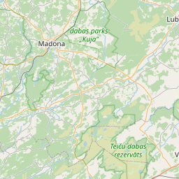
Building (cadastre designation: 70500050145002)
Cadastre designation: 70500050145002
Address: "Grāveri", Dzelzavas pagasts, Madonas novads, LV-4873
Cadastre designation of real estate | |
|---|---|
Cadastral object type | Cadastral object type: Building |
Address | Address: "Grāveri", Dzelzavas pagasts, Madonas novads, LV-4873 |
Address | |
|---|---|
Address ID | Address ID: 104680857 |
Companies registered at the address | |
Departments registered at the address | |
Institutions registered at the address | Institutions registered at the address: 0 |
Real estate registered at the address | |
Transactions with real estate at the address | Transactions with real estate at the address: 0 |
| Cadastral object type | Cadastre designation of the cadastral object | Person's property right status | Person status | Land Register |
|---|---|---|---|---|
| Cadastral object type: Building | 70500050145002 | Person's property right status: No data | Person status: No data | Land Register |
22.01.2025. State land service data
|
|
|
{"7201060210":{"name":"<div class='color_dot' style='background-color: #00ffff'><\/div><span>Specified land unit<\/span>","featureColor":"#00ffff","features":{"type":"FeatureCollection","features":[{"type":"Feature","geometry":{"type":"Polygon","coordinates":[[[26.496371855,57.009232029],[26.496390356,57.009191281],[26.498275726,57.004902157],[26.498282524,57.004849052],[26.498993122,57.004943091],[26.4989812,57.004980194],[26.497225465,57.009597381],[26.497210342,57.009641332],[26.496920238,57.009506233],[26.496371855,57.009232029]]]},"crs":{"type":"name","properties":{"name":"urn:ogc:def:crs:EPSG:3059"}},"properties":{"style":{"color":"#00ffff","dashArray":"8,12","weight":1},"name":"Land","object_type":"Parcel","parcel_code":"70500060088","code":null,"surveyor":null,"address":"","ownership":"<span>Owner - Natural person<br><\/span>","pro_cadastre_nr":"70500050145"}},{"type":"Feature","geometry":{"type":"Polygon","coordinates":[[[26.438906581,57.005029494],[26.438950029,57.004485126],[26.440899065,57.004403667],[26.440693138,57.004894472],[26.440660362,57.005007581],[26.440897118,57.005163476],[26.441046843,57.005211699],[26.441052448,57.005230632],[26.441144986,57.005222482],[26.441234709,57.005290532],[26.441917873,57.005722317],[26.444272746,57.007312896],[26.443322586,57.007521174],[26.442839588,57.006646573],[26.443027652,57.006637339],[26.44180813,57.005774794],[26.44100916,57.00585188],[26.43989923,57.005955129],[26.439592385,57.004966921],[26.438906581,57.005029494]]]},"crs":{"type":"name","properties":{"name":"urn:ogc:def:crs:EPSG:3059"}},"properties":{"style":{"color":"#00ffff","dashArray":"8,12","weight":1},"name":"Land","object_type":"Parcel","parcel_code":"70500050145","code":null,"surveyor":null,"address":"\"Gr\u0101veri\", Dzelzavas pag., Madonas nov., LV-4873","ownership":"<span>Owner - Natural person<br><\/span>","pro_cadastre_nr":"70500050145"}},{"type":"Feature","geometry":{"type":"Polygon","coordinates":[[[26.411640505,57.024359057],[26.411629216,57.024182506],[26.412548042,57.023903169],[26.412936937,57.024009902],[26.413804731,57.02416636],[26.414950071,57.0237642],[26.415901855,57.024275338],[26.416981913,57.024861277],[26.417602881,57.025068496],[26.417905528,57.025232158],[26.418967168,57.026042187],[26.419624863,57.026542652],[26.418389426,57.026876561],[26.417296143,57.02698983],[26.416792262,57.027029046],[26.416590691,57.027032938],[26.416093743,57.027038847],[26.415499764,57.026912968],[26.414662674,57.026502611],[26.411640505,57.024359057]]]},"crs":{"type":"name","properties":{"name":"urn:ogc:def:crs:EPSG:3059"}},"properties":{"style":{"color":"#00ffff","dashArray":"8,12","weight":1},"name":"Land","object_type":"Parcel","parcel_code":"70500010014","code":null,"surveyor":null,"address":"","ownership":"<span>Owner - Natural person<br><\/span>","pro_cadastre_nr":"70500050145"}}]}},"5201011310":{"name":"<div class='color_dot' style='background-color: #960096'><\/div><span>Vectorized building<\/span>","featureColor":"#960096","features":{"type":"FeatureCollection","features":[{"type":"Feature","geometry":{"type":"Polygon","coordinates":[[[26.440348699,57.005262181],[26.440323735,57.005088764],[26.44041032,57.005085045],[26.440435285,57.00525847],[26.440348699,57.005262181]]]},"crs":{"type":"name","properties":{"name":"urn:ogc:def:crs:EPSG:3059"}},"properties":{"style":{"color":"#960096","dashArray":"0","weight":2},"name":"Building","object_type":"Building","parcel_code":"70500050145","code":"70500050145002","surveyor":null,"address":"\"Gr\u0101veri\", Dzelzavas pag., Madonas nov., LV-4873","ownership":"<span>Owner - Natural person<br><\/span>","pro_cadastre_nr":"70500050145"}},{"type":"Feature","geometry":{"type":"Polygon","coordinates":[[[26.440535513,57.005288266],[26.440528864,57.005215431],[26.440917454,57.005204877],[26.440924088,57.00527772],[26.440535513,57.005288266]]]},"crs":{"type":"name","properties":{"name":"urn:ogc:def:crs:EPSG:3059"}},"properties":{"style":{"color":"#960096","dashArray":"0","weight":2},"name":"Building","object_type":"Building","parcel_code":"70500050145","code":"70500050145003","surveyor":null,"address":"\"Gr\u0101veri\", Dzelzavas pag., Madonas nov., LV-4873","ownership":"<span>Owner - Natural person<br><\/span>","pro_cadastre_nr":"70500050145"}},{"type":"Feature","geometry":{"type":"Polygon","coordinates":[[[26.440535513,57.005288266],[26.440528864,57.005215431],[26.440917454,57.005204877],[26.440924088,57.00527772],[26.440535513,57.005288266]]]},"crs":{"type":"name","properties":{"name":"urn:ogc:def:crs:EPSG:3059"}},"properties":{"style":{"color":"#960096","dashArray":"0","weight":2},"name":"Building","object_type":"Building","parcel_code":"70500050145","code":"70500050145003","surveyor":null,"address":"\"Gr\u0101veri\", Dzelzavas pag., Madonas nov., LV-4873","ownership":"<span>Owner - Natural person<br><\/span>","pro_cadastre_nr":"70500050145"}},{"type":"Feature","geometry":{"type":"Polygon","coordinates":[[[26.440348699,57.005262181],[26.440323735,57.005088764],[26.44041032,57.005085045],[26.440435285,57.00525847],[26.440348699,57.005262181]]]},"crs":{"type":"name","properties":{"name":"urn:ogc:def:crs:EPSG:3059"}},"properties":{"style":{"color":"#960096","dashArray":"0","weight":2},"name":"Building","object_type":"Building","parcel_code":"70500050145","code":"70500050145002","surveyor":null,"address":"\"Gr\u0101veri\", Dzelzavas pag., Madonas nov., LV-4873","ownership":"<span>Owner - Natural person<br><\/span>","pro_cadastre_nr":"70500050145"}}]}},"5201011110":{"name":"<div class='color_dot' style='background-color: #ff0000'><\/div><span>Measured building<\/span>","featureColor":"#ff0000","features":{"type":"FeatureCollection","features":[{"type":"Feature","geometry":{"type":"Polygon","coordinates":[[[26.440459481,57.004985725],[26.440489573,57.004903547],[26.440681726,57.004922661],[26.440660641,57.005006569],[26.440600637,57.005000451],[26.440593526,57.005018114],[26.44052058,57.005010811],[26.440527748,57.004993012],[26.440459481,57.004985725]]]},"crs":{"type":"name","properties":{"name":"urn:ogc:def:crs:EPSG:3059"}},"properties":{"style":{"color":"#ff0000","dashArray":"0","weight":1},"name":"Building","object_type":"Building","parcel_code":"70500050145","code":"70500050145001","surveyor":null,"address":"\"Gr\u0101veri\", Dzelzavas pag., Madonas nov., LV-4873","ownership":"<span>Owner - Natural person<br><\/span>","pro_cadastre_nr":"70500050145"}},{"type":"Feature","geometry":{"type":"Polygon","coordinates":[[[26.440459481,57.004985725],[26.440489573,57.004903547],[26.440681726,57.004922661],[26.440660641,57.005006569],[26.440600637,57.005000451],[26.440593526,57.005018114],[26.44052058,57.005010811],[26.440527748,57.004993012],[26.440459481,57.004985725]]]},"crs":{"type":"name","properties":{"name":"urn:ogc:def:crs:EPSG:3059"}},"properties":{"style":{"color":"#ff0000","dashArray":"0","weight":1},"name":"Building","object_type":"Building","parcel_code":"70500050145","code":"70500050145001","surveyor":null,"address":"\"Gr\u0101veri\", Dzelzavas pag., Madonas nov., LV-4873","ownership":"<span>Owner - Natural person<br><\/span>","pro_cadastre_nr":"70500050145"}}]}}}
[]
https://tile.openstreetmap.org/{z}/{x}/{y}.png|© OpenStreetMap contributors|minZoom: 7|maxZoom: 19
|
Building data updated: 24.01.2025.
Data source and license: Cadastre Information System open text and spatial data, Real Estate Market Database open data, open data license Creative Commons Attribution, OpenStreetMap

