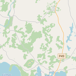
Building (cadastre designation: 68900050011002)
Cadastre designation: 68900050011002
Address: "Bērziņi", Pušmucova, Pušmucovas pagasts, Ludzas novads, LV-5742
Cadastre designation of real estate | |
|---|---|
Cadastral object type | Cadastral object type: Building |
Address | Address: "Bērziņi", Pušmucova, Pušmucovas pagasts, Ludzas novads, LV-5742 |
Address | |
|---|---|
Address ID | Address ID: 104761467 |
Companies registered at the address | Companies registered at the address: 0 |
Departments registered at the address | Departments registered at the address: 0 |
Institutions registered at the address | Institutions registered at the address: 0 |
Real estate registered at the address | |
Transactions with real estate at the address | Transactions with real estate at the address: 0 |
| Cadastral object type | Cadastre designation of the cadastral object | Person's property right status | Person status | Land Register |
|---|---|---|---|---|
| Cadastral object type: Building | 68900050011002 | Person's property right status: No data | Person status: No data | Land Register |
17.12.2024. State land service data
|
|
|
{"7201070000":{"name":"<div class='color_dot' style='background-color: #00ff00'><\/div><span>Areas with initiated surveying<\/span>","featureColor":"#00ff00","features":{"type":"FeatureCollection","features":[{"type":"Feature","geometry":{"type":"Polygon","coordinates":[[[27.720509601,56.653518181],[27.720563333,56.653488331],[27.721368947,56.65265229],[27.725150545,56.654215074],[27.727976438,56.654499009],[27.72878288,56.65440492],[27.729277514,56.655457723],[27.729493936,56.655855221],[27.729574413,56.655918581],[27.729392458,56.65597805],[27.729190924,56.656043915],[27.728979586,56.656096164],[27.728620683,56.656129881],[27.728301782,56.65614714],[27.726614333,56.656191303],[27.724926864,56.656235452],[27.722523924,56.654753255],[27.722349061,56.65464178],[27.722174182,56.654530305],[27.720900464,56.653758886],[27.720509601,56.653518181]]]},"crs":{"type":"name","properties":{"name":"urn:ogc:def:crs:EPSG:3059"}},"properties":{"style":{"color":"#00ff00","dashArray":"0","weight":1},"name":"Areas with initiated surveying","object_type":"SurveyingStatus","parcel_code":"68900050011","code":null,"surveyor":"Austrumu m\u0113rnieks SIA 25.10.2021.","address":"\"B\u0113rzi\u0146i\", Pu\u0161mucova, Pu\u0161mucovas pag., Ludzas nov., LV-5742","ownership":"<span>Owner - Natural person<br><\/span>","pro_cadastre_nr":"68900050011"}},{"type":"Feature","geometry":{"type":"Polygon","coordinates":[[[27.720509601,56.653518181],[27.720563333,56.653488331],[27.721368947,56.65265229],[27.725150545,56.654215074],[27.727976438,56.654499009],[27.72878288,56.65440492],[27.729277514,56.655457723],[27.729493936,56.655855221],[27.729574413,56.655918581],[27.729392458,56.65597805],[27.729190924,56.656043915],[27.728979586,56.656096164],[27.728620683,56.656129881],[27.728301782,56.65614714],[27.726614333,56.656191303],[27.724926864,56.656235452],[27.722523924,56.654753255],[27.722349061,56.65464178],[27.722174182,56.654530305],[27.720900464,56.653758886],[27.720509601,56.653518181]]]},"crs":{"type":"name","properties":{"name":"urn:ogc:def:crs:EPSG:3059"}},"properties":{"style":{"color":"#00ff00","dashArray":"0","weight":1},"name":"Areas with initiated surveying","object_type":"SurveyingStatus","parcel_code":"68900050011","code":null,"surveyor":"Austrumu m\u0113rnieks SIA 25.10.2021.","address":"\"B\u0113rzi\u0146i\", Pu\u0161mucova, Pu\u0161mucovas pag., Ludzas nov., LV-5742","ownership":"<span>Owner - Natural person<br><\/span>","pro_cadastre_nr":"68900050011"}},{"type":"Feature","geometry":{"type":"Polygon","coordinates":[[[27.720509601,56.653518181],[27.720563333,56.653488331],[27.721368947,56.65265229],[27.725150545,56.654215074],[27.727976438,56.654499009],[27.72878288,56.65440492],[27.729277514,56.655457723],[27.729493936,56.655855221],[27.729574413,56.655918581],[27.729392458,56.65597805],[27.729190924,56.656043915],[27.728979586,56.656096164],[27.728620683,56.656129881],[27.728301782,56.65614714],[27.726614333,56.656191303],[27.724926864,56.656235452],[27.722523924,56.654753255],[27.722349061,56.65464178],[27.722174182,56.654530305],[27.720900464,56.653758886],[27.720509601,56.653518181]]]},"crs":{"type":"name","properties":{"name":"urn:ogc:def:crs:EPSG:3059"}},"properties":{"style":{"color":"#00ff00","dashArray":"0","weight":1},"name":"Areas with initiated surveying","object_type":"SurveyingStatus","parcel_code":"68900050011","code":null,"surveyor":"Austrumu m\u0113rnieks SIA 25.10.2021.","address":"\"B\u0113rzi\u0146i\", Pu\u0161mucova, Pu\u0161mucovas pag., Ludzas nov., LV-5742","ownership":"<span>Owner - Natural person<br><\/span>","pro_cadastre_nr":"68900050011"}}]}},"7201060210":{"name":"<div class='color_dot' style='background-color: #00ffff'><\/div><span>Specified land unit<\/span>","featureColor":"#00ffff","features":{"type":"FeatureCollection","features":[{"type":"Feature","geometry":{"type":"Polygon","coordinates":[[[27.720509601,56.653518181],[27.720563333,56.653488331],[27.721368947,56.65265229],[27.725150545,56.654215074],[27.727976438,56.654499009],[27.72878288,56.65440492],[27.729277514,56.655457723],[27.729493936,56.655855221],[27.729574413,56.655918581],[27.729392458,56.65597805],[27.729190924,56.656043915],[27.728979586,56.656096164],[27.728620683,56.656129881],[27.728301782,56.65614714],[27.726614333,56.656191303],[27.724926864,56.656235452],[27.722523924,56.654753255],[27.722349061,56.65464178],[27.722174182,56.654530305],[27.720900464,56.653758886],[27.720509601,56.653518181]]]},"crs":{"type":"name","properties":{"name":"urn:ogc:def:crs:EPSG:3059"}},"properties":{"style":{"color":"#00ffff","dashArray":"8,12","weight":1},"name":"Land","object_type":"Parcel","parcel_code":"68900050011","code":null,"surveyor":null,"address":"\"B\u0113rzi\u0146i\", Pu\u0161mucova, Pu\u0161mucovas pag., Ludzas nov., LV-5742","ownership":"<span>Owner - Natural person<br><\/span>","pro_cadastre_nr":"68900050011"}},{"type":"Feature","geometry":{"type":"Polygon","coordinates":[[[27.752868949,56.660886414],[27.752968891,56.660376324],[27.753155912,56.659490445],[27.753165971,56.659411536],[27.753256621,56.659050142],[27.753248714,56.658958864],[27.753289564,56.658864873],[27.75333654,56.658770257],[27.756958723,56.659625507],[27.757929465,56.659877712],[27.756639992,56.661016027],[27.752868949,56.660886414]]]},"crs":{"type":"name","properties":{"name":"urn:ogc:def:crs:EPSG:3059"}},"properties":{"style":{"color":"#00ffff","dashArray":"8,12","weight":1},"name":"Land","object_type":"Parcel","parcel_code":"68900020060","code":null,"surveyor":null,"address":"","ownership":"<span>Owner - Natural person<br><\/span>","pro_cadastre_nr":"68900050011"}}]}},"5201011310":{"name":"<div class='color_dot' style='background-color: #960096'><\/div><span>Vectorized building<\/span>","featureColor":"#960096","features":{"type":"FeatureCollection","features":[{"type":"Feature","geometry":{"type":"Polygon","coordinates":[[[27.725761424,56.654965448],[27.725751685,56.654866833],[27.725906309,56.6548622],[27.725916049,56.654960815],[27.725761424,56.654965448]]]},"crs":{"type":"name","properties":{"name":"urn:ogc:def:crs:EPSG:3059"}},"properties":{"style":{"color":"#960096","dashArray":"0","weight":2},"name":"Building","object_type":"Building","parcel_code":"68900050011","code":"68900050011001","surveyor":null,"address":"\"B\u0113rzi\u0146i\", Pu\u0161mucova, Pu\u0161mucovas pag., Ludzas nov., LV-5742","ownership":"<span>Owner - Natural person<br><\/span>","pro_cadastre_nr":"68900050011"}},{"type":"Feature","geometry":{"type":"Polygon","coordinates":[[[27.72560426,56.655072148],[27.725600719,56.655036288],[27.725714653,56.655032874],[27.725718195,56.655068734],[27.72560426,56.655072148]]]},"crs":{"type":"name","properties":{"name":"urn:ogc:def:crs:EPSG:3059"}},"properties":{"style":{"color":"#960096","dashArray":"0","weight":2},"name":"Building","object_type":"Building","parcel_code":"68900050011","code":"68900050011004","surveyor":null,"address":"\"B\u0113rzi\u0146i\", Pu\u0161mucova, Pu\u0161mucovas pag., Ludzas nov., LV-5742","ownership":"<span>Owner - Natural person<br><\/span>","pro_cadastre_nr":"68900050011"}},{"type":"Feature","geometry":{"type":"Polygon","coordinates":[[[27.725296151,56.655394508],[27.72529261,56.655358648],[27.725325163,56.655357673],[27.725328704,56.655393533],[27.725296151,56.655394508]]]},"crs":{"type":"name","properties":{"name":"urn:ogc:def:crs:EPSG:3059"}},"properties":{"style":{"color":"#960096","dashArray":"0","weight":2},"name":"Building","object_type":"Building","parcel_code":"68900050011","code":"68900050011003","surveyor":null,"address":"\"B\u0113rzi\u0146i\", Pu\u0161mucova, Pu\u0161mucovas pag., Ludzas nov., LV-5742","ownership":"<span>Owner - Natural person<br><\/span>","pro_cadastre_nr":"68900050011"}},{"type":"Feature","geometry":{"type":"Polygon","coordinates":[[[27.726120087,56.655132014],[27.726112117,56.655051329],[27.72650275,56.655039623],[27.72651072,56.655120308],[27.726120087,56.655132014]]]},"crs":{"type":"name","properties":{"name":"urn:ogc:def:crs:EPSG:3059"}},"properties":{"style":{"color":"#960096","dashArray":"0","weight":2},"name":"Building","object_type":"Building","parcel_code":"68900050011","code":"68900050011005","surveyor":null,"address":"\"B\u0113rzi\u0146i\", Pu\u0161mucova, Pu\u0161mucovas pag., Ludzas nov., LV-5742","ownership":"<span>Owner - Natural person<br><\/span>","pro_cadastre_nr":"68900050011"}},{"type":"Feature","geometry":{"type":"Polygon","coordinates":[[[27.725466342,56.655027105],[27.725452177,56.654883666],[27.725582387,56.654879764],[27.725596553,56.655023204],[27.725466342,56.655027105]]]},"crs":{"type":"name","properties":{"name":"urn:ogc:def:crs:EPSG:3059"}},"properties":{"style":{"color":"#960096","dashArray":"0","weight":2},"name":"Building","object_type":"Building","parcel_code":"68900050011","code":"68900050011002","surveyor":null,"address":"\"B\u0113rzi\u0146i\", Pu\u0161mucova, Pu\u0161mucovas pag., Ludzas nov., LV-5742","ownership":"<span>Owner - Natural person<br><\/span>","pro_cadastre_nr":"68900050011"}},{"type":"Feature","geometry":{"type":"Polygon","coordinates":[[[27.726120087,56.655132014],[27.726112117,56.655051329],[27.72650275,56.655039623],[27.72651072,56.655120308],[27.726120087,56.655132014]]]},"crs":{"type":"name","properties":{"name":"urn:ogc:def:crs:EPSG:3059"}},"properties":{"style":{"color":"#960096","dashArray":"0","weight":2},"name":"Building","object_type":"Building","parcel_code":"68900050011","code":"68900050011005","surveyor":null,"address":"\"B\u0113rzi\u0146i\", Pu\u0161mucova, Pu\u0161mucovas pag., Ludzas nov., LV-5742","ownership":"<span>Owner - Natural person<br><\/span>","pro_cadastre_nr":"68900050011"}},{"type":"Feature","geometry":{"type":"Polygon","coordinates":[[[27.72560426,56.655072148],[27.725600719,56.655036288],[27.725714653,56.655032874],[27.725718195,56.655068734],[27.72560426,56.655072148]]]},"crs":{"type":"name","properties":{"name":"urn:ogc:def:crs:EPSG:3059"}},"properties":{"style":{"color":"#960096","dashArray":"0","weight":2},"name":"Building","object_type":"Building","parcel_code":"68900050011","code":"68900050011004","surveyor":null,"address":"\"B\u0113rzi\u0146i\", Pu\u0161mucova, Pu\u0161mucovas pag., Ludzas nov., LV-5742","ownership":"<span>Owner - Natural person<br><\/span>","pro_cadastre_nr":"68900050011"}},{"type":"Feature","geometry":{"type":"Polygon","coordinates":[[[27.725296151,56.655394508],[27.72529261,56.655358648],[27.725325163,56.655357673],[27.725328704,56.655393533],[27.725296151,56.655394508]]]},"crs":{"type":"name","properties":{"name":"urn:ogc:def:crs:EPSG:3059"}},"properties":{"style":{"color":"#960096","dashArray":"0","weight":2},"name":"Building","object_type":"Building","parcel_code":"68900050011","code":"68900050011003","surveyor":null,"address":"\"B\u0113rzi\u0146i\", Pu\u0161mucova, Pu\u0161mucovas pag., Ludzas nov., LV-5742","ownership":"<span>Owner - Natural person<br><\/span>","pro_cadastre_nr":"68900050011"}},{"type":"Feature","geometry":{"type":"Polygon","coordinates":[[[27.725466342,56.655027105],[27.725452177,56.654883666],[27.725582387,56.654879764],[27.725596553,56.655023204],[27.725466342,56.655027105]]]},"crs":{"type":"name","properties":{"name":"urn:ogc:def:crs:EPSG:3059"}},"properties":{"style":{"color":"#960096","dashArray":"0","weight":2},"name":"Building","object_type":"Building","parcel_code":"68900050011","code":"68900050011002","surveyor":null,"address":"\"B\u0113rzi\u0146i\", Pu\u0161mucova, Pu\u0161mucovas pag., Ludzas nov., LV-5742","ownership":"<span>Owner - Natural person<br><\/span>","pro_cadastre_nr":"68900050011"}},{"type":"Feature","geometry":{"type":"Polygon","coordinates":[[[27.725761424,56.654965448],[27.725751685,56.654866833],[27.725906309,56.6548622],[27.725916049,56.654960815],[27.725761424,56.654965448]]]},"crs":{"type":"name","properties":{"name":"urn:ogc:def:crs:EPSG:3059"}},"properties":{"style":{"color":"#960096","dashArray":"0","weight":2},"name":"Building","object_type":"Building","parcel_code":"68900050011","code":"68900050011001","surveyor":null,"address":"\"B\u0113rzi\u0146i\", Pu\u0161mucova, Pu\u0161mucovas pag., Ludzas nov., LV-5742","ownership":"<span>Owner - Natural person<br><\/span>","pro_cadastre_nr":"68900050011"}}]}}}
[]
https://tile.openstreetmap.org/{z}/{x}/{y}.png|© OpenStreetMap contributors|minZoom: 7|maxZoom: 19
|
Building data updated: 24.11.2024.
Data source and license: Cadastre Information System open text and spatial data, Real Estate Market Database open data, open data license Creative Commons Attribution, OpenStreetMap

