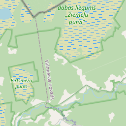
Building (cadastre designation: 66370040030001)
Cadastre designation: 66370040030001
Address: "Griķi", Staiceles pagasts, Limbažu novads, LV-4043
Cadastre designation of real estate | |
|---|---|
Cadastral object type | Cadastral object type: Building |
Address | Address: "Griķi", Staiceles pagasts, Limbažu novads, LV-4043 |
Address | |
|---|---|
Address ID | Address ID: 104118488 |
Companies registered at the address | Companies registered at the address: 0 |
Departments registered at the address | Departments registered at the address: 0 |
Institutions registered at the address | Institutions registered at the address: 0 |
Real estate registered at the address | |
Transactions with real estate at the address | Transactions with real estate at the address: 0 |
| Cadastral object type | Cadastre designation of the cadastral object | Person's property right status | Person status | Land Register |
|---|---|---|---|---|
| Cadastral object type: Building | 66370040030001 | Person's property right status: No data | Person status: No data | Land Register |
17.12.2024. State land service data
|
|
|
{"7201060110":{"name":"<div class='color_dot' style='background-color: #00ffff'><\/div><span>Measured land unit<\/span>","featureColor":"#00ffff","features":{"type":"FeatureCollection","features":[{"type":"Feature","geometry":{"type":"Polygon","coordinates":[[[24.830232788,57.887986574],[24.830540035,57.886181806],[24.830558341,57.886164575],[24.831524675,57.88645598],[24.832049969,57.886676127],[24.832813592,57.887125993],[24.833360788,57.88731376],[24.834031667,57.887810425],[24.835405015,57.888278448],[24.835883015,57.888449153],[24.836979776,57.888819479],[24.837016801,57.888788379],[24.839534907,57.889495112],[24.839950955,57.889640386],[24.841614567,57.890164154],[24.84167275,57.890178212],[24.842297994,57.890337632],[24.84263625,57.890427209],[24.843264828,57.890660241],[24.84359487,57.890815803],[24.84414206,57.891066888],[24.844192774,57.891062302],[24.845323022,57.890792536],[24.846927741,57.890436526],[24.847709687,57.890280392],[24.848271194,57.890151533],[24.848936306,57.889983829],[24.849454304,57.889852821],[24.849964719,57.889748029],[24.85049051,57.889624465],[24.851242989,57.889449669],[24.851412671,57.889414111],[24.851713299,57.889360436],[24.852122492,57.889261693],[24.852832056,57.889051596],[24.853151105,57.888981186],[24.853367513,57.888943918],[24.853461251,57.888945803],[24.854568254,57.888968101],[24.854647641,57.88896727],[24.854648174,57.888981917],[24.855910321,57.890239504],[24.854692721,57.890858676],[24.854669918,57.890845248],[24.854537004,57.890909263],[24.853511064,57.891482392],[24.853487947,57.891470663],[24.851457853,57.89148754],[24.850822552,57.891492642],[24.850867403,57.891793278],[24.850575243,57.891798568],[24.850615193,57.892177403],[24.850843141,57.892167154],[24.850927796,57.892436848],[24.851092026,57.892868091],[24.851127637,57.892991669],[24.850645191,57.893976119],[24.850626158,57.89399661],[24.85015315,57.893872017],[24.849216447,57.893616736],[24.848158677,57.89332497],[24.847918646,57.893249366],[24.847905834,57.893247557],[24.847901062,57.893248343],[24.847891857,57.893252132],[24.847742941,57.893329515],[24.847430587,57.893483648],[24.847395594,57.89355788],[24.847316332,57.893786056],[24.847193496,57.893773959],[24.84543682,57.894865448],[24.842183037,57.894292045],[24.838979621,57.892703882],[24.834695992,57.890669363],[24.834620429,57.890647627],[24.834680454,57.890588442],[24.835033328,57.890240453],[24.834962543,57.890211581],[24.830232788,57.887986574]]]},"crs":{"type":"name","properties":{"name":"urn:ogc:def:crs:EPSG:3059"}},"properties":{"style":{"color":"#00ffff","dashArray":"0","weight":1},"name":"Land","object_type":"Parcel","parcel_code":"66370040030","code":null,"surveyor":null,"address":"\"Gri\u0137i\", Staiceles pag., Limba\u017eu nov., LV-4043","ownership":"<span>Owner - Natural person<br><\/span>","pro_cadastre_nr":"66370040030"}}]}},"5201011110":{"name":"<div class='color_dot' style='background-color: #ff0000'><\/div><span>Measured building<\/span>","featureColor":"#ff0000","features":{"type":"FeatureCollection","features":[{"type":"Feature","geometry":{"type":"Polygon","coordinates":[[[24.84984339,57.892124138],[24.849866967,57.892041726],[24.850114404,57.892061799],[24.850090827,57.892144211],[24.84984339,57.892124138]]]},"crs":{"type":"name","properties":{"name":"urn:ogc:def:crs:EPSG:3059"}},"properties":{"style":{"color":"#ff0000","dashArray":"0","weight":1},"name":"Building","object_type":"Building","parcel_code":"66370040030","code":"66370040030001","surveyor":null,"address":"\"Gri\u0137i\", Staiceles pag., Limba\u017eu nov., LV-4043","ownership":"<span>Owner - Natural person<br><\/span>","pro_cadastre_nr":"66370040030"}},{"type":"Feature","geometry":{"type":"Polygon","coordinates":[[[24.849716672,57.892364858],[24.849738233,57.892312803],[24.84994446,57.892337033],[24.8499229,57.892389088],[24.849716672,57.892364858]]]},"crs":{"type":"name","properties":{"name":"urn:ogc:def:crs:EPSG:3059"}},"properties":{"style":{"color":"#ff0000","dashArray":"0","weight":1},"name":"Building","object_type":"Building","parcel_code":"66370040030","code":"66370040030002","surveyor":null,"address":"\"Gri\u0137i\", Staiceles pag., Limba\u017eu nov., LV-4043","ownership":"<span>Owner - Natural person<br><\/span>","pro_cadastre_nr":"66370040030"}},{"type":"Feature","geometry":{"type":"Polygon","coordinates":[[[24.849716672,57.892364858],[24.849738233,57.892312803],[24.84994446,57.892337033],[24.8499229,57.892389088],[24.849716672,57.892364858]]]},"crs":{"type":"name","properties":{"name":"urn:ogc:def:crs:EPSG:3059"}},"properties":{"style":{"color":"#ff0000","dashArray":"0","weight":1},"name":"Building","object_type":"Building","parcel_code":"66370040030","code":"66370040030002","surveyor":null,"address":"\"Gri\u0137i\", Staiceles pag., Limba\u017eu nov., LV-4043","ownership":"<span>Owner - Natural person<br><\/span>","pro_cadastre_nr":"66370040030"}},{"type":"Feature","geometry":{"type":"Polygon","coordinates":[[[24.84984339,57.892124138],[24.849866967,57.892041726],[24.850114404,57.892061799],[24.850090827,57.892144211],[24.84984339,57.892124138]]]},"crs":{"type":"name","properties":{"name":"urn:ogc:def:crs:EPSG:3059"}},"properties":{"style":{"color":"#ff0000","dashArray":"0","weight":1},"name":"Building","object_type":"Building","parcel_code":"66370040030","code":"66370040030001","surveyor":null,"address":"\"Gri\u0137i\", Staiceles pag., Limba\u017eu nov., LV-4043","ownership":"<span>Owner - Natural person<br><\/span>","pro_cadastre_nr":"66370040030"}}]}}}
[]
https://tile.openstreetmap.org/{z}/{x}/{y}.png|© OpenStreetMap contributors|minZoom: 7|maxZoom: 19
|
Building data updated: 24.11.2024.
Data source and license: Cadastre Information System open text and spatial data, Real Estate Market Database open data, open data license Creative Commons Attribution, OpenStreetMap

