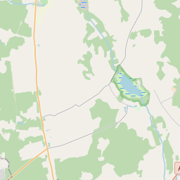
Building (cadastre designation: 64760040007003)
Cadastre designation: 64760040007003
Address: "Reliņi", Medzes pagasts, Dienvidkurzemes novads, LV-3461
Cadastre designation of real estate | |
|---|---|
Cadastral object type | Cadastral object type: Building |
Address | Address: "Reliņi", Medzes pagasts, Dienvidkurzemes novads, LV-3461 |
Address | |
|---|---|
Address ID | Address ID: 103925240 |
Companies registered at the address | |
Departments registered at the address | Departments registered at the address: 0 |
Institutions registered at the address | Institutions registered at the address: 0 |
Real estate registered at the address | |
Transactions with real estate at the address | Transactions with real estate at the address: 0 |
| Cadastral object type | Cadastre designation of the cadastral object | Person's property right status | Person status | Land Register |
|---|---|---|---|---|
| Cadastral object type: Building | 64760040007003 | Person's property right status: No data | Person status: No data | Land Register |
22.01.2025. State land service data
|
|
|
{"7201060210":{"name":"<div class='color_dot' style='background-color: #00ffff'><\/div><span>Specified land unit<\/span>","featureColor":"#00ffff","features":{"type":"FeatureCollection","features":[{"type":"Feature","geometry":{"type":"Polygon","coordinates":[[[21.168455881,56.64190152],[21.16848244,56.641872778],[21.168515124,56.641837416],[21.168841559,56.641466023],[21.169382827,56.640850208],[21.1703532,56.640517731],[21.170445282,56.640592658],[21.171949037,56.641818618],[21.171571608,56.64259462],[21.171551553,56.642633685],[21.171258842,56.642545056],[21.170179987,56.642279739],[21.169489644,56.642104966],[21.16901708,56.641987521],[21.168455881,56.64190152]]]},"crs":{"type":"name","properties":{"name":"urn:ogc:def:crs:EPSG:3059"}},"properties":{"style":{"color":"#00ffff","dashArray":"8,12","weight":1},"name":"Land","object_type":"Parcel","parcel_code":"64760040009","code":null,"surveyor":null,"address":"","ownership":"<span>Owner - Natural person<br><\/span>","pro_cadastre_nr":"64760040007"}},{"type":"Feature","geometry":{"type":"Polygon","coordinates":[[[21.153973264,56.639019474],[21.154874953,56.637828484],[21.156296116,56.635983631],[21.160463686,56.637385832],[21.163255566,56.638485911],[21.164324183,56.638895742],[21.166511857,56.639669337],[21.164271937,56.641424838],[21.164229189,56.641465794],[21.163317261,56.641290788],[21.162610745,56.641160613],[21.162157627,56.641079178],[21.1615839,56.640957509],[21.159755855,56.640464621],[21.158050869,56.640012457],[21.156038831,56.639476021],[21.154469751,56.639059289],[21.154296763,56.639037418],[21.153973264,56.639019474]]]},"crs":{"type":"name","properties":{"name":"urn:ogc:def:crs:EPSG:3059"}},"properties":{"style":{"color":"#00ffff","dashArray":"8,12","weight":1},"name":"Land","object_type":"Parcel","parcel_code":"64760040008","code":null,"surveyor":null,"address":"","ownership":"<span>Owner - Natural person<br><\/span>","pro_cadastre_nr":"64760040007"}},{"type":"Feature","geometry":{"type":"Polygon","coordinates":[[[21.151774207,56.639152279],[21.151825634,56.639124217],[21.152491042,56.639157617],[21.153524926,56.639128194],[21.154090487,56.63911097],[21.154450577,56.639165049],[21.156371462,56.639668921],[21.159836322,56.640592412],[21.159823445,56.640632197],[21.159675172,56.640993443],[21.159641777,56.641374363],[21.159491548,56.641385907],[21.159140937,56.641714866],[21.158916742,56.64180709],[21.158642269,56.641845745],[21.158440075,56.641826151],[21.158363809,56.641757014],[21.158306717,56.641613442],[21.158167174,56.641482961],[21.157984156,56.641388923],[21.157705138,56.641307666],[21.157541344,56.641318898],[21.157476441,56.641459692],[21.15752334,56.641558099],[21.157495163,56.641752143],[21.157312251,56.642017534],[21.157066623,56.642214096],[21.15670744,56.642295744],[21.156562313,56.64241972],[21.156357865,56.642430021],[21.155958523,56.642323548],[21.155300522,56.642226133],[21.154880315,56.642216522],[21.154666292,56.642353904],[21.154529607,56.642365753],[21.154423417,56.642333374],[21.154280505,56.642247735],[21.154047223,56.642100121],[21.15375915,56.64195875],[21.153586282,56.641730156],[21.153476213,56.64166746],[21.153456984,56.641494039],[21.15340644,56.641432444],[21.152482612,56.640642217],[21.152407357,56.64059859],[21.152347305,56.640421897],[21.152029144,56.639770999],[21.151774207,56.639152279]]]},"crs":{"type":"name","properties":{"name":"urn:ogc:def:crs:EPSG:3059"}},"properties":{"style":{"color":"#00ffff","dashArray":"8,12","weight":1},"name":"Land","object_type":"Parcel","parcel_code":"64760040007","code":null,"surveyor":null,"address":"\"Reli\u0146i\", Medzes pag., Dienvidkurzemes nov., LV-3461","ownership":"<span>Owner - Natural person<br><\/span>","pro_cadastre_nr":"64760040007"}}]}},"5201011310":{"name":"<div class='color_dot' style='background-color: #960096'><\/div><span>Vectorized building<\/span>","featureColor":"#960096","features":{"type":"FeatureCollection","features":[{"type":"Feature","geometry":{"type":"Polygon","coordinates":[[[21.154277962,56.639491756],[21.154186413,56.639429053],[21.154395739,56.639336263],[21.154487272,56.639398966],[21.154277962,56.639491756]]]},"crs":{"type":"name","properties":{"name":"urn:ogc:def:crs:EPSG:3059"}},"properties":{"style":{"color":"#960096","dashArray":"0","weight":2},"name":"Building","object_type":"Building","parcel_code":"64760040007","code":"64760040007001","surveyor":null,"address":"\"Reli\u0146i\", Medzes pag., Dienvidkurzemes nov., LV-3461","ownership":"<span>Owner - Natural person<br><\/span>","pro_cadastre_nr":"64760040007"}},{"type":"Feature","geometry":{"type":"Polygon","coordinates":[[[21.154079307,56.64000425],[21.153944677,56.640059514],[21.153705973,56.639882958],[21.153840603,56.639827695],[21.154079307,56.64000425]]]},"crs":{"type":"name","properties":{"name":"urn:ogc:def:crs:EPSG:3059"}},"properties":{"style":{"color":"#960096","dashArray":"0","weight":2},"name":"Building","object_type":"Building","parcel_code":"64760040007","code":"64760040007006","surveyor":null,"address":"\"Reli\u0146i\", Medzes pag., Dienvidkurzemes nov., LV-3461","ownership":null,"pro_cadastre_nr":null}},{"type":"Feature","geometry":{"type":"Polygon","coordinates":[[[21.15387234,56.639471051],[21.153830098,56.639447155],[21.153879024,56.639420887],[21.153921265,56.639444783],[21.15387234,56.639471051]]]},"crs":{"type":"name","properties":{"name":"urn:ogc:def:crs:EPSG:3059"}},"properties":{"style":{"color":"#960096","dashArray":"0","weight":2},"name":"Building","object_type":"Building","parcel_code":"64760040007","code":"64760040007003","surveyor":null,"address":"\"Reli\u0146i\", Medzes pag., Dienvidkurzemes nov., LV-3461","ownership":"<span>Owner - Natural person<br><\/span>","pro_cadastre_nr":"64760040007"}},{"type":"Feature","geometry":{"type":"Polygon","coordinates":[[[21.153704903,56.639661217],[21.153818293,56.639593414],[21.153915937,56.63964299],[21.153802548,56.639710793],[21.153704903,56.639661217]]]},"crs":{"type":"name","properties":{"name":"urn:ogc:def:crs:EPSG:3059"}},"properties":{"style":{"color":"#960096","dashArray":"0","weight":2},"name":"Building","object_type":"Building","parcel_code":"64760040007","code":"64760040007004","surveyor":null,"address":"\"Reli\u0146i\", Medzes pag., Dienvidkurzemes nov., LV-3461","ownership":"<span>Owner - Natural person<br><\/span>","pro_cadastre_nr":"64760040007"}},{"type":"Feature","geometry":{"type":"Polygon","coordinates":[[[21.154195047,56.63969181],[21.154139121,56.639687582],[21.154150362,56.63964252],[21.154206288,56.639646748],[21.154195047,56.63969181]]]},"crs":{"type":"name","properties":{"name":"urn:ogc:def:crs:EPSG:3059"}},"properties":{"style":{"color":"#960096","dashArray":"0","weight":2},"name":"Building","object_type":"Building","parcel_code":"64760040007","code":"64760040007005","surveyor":null,"address":"\"Reli\u0146i\", Medzes pag., Dienvidkurzemes nov., LV-3461","ownership":"<span>Owner - Natural person<br><\/span>","pro_cadastre_nr":"64760040007"}},{"type":"Feature","geometry":{"type":"Polygon","coordinates":[[[21.154329177,56.639298491],[21.154185793,56.639231393],[21.154252199,56.639188312],[21.154395567,56.639255409],[21.154329177,56.639298491]]]},"crs":{"type":"name","properties":{"name":"urn:ogc:def:crs:EPSG:3059"}},"properties":{"style":{"color":"#960096","dashArray":"0","weight":2},"name":"Building","object_type":"Building","parcel_code":"64760040007","code":"64760040007002","surveyor":null,"address":"\"Reli\u0146i\", Medzes pag., Dienvidkurzemes nov., LV-3461","ownership":"<span>Owner - Natural person<br><\/span>","pro_cadastre_nr":"64760040007"}},{"type":"Feature","geometry":{"type":"Polygon","coordinates":[[[21.154195047,56.63969181],[21.154139121,56.639687582],[21.154150362,56.63964252],[21.154206288,56.639646748],[21.154195047,56.63969181]]]},"crs":{"type":"name","properties":{"name":"urn:ogc:def:crs:EPSG:3059"}},"properties":{"style":{"color":"#960096","dashArray":"0","weight":2},"name":"Building","object_type":"Building","parcel_code":"64760040007","code":"64760040007005","surveyor":null,"address":"\"Reli\u0146i\", Medzes pag., Dienvidkurzemes nov., LV-3461","ownership":"<span>Owner - Natural person<br><\/span>","pro_cadastre_nr":"64760040007"}},{"type":"Feature","geometry":{"type":"Polygon","coordinates":[[[21.153704903,56.639661217],[21.153818293,56.639593414],[21.153915937,56.63964299],[21.153802548,56.639710793],[21.153704903,56.639661217]]]},"crs":{"type":"name","properties":{"name":"urn:ogc:def:crs:EPSG:3059"}},"properties":{"style":{"color":"#960096","dashArray":"0","weight":2},"name":"Building","object_type":"Building","parcel_code":"64760040007","code":"64760040007004","surveyor":null,"address":"\"Reli\u0146i\", Medzes pag., Dienvidkurzemes nov., LV-3461","ownership":"<span>Owner - Natural person<br><\/span>","pro_cadastre_nr":"64760040007"}},{"type":"Feature","geometry":{"type":"Polygon","coordinates":[[[21.15387234,56.639471051],[21.153830098,56.639447155],[21.153879024,56.639420887],[21.153921265,56.639444783],[21.15387234,56.639471051]]]},"crs":{"type":"name","properties":{"name":"urn:ogc:def:crs:EPSG:3059"}},"properties":{"style":{"color":"#960096","dashArray":"0","weight":2},"name":"Building","object_type":"Building","parcel_code":"64760040007","code":"64760040007003","surveyor":null,"address":"\"Reli\u0146i\", Medzes pag., Dienvidkurzemes nov., LV-3461","ownership":"<span>Owner - Natural person<br><\/span>","pro_cadastre_nr":"64760040007"}},{"type":"Feature","geometry":{"type":"Polygon","coordinates":[[[21.154329177,56.639298491],[21.154185793,56.639231393],[21.154252199,56.639188312],[21.154395567,56.639255409],[21.154329177,56.639298491]]]},"crs":{"type":"name","properties":{"name":"urn:ogc:def:crs:EPSG:3059"}},"properties":{"style":{"color":"#960096","dashArray":"0","weight":2},"name":"Building","object_type":"Building","parcel_code":"64760040007","code":"64760040007002","surveyor":null,"address":"\"Reli\u0146i\", Medzes pag., Dienvidkurzemes nov., LV-3461","ownership":"<span>Owner - Natural person<br><\/span>","pro_cadastre_nr":"64760040007"}},{"type":"Feature","geometry":{"type":"Polygon","coordinates":[[[21.154277962,56.639491756],[21.154186413,56.639429053],[21.154395739,56.639336263],[21.154487272,56.639398966],[21.154277962,56.639491756]]]},"crs":{"type":"name","properties":{"name":"urn:ogc:def:crs:EPSG:3059"}},"properties":{"style":{"color":"#960096","dashArray":"0","weight":2},"name":"Building","object_type":"Building","parcel_code":"64760040007","code":"64760040007001","surveyor":null,"address":"\"Reli\u0146i\", Medzes pag., Dienvidkurzemes nov., LV-3461","ownership":"<span>Owner - Natural person<br><\/span>","pro_cadastre_nr":"64760040007"}}]}}}
[]
https://tile.openstreetmap.org/{z}/{x}/{y}.png|© OpenStreetMap contributors|minZoom: 7|maxZoom: 19
|
Building data updated: 24.01.2025.
Data source and license: Cadastre Information System open text and spatial data, Real Estate Market Database open data, open data license Creative Commons Attribution, OpenStreetMap

