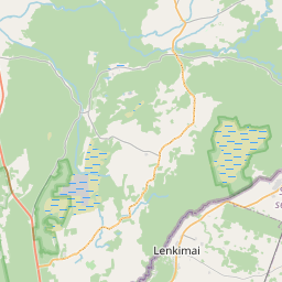
Building (cadastre designation: 64520120102001)
Cadastre designation: 64520120102001
Address: "Dzintari", Dunikas pagasts, Dienvidkurzemes novads, LV-3480
Cadastre designation of real estate | |
|---|---|
Cadastral object type | Cadastral object type: Building |
Address | Address: "Dzintari", Dunikas pagasts, Dienvidkurzemes novads, LV-3480 |
Address | |
|---|---|
Address ID | Address ID: 103916633 |
Companies registered at the address | |
Departments registered at the address | Departments registered at the address: 0 |
Institutions registered at the address | Institutions registered at the address: 0 |
Real estate registered at the address | |
Transactions with real estate at the address | Transactions with real estate at the address: 0 |
| Cadastral object type | Cadastre designation of the cadastral object | Person's property right status | Person status | Land Register |
|---|---|---|---|---|
| Cadastral object type: Building | 64520120102001 | Person's property right status: No data | Person status: No data | Land Register |
17.12.2024. State land service data
|
|
|
{"7206040110":{"name":"<div class='color_dot' style='background-color: #ff7f00'><\/div><span>Parts of the land unit<\/span>","featureColor":"#ff7f00","features":{"type":"FeatureCollection","features":[{"type":"Feature","geometry":{"type":"Polygon","coordinates":[[[21.28905935,56.29517954],[21.289099725,56.295023973],[21.288802973,56.295000161],[21.288702106,56.294986285],[21.288660689,56.294931815],[21.288730814,56.294949315],[21.288813355,56.294960157],[21.289110107,56.294983968],[21.289749547,56.295035284],[21.289731078,56.2951064],[21.289799167,56.295112259],[21.28980459,56.295091372],[21.28996077,56.295103906],[21.289936092,56.29519902],[21.289779896,56.295186486],[21.289785319,56.295165598],[21.289717246,56.295159739],[21.289698794,56.295230847],[21.28905935,56.29517954]]]},"crs":{"type":"name","properties":{"name":"urn:ogc:def:crs:EPSG:3059"}},"properties":{"style":{"color":"#ff7f00","dashArray":"0","weight":1},"name":"Part of the land unit","object_type":"ParcelPart","parcel_code":"64520070074","code":"645200700748001","surveyor":null,"address":"","ownership":null,"pro_cadastre_nr":null}}]}},"7201070000":{"name":"<div class='color_dot' style='background-color: #00ff00'><\/div><span>Areas with initiated surveying<\/span>","featureColor":"#00ff00","features":{"type":"FeatureCollection","features":[{"type":"Feature","geometry":{"type":"Polygon","coordinates":[[[21.310541157,56.287077667],[21.311638365,56.286187395],[21.312862347,56.28513707],[21.314407259,56.28394266],[21.315335585,56.283261391],[21.315548492,56.283043666],[21.315711285,56.282373083],[21.315860016,56.28241033],[21.316117915,56.282548313],[21.316476678,56.282758492],[21.317830714,56.283561805],[21.318955094,56.284169503],[21.320442301,56.285116023],[21.321645995,56.28586607],[21.325498956,56.288305733],[21.320411681,56.288457011],[21.315441199,56.287348979],[21.310541157,56.287077667]]]},"crs":{"type":"name","properties":{"name":"urn:ogc:def:crs:EPSG:3059"}},"properties":{"style":{"color":"#00ff00","dashArray":"0","weight":1},"name":"Areas with initiated surveying","object_type":"SurveyingStatus","parcel_code":"64520120102","code":null,"surveyor":"Topoprojekts SIA, 19.07.2023.","address":"\"Dzintari\", Dunikas pag., Dienvidkurzemes nov., LV-3480","ownership":"<span>Owner - Natural person<br><\/span>","pro_cadastre_nr":"64520120102"}}]}},"7201060210":{"name":"<div class='color_dot' style='background-color: #00ffff'><\/div><span>Specified land unit<\/span>","featureColor":"#00ffff","features":{"type":"FeatureCollection","features":[{"type":"Feature","geometry":{"type":"Polygon","coordinates":[[[21.310541157,56.287077667],[21.311638365,56.286187395],[21.312862347,56.28513707],[21.314407259,56.28394266],[21.315335585,56.283261391],[21.315548492,56.283043666],[21.315711285,56.282373083],[21.315712262,56.28236905],[21.315817468,56.282395601],[21.315875408,56.282426097],[21.3162359,56.282639694],[21.317392428,56.283308362],[21.318129003,56.28372872],[21.318995459,56.284216361],[21.322045608,56.286126112],[21.322201352,56.286220956],[21.322334044,56.286289585],[21.322480849,56.286372686],[21.3226975,56.286505016],[21.323430664,56.28696638],[21.324599271,56.287707674],[21.325437671,56.288248168],[21.325498956,56.288305733],[21.320411681,56.288457011],[21.315441199,56.287348979],[21.310541157,56.287077667]]]},"crs":{"type":"name","properties":{"name":"urn:ogc:def:crs:EPSG:3059"}},"properties":{"style":{"color":"#00ffff","dashArray":"8,12","weight":1},"name":"Land","object_type":"Parcel","parcel_code":"64520120102","code":null,"surveyor":null,"address":"\"Dzintari\", Dunikas pag., Dienvidkurzemes nov., LV-3480","ownership":"<span>Owner - Natural person<br><\/span>","pro_cadastre_nr":"64520120102"}},{"type":"Feature","geometry":{"type":"Polygon","coordinates":[[[21.287541766,56.293343751],[21.287990505,56.293273373],[21.288185384,56.293315394],[21.291800821,56.293921379],[21.292680641,56.294564142],[21.294102653,56.296003393],[21.294191261,56.296051935],[21.294090062,56.296061893],[21.291650051,56.296542674],[21.290459022,56.29637681],[21.290069398,56.296287411],[21.289386428,56.295958958],[21.288973328,56.295395337],[21.287541766,56.293343751]]]},"crs":{"type":"name","properties":{"name":"urn:ogc:def:crs:EPSG:3059"}},"properties":{"style":{"color":"#00ffff","dashArray":"8,12","weight":1},"name":"Land","object_type":"Parcel","parcel_code":"64520070074","code":null,"surveyor":null,"address":"","ownership":"<span>Owner - Natural person<br><\/span>","pro_cadastre_nr":"64520120102"}},{"type":"Feature","geometry":{"type":"Polygon","coordinates":[[[21.28867581,56.293175143],[21.289249576,56.293055592],[21.290092057,56.29270017],[21.291359089,56.293605685],[21.288792995,56.293196586],[21.28867581,56.293175143]]]},"crs":{"type":"name","properties":{"name":"urn:ogc:def:crs:EPSG:3059"}},"properties":{"style":{"color":"#00ffff","dashArray":"8,12","weight":1},"name":"Land","object_type":"Parcel","parcel_code":"64520070059","code":null,"surveyor":null,"address":"","ownership":"<span>Owner - Natural person<br><\/span>","pro_cadastre_nr":"64520120102"}}]}},"7114100000":{"name":"<div class='color_dot' style='background-color: #b40000'><\/div><span>Burdened access road servitude area<\/span>","featureColor":"#b40000","features":{"type":"FeatureCollection","features":[{"type":"Feature","geometry":{"type":"Polygon","coordinates":[[[21.313088341,56.28721809],[21.313023949,56.287214526],[21.313026595,56.287175898],[21.311574927,56.28624045],[21.311593851,56.286225024],[21.311646108,56.286260539],[21.311665096,56.286245132],[21.312708214,56.285302371],[21.314067941,56.284251136],[21.315389996,56.283280935],[21.315632581,56.283032862],[21.315753024,56.282536704],[21.315902397,56.282443562],[21.315935073,56.282463344],[21.315799043,56.282548479],[21.315679394,56.283041382],[21.315430804,56.28329559],[21.314107284,56.284266883],[21.312749576,56.285316527],[21.311699083,56.286265825],[21.313092133,56.287163146],[21.313088341,56.28721809]]]},"crs":{"type":"name","properties":{"name":"urn:ogc:def:crs:EPSG:3059"}},"properties":{"style":{"color":"#b40000","dashArray":"4,2,1,2","weight":1},"name":"Burdened access road servitude area","object_type":"WayRestriction","parcel_code":"64520120102","code":"7315030100003","surveyor":null,"address":"\"Dzintari\", Dunikas pag., Dienvidkurzemes nov., LV-3480","ownership":"<span>Owner - Natural person<br><\/span>","pro_cadastre_nr":"64520120102"}},{"type":"Feature","geometry":{"type":"Polygon","coordinates":[[[21.294089352,56.296061877],[21.293990137,56.296081262],[21.290257484,56.295158185],[21.289951008,56.295144293],[21.28996077,56.295103906],[21.290269036,56.29511488],[21.294089352,56.296061877]]]},"crs":{"type":"name","properties":{"name":"urn:ogc:def:crs:EPSG:3059"}},"properties":{"style":{"color":"#b40000","dashArray":"4,2,1,2","weight":1},"name":"Burdened access road servitude area","object_type":"WayRestriction","parcel_code":"64520070074","code":"7315030100002","surveyor":null,"address":"","ownership":"<span>Owner - Natural person<br><\/span>","pro_cadastre_nr":"64520120102"}},{"type":"Feature","geometry":{"type":"Polygon","coordinates":[[[21.289006814,56.2954365],[21.288999015,56.29542566],[21.290168727,56.295165473],[21.290176527,56.295176313],[21.289006814,56.2954365]]]},"crs":{"type":"name","properties":{"name":"urn:ogc:def:crs:EPSG:3059"}},"properties":{"style":{"color":"#b40000","dashArray":"4,2,1,2","weight":1},"name":"Burdened access road servitude area","object_type":"WayRestriction","parcel_code":"64520070074","code":"7315010100001","surveyor":null,"address":"","ownership":"<span>Owner - Natural person<br><\/span>","pro_cadastre_nr":"64520120102"}},{"type":"Feature","geometry":{"type":"Polygon","coordinates":[[[21.294043145,56.296071141],[21.293997016,56.296080226],[21.289866587,56.29516203],[21.289864113,56.295161365],[21.289861516,56.295160373],[21.289858917,56.295158491],[21.289857198,56.295156521],[21.289856317,56.295154129],[21.289856789,56.295151793],[21.289857859,56.29514992],[21.289860237,56.295147842],[21.289864337,56.295145865],[21.289868487,56.295145021],[21.289872857,56.295144703],[21.289878566,56.295145349],[21.294043145,56.296071141]]]},"crs":{"type":"name","properties":{"name":"urn:ogc:def:crs:EPSG:3059"}},"properties":{"style":{"color":"#b40000","dashArray":"4,2,1,2","weight":1},"name":"Burdened access road servitude area","object_type":"WayRestriction","parcel_code":"64520070074","code":"7315010100003","surveyor":null,"address":"","ownership":"<span>Owner - Natural person<br><\/span>","pro_cadastre_nr":"64520120102"}}]}},"5201011310":{"name":"<div class='color_dot' style='background-color: #960096'><\/div><span>Vectorized building<\/span>","featureColor":"#960096","features":{"type":"FeatureCollection","features":[{"type":"Feature","geometry":{"type":"Polygon","coordinates":[[[21.32090423,56.286758101],[21.320768122,56.286816814],[21.320706493,56.286772605],[21.320842601,56.286713901],[21.32090423,56.286758101]]]},"crs":{"type":"name","properties":{"name":"urn:ogc:def:crs:EPSG:3059"}},"properties":{"style":{"color":"#960096","dashArray":"0","weight":2},"name":"Building","object_type":"Building","parcel_code":"64520120102","code":"64520120102005","surveyor":null,"address":"\"Dzintari\", Dunikas pag., Dienvidkurzemes nov., LV-3480","ownership":null,"pro_cadastre_nr":null}},{"type":"Feature","geometry":{"type":"Polygon","coordinates":[[[21.320893108,56.286920027],[21.320652202,56.287023938],[21.320473377,56.286895677],[21.320495057,56.286886323],[21.320570943,56.286853594],[21.320633581,56.286826575],[21.320714283,56.286791766],[21.320893108,56.286920027]]]},"crs":{"type":"name","properties":{"name":"urn:ogc:def:crs:EPSG:3059"}},"properties":{"style":{"color":"#960096","dashArray":"0","weight":2},"name":"Building","object_type":"Building","parcel_code":"64520120102","code":"64520120102004","surveyor":null,"address":"\"Dzintari\", Dunikas pag., Dienvidkurzemes nov., LV-3480","ownership":"<span>Owner - Natural person<br><\/span>","pro_cadastre_nr":"64520120102"}},{"type":"Feature","geometry":{"type":"Polygon","coordinates":[[[21.320871617,56.286489562],[21.32073671,56.286547752],[21.320520063,56.286392364],[21.32065497,56.286334182],[21.320871617,56.286489562]]]},"crs":{"type":"name","properties":{"name":"urn:ogc:def:crs:EPSG:3059"}},"properties":{"style":{"color":"#960096","dashArray":"0","weight":2},"name":"Building","object_type":"Building","parcel_code":"64520120102","code":"64520120102001","surveyor":null,"address":"\"Dzintari\", Dunikas pag., Dienvidkurzemes nov., LV-3480","ownership":"<span>Owner - Natural person<br><\/span>","pro_cadastre_nr":"64520120102"}},{"type":"Feature","geometry":{"type":"Polygon","coordinates":[[[21.321658656,56.286324927],[21.321583972,56.286357133],[21.321488736,56.286288819],[21.321563404,56.286256603],[21.321658656,56.286324927]]]},"crs":{"type":"name","properties":{"name":"urn:ogc:def:crs:EPSG:3059"}},"properties":{"style":{"color":"#960096","dashArray":"0","weight":2},"name":"Building","object_type":"Building","parcel_code":"64520120102","code":"64520120102006","surveyor":null,"address":"\"Dzintari\", Dunikas pag., Dienvidkurzemes nov., LV-3480","ownership":null,"pro_cadastre_nr":null}},{"type":"Feature","geometry":{"type":"Polygon","coordinates":[[[21.320495057,56.286886323],[21.320394204,56.286813985],[21.32047009,56.286781257],[21.320570943,56.286853594],[21.320495057,56.286886323]]]},"crs":{"type":"name","properties":{"name":"urn:ogc:def:crs:EPSG:3059"}},"properties":{"style":{"color":"#960096","dashArray":"0","weight":2},"name":"Building","object_type":"Building","parcel_code":"64520120102","code":"64520120102002","surveyor":null,"address":"\"Dzintari\", Dunikas pag., Dienvidkurzemes nov., LV-3480","ownership":null,"pro_cadastre_nr":null}},{"type":"Feature","geometry":{"type":"Polygon","coordinates":[[[21.320570943,56.286853594],[21.32047009,56.286781257],[21.320468228,56.286779913],[21.320530866,56.286752903],[21.320633581,56.286826575],[21.320570943,56.286853594]]]},"crs":{"type":"name","properties":{"name":"urn:ogc:def:crs:EPSG:3059"}},"properties":{"style":{"color":"#960096","dashArray":"0","weight":2},"name":"Building","object_type":"Building","parcel_code":"64520120102","code":"64520120102003","surveyor":null,"address":"\"Dzintari\", Dunikas pag., Dienvidkurzemes nov., LV-3480","ownership":null,"pro_cadastre_nr":null}},{"type":"Feature","geometry":{"type":"Polygon","coordinates":[[[21.320893108,56.286920027],[21.320652202,56.287023938],[21.320473377,56.286895677],[21.320495057,56.286886323],[21.320570943,56.286853594],[21.320633581,56.286826575],[21.320714283,56.286791766],[21.320893108,56.286920027]]]},"crs":{"type":"name","properties":{"name":"urn:ogc:def:crs:EPSG:3059"}},"properties":{"style":{"color":"#960096","dashArray":"0","weight":2},"name":"Building","object_type":"Building","parcel_code":"64520120102","code":"64520120102004","surveyor":null,"address":"\"Dzintari\", Dunikas pag., Dienvidkurzemes nov., LV-3480","ownership":"<span>Owner - Natural person<br><\/span>","pro_cadastre_nr":"64520120102"}},{"type":"Feature","geometry":{"type":"Polygon","coordinates":[[[21.320871617,56.286489562],[21.32073671,56.286547752],[21.320520063,56.286392364],[21.32065497,56.286334182],[21.320871617,56.286489562]]]},"crs":{"type":"name","properties":{"name":"urn:ogc:def:crs:EPSG:3059"}},"properties":{"style":{"color":"#960096","dashArray":"0","weight":2},"name":"Building","object_type":"Building","parcel_code":"64520120102","code":"64520120102001","surveyor":null,"address":"\"Dzintari\", Dunikas pag., Dienvidkurzemes nov., LV-3480","ownership":"<span>Owner - Natural person<br><\/span>","pro_cadastre_nr":"64520120102"}}]}}}
{"7114100000":{"name":"<div class='color_dot' style='background-color: #b40000'><\/div><span>Burdened access road servitude area<\/span>","featureColor":"#b40000","features":{"type":"FeatureCollection","features":[{"type":"Feature","geometry":{"type":"Polygon","coordinates":[[[21.313088233,56.287218717],[21.31302384,56.287215153],[21.313026595,56.287175898],[21.311573651,56.286239973],[21.311592576,56.286224547],[21.311646108,56.286260539],[21.311665096,56.286245132],[21.312708214,56.285302371],[21.314067941,56.284251136],[21.315389996,56.283280935],[21.315632581,56.283032862],[21.315753024,56.282536704],[21.315911411,56.282437835],[21.315946345,56.282456524],[21.315799043,56.282548479],[21.315679394,56.283041382],[21.315430804,56.28329559],[21.314107284,56.284266883],[21.312749576,56.285316527],[21.311699083,56.286265825],[21.313092133,56.287163146],[21.313088233,56.287218717]]]},"crs":{"type":"name","properties":{"name":"urn:ogc:def:crs:EPSG:3059"}},"properties":{"style":{"color":"#b40000","dashArray":"4,2,1,2","weight":1},"name":"Burdened access road servitude area","object_type":"WayRestriction","parcel_code":"64520120102","code":"7315030100003","surveyor":null,"address":"\"Dzintari\", Dunikas pag., Dienvidkurzemes nov., LV-3480","ownership":null,"pro_cadastre_nr":null}}]}}}
https://tile.openstreetmap.org/{z}/{x}/{y}.png|© OpenStreetMap contributors|minZoom: 7|maxZoom: 19
|
Building data updated: 29.12.2024.
Data source and license: Cadastre Information System open text and spatial data, Real Estate Market Database open data, open data license Creative Commons Attribution, OpenStreetMap

