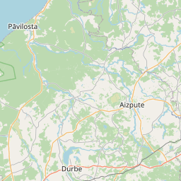
Building (cadastre designation: 62420080296004)
Cadastre designation: 62420080296004
Address: Dārza iela 4, Alsunga, Alsungas pagasts, Kuldīgas novads, LV-3306
Cadastre designation of real estate | |
|---|---|
Cadastral object type | Cadastral object type: Building |
Address | Address: Dārza iela 4, Alsunga, Alsungas pagasts, Kuldīgas novads, LV-3306 |
Address | |
|---|---|
Address ID | Address ID: 102227913 |
Companies registered at the address | Companies registered at the address: 0 |
Departments registered at the address | Departments registered at the address: 0 |
Institutions registered at the address | Institutions registered at the address: 0 |
Real estate registered at the address | |
Transactions with real estate at the address | Transactions with real estate at the address: 0 |
| Cadastral object type | Cadastre designation of the cadastral object | Person's property right status | Person status | Land Register |
|---|---|---|---|---|
| Cadastral object type: Building | 62420080296004 | Person's property right status: No data | Person status: No data | Land Register |
09.01.2025. State land service data
|
|
|
{"7201060210":{"name":"<div class='color_dot' style='background-color: #00ffff'><\/div><span>Specified land unit<\/span>","featureColor":"#00ffff","features":{"type":"FeatureCollection","features":[{"type":"Feature","geometry":{"type":"Polygon","coordinates":[[[21.653751012,56.959190673],[21.654211701,56.959055118],[21.654421483,56.958901626],[21.65479306,56.958402264],[21.655526249,56.957533135],[21.655822753,56.957189718],[21.656129606,56.957205239],[21.656511121,56.957194507],[21.656845796,56.957168769],[21.656910304,56.957163031],[21.656930301,56.95719086],[21.657840477,56.958457364],[21.657953466,56.958746171],[21.65869433,56.960496722],[21.658970208,56.960821594],[21.657021607,56.960219938],[21.653870038,56.959332486],[21.653751012,56.959190673]]]},"crs":{"type":"name","properties":{"name":"urn:ogc:def:crs:EPSG:3059"}},"properties":{"style":{"color":"#00ffff","dashArray":"8,12","weight":1},"name":"Land","object_type":"Parcel","parcel_code":"62420090184","code":null,"surveyor":null,"address":"","ownership":"<span>Owner - Natural person<br><\/span>","pro_cadastre_nr":"62420080296"}},{"type":"Feature","geometry":{"type":"Polygon","coordinates":[[[21.563897365,56.973905051],[21.56502489,56.973489001],[21.5660651,56.974679423],[21.565890623,56.974854263],[21.565410058,56.975091067],[21.565259645,56.974704869],[21.564693952,56.974751586],[21.564670211,56.974549387],[21.563920126,56.973927692],[21.563897365,56.973905051]]]},"crs":{"type":"name","properties":{"name":"urn:ogc:def:crs:EPSG:3059"}},"properties":{"style":{"color":"#00ffff","dashArray":"8,12","weight":1},"name":"Land","object_type":"Parcel","parcel_code":"62420080296","code":null,"surveyor":null,"address":"D\u0101rza iela 4, Alsunga, Alsungas pag., Kuld\u012bgas nov., LV-3306","ownership":"<span>Owner - Natural person<br><\/span>","pro_cadastre_nr":"62420080296"}},{"type":"Feature","geometry":{"type":"Polygon","coordinates":[[[21.531696464,56.98054168],[21.532253246,56.980490891],[21.533533621,56.980355911],[21.535000298,56.980231187],[21.535421431,56.980195369],[21.535398381,56.980228104],[21.535370932,56.980333366],[21.535324339,56.98071182],[21.535228415,56.981081574],[21.533636095,56.981230317],[21.532755913,56.981309899],[21.532022808,56.981413379],[21.531923118,56.981432944],[21.531899143,56.981340095],[21.531714055,56.980610858],[21.531696464,56.98054168]]]},"crs":{"type":"name","properties":{"name":"urn:ogc:def:crs:EPSG:3059"}},"properties":{"style":{"color":"#00ffff","dashArray":"8,12","weight":1},"name":"Land","object_type":"Parcel","parcel_code":"62420070089","code":null,"surveyor":null,"address":"","ownership":"<span>Owner - Natural person<br><\/span>","pro_cadastre_nr":"62420080296"}}]}},"7114100000":{"name":"<div class='color_dot' style='background-color: #b40000'><\/div><span>Burdened access road servitude area<\/span>","featureColor":"#b40000","features":{"type":"FeatureCollection","features":[{"type":"Feature","geometry":{"type":"Polygon","coordinates":[[[21.656128601,56.957232243],[21.655801024,56.95721565],[21.655823177,56.957190031],[21.656130096,56.957205805],[21.656514889,56.957195009],[21.656800229,56.957172786],[21.656909728,56.95716356],[21.656928122,56.957188635],[21.656853186,56.957195409],[21.656515833,56.957221357],[21.656128601,56.957232243]]]},"crs":{"type":"name","properties":{"name":"urn:ogc:def:crs:EPSG:3059"}},"properties":{"style":{"color":"#b40000","dashArray":"4,2,1,2","weight":1},"name":"Burdened access road servitude area","object_type":"WayRestriction","parcel_code":"62420090184","code":"7315030100006","surveyor":null,"address":"","ownership":"<span>Owner - Natural person<br><\/span>","pro_cadastre_nr":"62420080296"}},{"type":"Feature","geometry":{"type":"Polygon","coordinates":[[[21.654472107,56.958834457],[21.654511622,56.958783085],[21.656026049,56.958951846],[21.656487104,56.958961945],[21.657941395,56.958720441],[21.657961839,56.958770546],[21.656499783,56.959014646],[21.656014556,56.959005182],[21.654472107,56.958834457]]]},"crs":{"type":"name","properties":{"name":"urn:ogc:def:crs:EPSG:3059"}},"properties":{"style":{"color":"#b40000","dashArray":"4,2,1,2","weight":1},"name":"Burdened access road servitude area","object_type":"WayRestriction","parcel_code":"62420090184","code":"7315030100005","surveyor":null,"address":"","ownership":"<span>Owner - Natural person<br><\/span>","pro_cadastre_nr":"62420080296"}},{"type":"Feature","geometry":{"type":"Polygon","coordinates":[[[21.563921549,56.973928079],[21.563897543,56.97390509],[21.565024831,56.973489152],[21.565045518,56.973514332],[21.563921549,56.973928079]]]},"crs":{"type":"name","properties":{"name":"urn:ogc:def:crs:EPSG:3059"}},"properties":{"style":{"color":"#b40000","dashArray":"4,2,1,2","weight":1},"name":"Burdened access road servitude area","object_type":"WayRestriction","parcel_code":"62420080296","code":"7315030100004","surveyor":null,"address":"D\u0101rza iela 4, Alsunga, Alsungas pag., Kuld\u012bgas nov., LV-3306","ownership":"<span>Owner - Natural person<br><\/span>","pro_cadastre_nr":"62420080296"}}]}},"5201011310":{"name":"<div class='color_dot' style='background-color: #960096'><\/div><span>Vectorized building<\/span>","featureColor":"#960096","features":{"type":"FeatureCollection","features":[{"type":"Feature","geometry":{"type":"Polygon","coordinates":[[[21.565099385,56.974474094],[21.565061028,56.974412552],[21.565180785,56.974390296],[21.565219143,56.974451829],[21.565099385,56.974474094]]]},"crs":{"type":"name","properties":{"name":"urn:ogc:def:crs:EPSG:3059"}},"properties":{"style":{"color":"#960096","dashArray":"0","weight":2},"name":"Building","object_type":"Building","parcel_code":"62420080296","code":"62420080296003","surveyor":null,"address":"D\u0101rza iela 4, Alsunga, Alsungas pag., Kuld\u012bgas nov., LV-3306","ownership":"<span>Owner - Natural person<br><\/span>","pro_cadastre_nr":"62420080296"}},{"type":"Feature","geometry":{"type":"Polygon","coordinates":[[[21.565361607,56.974432882],[21.565267753,56.974450843],[21.565224481,56.974383427],[21.565318351,56.974365456],[21.565361607,56.974432882]]]},"crs":{"type":"name","properties":{"name":"urn:ogc:def:crs:EPSG:3059"}},"properties":{"style":{"color":"#960096","dashArray":"0","weight":2},"name":"Building","object_type":"Building","parcel_code":"62420080296","code":"62420080296002","surveyor":null,"address":"D\u0101rza iela 4, Alsunga, Alsungas pag., Kuld\u012bgas nov., LV-3306","ownership":"<span>Owner - Natural person<br><\/span>","pro_cadastre_nr":"62420080296"}},{"type":"Feature","geometry":{"type":"Polygon","coordinates":[[[21.565364069,56.974314241],[21.565337549,56.97427456],[21.565385616,56.97426499],[21.565345919,56.974205569],[21.565496426,56.974175589],[21.565562627,56.974274691],[21.565364069,56.974314241]]]},"crs":{"type":"name","properties":{"name":"urn:ogc:def:crs:EPSG:3059"}},"properties":{"style":{"color":"#960096","dashArray":"0","weight":2},"name":"Building","object_type":"Building","parcel_code":"62420080296","code":"62420080296001","surveyor":null,"address":"D\u0101rza iela 4, Alsunga, Alsungas pag., Kuld\u012bgas nov., LV-3306","ownership":"<span>Owner - Natural person<br><\/span>","pro_cadastre_nr":"62420080296"}},{"type":"Feature","geometry":{"type":"Polygon","coordinates":[[[21.564983384,56.974466048],[21.564940679,56.974389952],[21.565011141,56.974378159],[21.565053846,56.974454255],[21.564983384,56.974466048]]]},"crs":{"type":"name","properties":{"name":"urn:ogc:def:crs:EPSG:3059"}},"properties":{"style":{"color":"#960096","dashArray":"0","weight":2},"name":"Building","object_type":"Building","parcel_code":"62420080296","code":"62420080296004","surveyor":null,"address":"D\u0101rza iela 4, Alsunga, Alsungas pag., Kuld\u012bgas nov., LV-3306","ownership":"<span>Owner - Natural person<br><\/span>","pro_cadastre_nr":"62420080296"}},{"type":"Feature","geometry":{"type":"Polygon","coordinates":[[[21.564983384,56.974466048],[21.564940679,56.974389952],[21.565011141,56.974378159],[21.565053846,56.974454255],[21.564983384,56.974466048]]]},"crs":{"type":"name","properties":{"name":"urn:ogc:def:crs:EPSG:3059"}},"properties":{"style":{"color":"#960096","dashArray":"0","weight":2},"name":"Building","object_type":"Building","parcel_code":"62420080296","code":"62420080296004","surveyor":null,"address":"D\u0101rza iela 4, Alsunga, Alsungas pag., Kuld\u012bgas nov., LV-3306","ownership":"<span>Owner - Natural person<br><\/span>","pro_cadastre_nr":"62420080296"}},{"type":"Feature","geometry":{"type":"Polygon","coordinates":[[[21.565099385,56.974474094],[21.565061028,56.974412552],[21.565180785,56.974390296],[21.565219143,56.974451829],[21.565099385,56.974474094]]]},"crs":{"type":"name","properties":{"name":"urn:ogc:def:crs:EPSG:3059"}},"properties":{"style":{"color":"#960096","dashArray":"0","weight":2},"name":"Building","object_type":"Building","parcel_code":"62420080296","code":"62420080296003","surveyor":null,"address":"D\u0101rza iela 4, Alsunga, Alsungas pag., Kuld\u012bgas nov., LV-3306","ownership":"<span>Owner - Natural person<br><\/span>","pro_cadastre_nr":"62420080296"}},{"type":"Feature","geometry":{"type":"Polygon","coordinates":[[[21.565361607,56.974432882],[21.565267753,56.974450843],[21.565224481,56.974383427],[21.565318351,56.974365456],[21.565361607,56.974432882]]]},"crs":{"type":"name","properties":{"name":"urn:ogc:def:crs:EPSG:3059"}},"properties":{"style":{"color":"#960096","dashArray":"0","weight":2},"name":"Building","object_type":"Building","parcel_code":"62420080296","code":"62420080296002","surveyor":null,"address":"D\u0101rza iela 4, Alsunga, Alsungas pag., Kuld\u012bgas nov., LV-3306","ownership":"<span>Owner - Natural person<br><\/span>","pro_cadastre_nr":"62420080296"}},{"type":"Feature","geometry":{"type":"Polygon","coordinates":[[[21.565364069,56.974314241],[21.565337549,56.97427456],[21.565385616,56.97426499],[21.565345919,56.974205569],[21.565496426,56.974175589],[21.565562627,56.974274691],[21.565364069,56.974314241]]]},"crs":{"type":"name","properties":{"name":"urn:ogc:def:crs:EPSG:3059"}},"properties":{"style":{"color":"#960096","dashArray":"0","weight":2},"name":"Building","object_type":"Building","parcel_code":"62420080296","code":"62420080296001","surveyor":null,"address":"D\u0101rza iela 4, Alsunga, Alsungas pag., Kuld\u012bgas nov., LV-3306","ownership":"<span>Owner - Natural person<br><\/span>","pro_cadastre_nr":"62420080296"}}]}}}
[]
https://tile.openstreetmap.org/{z}/{x}/{y}.png|© OpenStreetMap contributors|minZoom: 7|maxZoom: 19
|
Building data updated: 12.01.2025.
Data source and license: Cadastre Information System open text and spatial data, Real Estate Market Database open data, open data license Creative Commons Attribution, OpenStreetMap

