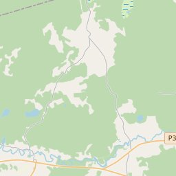
Building (cadastre designation: 50640160120006)
Cadastre designation: 50640160120006
Address: "Kalniņi 2", Lejasciema pagasts, Gulbenes novads, LV-4412
Cadastre designation of real estate | |
|---|---|
Cadastral object type | Cadastral object type: Building |
Address | Address: "Kalniņi 2", Lejasciema pagasts, Gulbenes novads, LV-4412 |
Address | |
|---|---|
Address ID | Address ID: 104250186 |
Companies registered at the address | Companies registered at the address: 0 |
Departments registered at the address | Departments registered at the address: 0 |
Institutions registered at the address | Institutions registered at the address: 0 |
Real estate registered at the address | |
Transactions with real estate at the address | Transactions with real estate at the address: 0 |
| Cadastral object type | Cadastre designation of the cadastral object | Person's property right status | Person status | Land Register |
|---|---|---|---|---|
| Cadastral object type: Building | 50640160120006 | Person's property right status: No data | Person status: No data | Land Register |
17.12.2024. State land service data
|
|
|
{"7201060210":{"name":"<div class='color_dot' style='background-color: #00ffff'><\/div><span>Specified land unit<\/span>","featureColor":"#00ffff","features":{"type":"FeatureCollection","features":[{"type":"Feature","geometry":{"type":"Polygon","coordinates":[[[26.498799011,57.26007109],[26.498869017,57.259936272],[26.499622331,57.259959712],[26.500515855,57.259997971],[26.500845036,57.2600118],[26.500994884,57.260008816],[26.501169074,57.260118544],[26.501763559,57.260508114],[26.501882369,57.260580032],[26.502553608,57.260732547],[26.502932939,57.260824966],[26.502828014,57.260895894],[26.502439247,57.261219071],[26.502297879,57.261372324],[26.502297183,57.261376481],[26.502043228,57.261511477],[26.501906331,57.26160159],[26.501652759,57.261684321],[26.501367456,57.261694855],[26.500877538,57.261719176],[26.50068445,57.261752289],[26.500237435,57.261462695],[26.499794609,57.261159176],[26.499311938,57.260797882],[26.499018688,57.260447458],[26.498853094,57.260257431],[26.498806634,57.260102095],[26.498799011,57.26007109]]]},"crs":{"type":"name","properties":{"name":"urn:ogc:def:crs:EPSG:3059"}},"properties":{"style":{"color":"#00ffff","dashArray":"8,12","weight":1},"name":"Land","object_type":"Parcel","parcel_code":"50640160122","code":null,"surveyor":null,"address":"","ownership":"<span>Owner - Natural person<br><\/span>","pro_cadastre_nr":"50640160120"}},{"type":"Feature","geometry":{"type":"Polygon","coordinates":[[[26.472773809,57.26126899],[26.473182122,57.260911194],[26.473182388,57.260911216],[26.473560796,57.260943001],[26.474148103,57.261030989],[26.474846841,57.261249727],[26.475454038,57.261550461],[26.475818831,57.261766706],[26.476395489,57.262192332],[26.476771859,57.262484732],[26.475298711,57.262998988],[26.474368766,57.262229759],[26.47295072,57.26150979],[26.472915066,57.26152541],[26.472773809,57.26126899]]]},"crs":{"type":"name","properties":{"name":"urn:ogc:def:crs:EPSG:3059"}},"properties":{"style":{"color":"#00ffff","dashArray":"8,12","weight":1},"name":"Land","object_type":"Parcel","parcel_code":"50640160121","code":null,"surveyor":null,"address":"","ownership":"<span>Owner - Natural person<br><\/span>","pro_cadastre_nr":"50640160120"}},{"type":"Feature","geometry":{"type":"Polygon","coordinates":[[[26.472705402,57.259571593],[26.474840955,57.259942618],[26.47737408,57.259139872],[26.477445392,57.259118453],[26.478023628,57.258944795],[26.480628913,57.259334348],[26.480106842,57.259714581],[26.479786086,57.260017337],[26.479450193,57.260153185],[26.47918786,57.260295893],[26.47872327,57.260498615],[26.478494635,57.260584625],[26.477987465,57.260711779],[26.477716107,57.260779274],[26.477718694,57.260817785],[26.475683255,57.261553242],[26.475571336,57.261486897],[26.474945337,57.261176847],[26.474212686,57.26094749],[26.473595695,57.260855054],[26.473355916,57.26083491],[26.472705402,57.259571593]]]},"crs":{"type":"name","properties":{"name":"urn:ogc:def:crs:EPSG:3059"}},"properties":{"style":{"color":"#00ffff","dashArray":"8,12","weight":1},"name":"Land","object_type":"Parcel","parcel_code":"50640160120","code":null,"surveyor":null,"address":"\"Kalni\u0146i 2\", Lejasciema pag., Gulbenes nov., LV-4412","ownership":"<span>Owner - Natural person<br><\/span>","pro_cadastre_nr":"50640160120"}}]}},"7114100000":{"name":"<div class='color_dot' style='background-color: #b40000'><\/div><span>Burdened access road servitude area<\/span>","featureColor":"#b40000","features":{"type":"FeatureCollection","features":[{"type":"Feature","geometry":{"type":"Polygon","coordinates":[[[26.498869017,57.259936272],[26.498908019,57.259939172],[26.498829655,57.260072511],[26.498887798,57.260254898],[26.499061813,57.260445099],[26.499345786,57.260789561],[26.499835927,57.261159522],[26.500277571,57.261458562],[26.500726364,57.261745029],[26.50068445,57.261752289],[26.500237435,57.261462695],[26.499794609,57.261159176],[26.499311938,57.260797882],[26.499018688,57.260447458],[26.498853094,57.260257431],[26.498806634,57.260102095],[26.498802815,57.260086597],[26.498799011,57.26007109],[26.498869017,57.259936272]]]},"crs":{"type":"name","properties":{"name":"urn:ogc:def:crs:EPSG:3059"}},"properties":{"style":{"color":"#b40000","dashArray":"4,2,1,2","weight":1},"name":"Burdened access road servitude area","object_type":"WayRestriction","parcel_code":"50640160122","code":"7315030100002","surveyor":null,"address":"","ownership":"<span>Owner - Natural person<br><\/span>","pro_cadastre_nr":"50640160120"}},{"type":"Feature","geometry":{"type":"Polygon","coordinates":[[[26.474348622,57.260987984],[26.474212686,57.26094749],[26.475416818,57.260899451],[26.475569375,57.260857434],[26.476491784,57.260824875],[26.477326801,57.26079193],[26.477620495,57.260762405],[26.478487485,57.260550779],[26.478680921,57.260469588],[26.479152692,57.26027156],[26.479300676,57.260174684],[26.479400626,57.260117201],[26.479722764,57.259986918],[26.480034974,57.259692221],[26.480543274,57.259321742],[26.480628913,57.259334348],[26.480106842,57.259714581],[26.479786086,57.260017337],[26.479450193,57.260153185],[26.47918786,57.260295893],[26.47872327,57.260498615],[26.478494635,57.260584625],[26.477987465,57.260711779],[26.477716107,57.260779274],[26.477718694,57.260817785],[26.477347315,57.260854405],[26.476533476,57.26088341],[26.475587179,57.260919846],[26.475453375,57.26094698],[26.474348622,57.260987984]]]},"crs":{"type":"name","properties":{"name":"urn:ogc:def:crs:EPSG:3059"}},"properties":{"style":{"color":"#b40000","dashArray":"4,2,1,2","weight":1},"name":"Burdened access road servitude area","object_type":"WayRestriction","parcel_code":"50640160120","code":"7315030100001","surveyor":null,"address":"\"Kalni\u0146i 2\", Lejasciema pag., Gulbenes nov., LV-4412","ownership":"<span>Owner - Natural person<br><\/span>","pro_cadastre_nr":"50640160120"}}]}},"5201011310":{"name":"<div class='color_dot' style='background-color: #960096'><\/div><span>Vectorized building<\/span>","featureColor":"#960096","features":{"type":"FeatureCollection","features":[{"type":"Feature","geometry":{"type":"Polygon","coordinates":[[[26.47581199,57.261004311],[26.475772712,57.26095751],[26.475770586,57.260954991],[26.475936747,57.260914044],[26.475978135,57.260963365],[26.47581199,57.261004311]]]},"crs":{"type":"name","properties":{"name":"urn:ogc:def:crs:EPSG:3059"}},"properties":{"style":{"color":"#960096","dashArray":"0","weight":2},"name":"Building","object_type":"Building","parcel_code":"50640160120","code":"50640160120008","surveyor":null,"address":"\"Kalni\u0146i 2\", Lejasciema pag., Gulbenes nov., LV-4412","ownership":null,"pro_cadastre_nr":null}},{"type":"Feature","geometry":{"type":"Polygon","coordinates":[[[26.474978158,57.261179579],[26.474870505,57.26105418],[26.475026788,57.261014786],[26.475134441,57.261140185],[26.474978158,57.261179579]]]},"crs":{"type":"name","properties":{"name":"urn:ogc:def:crs:EPSG:3059"}},"properties":{"style":{"color":"#960096","dashArray":"0","weight":2},"name":"Building","object_type":"Building","parcel_code":"50640160120","code":"50640160120006","surveyor":null,"address":"\"Kalni\u0146i 2\", Lejasciema pag., Gulbenes nov., LV-4412","ownership":"<span>Owner - Natural person<br><\/span>","pro_cadastre_nr":"50640160120"}},{"type":"Feature","geometry":{"type":"Polygon","coordinates":[[[26.47545921,57.261077665],[26.475420999,57.261017596],[26.475558581,57.260991898],[26.475596792,57.261051975],[26.47545921,57.261077665]]]},"crs":{"type":"name","properties":{"name":"urn:ogc:def:crs:EPSG:3059"}},"properties":{"style":{"color":"#960096","dashArray":"0","weight":2},"name":"Building","object_type":"Building","parcel_code":"50640160120","code":"50640160120003","surveyor":null,"address":"\"Kalni\u0146i 2\", Lejasciema pag., Gulbenes nov., LV-4412","ownership":"<span>Owner - Natural person<br><\/span>","pro_cadastre_nr":"50640160120"}},{"type":"Feature","geometry":{"type":"Polygon","coordinates":[[[26.475020741,57.260901926],[26.474935558,57.260820748],[26.475031861,57.260791073],[26.475117044,57.260872251],[26.475020741,57.260901926]]]},"crs":{"type":"name","properties":{"name":"urn:ogc:def:crs:EPSG:3059"}},"properties":{"style":{"color":"#960096","dashArray":"0","weight":2},"name":"Building","object_type":"Building","parcel_code":"50640160120","code":"50640160120004","surveyor":null,"address":"\"Kalni\u0146i 2\", Lejasciema pag., Gulbenes nov., LV-4412","ownership":"<span>Owner - Natural person<br><\/span>","pro_cadastre_nr":"50640160120"}},{"type":"Feature","geometry":{"type":"Polygon","coordinates":[[[26.475666939,57.261040051],[26.475627661,57.26099325],[26.475772712,57.26095751],[26.47581199,57.261004311],[26.475666939,57.261040051]]]},"crs":{"type":"name","properties":{"name":"urn:ogc:def:crs:EPSG:3059"}},"properties":{"style":{"color":"#960096","dashArray":"0","weight":2},"name":"Building","object_type":"Building","parcel_code":"50640160120","code":"50640160120002","surveyor":null,"address":"\"Kalni\u0146i 2\", Lejasciema pag., Gulbenes nov., LV-4412","ownership":"<span>Owner - Natural person<br><\/span>","pro_cadastre_nr":"50640160120"}},{"type":"Feature","geometry":{"type":"Polygon","coordinates":[[[26.476125214,57.26099146],[26.476124175,57.260946081],[26.476218462,57.260945435],[26.476219502,57.260990824],[26.476125214,57.26099146]]]},"crs":{"type":"name","properties":{"name":"urn:ogc:def:crs:EPSG:3059"}},"properties":{"style":{"color":"#960096","dashArray":"0","weight":2},"name":"Building","object_type":"Building","parcel_code":"50640160120","code":"50640160120009","surveyor":null,"address":"\"Kalni\u0146i 2\", Lejasciema pag., Gulbenes nov., LV-4412","ownership":null,"pro_cadastre_nr":null}},{"type":"Feature","geometry":{"type":"Polygon","coordinates":[[[26.476271913,57.260380698],[26.476270874,57.260335318],[26.476365159,57.260334672],[26.4763662,57.260380061],[26.476271913,57.260380698]]]},"crs":{"type":"name","properties":{"name":"urn:ogc:def:crs:EPSG:3059"}},"properties":{"style":{"color":"#960096","dashArray":"0","weight":2},"name":"Building","object_type":"Building","parcel_code":"50640160120","code":"50640160120005","surveyor":null,"address":"\"Kalni\u0146i 2\", Lejasciema pag., Gulbenes nov., LV-4412","ownership":"<span>Owner - Natural person<br><\/span>","pro_cadastre_nr":"50640160120"}},{"type":"Feature","geometry":{"type":"Polygon","coordinates":[[[26.475892057,57.260800948],[26.47576033,57.260845916],[26.475647391,57.260748777],[26.475779117,57.2607038],[26.475892057,57.260800948]]]},"crs":{"type":"name","properties":{"name":"urn:ogc:def:crs:EPSG:3059"}},"properties":{"style":{"color":"#960096","dashArray":"0","weight":2},"name":"Building","object_type":"Building","parcel_code":"50640160120","code":"50640160120001","surveyor":null,"address":"\"Kalni\u0146i 2\", Lejasciema pag., Gulbenes nov., LV-4412","ownership":"<span>Owner - Natural person<br><\/span>","pro_cadastre_nr":"50640160120"}},{"type":"Feature","geometry":{"type":"Polygon","coordinates":[[[26.474978158,57.261179579],[26.474870505,57.26105418],[26.475026788,57.261014786],[26.475134441,57.261140185],[26.474978158,57.261179579]]]},"crs":{"type":"name","properties":{"name":"urn:ogc:def:crs:EPSG:3059"}},"properties":{"style":{"color":"#960096","dashArray":"0","weight":2},"name":"Building","object_type":"Building","parcel_code":"50640160120","code":"50640160120006","surveyor":null,"address":"\"Kalni\u0146i 2\", Lejasciema pag., Gulbenes nov., LV-4412","ownership":"<span>Owner - Natural person<br><\/span>","pro_cadastre_nr":"50640160120"}},{"type":"Feature","geometry":{"type":"Polygon","coordinates":[[[26.476271913,57.260380698],[26.476270874,57.260335318],[26.476365159,57.260334672],[26.4763662,57.260380061],[26.476271913,57.260380698]]]},"crs":{"type":"name","properties":{"name":"urn:ogc:def:crs:EPSG:3059"}},"properties":{"style":{"color":"#960096","dashArray":"0","weight":2},"name":"Building","object_type":"Building","parcel_code":"50640160120","code":"50640160120005","surveyor":null,"address":"\"Kalni\u0146i 2\", Lejasciema pag., Gulbenes nov., LV-4412","ownership":"<span>Owner - Natural person<br><\/span>","pro_cadastre_nr":"50640160120"}},{"type":"Feature","geometry":{"type":"Polygon","coordinates":[[[26.475020741,57.260901926],[26.474935558,57.260820748],[26.475031861,57.260791073],[26.475117044,57.260872251],[26.475020741,57.260901926]]]},"crs":{"type":"name","properties":{"name":"urn:ogc:def:crs:EPSG:3059"}},"properties":{"style":{"color":"#960096","dashArray":"0","weight":2},"name":"Building","object_type":"Building","parcel_code":"50640160120","code":"50640160120004","surveyor":null,"address":"\"Kalni\u0146i 2\", Lejasciema pag., Gulbenes nov., LV-4412","ownership":"<span>Owner - Natural person<br><\/span>","pro_cadastre_nr":"50640160120"}},{"type":"Feature","geometry":{"type":"Polygon","coordinates":[[[26.47545921,57.261077665],[26.475420999,57.261017596],[26.475558581,57.260991898],[26.475596792,57.261051975],[26.47545921,57.261077665]]]},"crs":{"type":"name","properties":{"name":"urn:ogc:def:crs:EPSG:3059"}},"properties":{"style":{"color":"#960096","dashArray":"0","weight":2},"name":"Building","object_type":"Building","parcel_code":"50640160120","code":"50640160120003","surveyor":null,"address":"\"Kalni\u0146i 2\", Lejasciema pag., Gulbenes nov., LV-4412","ownership":"<span>Owner - Natural person<br><\/span>","pro_cadastre_nr":"50640160120"}},{"type":"Feature","geometry":{"type":"Polygon","coordinates":[[[26.475666939,57.261040051],[26.475627661,57.26099325],[26.475772712,57.26095751],[26.47581199,57.261004311],[26.475666939,57.261040051]]]},"crs":{"type":"name","properties":{"name":"urn:ogc:def:crs:EPSG:3059"}},"properties":{"style":{"color":"#960096","dashArray":"0","weight":2},"name":"Building","object_type":"Building","parcel_code":"50640160120","code":"50640160120002","surveyor":null,"address":"\"Kalni\u0146i 2\", Lejasciema pag., Gulbenes nov., LV-4412","ownership":"<span>Owner - Natural person<br><\/span>","pro_cadastre_nr":"50640160120"}},{"type":"Feature","geometry":{"type":"Polygon","coordinates":[[[26.475892057,57.260800948],[26.47576033,57.260845916],[26.475647391,57.260748777],[26.475779117,57.2607038],[26.475892057,57.260800948]]]},"crs":{"type":"name","properties":{"name":"urn:ogc:def:crs:EPSG:3059"}},"properties":{"style":{"color":"#960096","dashArray":"0","weight":2},"name":"Building","object_type":"Building","parcel_code":"50640160120","code":"50640160120001","surveyor":null,"address":"\"Kalni\u0146i 2\", Lejasciema pag., Gulbenes nov., LV-4412","ownership":"<span>Owner - Natural person<br><\/span>","pro_cadastre_nr":"50640160120"}}]}}}
[]
https://tile.openstreetmap.org/{z}/{x}/{y}.png|© OpenStreetMap contributors|minZoom: 7|maxZoom: 19
|
Building data updated: 29.12.2024.
Data source and license: Cadastre Information System open text and spatial data, Real Estate Market Database open data, open data license Creative Commons Attribution, OpenStreetMap

