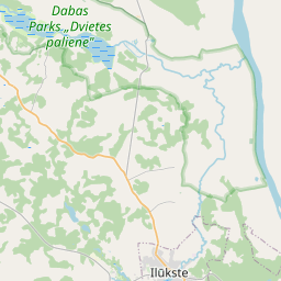
Building (cadastre designation: 44800050231005)
Cadastre designation: 44800050231005
Address: "Spodri", Doļnaja, Pilskalnes pagasts, Augšdaugavas novads, LV-5447
Cadastre designation of real estate | |
|---|---|
Cadastral object type | Cadastral object type: Building |
Address | Address: "Spodri", Doļnaja, Pilskalnes pagasts, Augšdaugavas novads, LV-5447 |
Address | |
|---|---|
Address ID | Address ID: 103567451 |
Companies registered at the address | Companies registered at the address: 0 |
Departments registered at the address | Departments registered at the address: 0 |
Institutions registered at the address | Institutions registered at the address: 0 |
Real estate registered at the address | |
Transactions with real estate at the address | Transactions with real estate at the address: 0 |
| Cadastral object type | Cadastre designation of the cadastral object | Person's property right status | Person status | Land Register |
|---|---|---|---|---|
| Cadastral object type: Building | 44800050231005 | Person's property right status: No data | Person status: No data | Land Register |
22.01.2025. State land service data
|
|
|
{"7201070000":{"name":"<div class='color_dot' style='background-color: #00ff00'><\/div><span>Areas with initiated surveying<\/span>","featureColor":"#00ff00","features":{"type":"FeatureCollection","features":[{"type":"Feature","geometry":{"type":"Polygon","coordinates":[[[26.325932506,56.019864915],[26.326628761,56.019546179],[26.326693337,56.019516622],[26.328286136,56.020527096],[26.330128021,56.021682543],[26.330100379,56.022304628],[26.330016976,56.022416492],[26.329838001,56.022318627],[26.329398134,56.02204361],[26.32844985,56.02145069],[26.327551358,56.020900684],[26.325932506,56.019864915]]]},"crs":{"type":"name","properties":{"name":"urn:ogc:def:crs:EPSG:3059"}},"properties":{"style":{"color":"#00ff00","dashArray":"0","weight":1},"name":"Areas with initiated surveying","object_type":"SurveyingStatus","parcel_code":"44800050233","code":null,"surveyor":"GEO Latgale SIA, 26.09.2023.","address":"","ownership":"<span>User - Natural person<br><\/span>","pro_cadastre_nr":"44800050231"}},{"type":"Feature","geometry":{"type":"Polygon","coordinates":[[[26.325932506,56.019864915],[26.326628761,56.019546179],[26.326693337,56.019516622],[26.328286136,56.020527096],[26.330128021,56.021682543],[26.330100379,56.022304628],[26.330016976,56.022416492],[26.329838001,56.022318627],[26.329398134,56.02204361],[26.32844985,56.02145069],[26.327551358,56.020900684],[26.325932506,56.019864915]]]},"crs":{"type":"name","properties":{"name":"urn:ogc:def:crs:EPSG:3059"}},"properties":{"style":{"color":"#00ff00","dashArray":"0","weight":1},"name":"Areas with initiated surveying","object_type":"SurveyingStatus","parcel_code":"44800050233","code":null,"surveyor":"GEO Latgale SIA, 26.09.2023.","address":"","ownership":"<span>User - Natural person<br><\/span>","pro_cadastre_nr":"44800050231"}},{"type":"Feature","geometry":{"type":"Polygon","coordinates":[[[26.309749907,56.012547995],[26.309754236,56.012327051],[26.309969879,56.01232914],[26.315728996,56.012384773],[26.31597725,56.012625285],[26.315382111,56.012701678],[26.315096893,56.012850172],[26.315218312,56.014230304],[26.313047854,56.014045525],[26.313319012,56.013411264],[26.310124346,56.013386673],[26.309959819,56.012970562],[26.309875671,56.012730919],[26.309875498,56.012730437],[26.309875309,56.012729955],[26.309825494,56.012611209],[26.309822521,56.012606294],[26.30981792,56.012601797],[26.309749907,56.012547995]]]},"crs":{"type":"name","properties":{"name":"urn:ogc:def:crs:EPSG:3059"}},"properties":{"style":{"color":"#00ff00","dashArray":"0","weight":1},"name":"Areas with initiated surveying","object_type":"SurveyingStatus","parcel_code":"44800050232","code":null,"surveyor":"GEO Latgale SIA, 26.09.2023.","address":"","ownership":"<span>User - Natural person<br><\/span>","pro_cadastre_nr":"44800050231"}},{"type":"Feature","geometry":{"type":"Polygon","coordinates":[[[26.309749907,56.012547995],[26.309754236,56.012327051],[26.309969879,56.01232914],[26.315728996,56.012384773],[26.31597725,56.012625285],[26.315382111,56.012701678],[26.315096893,56.012850172],[26.315218312,56.014230304],[26.313047854,56.014045525],[26.313319012,56.013411264],[26.310124346,56.013386673],[26.309959819,56.012970562],[26.309875671,56.012730919],[26.309875498,56.012730437],[26.309875309,56.012729955],[26.309825494,56.012611209],[26.309822521,56.012606294],[26.30981792,56.012601797],[26.309749907,56.012547995]]]},"crs":{"type":"name","properties":{"name":"urn:ogc:def:crs:EPSG:3059"}},"properties":{"style":{"color":"#00ff00","dashArray":"0","weight":1},"name":"Areas with initiated surveying","object_type":"SurveyingStatus","parcel_code":"44800050232","code":null,"surveyor":"GEO Latgale SIA, 26.09.2023.","address":"","ownership":"<span>User - Natural person<br><\/span>","pro_cadastre_nr":"44800050231"}},{"type":"Feature","geometry":{"type":"Polygon","coordinates":[[[26.297807137,56.010349731],[26.29787792,56.010143089],[26.298024862,56.009082945],[26.298028555,56.009056255],[26.298056208,56.008316335],[26.29809442,56.00832497],[26.301002406,56.008981875],[26.301002527,56.009411769],[26.301002471,56.009412184],[26.3010024,56.009412599],[26.300792886,56.010463237],[26.300389023,56.010432837],[26.299578207,56.010395601],[26.297856546,56.010351012],[26.297807137,56.010349731]]]},"crs":{"type":"name","properties":{"name":"urn:ogc:def:crs:EPSG:3059"}},"properties":{"style":{"color":"#00ff00","dashArray":"0","weight":1},"name":"Areas with initiated surveying","object_type":"SurveyingStatus","parcel_code":"44800050231","code":null,"surveyor":"GEO Latgale SIA, 26.09.2023.","address":"\"Spodri\", Do\u013cnaja, Pilskalnes pag., Aug\u0161daugavas nov., LV-5447","ownership":"<span>User - Natural person<br><\/span>","pro_cadastre_nr":"44800050231"}},{"type":"Feature","geometry":{"type":"Polygon","coordinates":[[[26.297807137,56.010349731],[26.29787792,56.010143089],[26.298024862,56.009082945],[26.298028555,56.009056255],[26.298056208,56.008316335],[26.29809442,56.00832497],[26.301002406,56.008981875],[26.301002527,56.009411769],[26.301002471,56.009412184],[26.3010024,56.009412599],[26.300792886,56.010463237],[26.300389023,56.010432837],[26.299578207,56.010395601],[26.297856546,56.010351012],[26.297807137,56.010349731]]]},"crs":{"type":"name","properties":{"name":"urn:ogc:def:crs:EPSG:3059"}},"properties":{"style":{"color":"#00ff00","dashArray":"0","weight":1},"name":"Areas with initiated surveying","object_type":"SurveyingStatus","parcel_code":"44800050231","code":null,"surveyor":"GEO Latgale SIA, 26.09.2023.","address":"\"Spodri\", Do\u013cnaja, Pilskalnes pag., Aug\u0161daugavas nov., LV-5447","ownership":"<span>User - Natural person<br><\/span>","pro_cadastre_nr":"44800050231"}}]}},"7201060110":{"name":"<div class='color_dot' style='background-color: #00ffff'><\/div><span>Measured land unit<\/span>","featureColor":"#00ffff","features":{"type":"FeatureCollection","features":[{"type":"Feature","geometry":{"type":"Polygon","coordinates":[[[26.325901733,56.019862601],[26.326639679,56.019529741],[26.326669472,56.019516299],[26.326891263,56.019654048],[26.327971605,56.020342298],[26.328460976,56.020658314],[26.329487189,56.021307794],[26.32998586,56.02161846],[26.330087182,56.021672997],[26.330128021,56.021682543],[26.330100379,56.022304628],[26.330016976,56.022416492],[26.329838001,56.022318627],[26.329398134,56.02204361],[26.32844985,56.02145069],[26.328043389,56.021203232],[26.327230566,56.020711832],[26.326752655,56.020409841],[26.326180963,56.020052744],[26.325943493,56.019893378],[26.325901733,56.019862601]]]},"crs":{"type":"name","properties":{"name":"urn:ogc:def:crs:EPSG:3059"}},"properties":{"style":{"color":"#00ffff","dashArray":"0","weight":1},"name":"Land","object_type":"Parcel","parcel_code":"44800050233","code":null,"surveyor":null,"address":"","ownership":"<span>User - Natural person<br><\/span>","pro_cadastre_nr":"44800050231"}},{"type":"Feature","geometry":{"type":"Polygon","coordinates":[[[26.309702573,56.012461117],[26.309847253,56.012310829],[26.315531251,56.012398131],[26.315663751,56.012400163],[26.315950744,56.012614018],[26.315832408,56.012621867],[26.314989717,56.012677751],[26.314967045,56.012713112],[26.31497984,56.012719415],[26.315012463,56.012970997],[26.315051492,56.013291564],[26.315095029,56.013688532],[26.315136217,56.014030656],[26.315159905,56.014224867],[26.315115745,56.014220762],[26.31321491,56.01406912],[26.313148683,56.014063837],[26.31347717,56.013410337],[26.313357276,56.013409639],[26.310153658,56.013390941],[26.310080495,56.01320607],[26.30999334,56.013001805],[26.309927507,56.012816877],[26.309891541,56.012685549],[26.309873234,56.012633125],[26.309841132,56.012573249],[26.309785381,56.012515235],[26.309702573,56.012461117]]]},"crs":{"type":"name","properties":{"name":"urn:ogc:def:crs:EPSG:3059"}},"properties":{"style":{"color":"#00ffff","dashArray":"0","weight":1},"name":"Land","object_type":"Parcel","parcel_code":"44800050232","code":null,"surveyor":null,"address":"","ownership":"<span>User - Natural person<br><\/span>","pro_cadastre_nr":"44800050231"}},{"type":"Feature","geometry":{"type":"Polygon","coordinates":[[[26.297788161,56.010178501],[26.29781673,56.009906407],[26.297846921,56.009632998],[26.297867998,56.009445474],[26.297917555,56.009232891],[26.297936612,56.009137779],[26.297942461,56.009081758],[26.297952117,56.008989347],[26.297987104,56.008628695],[26.298009157,56.008442221],[26.298056208,56.008316335],[26.29809442,56.00832497],[26.301002406,56.008981875],[26.300792886,56.010463237],[26.300389023,56.010432837],[26.299578207,56.010395601],[26.297856546,56.010351012],[26.297807137,56.010349731],[26.297788161,56.010178501]]]},"crs":{"type":"name","properties":{"name":"urn:ogc:def:crs:EPSG:3059"}},"properties":{"style":{"color":"#00ffff","dashArray":"0","weight":1},"name":"Land","object_type":"Parcel","parcel_code":"44800050231","code":null,"surveyor":null,"address":"\"Spodri\", Do\u013cnaja, Pilskalnes pag., Aug\u0161daugavas nov., LV-5447","ownership":"<span>User - Natural person<br><\/span>","pro_cadastre_nr":"44800050231"}}]}},"5201011310":{"name":"<div class='color_dot' style='background-color: #960096'><\/div><span>Vectorized building<\/span>","featureColor":"#960096","features":{"type":"FeatureCollection","features":[{"type":"Feature","geometry":{"type":"Polygon","coordinates":[[[26.300105674,56.009530174],[26.300098801,56.009414541],[26.300213699,56.009412397],[26.300220573,56.00952803],[26.300105674,56.009530174]]]},"crs":{"type":"name","properties":{"name":"urn:ogc:def:crs:EPSG:3059"}},"properties":{"style":{"color":"#960096","dashArray":"0","weight":2},"name":"Building","object_type":"Building","parcel_code":"44800050231","code":"44800050231005","surveyor":null,"address":"\"Spodri\", Do\u013cnaja, Pilskalnes pag., Aug\u0161daugavas nov., LV-5447","ownership":"<span>User - Natural person<br><\/span>","pro_cadastre_nr":"44800050231"}},{"type":"Feature","geometry":{"type":"Polygon","coordinates":[[[26.300105674,56.009530174],[26.300098801,56.009414541],[26.300213699,56.009412397],[26.300220573,56.00952803],[26.300105674,56.009530174]]]},"crs":{"type":"name","properties":{"name":"urn:ogc:def:crs:EPSG:3059"}},"properties":{"style":{"color":"#960096","dashArray":"0","weight":2},"name":"Building","object_type":"Building","parcel_code":"44800050231","code":"44800050231005","surveyor":null,"address":"\"Spodri\", Do\u013cnaja, Pilskalnes pag., Aug\u0161daugavas nov., LV-5447","ownership":"<span>User - Natural person<br><\/span>","pro_cadastre_nr":"44800050231"}}]}},"5201011110":{"name":"<div class='color_dot' style='background-color: #ff0000'><\/div><span>Measured building<\/span>","featureColor":"#ff0000","features":{"type":"FeatureCollection","features":[{"type":"Feature","geometry":{"type":"Polygon","coordinates":[[[26.300082919,56.009429928],[26.300092334,56.009380778],[26.300204713,56.009387535],[26.300194445,56.009436637],[26.300082919,56.009429928]]]},"crs":{"type":"name","properties":{"name":"urn:ogc:def:crs:EPSG:3059"}},"properties":{"style":{"color":"#ff0000","dashArray":"0","weight":1},"name":"Building","object_type":"Building","parcel_code":"44800050231","code":"44800050231004","surveyor":null,"address":"\"Spodri\", Do\u013cnaja, Pilskalnes pag., Aug\u0161daugavas nov., LV-5447","ownership":"<span>User - Natural person<br><\/span>","pro_cadastre_nr":"44800050231"}},{"type":"Feature","geometry":{"type":"Polygon","coordinates":[[[26.300373153,56.00915695],[26.300382203,56.009110046],[26.300462384,56.009114904],[26.300456412,56.00914587],[26.300476892,56.009147105],[26.300473813,56.009163044],[26.300373153,56.00915695]]]},"crs":{"type":"name","properties":{"name":"urn:ogc:def:crs:EPSG:3059"}},"properties":{"style":{"color":"#ff0000","dashArray":"0","weight":1},"name":"Building","object_type":"Building","parcel_code":"44800050231","code":"44800050231003","surveyor":null,"address":"\"Spodri\", Do\u013cnaja, Pilskalnes pag., Aug\u0161daugavas nov., LV-5447","ownership":"<span>User - Natural person<br><\/span>","pro_cadastre_nr":"44800050231"}},{"type":"Feature","geometry":{"type":"Polygon","coordinates":[[[26.300422284,56.009301202],[26.300449054,56.00925793],[26.300483088,56.009264539],[26.300497855,56.009240653],[26.300572341,56.009256043],[26.300591365,56.009227134],[26.300648488,56.009239199],[26.300629611,56.009267881],[26.300710805,56.009284655],[26.300670733,56.00934944],[26.300422284,56.009301202]]]},"crs":{"type":"name","properties":{"name":"urn:ogc:def:crs:EPSG:3059"}},"properties":{"style":{"color":"#ff0000","dashArray":"0","weight":1},"name":"Building","object_type":"Building","parcel_code":"44800050231","code":"44800050231001","surveyor":null,"address":"\"Spodri\", Do\u013cnaja, Pilskalnes pag., Aug\u0161daugavas nov., LV-5447","ownership":"<span>User - Natural person<br><\/span>","pro_cadastre_nr":"44800050231"}},{"type":"Feature","geometry":{"type":"Polygon","coordinates":[[[26.300082919,56.009429928],[26.300092334,56.009380778],[26.300204713,56.009387535],[26.300194445,56.009436637],[26.300082919,56.009429928]]]},"crs":{"type":"name","properties":{"name":"urn:ogc:def:crs:EPSG:3059"}},"properties":{"style":{"color":"#ff0000","dashArray":"0","weight":1},"name":"Building","object_type":"Building","parcel_code":"44800050231","code":"44800050231004","surveyor":null,"address":"\"Spodri\", Do\u013cnaja, Pilskalnes pag., Aug\u0161daugavas nov., LV-5447","ownership":"<span>User - Natural person<br><\/span>","pro_cadastre_nr":"44800050231"}},{"type":"Feature","geometry":{"type":"Polygon","coordinates":[[[26.300373153,56.00915695],[26.300382203,56.009110046],[26.300462384,56.009114904],[26.300456412,56.00914587],[26.300476892,56.009147105],[26.300473813,56.009163044],[26.300373153,56.00915695]]]},"crs":{"type":"name","properties":{"name":"urn:ogc:def:crs:EPSG:3059"}},"properties":{"style":{"color":"#ff0000","dashArray":"0","weight":1},"name":"Building","object_type":"Building","parcel_code":"44800050231","code":"44800050231003","surveyor":null,"address":"\"Spodri\", Do\u013cnaja, Pilskalnes pag., Aug\u0161daugavas nov., LV-5447","ownership":"<span>User - Natural person<br><\/span>","pro_cadastre_nr":"44800050231"}},{"type":"Feature","geometry":{"type":"Polygon","coordinates":[[[26.300422284,56.009301202],[26.300449054,56.00925793],[26.300483088,56.009264539],[26.300497855,56.009240653],[26.300572341,56.009256043],[26.300591365,56.009227134],[26.300648488,56.009239199],[26.300629611,56.009267881],[26.300710805,56.009284655],[26.300670733,56.00934944],[26.300422284,56.009301202]]]},"crs":{"type":"name","properties":{"name":"urn:ogc:def:crs:EPSG:3059"}},"properties":{"style":{"color":"#ff0000","dashArray":"0","weight":1},"name":"Building","object_type":"Building","parcel_code":"44800050231","code":"44800050231001","surveyor":null,"address":"\"Spodri\", Do\u013cnaja, Pilskalnes pag., Aug\u0161daugavas nov., LV-5447","ownership":"<span>User - Natural person<br><\/span>","pro_cadastre_nr":"44800050231"}}]}}}
{"7201060310":{"name":"<div class='color_dot' style='background-color: #00ffff'><\/div><span>Projected land unit<\/span>","featureColor":"#00ffff","features":{"type":"FeatureCollection","features":[{"type":"Feature","geometry":{"type":"Polygon","coordinates":[[[26.325932506,56.019864915],[26.326628761,56.019546179],[26.326693337,56.019516622],[26.328286136,56.020527096],[26.330128021,56.021682543],[26.330100379,56.022304628],[26.330016976,56.022416492],[26.329838001,56.022318627],[26.329398134,56.02204361],[26.32844985,56.02145069],[26.327551358,56.020900684],[26.325932506,56.019864915]]]},"crs":{"type":"name","properties":{"name":"urn:ogc:def:crs:EPSG:3059"}},"properties":{"style":{"color":"#00ffff","dashArray":"2,4","weight":1},"name":"Land","object_type":"Parcel","parcel_code":"44800050233","code":null,"surveyor":null,"address":"","ownership":"<span>User - Natural person<br><\/span>","pro_cadastre_nr":"44800050231"}},{"type":"Feature","geometry":{"type":"Polygon","coordinates":[[[26.309749907,56.012547995],[26.309754236,56.012327051],[26.309969879,56.01232914],[26.315728996,56.012384773],[26.31597725,56.012625285],[26.315382111,56.012701678],[26.315096893,56.012850172],[26.315218312,56.014230304],[26.313047854,56.014045525],[26.313319012,56.013411264],[26.310124346,56.013386673],[26.309959819,56.012970562],[26.309875671,56.012730919],[26.309875498,56.012730437],[26.309875309,56.012729955],[26.309825494,56.012611209],[26.309822521,56.012606294],[26.30981792,56.012601797],[26.309749907,56.012547995]]]},"crs":{"type":"name","properties":{"name":"urn:ogc:def:crs:EPSG:3059"}},"properties":{"style":{"color":"#00ffff","dashArray":"2,4","weight":1},"name":"Land","object_type":"Parcel","parcel_code":"44800050232","code":null,"surveyor":null,"address":"","ownership":"<span>User - Natural person<br><\/span>","pro_cadastre_nr":"44800050231"}},{"type":"Feature","geometry":{"type":"Polygon","coordinates":[[[26.297807137,56.010349731],[26.29787792,56.010143089],[26.298024862,56.009082945],[26.298028555,56.009056255],[26.298056208,56.008316335],[26.29809442,56.00832497],[26.301002406,56.008981875],[26.301002527,56.009411769],[26.301002471,56.009412184],[26.3010024,56.009412599],[26.300792886,56.010463237],[26.300389023,56.010432837],[26.299578207,56.010395601],[26.297856546,56.010351012],[26.297807137,56.010349731]]]},"crs":{"type":"name","properties":{"name":"urn:ogc:def:crs:EPSG:3059"}},"properties":{"style":{"color":"#00ffff","dashArray":"2,4","weight":1},"name":"Land","object_type":"Parcel","parcel_code":"44800050231","code":null,"surveyor":null,"address":"\"Spodri\", Do\u013cnaja, Pilskalnes pag., Aug\u0161daugavas nov., LV-5447","ownership":"<span>User - Natural person<br><\/span>","pro_cadastre_nr":"44800050231"}}]}},"5201011310":{"name":"<div class='color_dot' style='background-color: #960096'><\/div><span>Vectorized building<\/span>","featureColor":"#960096","features":{"type":"FeatureCollection","features":[{"type":"Feature","geometry":{"type":"Polygon","coordinates":[[[26.300397399,56.009301684],[26.300432068,56.00925556],[26.300467489,56.009263914],[26.300486087,56.009239156],[26.300567326,56.009258312],[26.300591246,56.009226471],[26.30063529,56.009236857],[26.300605247,56.009276865],[26.30069415,56.009297818],[26.300646978,56.00936057],[26.300437295,56.009311096],[26.300397399,56.009301684]]]},"crs":{"type":"name","properties":{"name":"urn:ogc:def:crs:EPSG:3059"}},"properties":{"style":{"color":"#960096","dashArray":"0","weight":2},"name":"Building","object_type":"Building","parcel_code":"44800050231","code":"44800050231001","surveyor":null,"address":"\"Spodri\", Do\u013cnaja, Pilskalnes pag., Aug\u0161daugavas nov., LV-5447","ownership":"<span>User - Natural person<br><\/span>","pro_cadastre_nr":"44800050231"}},{"type":"Feature","geometry":{"type":"Polygon","coordinates":[[[26.300356343,56.009157812],[26.300406975,56.009119245],[26.300430064,56.009128764],[26.300448082,56.009115036],[26.300468014,56.009123247],[26.300449996,56.009136975],[26.300475815,56.009147611],[26.300425184,56.009186178],[26.300356343,56.009157812]]]},"crs":{"type":"name","properties":{"name":"urn:ogc:def:crs:EPSG:3059"}},"properties":{"style":{"color":"#960096","dashArray":"0","weight":2},"name":"Building","object_type":"Building","parcel_code":"44800050231","code":"44800050231003","surveyor":null,"address":"\"Spodri\", Do\u013cnaja, Pilskalnes pag., Aug\u0161daugavas nov., LV-5447","ownership":"<span>User - Natural person<br><\/span>","pro_cadastre_nr":"44800050231"}},{"type":"Feature","geometry":{"type":"Polygon","coordinates":[[[26.300094499,56.009351618],[26.300207153,56.009349516],[26.300210169,56.00940024],[26.300097514,56.009402342],[26.300094499,56.009351618]]]},"crs":{"type":"name","properties":{"name":"urn:ogc:def:crs:EPSG:3059"}},"properties":{"style":{"color":"#960096","dashArray":"0","weight":2},"name":"Building","object_type":"Building","parcel_code":"44800050231","code":"44800050231004","surveyor":null,"address":"\"Spodri\", Do\u013cnaja, Pilskalnes pag., Aug\u0161daugavas nov., LV-5447","ownership":"<span>User - Natural person<br><\/span>","pro_cadastre_nr":"44800050231"}}]}}}
https://tile.openstreetmap.org/{z}/{x}/{y}.png|© OpenStreetMap contributors|minZoom: 7|maxZoom: 19
|
Building data updated: 24.01.2025.
Data source and license: Cadastre Information System open text and spatial data, Real Estate Market Database open data, open data license Creative Commons Attribution, OpenStreetMap

