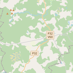
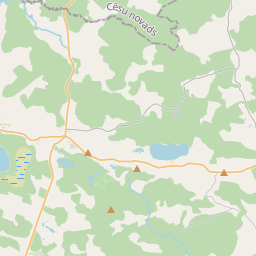
Building (cadastre designation: 42960090001001)
Cadastre designation: 42960090001001
Address: "Ceplīši", Zaubes pagasts, Cēsu novads, LV-4113
Cadastre designation of real estate | |
|---|---|
Cadastral object type | Cadastral object type: Building |
Address | Address: "Ceplīši", Zaubes pagasts, Cēsu novads, LV-4113 |
Address | |
|---|---|
Address ID | Address ID: 103005887 |
Companies registered at the address | |
Departments registered at the address | Departments registered at the address: 0 |
Institutions registered at the address | Institutions registered at the address: 0 |
Real estate registered at the address | |
Transactions with real estate at the address | Transactions with real estate at the address: 0 |
| Cadastral object type | Cadastre designation of the cadastral object | Person's property right status | Person status | Land Register |
|---|---|---|---|---|
| Cadastral object type: Building | 42960090001001 | Person's property right status: No data | Person status: No data | Land Register |
17.12.2024. State land service data
|
|
|
{"7201060210":{"name":"<div class='color_dot' style='background-color: #00ffff'><\/div><span>Specified land unit<\/span>","featureColor":"#00ffff","features":{"type":"FeatureCollection","features":[{"type":"Feature","geometry":{"type":"Polygon","coordinates":[[[25.204844266,56.952351809],[25.204976707,56.952158699],[25.205138191,56.952077434],[25.205212777,56.952059807],[25.205292014,56.952041074],[25.20747209,56.952074851],[25.209580241,56.952139177],[25.210009744,56.952169891],[25.210255671,56.952171581],[25.210611602,56.95217403],[25.211503999,56.952140485],[25.214299477,56.95201807],[25.214435563,56.952012418],[25.214366604,56.952460356],[25.214264363,56.952915806],[25.214231144,56.953015765],[25.214102354,56.953261129],[25.213813387,56.953627612],[25.213463372,56.954079383],[25.213357233,56.954180049],[25.212042411,56.954964986],[25.208157134,56.953505366],[25.204932712,56.952382528],[25.204844266,56.952351809]]]},"crs":{"type":"name","properties":{"name":"urn:ogc:def:crs:EPSG:3059"}},"properties":{"style":{"color":"#00ffff","dashArray":"8,12","weight":1},"name":"Land","object_type":"Parcel","parcel_code":"42960090013","code":null,"surveyor":null,"address":"","ownership":"<span>Owner - Natural person<br><\/span>","pro_cadastre_nr":"42960090001"}},{"type":"Feature","geometry":{"type":"Polygon","coordinates":[[[25.216860501,56.94460754],[25.21723762,56.944557124],[25.221755339,56.942218734],[25.223333127,56.942340681],[25.223405982,56.942346311],[25.223574304,56.942591753],[25.223812439,56.942935035],[25.224023997,56.943236152],[25.224504733,56.943937988],[25.224775085,56.944331795],[25.225090886,56.944795513],[25.225174343,56.944923253],[25.225061398,56.94501264],[25.224963458,56.94498715],[25.22488635,56.944970295],[25.223749562,56.945306031],[25.223346062,56.945422751],[25.223210824,56.945464575],[25.223177656,56.945485339],[25.223099317,56.945659818],[25.222684056,56.946610214],[25.222672519,56.946639976],[25.221989963,56.946608149],[25.221553527,56.946642303],[25.221163787,56.946710878],[25.220883072,56.946768423],[25.220477218,56.946901913],[25.220189187,56.947014324],[25.219858345,56.947211848],[25.219413267,56.947540012],[25.219132707,56.94760253],[25.218842227,56.947640229],[25.218606751,56.947687365],[25.218342592,56.947806242],[25.218370458,56.947685301],[25.21843632,56.947485314],[25.218458908,56.947356806],[25.218445008,56.947135305],[25.218450326,56.946970228],[25.218498025,56.946819805],[25.218551968,56.946665745],[25.218564511,56.946567972],[25.218543148,56.946376732],[25.21850603,56.946228123],[25.218418932,56.946029985],[25.218333604,56.945876977],[25.218178963,56.945660792],[25.217992133,56.945497415],[25.217782218,56.945343949],[25.217603194,56.945238913],[25.217389555,56.945122893],[25.217213283,56.945019024],[25.217036491,56.944873401],[25.216939829,56.944749198],[25.216860501,56.94460754]]]},"crs":{"type":"name","properties":{"name":"urn:ogc:def:crs:EPSG:3059"}},"properties":{"style":{"color":"#00ffff","dashArray":"8,12","weight":1},"name":"Land","object_type":"Parcel","parcel_code":"42960090002","code":null,"surveyor":null,"address":"","ownership":"<span>Owner - Natural person<br><\/span>","pro_cadastre_nr":"42960090001"}},{"type":"Feature","geometry":{"type":"Polygon","coordinates":[[[25.212350197,56.954897243],[25.21353152,56.954213227],[25.214231073,56.953294748],[25.214352521,56.953104259],[25.214427594,56.952889307],[25.214562282,56.952265256],[25.214608221,56.951995791],[25.214647968,56.951816059],[25.214787799,56.951630369],[25.216194558,56.95087439],[25.216980687,56.950378514],[25.217399786,56.950090466],[25.217735549,56.949763373],[25.217883992,56.949562654],[25.218082549,56.949221946],[25.218157269,56.948997031],[25.218281777,56.948622176],[25.218275117,56.948417981],[25.218278374,56.948238603],[25.218344781,56.948038673],[25.218395561,56.947918614],[25.218547405,56.947822476],[25.218781907,56.947745467],[25.219226667,56.947686328],[25.219534071,56.947608598],[25.219730183,56.94747218],[25.22016695,56.947169009],[25.220436285,56.947041831],[25.22082341,56.946893574],[25.2211396,56.946805801],[25.221547568,56.946737048],[25.221892714,56.946698808],[25.222556634,56.946735292],[25.223174084,56.946718689],[25.223598119,56.946693418],[25.224159879,56.946616854],[25.224153043,56.946686667],[25.222176849,56.948226541],[25.222055202,56.948321329],[25.220110619,56.949909617],[25.2179436,56.950832465],[25.216586549,56.951433539],[25.218062505,56.951962198],[25.219917172,56.952720175],[25.218666482,56.953819522],[25.218622277,56.953860113],[25.216005709,56.954881048],[25.215621499,56.954835593],[25.214486227,56.954692189],[25.213845424,56.954613714],[25.213564477,56.954666258],[25.212350197,56.954897243]]]},"crs":{"type":"name","properties":{"name":"urn:ogc:def:crs:EPSG:3059"}},"properties":{"style":{"color":"#00ffff","dashArray":"8,12","weight":1},"name":"Land","object_type":"Parcel","parcel_code":"42960090001","code":null,"surveyor":null,"address":"\"Cepl\u012b\u0161i\", Zaubes pag., C\u0113su nov., LV-4113","ownership":"<span>Owner - Natural person<br><\/span>","pro_cadastre_nr":"42960090001"}}]}},"5201011310":{"name":"<div class='color_dot' style='background-color: #960096'><\/div><span>Vectorized building<\/span>","featureColor":"#960096","features":{"type":"FeatureCollection","features":[{"type":"Feature","geometry":{"type":"Polygon","coordinates":[[[25.214478233,56.954141021],[25.214566785,56.954084647],[25.214693535,56.954144088],[25.214604983,56.954200462],[25.214478233,56.954141021]]]},"crs":{"type":"name","properties":{"name":"urn:ogc:def:crs:EPSG:3059"}},"properties":{"style":{"color":"#960096","dashArray":"0","weight":2},"name":"Building","object_type":"Building","parcel_code":"42960090001","code":"42960090001001","surveyor":null,"address":"\"Cepl\u012b\u0161i\", Zaubes pag., C\u0113su nov., LV-4113","ownership":"<span>Owner - Natural person<br><\/span>","pro_cadastre_nr":"42960090001"}},{"type":"Feature","geometry":{"type":"Polygon","coordinates":[[[25.21457761,56.953958428],[25.214634794,56.953912331],[25.214802857,56.953974578],[25.214745673,56.954020675],[25.21457761,56.953958428]]]},"crs":{"type":"name","properties":{"name":"urn:ogc:def:crs:EPSG:3059"}},"properties":{"style":{"color":"#960096","dashArray":"0","weight":2},"name":"Building","object_type":"Building","parcel_code":"42960090001","code":"42960090001004","surveyor":null,"address":"\"Cepl\u012b\u0161i\", Zaubes pag., C\u0113su nov., LV-4113","ownership":"<span>Owner - Natural person<br><\/span>","pro_cadastre_nr":"42960090001"}},{"type":"Feature","geometry":{"type":"Polygon","coordinates":[[[25.214835187,56.954185963],[25.214903487,56.954127727],[25.214978232,56.954153901],[25.214909932,56.954212136],[25.214835187,56.954185963]]]},"crs":{"type":"name","properties":{"name":"urn:ogc:def:crs:EPSG:3059"}},"properties":{"style":{"color":"#960096","dashArray":"0","weight":2},"name":"Building","object_type":"Building","parcel_code":"42960090001","code":"42960090001002","surveyor":null,"address":"\"Cepl\u012b\u0161i\", Zaubes pag., C\u0113su nov., LV-4113","ownership":"<span>Owner - Natural person<br><\/span>","pro_cadastre_nr":"42960090001"}},{"type":"Feature","geometry":{"type":"Polygon","coordinates":[[[25.213807661,56.953948186],[25.213851989,56.953906679],[25.213984759,56.953949009],[25.21394043,56.953990516],[25.213807661,56.953948186]]]},"crs":{"type":"name","properties":{"name":"urn:ogc:def:crs:EPSG:3059"}},"properties":{"style":{"color":"#960096","dashArray":"0","weight":2},"name":"Building","object_type":"Building","parcel_code":"42960090001","code":"42960090001006","surveyor":null,"address":"\"Cepl\u012b\u0161i\", Zaubes pag., C\u0113su nov., LV-4113","ownership":"<span>Owner - Natural person<br><\/span>","pro_cadastre_nr":"42960090001"}},{"type":"Feature","geometry":{"type":"Polygon","coordinates":[[[25.214021104,56.954034709],[25.214183493,56.953916884],[25.214295119,56.953962815],[25.214132731,56.954080641],[25.214021104,56.954034709]]]},"crs":{"type":"name","properties":{"name":"urn:ogc:def:crs:EPSG:3059"}},"properties":{"style":{"color":"#960096","dashArray":"0","weight":2},"name":"Building","object_type":"Building","parcel_code":"42960090001","code":"42960090001005","surveyor":null,"address":"\"Cepl\u012b\u0161i\", Zaubes pag., C\u0113su nov., LV-4113","ownership":"<span>Owner - Natural person<br><\/span>","pro_cadastre_nr":"42960090001"}},{"type":"Feature","geometry":{"type":"Polygon","coordinates":[[[25.214815078,56.954035858],[25.214873858,56.953978174],[25.214914363,56.953990493],[25.214855583,56.954048178],[25.214815078,56.954035858]]]},"crs":{"type":"name","properties":{"name":"urn:ogc:def:crs:EPSG:3059"}},"properties":{"style":{"color":"#960096","dashArray":"0","weight":2},"name":"Building","object_type":"Building","parcel_code":"42960090001","code":"42960090001003","surveyor":null,"address":"\"Cepl\u012b\u0161i\", Zaubes pag., C\u0113su nov., LV-4113","ownership":"<span>Owner - Natural person<br><\/span>","pro_cadastre_nr":"42960090001"}},{"type":"Feature","geometry":{"type":"Polygon","coordinates":[[[25.214616725,56.953485201],[25.214386954,56.953326809],[25.214531242,56.953264315],[25.214761014,56.953422706],[25.214616725,56.953485201]]]},"crs":{"type":"name","properties":{"name":"urn:ogc:def:crs:EPSG:3059"}},"properties":{"style":{"color":"#960096","dashArray":"0","weight":2},"name":"Building","object_type":"Building","parcel_code":"42960090001","code":"42960030087001","surveyor":null,"address":"\"Cepl\u012b\u0161i\", Zaubes pag., C\u0113su nov., LV-4113","ownership":null,"pro_cadastre_nr":null}},{"type":"Feature","geometry":{"type":"Polygon","coordinates":[[[25.213807661,56.953948186],[25.213851989,56.953906679],[25.213984759,56.953949009],[25.21394043,56.953990516],[25.213807661,56.953948186]]]},"crs":{"type":"name","properties":{"name":"urn:ogc:def:crs:EPSG:3059"}},"properties":{"style":{"color":"#960096","dashArray":"0","weight":2},"name":"Building","object_type":"Building","parcel_code":"42960090001","code":"42960090001006","surveyor":null,"address":"\"Cepl\u012b\u0161i\", Zaubes pag., C\u0113su nov., LV-4113","ownership":"<span>Owner - Natural person<br><\/span>","pro_cadastre_nr":"42960090001"}},{"type":"Feature","geometry":{"type":"Polygon","coordinates":[[[25.214021104,56.954034709],[25.214183493,56.953916884],[25.214295119,56.953962815],[25.214132731,56.954080641],[25.214021104,56.954034709]]]},"crs":{"type":"name","properties":{"name":"urn:ogc:def:crs:EPSG:3059"}},"properties":{"style":{"color":"#960096","dashArray":"0","weight":2},"name":"Building","object_type":"Building","parcel_code":"42960090001","code":"42960090001005","surveyor":null,"address":"\"Cepl\u012b\u0161i\", Zaubes pag., C\u0113su nov., LV-4113","ownership":"<span>Owner - Natural person<br><\/span>","pro_cadastre_nr":"42960090001"}},{"type":"Feature","geometry":{"type":"Polygon","coordinates":[[[25.21457761,56.953958428],[25.214634794,56.953912331],[25.214802857,56.953974578],[25.214745673,56.954020675],[25.21457761,56.953958428]]]},"crs":{"type":"name","properties":{"name":"urn:ogc:def:crs:EPSG:3059"}},"properties":{"style":{"color":"#960096","dashArray":"0","weight":2},"name":"Building","object_type":"Building","parcel_code":"42960090001","code":"42960090001004","surveyor":null,"address":"\"Cepl\u012b\u0161i\", Zaubes pag., C\u0113su nov., LV-4113","ownership":"<span>Owner - Natural person<br><\/span>","pro_cadastre_nr":"42960090001"}},{"type":"Feature","geometry":{"type":"Polygon","coordinates":[[[25.214815078,56.954035858],[25.214873858,56.953978174],[25.214914363,56.953990493],[25.214855583,56.954048178],[25.214815078,56.954035858]]]},"crs":{"type":"name","properties":{"name":"urn:ogc:def:crs:EPSG:3059"}},"properties":{"style":{"color":"#960096","dashArray":"0","weight":2},"name":"Building","object_type":"Building","parcel_code":"42960090001","code":"42960090001003","surveyor":null,"address":"\"Cepl\u012b\u0161i\", Zaubes pag., C\u0113su nov., LV-4113","ownership":"<span>Owner - Natural person<br><\/span>","pro_cadastre_nr":"42960090001"}},{"type":"Feature","geometry":{"type":"Polygon","coordinates":[[[25.214835187,56.954185963],[25.214903487,56.954127727],[25.214978232,56.954153901],[25.214909932,56.954212136],[25.214835187,56.954185963]]]},"crs":{"type":"name","properties":{"name":"urn:ogc:def:crs:EPSG:3059"}},"properties":{"style":{"color":"#960096","dashArray":"0","weight":2},"name":"Building","object_type":"Building","parcel_code":"42960090001","code":"42960090001002","surveyor":null,"address":"\"Cepl\u012b\u0161i\", Zaubes pag., C\u0113su nov., LV-4113","ownership":"<span>Owner - Natural person<br><\/span>","pro_cadastre_nr":"42960090001"}},{"type":"Feature","geometry":{"type":"Polygon","coordinates":[[[25.214478233,56.954141021],[25.214566785,56.954084647],[25.214693535,56.954144088],[25.214604983,56.954200462],[25.214478233,56.954141021]]]},"crs":{"type":"name","properties":{"name":"urn:ogc:def:crs:EPSG:3059"}},"properties":{"style":{"color":"#960096","dashArray":"0","weight":2},"name":"Building","object_type":"Building","parcel_code":"42960090001","code":"42960090001001","surveyor":null,"address":"\"Cepl\u012b\u0161i\", Zaubes pag., C\u0113su nov., LV-4113","ownership":"<span>Owner - Natural person<br><\/span>","pro_cadastre_nr":"42960090001"}}]}}}
[]
https://tile.openstreetmap.org/{z}/{x}/{y}.png|© OpenStreetMap contributors|minZoom: 7|maxZoom: 19
|
Building data updated: 29.12.2024.
Data source and license: Cadastre Information System open text and spatial data, Real Estate Market Database open data, open data license Creative Commons Attribution, OpenStreetMap

