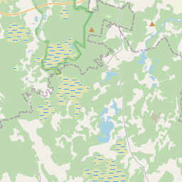
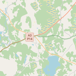
Building (cadastre designation: 42800050115001)
Cadastre designation: 42800050115001
Address: "Janitēni", Stalbes pagasts, Cēsu novads, LV-4151
Cadastre designation of real estate | |
|---|---|
Cadastral object type | Cadastral object type: Building |
Address | Address: "Janitēni", Stalbes pagasts, Cēsu novads, LV-4151 |
Address | |
|---|---|
Address ID | Address ID: 104352172 |
Companies registered at the address | Companies registered at the address: 0 |
Departments registered at the address | |
Institutions registered at the address | Institutions registered at the address: 0 |
Real estate registered at the address | |
Transactions with real estate at the address | Transactions with real estate at the address: 0 |
| Cadastral object type | Cadastre designation of the cadastral object | Person's property right status | Person status | Land Register |
|---|---|---|---|---|
| Cadastral object type: Building | 42800050115001 | Person's property right status: No data | Person status: No data | Land Register |
17.12.2024. State land service data
|
|
|
{"7201060210":{"name":"<div class='color_dot' style='background-color: #00ffff'><\/div><span>Specified land unit<\/span>","featureColor":"#00ffff","features":{"type":"FeatureCollection","features":[{"type":"Feature","geometry":{"type":"Polygon","coordinates":[[[25.105719273,57.425197873],[25.106387063,57.424590067],[25.106689999,57.424224309],[25.108125114,57.425151335],[25.110357943,57.424820518],[25.110419515,57.424814127],[25.110373261,57.424703255],[25.110319073,57.424559186],[25.110271622,57.424431867],[25.110129247,57.424254958],[25.110000666,57.424121634],[25.109923101,57.424028196],[25.109858294,57.423944725],[25.109716331,57.42378127],[25.109613862,57.423688043],[25.109442802,57.423592068],[25.109340249,57.42349549],[25.109243703,57.42339213],[25.109158797,57.42326178],[25.109035214,57.423088074],[25.108881313,57.422941523],[25.108690581,57.422812112],[25.108578571,57.422720953],[25.108708341,57.42268076],[25.108943362,57.422593006],[25.109147721,57.422539795],[25.109305086,57.422504128],[25.10925786,57.421990413],[25.109425613,57.421852898],[25.109829282,57.421640457],[25.110098749,57.421506591],[25.111337825,57.421276515],[25.112224001,57.421170703],[25.115220731,57.424267805],[25.11730289,57.424029973],[25.117397331,57.424016424],[25.118013986,57.424471184],[25.11977322,57.426026445],[25.119751936,57.426127879],[25.120030036,57.42636509],[25.120210474,57.426331128],[25.120853894,57.426379757],[25.121871548,57.427215753],[25.123593955,57.426596298],[25.12478871,57.428770604],[25.124951728,57.428735883],[25.12586643,57.430469024],[25.129916534,57.429313314],[25.129184637,57.430784713],[25.128192971,57.432028102],[25.127410784,57.43260476],[25.126526829,57.432477658],[25.125775923,57.432963786],[25.126424134,57.433296577],[25.125328538,57.434275882],[25.123317058,57.432412006],[25.122772885,57.431971798],[25.12302271,57.431641636],[25.123065124,57.43161198],[25.123263663,57.431375973],[25.123213454,57.431351248],[25.121964713,57.430562292],[25.120750099,57.431097282],[25.120612922,57.431078792],[25.119565663,57.431925738],[25.118393399,57.431986418],[25.118267123,57.430968332],[25.117259071,57.429902144],[25.115901231,57.429499384],[25.115984313,57.429429537],[25.115554553,57.429306646],[25.115835504,57.429041093],[25.113927743,57.428263497],[25.113872416,57.428244833],[25.113231768,57.427961303],[25.111009215,57.428419081],[25.110709891,57.428167583],[25.111363276,57.427802524],[25.111016489,57.426920493],[25.107869471,57.427084028],[25.107839265,57.426521895],[25.107946439,57.425855683],[25.108021151,57.425808976],[25.107285466,57.425674867],[25.106728774,57.425499286],[25.105732159,57.425235859],[25.105719273,57.425197873]],[[25.112518725,57.427012708],[25.112851958,57.427204871],[25.113894994,57.427448571],[25.115345727,57.427475484],[25.116357071,57.427116062],[25.115689026,57.426460785],[25.114681578,57.426068646],[25.11253567,57.426029799],[25.112518725,57.427012708]]]},"crs":{"type":"name","properties":{"name":"urn:ogc:def:crs:EPSG:3059"}},"properties":{"style":{"color":"#00ffff","dashArray":"8,12","weight":1},"name":"Land","object_type":"Parcel","parcel_code":"42800050115","code":null,"surveyor":null,"address":"","ownership":"<span>Owner - Legal entity<br><\/span>","pro_cadastre_nr":"42800050115"}}]}},"6211003110":{"name":"<div class='color_dot' style='background-color: #878787'><\/div><span>Vectorized engineering structure<\/span>","featureColor":"#878787","features":{"type":"FeatureCollection","features":[{"type":"Feature","geometry":{"type":"Polygon","coordinates":[[[25.112764572,57.425840955],[25.112755896,57.42583221],[25.112762398,57.425821453],[25.112774618,57.425817482],[25.112794499,57.425819588],[25.112806142,57.425828433],[25.112802216,57.425838467],[25.112781957,57.425845302],[25.112764572,57.425840955]]]},"crs":{"type":"name","properties":{"name":"urn:ogc:def:crs:EPSG:3059"}},"properties":{"style":{"color":"#878787","dashArray":"0","weight":1},"name":"Engineering buildings","object_type":"EngineeringStructurePoly","parcel_code":"42800050115","code":"42800050115002","surveyor":null,"address":"","ownership":null,"pro_cadastre_nr":null}},{"type":"Feature","geometry":{"type":"Polygon","coordinates":[[[25.113056547,57.42580936],[25.112960118,57.425806438],[25.112966193,57.425748135],[25.113062622,57.425751074],[25.113056547,57.42580936]]]},"crs":{"type":"name","properties":{"name":"urn:ogc:def:crs:EPSG:3059"}},"properties":{"style":{"color":"#878787","dashArray":"0","weight":1},"name":"Engineering buildings","object_type":"EngineeringStructurePoly","parcel_code":"42800050115","code":"42800050115004","surveyor":null,"address":"","ownership":"<span>Owner - Legal entity<br><\/span>","pro_cadastre_nr":"42800050115"}},{"type":"Feature","geometry":{"type":"Polygon","coordinates":[[[25.113056547,57.42580936],[25.112960118,57.425806438],[25.112966193,57.425748135],[25.113062622,57.425751074],[25.113056547,57.42580936]]]},"crs":{"type":"name","properties":{"name":"urn:ogc:def:crs:EPSG:3059"}},"properties":{"style":{"color":"#878787","dashArray":"0","weight":1},"name":"Engineering buildings","object_type":"EngineeringStructurePoly","parcel_code":"42800050115","code":"42800050115004","surveyor":null,"address":"\"Janit\u0113ni\", Stalbes pag., C\u0113su nov., LV-4151","ownership":"<span>Owner - Legal entity<br><\/span>","pro_cadastre_nr":"42800050115"}}]}},"5201011310":{"name":"<div class='color_dot' style='background-color: #960096'><\/div><span>Vectorized building<\/span>","featureColor":"#960096","features":{"type":"FeatureCollection","features":[{"type":"Feature","geometry":{"type":"Polygon","coordinates":[[[25.111598862,57.426294196],[25.111512286,57.425610321],[25.111691059,57.425603731],[25.111700975,57.425670428],[25.111795575,57.425666323],[25.111823541,57.425854354],[25.111728957,57.42585845],[25.111736549,57.425909481],[25.111863482,57.425903987],[25.111878667,57.42600605],[25.111751734,57.426011554],[25.111777639,57.426287606],[25.111598862,57.426294196]]]},"crs":{"type":"name","properties":{"name":"urn:ogc:def:crs:EPSG:3059"}},"properties":{"style":{"color":"#960096","dashArray":"0","weight":2},"name":"Building","object_type":"Building","parcel_code":"42800050115","code":"42800050115001","surveyor":null,"address":"","ownership":"<span>Owner - Legal entity<br><\/span>","pro_cadastre_nr":"42800050115"}},{"type":"Feature","geometry":{"type":"Polygon","coordinates":[[[25.108396474,57.425644941],[25.108523878,57.425380674],[25.108693093,57.425404411],[25.108565674,57.425668679],[25.108396474,57.425644941]]]},"crs":{"type":"name","properties":{"name":"urn:ogc:def:crs:EPSG:3059"}},"properties":{"style":{"color":"#960096","dashArray":"0","weight":2},"name":"Building","object_type":"Building","parcel_code":"42800050115","code":"42800050115003","surveyor":null,"address":"","ownership":null,"pro_cadastre_nr":null}},{"type":"Feature","geometry":{"type":"Polygon","coordinates":[[[25.111598862,57.426294196],[25.111512286,57.425610321],[25.111691059,57.425603731],[25.111700975,57.425670428],[25.111795575,57.425666323],[25.111823541,57.425854354],[25.111728957,57.42585845],[25.111736549,57.425909481],[25.111863482,57.425903987],[25.111878667,57.42600605],[25.111751734,57.426011554],[25.111777639,57.426287606],[25.111598862,57.426294196]]]},"crs":{"type":"name","properties":{"name":"urn:ogc:def:crs:EPSG:3059"}},"properties":{"style":{"color":"#960096","dashArray":"0","weight":2},"name":"Building","object_type":"Building","parcel_code":"42800050115","code":"42800050115001","surveyor":null,"address":"\"Janit\u0113ni\", Stalbes pag., C\u0113su nov., LV-4151","ownership":"<span>Owner - Legal entity<br><\/span>","pro_cadastre_nr":"42800050115"}}]}}}
[]
https://tile.openstreetmap.org/{z}/{x}/{y}.png|© OpenStreetMap contributors|minZoom: 7|maxZoom: 19
|
Building data updated: 23.11.2024.
Data source and license: Cadastre Information System open text and spatial data, Real Estate Market Database open data, open data license Creative Commons Attribution, OpenStreetMap

