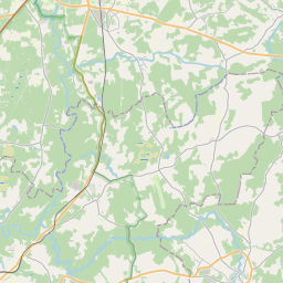
Building (cadastre designation: 42760080045003)
Cadastre designation: 42760080045003
Address: "Vizuļi", Raunas pagasts, Smiltenes novads, LV-4131
Cadastre designation of real estate | |
|---|---|
Cadastral object type | Cadastral object type: Building |
Address | Address: "Vizuļi", Raunas pagasts, Smiltenes novads, LV-4131 |
Address | |
|---|---|
Address ID | Address ID: 104311963 |
Companies registered at the address | |
Departments registered at the address | Departments registered at the address: 0 |
Institutions registered at the address | Institutions registered at the address: 0 |
Real estate registered at the address | |
Transactions with real estate at the address | Transactions with real estate at the address: 0 |
| Cadastral object type | Cadastre designation of the cadastral object | Person's property right status | Person status | Land Register |
|---|---|---|---|---|
| Cadastral object type: Building | 42760080045003 | Person's property right status: No data | Person status: No data | Land Register |
09.01.2025. State land service data
|
|
|
{"7201060210":{"name":"<div class='color_dot' style='background-color: #00ffff'><\/div><span>Specified land unit<\/span>","featureColor":"#00ffff","features":{"type":"FeatureCollection","features":[{"type":"Feature","geometry":{"type":"Polygon","coordinates":[[[25.637089018,57.302043095],[25.637113573,57.302020422],[25.638433353,57.300801249],[25.641186901,57.29839775],[25.644638076,57.29941781],[25.643384876,57.300570368],[25.641413103,57.30245027],[25.640424686,57.303393048],[25.640310393,57.30333552],[25.640276179,57.303280563],[25.640248318,57.303209764],[25.640243898,57.303110479],[25.640142831,57.30290165],[25.639871807,57.302759992],[25.639575027,57.302674072],[25.639238444,57.302609928],[25.639059231,57.302488483],[25.638848077,57.302471433],[25.638764269,57.302437872],[25.638339983,57.302359224],[25.638084007,57.302362558],[25.637808192,57.302331497],[25.637521054,57.30225106],[25.637089018,57.302043095]]]},"crs":{"type":"name","properties":{"name":"urn:ogc:def:crs:EPSG:3059"}},"properties":{"style":{"color":"#00ffff","dashArray":"8,12","weight":1},"name":"Land","object_type":"Parcel","parcel_code":"42760110032","code":null,"surveyor":null,"address":"","ownership":"<span>Owner - Natural person<br><\/span>","pro_cadastre_nr":"42760080045"}},{"type":"Feature","geometry":{"type":"Polygon","coordinates":[[[25.58843819,57.307050404],[25.588459775,57.30700689],[25.588460871,57.307004683],[25.588798658,57.306323561],[25.589577294,57.306342275],[25.590735625,57.305706729],[25.590837271,57.30520817],[25.591105603,57.303930352],[25.591117773,57.303872374],[25.591228646,57.303116489],[25.591272208,57.302803412],[25.591574469,57.300607972],[25.592550948,57.300816673],[25.596443248,57.30163189],[25.597706177,57.301902214],[25.597170727,57.302612709],[25.596501067,57.303679848],[25.596473377,57.303720423],[25.596443815,57.303763735],[25.594815657,57.306129607],[25.593999402,57.307407156],[25.593967838,57.30745653],[25.593702663,57.307446099],[25.592570899,57.307295068],[25.591929206,57.307191964],[25.590911477,57.307070596],[25.590613602,57.307059018],[25.589169665,57.307069608],[25.58843819,57.307050404]]]},"crs":{"type":"name","properties":{"name":"urn:ogc:def:crs:EPSG:3059"}},"properties":{"style":{"color":"#00ffff","dashArray":"8,12","weight":1},"name":"Land","object_type":"Parcel","parcel_code":"42760080045","code":null,"surveyor":null,"address":"\"Vizu\u013ci\", Raunas pag., Smiltenes nov., LV-4131","ownership":"<span>Owner - Natural person<br><\/span>","pro_cadastre_nr":"42760080045"}}]}},"5201013310":{"name":"<div class='color_dot' style='background-color: #960096'><\/div><span>Vectorized underground building<\/span>","featureColor":"#960096","features":{"type":"FeatureCollection","features":[{"type":"Feature","geometry":{"type":"Polygon","coordinates":[[[25.594210836,57.30504999],[25.594201181,57.304997975],[25.594262607,57.304994636],[25.594272262,57.305046651],[25.594210836,57.30504999]]]},"crs":{"type":"name","properties":{"name":"urn:ogc:def:crs:EPSG:3059"}},"properties":{"style":{"color":"#960096","dashArray":"4,6","weight":1},"name":"Building","object_type":"Building","parcel_code":"42760080045","code":"42760080045003","surveyor":null,"address":"\"Vizu\u013ci\", Raunas pag., Smiltenes nov., LV-4131","ownership":"<span>Owner - Natural person<br><\/span>","pro_cadastre_nr":"42760080045"}},{"type":"Feature","geometry":{"type":"Polygon","coordinates":[[[25.594210836,57.30504999],[25.594201181,57.304997975],[25.594262607,57.304994636],[25.594272262,57.305046651],[25.594210836,57.30504999]]]},"crs":{"type":"name","properties":{"name":"urn:ogc:def:crs:EPSG:3059"}},"properties":{"style":{"color":"#960096","dashArray":"4,6","weight":1},"name":"Building","object_type":"Building","parcel_code":"42760080045","code":"42760080045003","surveyor":null,"address":"\"Vizu\u013ci\", Raunas pag., Smiltenes nov., LV-4131","ownership":"<span>Owner - Natural person<br><\/span>","pro_cadastre_nr":"42760080045"}}]}},"5201011310":{"name":"<div class='color_dot' style='background-color: #960096'><\/div><span>Vectorized building<\/span>","featureColor":"#960096","features":{"type":"FeatureCollection","features":[{"type":"Feature","geometry":{"type":"Polygon","coordinates":[[[25.593189354,57.304864467],[25.593354264,57.304859961],[25.593367157,57.304998384],[25.593202246,57.305002881],[25.593189354,57.304864467]]]},"crs":{"type":"name","properties":{"name":"urn:ogc:def:crs:EPSG:3059"}},"properties":{"style":{"color":"#960096","dashArray":"0","weight":2},"name":"Building","object_type":"Building","parcel_code":"42760080045","code":"42760080045001","surveyor":null,"address":"\"Vizu\u013ci\", Raunas pag., Smiltenes nov., LV-4131","ownership":"<span>Owner - Natural person<br><\/span>","pro_cadastre_nr":"42760080045"}},{"type":"Feature","geometry":{"type":"Polygon","coordinates":[[[25.593812705,57.304989548],[25.593947812,57.304986057],[25.593958094,57.305102456],[25.593554314,57.305112901],[25.593549284,57.30505611],[25.593817973,57.305049157],[25.593812705,57.304989548]]]},"crs":{"type":"name","properties":{"name":"urn:ogc:def:crs:EPSG:3059"}},"properties":{"style":{"color":"#960096","dashArray":"0","weight":2},"name":"Building","object_type":"Building","parcel_code":"42760080045","code":"42760080045002","surveyor":null,"address":"\"Vizu\u013ci\", Raunas pag., Smiltenes nov., LV-4131","ownership":"<span>Owner - Natural person<br><\/span>","pro_cadastre_nr":"42760080045"}},{"type":"Feature","geometry":{"type":"Polygon","coordinates":[[[25.593812705,57.304989548],[25.593947812,57.304986057],[25.593958094,57.305102456],[25.593554314,57.305112901],[25.593549284,57.30505611],[25.593817973,57.305049157],[25.593812705,57.304989548]]]},"crs":{"type":"name","properties":{"name":"urn:ogc:def:crs:EPSG:3059"}},"properties":{"style":{"color":"#960096","dashArray":"0","weight":2},"name":"Building","object_type":"Building","parcel_code":"42760080045","code":"42760080045002","surveyor":null,"address":"\"Vizu\u013ci\", Raunas pag., Smiltenes nov., LV-4131","ownership":"<span>Owner - Natural person<br><\/span>","pro_cadastre_nr":"42760080045"}},{"type":"Feature","geometry":{"type":"Polygon","coordinates":[[[25.593189354,57.304864467],[25.593354264,57.304859961],[25.593367157,57.304998384],[25.593202246,57.305002881],[25.593189354,57.304864467]]]},"crs":{"type":"name","properties":{"name":"urn:ogc:def:crs:EPSG:3059"}},"properties":{"style":{"color":"#960096","dashArray":"0","weight":2},"name":"Building","object_type":"Building","parcel_code":"42760080045","code":"42760080045001","surveyor":null,"address":"\"Vizu\u013ci\", Raunas pag., Smiltenes nov., LV-4131","ownership":"<span>Owner - Natural person<br><\/span>","pro_cadastre_nr":"42760080045"}}]}}}
{"7201060210":{"name":"<div class='color_dot' style='background-color: #00ffff'><\/div><span>Specified land unit<\/span>","featureColor":"#00ffff","features":{"type":"FeatureCollection","features":[{"type":"Feature","geometry":{"type":"Polygon","coordinates":[[[25.637089018,57.302043095],[25.637113573,57.302020422],[25.638433353,57.300801249],[25.641186901,57.29839775],[25.644579673,57.299514987],[25.643313398,57.300655469],[25.641276938,57.302578397],[25.640293782,57.303523879],[25.640245389,57.303448465],[25.640168971,57.30337515],[25.640092961,57.303311767],[25.639925322,57.303244637],[25.639786208,57.303201896],[25.639551262,57.303061368],[25.639379425,57.302900215],[25.639335595,57.302737402],[25.639238444,57.302609928],[25.639059231,57.302488483],[25.638848077,57.302471433],[25.638764269,57.302437872],[25.638339983,57.302359224],[25.638084007,57.302362558],[25.637808192,57.302331497],[25.637521054,57.30225106],[25.637089018,57.302043095]]]},"crs":{"type":"name","properties":{"name":"urn:ogc:def:crs:EPSG:3059"}},"properties":{"style":{"color":"#00ffff","dashArray":"8,12","weight":1},"name":"Land","object_type":"Parcel","parcel_code":"42760110032","code":null,"surveyor":null,"address":"","ownership":"<span>Owner - Natural person<br><\/span>","pro_cadastre_nr":"42760080045"}},{"type":"Feature","geometry":{"type":"Polygon","coordinates":[[[25.58843819,57.307050404],[25.588460871,57.307004683],[25.588798658,57.306323561],[25.589577294,57.306342275],[25.590735625,57.305706729],[25.590837271,57.30520817],[25.591105603,57.303930352],[25.591117773,57.303872374],[25.591228646,57.303116489],[25.591272208,57.302803412],[25.591574469,57.300607972],[25.592550948,57.300816673],[25.596443248,57.30163189],[25.597706177,57.301902214],[25.597170727,57.302612709],[25.596501067,57.303679848],[25.596473377,57.303720423],[25.596443815,57.303763735],[25.594815657,57.306129607],[25.593999402,57.307407156],[25.593967838,57.30745653],[25.593702663,57.307446099],[25.592570899,57.307295068],[25.591929206,57.307191964],[25.590911477,57.307070596],[25.590613602,57.307059018],[25.589169665,57.307069608],[25.58843819,57.307050404]]]},"crs":{"type":"name","properties":{"name":"urn:ogc:def:crs:EPSG:3059"}},"properties":{"style":{"color":"#00ffff","dashArray":"8,12","weight":1},"name":"Land","object_type":"Parcel","parcel_code":"42760080045","code":null,"surveyor":null,"address":"\"Vizu\u013ci\", Raunas pag., Smiltenes nov., LV-4131","ownership":"<span>Owner - Natural person<br><\/span>","pro_cadastre_nr":"42760080045"}}]}}}
https://tile.openstreetmap.org/{z}/{x}/{y}.png|© OpenStreetMap contributors|minZoom: 7|maxZoom: 19
|
Building data updated: 13.01.2025.
Data source and license: Cadastre Information System open text and spatial data, Real Estate Market Database open data, open data license Creative Commons Attribution, OpenStreetMap

