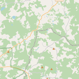
Building (cadastre designation: 42560070095009)
Cadastre designation: 42560070095009
Address: "Maznaukšēni", Jaunpiebalgas pagasts, Cēsu novads, LV-4125
Cadastre designation of real estate | |
|---|---|
Cadastral object type | Cadastral object type: Building |
Address | Address: "Maznaukšēni", Jaunpiebalgas pagasts, Cēsu novads, LV-4125 |
Address | |
|---|---|
Address ID | Address ID: 103185192 |
Companies registered at the address | |
Departments registered at the address | Departments registered at the address: 0 |
Institutions registered at the address | Institutions registered at the address: 0 |
Real estate registered at the address | |
Transactions with real estate at the address | Transactions with real estate at the address: 0 |
| Cadastral object type | Cadastre designation of the cadastral object | Person's property right status | Person status | Land Register |
|---|---|---|---|---|
| Cadastral object type: Building | 42560070095009 | Person's property right status: No data | Person status: No data | Land Register |
09.01.2025. State land service data
|
|
|
{"7201060210":{"name":"<div class='color_dot' style='background-color: #00ffff'><\/div><span>Specified land unit<\/span>","featureColor":"#00ffff","features":{"type":"FeatureCollection","features":[{"type":"Feature","geometry":{"type":"Polygon","coordinates":[[[25.948989056,57.141177663],[25.949161682,57.141120286],[25.949584295,57.141045338],[25.951202743,57.140688553],[25.951763833,57.140146519],[25.95264485,57.140081525],[25.952830649,57.140078632],[25.953436542,57.140164738],[25.953781587,57.140189168],[25.953739765,57.140266169],[25.953073076,57.140946615],[25.953388336,57.141215194],[25.957161393,57.141867452],[25.95766472,57.141965813],[25.96037621,57.142203042],[25.962493465,57.142169929],[25.963611681,57.142225362],[25.965553347,57.141404811],[25.96802142,57.140417951],[25.968840836,57.14030784],[25.970482914,57.140041977],[25.971523786,57.139936258],[25.971918522,57.139882653],[25.972042339,57.13987102],[25.971866536,57.140043457],[25.971407466,57.140439404],[25.971107034,57.140693221],[25.971009832,57.140775259],[25.970996412,57.140908922],[25.971353392,57.141130041],[25.972070834,57.141574721],[25.97203507,57.141630697],[25.971606513,57.142707173],[25.971441535,57.14304177],[25.971276587,57.143055343],[25.970709066,57.143082107],[25.97007361,57.143025508],[25.969464213,57.142986162],[25.968761468,57.142876916],[25.968001598,57.142695645],[25.967604236,57.142672425],[25.967254159,57.142727589],[25.967026749,57.142765148],[25.966731559,57.142875365],[25.966355343,57.14302363],[25.966093569,57.143087091],[25.96569414,57.143102239],[25.96529449,57.143081411],[25.963851573,57.142788677],[25.963748505,57.142766651],[25.963156463,57.142661543],[25.961934883,57.142557747],[25.961362594,57.142511536],[25.960845202,57.142492886],[25.960300858,57.142565596],[25.95940127,57.142858921],[25.958149585,57.143286795],[25.957567621,57.143422421],[25.957061013,57.143422564],[25.956457013,57.143364112],[25.955433089,57.14337538],[25.954775446,57.143394465],[25.95434898,57.143396969],[25.953936931,57.1433823],[25.953471115,57.143380831],[25.953032363,57.143408645],[25.952472133,57.143393368],[25.952118879,57.143335402],[25.950994626,57.143102733],[25.950656116,57.142996606],[25.950617605,57.142984688],[25.950447469,57.142886616],[25.950024946,57.142574689],[25.949644861,57.142383162],[25.949234075,57.142194563],[25.949162005,57.141720471],[25.948989056,57.141177663]]]},"crs":{"type":"name","properties":{"name":"urn:ogc:def:crs:EPSG:3059"}},"properties":{"style":{"color":"#00ffff","dashArray":"8,12","weight":1},"name":"Land","object_type":"Parcel","parcel_code":"42560070095","code":null,"surveyor":null,"address":"\"Maznauk\u0161\u0113ni\", Jaunpiebalgas pag., C\u0113su nov., LV-4125","ownership":"<span>Owner - Natural person<br><\/span>","pro_cadastre_nr":"42560070095"}}]}},"5201011310":{"name":"<div class='color_dot' style='background-color: #960096'><\/div><span>Vectorized building<\/span>","featureColor":"#960096","features":{"type":"FeatureCollection","features":[{"type":"Feature","geometry":{"type":"Polygon","coordinates":[[[25.953316489,57.140164182],[25.953322327,57.140203466],[25.953323629,57.1402034],[25.953331769,57.140248093],[25.953201338,57.140254779],[25.953193645,57.140210394],[25.953215762,57.140209205],[25.953208137,57.140167379],[25.953316489,57.140164182]]]},"crs":{"type":"name","properties":{"name":"urn:ogc:def:crs:EPSG:3059"}},"properties":{"style":{"color":"#960096","dashArray":"0","weight":2},"name":"Building","object_type":"Building","parcel_code":"42560070095","code":"42560070095002","surveyor":null,"address":"\"Maznauk\u0161\u0113ni\", Jaunpiebalgas pag., C\u0113su nov., LV-4125","ownership":null,"pro_cadastre_nr":null}},{"type":"Feature","geometry":{"type":"Polygon","coordinates":[[[25.952516905,57.140730953],[25.952723434,57.140710818],[25.952781004,57.140885309],[25.952574474,57.140905444],[25.952516905,57.140730953]]]},"crs":{"type":"name","properties":{"name":"urn:ogc:def:crs:EPSG:3059"}},"properties":{"style":{"color":"#960096","dashArray":"0","weight":2},"name":"Building","object_type":"Building","parcel_code":"42560070095","code":"42560070095010","surveyor":null,"address":"\"Maznauk\u0161\u0113ni\", Jaunpiebalgas pag., C\u0113su nov., LV-4125","ownership":"<span>Owner - Natural person<br><\/span>","pro_cadastre_nr":"42560070095"}},{"type":"Feature","geometry":{"type":"Polygon","coordinates":[[[25.952791175,57.140524646],[25.952808069,57.140659595],[25.952351321,57.140676501],[25.952334428,57.140541551],[25.952791175,57.140524646]]]},"crs":{"type":"name","properties":{"name":"urn:ogc:def:crs:EPSG:3059"}},"properties":{"style":{"color":"#960096","dashArray":"0","weight":2},"name":"Building","object_type":"Building","parcel_code":"42560070095","code":"42560070095009","surveyor":null,"address":"\"Maznauk\u0161\u0113ni\", Jaunpiebalgas pag., C\u0113su nov., LV-4125","ownership":"<span>Owner - Natural person<br><\/span>","pro_cadastre_nr":"42560070095"}},{"type":"Feature","geometry":{"type":"Polygon","coordinates":[[[25.95229967,57.140399376],[25.9521713,57.140404421],[25.952160861,57.140325763],[25.95228923,57.140320719],[25.95229967,57.140399376]]]},"crs":{"type":"name","properties":{"name":"urn:ogc:def:crs:EPSG:3059"}},"properties":{"style":{"color":"#960096","dashArray":"0","weight":2},"name":"Building","object_type":"Building","parcel_code":"42560070095","code":"42560070095007","surveyor":null,"address":"\"Maznauk\u0161\u0113ni\", Jaunpiebalgas pag., C\u0113su nov., LV-4125","ownership":null,"pro_cadastre_nr":null}},{"type":"Feature","geometry":{"type":"Polygon","coordinates":[[[25.953003781,57.140553063],[25.952996828,57.14061402],[25.952887005,57.140610321],[25.952893958,57.140549364],[25.953003781,57.140553063]]]},"crs":{"type":"name","properties":{"name":"urn:ogc:def:crs:EPSG:3059"}},"properties":{"style":{"color":"#960096","dashArray":"0","weight":2},"name":"Building","object_type":"Building","parcel_code":"42560070095","code":"42560070095005","surveyor":null,"address":"\"Maznauk\u0161\u0113ni\", Jaunpiebalgas pag., C\u0113su nov., LV-4125","ownership":null,"pro_cadastre_nr":null}},{"type":"Feature","geometry":{"type":"Polygon","coordinates":[[[25.952944357,57.14019343],[25.952683765,57.140197487],[25.952679523,57.140116954],[25.952940114,57.140112896],[25.952944357,57.14019343]]]},"crs":{"type":"name","properties":{"name":"urn:ogc:def:crs:EPSG:3059"}},"properties":{"style":{"color":"#960096","dashArray":"0","weight":2},"name":"Building","object_type":"Building","parcel_code":"42560070095","code":"42560070095001","surveyor":null,"address":"\"Maznauk\u0161\u0113ni\", Jaunpiebalgas pag., C\u0113su nov., LV-4125","ownership":"<span>Owner - Natural person<br><\/span>","pro_cadastre_nr":"42560070095"}},{"type":"Feature","geometry":{"type":"Polygon","coordinates":[[[25.953386842,57.140303349],[25.953386888,57.140231132],[25.953701445,57.140231193],[25.953701399,57.1403034],[25.953386842,57.140303349]]]},"crs":{"type":"name","properties":{"name":"urn:ogc:def:crs:EPSG:3059"}},"properties":{"style":{"color":"#960096","dashArray":"0","weight":2},"name":"Building","object_type":"Building","parcel_code":"42560070095","code":"42560070095011","surveyor":null,"address":"\"Maznauk\u0161\u0113ni\", Jaunpiebalgas pag., C\u0113su nov., LV-4125","ownership":"<span>Owner - Natural person<br><\/span>","pro_cadastre_nr":"42560070095"}},{"type":"Feature","geometry":{"type":"Polygon","coordinates":[[[25.953179836,57.140292116],[25.953083559,57.140293615],[25.953081383,57.140252316],[25.95317766,57.140250816],[25.953179836,57.140292116]]]},"crs":{"type":"name","properties":{"name":"urn:ogc:def:crs:EPSG:3059"}},"properties":{"style":{"color":"#960096","dashArray":"0","weight":2},"name":"Building","object_type":"Building","parcel_code":"42560070095","code":"42560070095003","surveyor":null,"address":"\"Maznauk\u0161\u0113ni\", Jaunpiebalgas pag., C\u0113su nov., LV-4125","ownership":null,"pro_cadastre_nr":null}},{"type":"Feature","geometry":{"type":"Polygon","coordinates":[[[25.952941825,57.140435222],[25.952937697,57.140356871],[25.953012374,57.140355708],[25.953016502,57.140434059],[25.952941825,57.140435222]]]},"crs":{"type":"name","properties":{"name":"urn:ogc:def:crs:EPSG:3059"}},"properties":{"style":{"color":"#960096","dashArray":"0","weight":2},"name":"Building","object_type":"Building","parcel_code":"42560070095","code":"42560070095004","surveyor":null,"address":"\"Maznauk\u0161\u0113ni\", Jaunpiebalgas pag., C\u0113su nov., LV-4125","ownership":null,"pro_cadastre_nr":null}},{"type":"Feature","geometry":{"type":"Polygon","coordinates":[[[25.953145972,57.140660075],[25.953223392,57.140719413],[25.953159391,57.140744105],[25.953081972,57.140684766],[25.953145972,57.140660075]]]},"crs":{"type":"name","properties":{"name":"urn:ogc:def:crs:EPSG:3059"}},"properties":{"style":{"color":"#960096","dashArray":"0","weight":2},"name":"Building","object_type":"Building","parcel_code":"42560070095","code":"42560070095006","surveyor":null,"address":"\"Maznauk\u0161\u0113ni\", Jaunpiebalgas pag., C\u0113su nov., LV-4125","ownership":null,"pro_cadastre_nr":null}},{"type":"Feature","geometry":{"type":"Polygon","coordinates":[[[25.953386842,57.140303349],[25.953386888,57.140231132],[25.953701445,57.140231193],[25.953701399,57.1403034],[25.953386842,57.140303349]]]},"crs":{"type":"name","properties":{"name":"urn:ogc:def:crs:EPSG:3059"}},"properties":{"style":{"color":"#960096","dashArray":"0","weight":2},"name":"Building","object_type":"Building","parcel_code":"42560070095","code":"42560070095011","surveyor":null,"address":"\"Maznauk\u0161\u0113ni\", Jaunpiebalgas pag., C\u0113su nov., LV-4125","ownership":"<span>Owner - Natural person<br><\/span>","pro_cadastre_nr":"42560070095"}},{"type":"Feature","geometry":{"type":"Polygon","coordinates":[[[25.952516905,57.140730953],[25.952723434,57.140710818],[25.952781004,57.140885309],[25.952574474,57.140905444],[25.952516905,57.140730953]]]},"crs":{"type":"name","properties":{"name":"urn:ogc:def:crs:EPSG:3059"}},"properties":{"style":{"color":"#960096","dashArray":"0","weight":2},"name":"Building","object_type":"Building","parcel_code":"42560070095","code":"42560070095010","surveyor":null,"address":"\"Maznauk\u0161\u0113ni\", Jaunpiebalgas pag., C\u0113su nov., LV-4125","ownership":"<span>Owner - Natural person<br><\/span>","pro_cadastre_nr":"42560070095"}},{"type":"Feature","geometry":{"type":"Polygon","coordinates":[[[25.952791175,57.140524646],[25.952808069,57.140659595],[25.952351321,57.140676501],[25.952334428,57.140541551],[25.952791175,57.140524646]]]},"crs":{"type":"name","properties":{"name":"urn:ogc:def:crs:EPSG:3059"}},"properties":{"style":{"color":"#960096","dashArray":"0","weight":2},"name":"Building","object_type":"Building","parcel_code":"42560070095","code":"42560070095009","surveyor":null,"address":"\"Maznauk\u0161\u0113ni\", Jaunpiebalgas pag., C\u0113su nov., LV-4125","ownership":"<span>Owner - Natural person<br><\/span>","pro_cadastre_nr":"42560070095"}},{"type":"Feature","geometry":{"type":"Polygon","coordinates":[[[25.952944357,57.14019343],[25.952683765,57.140197487],[25.952679523,57.140116954],[25.952940114,57.140112896],[25.952944357,57.14019343]]]},"crs":{"type":"name","properties":{"name":"urn:ogc:def:crs:EPSG:3059"}},"properties":{"style":{"color":"#960096","dashArray":"0","weight":2},"name":"Building","object_type":"Building","parcel_code":"42560070095","code":"42560070095001","surveyor":null,"address":"\"Maznauk\u0161\u0113ni\", Jaunpiebalgas pag., C\u0113su nov., LV-4125","ownership":"<span>Owner - Natural person<br><\/span>","pro_cadastre_nr":"42560070095"}}]}}}
[]
https://tile.openstreetmap.org/{z}/{x}/{y}.png|© OpenStreetMap contributors|minZoom: 7|maxZoom: 19
|
Building data updated: 29.12.2024.
Data source and license: Cadastre Information System open text and spatial data, Real Estate Market Database open data, open data license Creative Commons Attribution, OpenStreetMap

