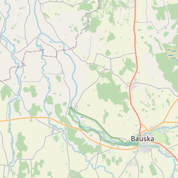
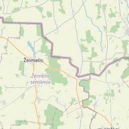
Building (cadastre designation: 40600020047002)
Cadastre designation: 40600020047002
Address: "Madaras", Mūsa, Gailīšu pagasts, Bauskas novads, LV-3931
Cadastre designation of real estate | |
|---|---|
Cadastral object type | Cadastral object type: Building |
Address | Address: "Madaras", Mūsa, Gailīšu pagasts, Bauskas novads, LV-3931 |
Address | |
|---|---|
Address ID | Address ID: 103019333 |
Companies registered at the address | Companies registered at the address: 0 |
Departments registered at the address | Departments registered at the address: 0 |
Institutions registered at the address | Institutions registered at the address: 0 |
Real estate registered at the address | |
Transactions with real estate at the address | Transactions with real estate at the address: 0 |
| Cadastral object type | Cadastre designation of the cadastral object | Person's property right status | Person status | Land Register |
|---|---|---|---|---|
| Cadastral object type: Building | 40600020047002 | Person's property right status: No data | Person status: No data | Land Register |
17.12.2024. State land service data
|
|
|
{"7201060210":{"name":"<div class='color_dot' style='background-color: #00ffff'><\/div><span>Specified land unit<\/span>","featureColor":"#00ffff","features":{"type":"FeatureCollection","features":[{"type":"Feature","geometry":{"type":"Polygon","coordinates":[[[24.239483124,56.369824372],[24.241953581,56.369021839],[24.244521571,56.368351692],[24.244536246,56.368347863],[24.244886235,56.368958626],[24.242232136,56.369578042],[24.24234579,56.369778407],[24.239740769,56.370474096],[24.239483124,56.369824372]]]},"crs":{"type":"name","properties":{"name":"urn:ogc:def:crs:EPSG:3059"}},"properties":{"style":{"color":"#00ffff","dashArray":"8,12","weight":1},"name":"Land","object_type":"Parcel","parcel_code":"40600020047","code":null,"surveyor":null,"address":"\"Madaras\", M\u016bsa, Gail\u012b\u0161u pag., Bauskas nov., LV-3931","ownership":"<span>Owner - Natural person<br><\/span>","pro_cadastre_nr":"40600020047"}}]}},"7201060110":{"name":"<div class='color_dot' style='background-color: #00ffff'><\/div><span>Measured land unit<\/span>","featureColor":"#00ffff","features":{"type":"FeatureCollection","features":[{"type":"Feature","geometry":{"type":"Polygon","coordinates":[[[24.187379514,56.266060094],[24.188508892,56.265377079],[24.188605307,56.265252137],[24.18855123,56.26492545],[24.188874007,56.264443295],[24.189237758,56.264021992],[24.190071674,56.263579931],[24.190334447,56.263504596],[24.191784236,56.263452314],[24.193569563,56.263350166],[24.193248595,56.264722073],[24.193185401,56.265253071],[24.193210256,56.265603969],[24.193292495,56.26600051],[24.187494946,56.266058931],[24.187379514,56.266060094]]]},"crs":{"type":"name","properties":{"name":"urn:ogc:def:crs:EPSG:3059"}},"properties":{"style":{"color":"#00ffff","dashArray":"0","weight":1},"name":"Land","object_type":"Parcel","parcel_code":"40600120024","code":null,"surveyor":null,"address":"","ownership":"<span>Owner - Natural person<br><\/span>","pro_cadastre_nr":"40600020047"}}]}},"7114100000":{"name":"<div class='color_dot' style='background-color: #b40000'><\/div><span>Burdened access road servitude area<\/span>","featureColor":"#b40000","features":{"type":"FeatureCollection","features":[{"type":"Feature","geometry":{"type":"Polygon","coordinates":[[[24.193546284,56.263433436],[24.193532828,56.26348926],[24.192764,56.263520486],[24.189923408,56.263661523],[24.190032947,56.263606558],[24.190073338,56.263606289],[24.190127477,56.26360449],[24.190173601,56.263601418],[24.193546284,56.263433436]]]},"crs":{"type":"name","properties":{"name":"urn:ogc:def:crs:EPSG:3059"}},"properties":{"style":{"color":"#b40000","dashArray":"4,2,1,2","weight":1},"name":"Burdened access road servitude area","object_type":"WayRestriction","parcel_code":"40600120024","code":"7315030100001","surveyor":null,"address":"","ownership":"<span>Owner - Natural person<br><\/span>","pro_cadastre_nr":"40600020047"}}]}},"5201011310":{"name":"<div class='color_dot' style='background-color: #960096'><\/div><span>Vectorized building<\/span>","featureColor":"#960096","features":{"type":"FeatureCollection","features":[{"type":"Feature","geometry":{"type":"Polygon","coordinates":[[[24.244412016,56.368580365],[24.244566414,56.368541427],[24.244612066,56.368597175],[24.244457668,56.368636122],[24.244412016,56.368580365]]]},"crs":{"type":"name","properties":{"name":"urn:ogc:def:crs:EPSG:3059"}},"properties":{"style":{"color":"#960096","dashArray":"0","weight":2},"name":"Building","object_type":"Building","parcel_code":"40600020047","code":"40600020047005","surveyor":null,"address":"\"Madaras\", M\u016bsa, Gail\u012b\u0161u pag., Bauskas nov., LV-3931","ownership":"<span>Owner - Natural person<br><\/span>","pro_cadastre_nr":"40600020047"}},{"type":"Feature","geometry":{"type":"Polygon","coordinates":[[[24.244001112,56.368685124],[24.24392693,56.368575103],[24.244027197,56.368554277],[24.244101379,56.368664298],[24.244001112,56.368685124]]]},"crs":{"type":"name","properties":{"name":"urn:ogc:def:crs:EPSG:3059"}},"properties":{"style":{"color":"#960096","dashArray":"0","weight":2},"name":"Building","object_type":"Building","parcel_code":"40600020047","code":"40600020047002","surveyor":null,"address":"\"Madaras\", M\u016bsa, Gail\u012b\u0161u pag., Bauskas nov., LV-3931","ownership":"<span>Owner - Natural person<br><\/span>","pro_cadastre_nr":"40600020047"}},{"type":"Feature","geometry":{"type":"Polygon","coordinates":[[[24.24436525,56.368590825],[24.244296185,56.368506498],[24.244451439,56.368467335],[24.244520488,56.368551679],[24.24436525,56.368590825]]]},"crs":{"type":"name","properties":{"name":"urn:ogc:def:crs:EPSG:3059"}},"properties":{"style":{"color":"#960096","dashArray":"0","weight":2},"name":"Building","object_type":"Building","parcel_code":"40600020047","code":"40600020047001","surveyor":null,"address":"\"Madaras\", M\u016bsa, Gail\u012b\u0161u pag., Bauskas nov., LV-3931","ownership":"<span>Owner - Natural person<br><\/span>","pro_cadastre_nr":"40600020047"}},{"type":"Feature","geometry":{"type":"Polygon","coordinates":[[[24.244412016,56.368580365],[24.244566414,56.368541427],[24.244612066,56.368597175],[24.244457668,56.368636122],[24.244412016,56.368580365]]]},"crs":{"type":"name","properties":{"name":"urn:ogc:def:crs:EPSG:3059"}},"properties":{"style":{"color":"#960096","dashArray":"0","weight":2},"name":"Building","object_type":"Building","parcel_code":"40600020047","code":"40600020047005","surveyor":null,"address":"\"Madaras\", M\u016bsa, Gail\u012b\u0161u pag., Bauskas nov., LV-3931","ownership":"<span>Owner - Natural person<br><\/span>","pro_cadastre_nr":"40600020047"}},{"type":"Feature","geometry":{"type":"Polygon","coordinates":[[[24.244001112,56.368685124],[24.24392693,56.368575103],[24.244027197,56.368554277],[24.244101379,56.368664298],[24.244001112,56.368685124]]]},"crs":{"type":"name","properties":{"name":"urn:ogc:def:crs:EPSG:3059"}},"properties":{"style":{"color":"#960096","dashArray":"0","weight":2},"name":"Building","object_type":"Building","parcel_code":"40600020047","code":"40600020047002","surveyor":null,"address":"\"Madaras\", M\u016bsa, Gail\u012b\u0161u pag., Bauskas nov., LV-3931","ownership":"<span>Owner - Natural person<br><\/span>","pro_cadastre_nr":"40600020047"}},{"type":"Feature","geometry":{"type":"Polygon","coordinates":[[[24.24436525,56.368590825],[24.244296185,56.368506498],[24.244451439,56.368467335],[24.244520488,56.368551679],[24.24436525,56.368590825]]]},"crs":{"type":"name","properties":{"name":"urn:ogc:def:crs:EPSG:3059"}},"properties":{"style":{"color":"#960096","dashArray":"0","weight":2},"name":"Building","object_type":"Building","parcel_code":"40600020047","code":"40600020047001","surveyor":null,"address":"\"Madaras\", M\u016bsa, Gail\u012b\u0161u pag., Bauskas nov., LV-3931","ownership":"<span>Owner - Natural person<br><\/span>","pro_cadastre_nr":"40600020047"}}]}}}
[]
https://tile.openstreetmap.org/{z}/{x}/{y}.png|© OpenStreetMap contributors|minZoom: 7|maxZoom: 19
|
Building data updated: 23.11.2024.
Data source and license: Cadastre Information System open text and spatial data, Real Estate Market Database open data, open data license Creative Commons Attribution, OpenStreetMap

