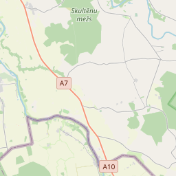
Building (cadastre designation: 40500090022001)
Cadastre designation: 40500090022001
Address: "Turķi", Ceraukstes pagasts, Bauskas novads, LV-3908
Cadastre designation of real estate | |
|---|---|
Cadastral object type | Cadastral object type: Building |
Address | Address: "Turķi", Ceraukstes pagasts, Bauskas novads, LV-3908 |
Address | |
|---|---|
Address ID | Address ID: 104880043 |
Companies registered at the address | Companies registered at the address: 0 |
Departments registered at the address | Departments registered at the address: 0 |
Institutions registered at the address | Institutions registered at the address: 0 |
Real estate registered at the address | |
Transactions with real estate at the address | Transactions with real estate at the address: 0 |
| Cadastral object type | Cadastre designation of the cadastral object | Person's property right status | Person status | Land Register |
|---|---|---|---|---|
| Cadastral object type: Building | 40500090022001 | Person's property right status: No data | Person status: No data | Land Register |
17.12.2024. State land service data
|
|
|
{"7201060210":{"name":"<div class='color_dot' style='background-color: #00ffff'><\/div><span>Specified land unit<\/span>","featureColor":"#00ffff","features":{"type":"FeatureCollection","features":[{"type":"Feature","geometry":{"type":"Polygon","coordinates":[[[24.327725336,56.351412401],[24.326548104,56.351561452],[24.326460714,56.351573335],[24.326414597,56.351588416],[24.32637075,56.351607893],[24.32538626,56.352249224],[24.325380239,56.352268071],[24.325849527,56.352937054],[24.325895445,56.353029375],[24.326287668,56.353606387],[24.326310348,56.35362258],[24.326335378,56.353633511],[24.326289105,56.353651449],[24.321169171,56.35563632],[24.318701808,56.356592707],[24.316722888,56.357337812],[24.316678057,56.357354692],[24.316350169,56.357195901],[24.315531772,56.356728422],[24.315741783,56.356565826],[24.315844585,56.356461486],[24.315835556,56.356357772],[24.315775548,56.356277706],[24.315020007,56.355812005],[24.315212725,56.35561524],[24.316512759,56.354723785],[24.316802597,56.354521864],[24.317039342,56.354308812],[24.317826415,56.353354873],[24.318560349,56.352386339],[24.319066488,56.351645579],[24.319179461,56.351493953],[24.326530133,56.350160746],[24.328420598,56.349925704],[24.327745863,56.351368215],[24.327725336,56.351412401]]]},"crs":{"type":"name","properties":{"name":"urn:ogc:def:crs:EPSG:3059"}},"properties":{"style":{"color":"#00ffff","dashArray":"8,12","weight":1},"name":"Land","object_type":"Parcel","parcel_code":"40500090393","code":null,"surveyor":null,"address":"","ownership":"<span>Owner - Natural person<br><\/span>","pro_cadastre_nr":"40500090022"}},{"type":"Feature","geometry":{"type":"Polygon","coordinates":[[[24.298647961,56.353447483],[24.298845317,56.353279852],[24.299114574,56.353042874],[24.29934961,56.352839869],[24.299852564,56.352403868],[24.300137111,56.352141488],[24.300536682,56.351792111],[24.300618403,56.351821535],[24.301792458,56.352240099],[24.304697161,56.353209884],[24.304728695,56.353225637],[24.304080511,56.353855774],[24.303004235,56.354943419],[24.302962921,56.354929199],[24.301259539,56.354344301],[24.299823335,56.353851122],[24.29874671,56.353481395],[24.298647961,56.353447483]]]},"crs":{"type":"name","properties":{"name":"urn:ogc:def:crs:EPSG:3059"}},"properties":{"style":{"color":"#00ffff","dashArray":"8,12","weight":1},"name":"Land","object_type":"Parcel","parcel_code":"40500090024","code":null,"surveyor":null,"address":"","ownership":"<span>Owner - Natural person<br><\/span>","pro_cadastre_nr":"40500090022"}},{"type":"Feature","geometry":{"type":"Polygon","coordinates":[[[24.313520137,56.356613143],[24.314247793,56.356092259],[24.314890383,56.355786701],[24.315725157,56.356298751],[24.315762933,56.356364284],[24.315758443,56.35644547],[24.31569104,56.356507942],[24.31540906,56.356683558],[24.314564506,56.357141049],[24.314521541,56.357080378],[24.314029113,56.356785597],[24.313856798,56.35670166],[24.313765889,56.356673167],[24.313691311,56.356660795],[24.313590897,56.356659252],[24.313525977,56.356660153],[24.313520137,56.356613143]]]},"crs":{"type":"name","properties":{"name":"urn:ogc:def:crs:EPSG:3059"}},"properties":{"style":{"color":"#00ffff","dashArray":"8,12","weight":1},"name":"Land","object_type":"Parcel","parcel_code":"40500090022","code":null,"surveyor":null,"address":"\"Tur\u0137i\", Ceraukstes pag., Bauskas nov., LV-3908","ownership":"<span>Owner - Natural person<br><\/span>","pro_cadastre_nr":"40500090022"}}]}},"7201060110":{"name":"<div class='color_dot' style='background-color: #00ffff'><\/div><span>Measured land unit<\/span>","featureColor":"#00ffff","features":{"type":"FeatureCollection","features":[{"type":"Feature","geometry":{"type":"Polygon","coordinates":[[[24.328420598,56.349925704],[24.328885436,56.349867878],[24.328305759,56.351047596],[24.328313131,56.35106577],[24.328234138,56.351301498],[24.328181287,56.351350092],[24.327725336,56.351412401],[24.327745863,56.351368215],[24.328420598,56.349925704]]]},"crs":{"type":"name","properties":{"name":"urn:ogc:def:crs:EPSG:3059"}},"properties":{"style":{"color":"#00ffff","dashArray":"0","weight":1},"name":"Land","object_type":"Parcel","parcel_code":"40500090394","code":null,"surveyor":null,"address":"","ownership":"<span>Owner - Natural person<br><\/span>","pro_cadastre_nr":"40500090022"}}]}},"7114100000":{"name":"<div class='color_dot' style='background-color: #b40000'><\/div><span>Burdened access road servitude area<\/span>","featureColor":"#b40000","features":{"type":"FeatureCollection","features":[{"type":"Feature","geometry":{"type":"Polygon","coordinates":[[[24.315531772,56.356728422],[24.315560787,56.35670642],[24.316383591,56.35717632],[24.316718032,56.357339497],[24.316678057,56.357354692],[24.316350169,56.357195901],[24.315531772,56.356728422]]]},"crs":{"type":"name","properties":{"name":"urn:ogc:def:crs:EPSG:3059"}},"properties":{"style":{"color":"#b40000","dashArray":"4,2,1,2","weight":1},"name":"Burdened access road servitude area","object_type":"WayRestriction","parcel_code":"40500090393","code":"7315030100003","surveyor":null,"address":"","ownership":"<span>Owner - Natural person<br><\/span>","pro_cadastre_nr":"40500090022"}},{"type":"Feature","geometry":{"type":"Polygon","coordinates":[[[24.303004235,56.354943419],[24.302962921,56.354929199],[24.304038416,56.353842943],[24.304691203,56.353207926],[24.304697161,56.353209884],[24.304728695,56.353225637],[24.304080511,56.353855774],[24.303004235,56.354943419]]]},"crs":{"type":"name","properties":{"name":"urn:ogc:def:crs:EPSG:3059"}},"properties":{"style":{"color":"#b40000","dashArray":"4,2,1,2","weight":1},"name":"Burdened access road servitude area","object_type":"WayRestriction","parcel_code":"40500090024","code":"7315030100001","surveyor":null,"address":"","ownership":"<span>Owner - Natural person<br><\/span>","pro_cadastre_nr":"40500090022"}},{"type":"Feature","geometry":{"type":"Polygon","coordinates":[[[24.313525977,56.356660153],[24.313522772,56.356633251],[24.313590962,56.35663229],[24.313699066,56.356633951],[24.31378501,56.356648208],[24.313885041,56.35667956],[24.314063012,56.356766252],[24.314563371,56.357065781],[24.314587182,56.357099405],[24.314600282,56.357121669],[24.314564506,56.357141049],[24.31454336,56.357111191],[24.314521541,56.357080378],[24.314029113,56.356785597],[24.313856798,56.35670166],[24.313765889,56.356673167],[24.313691311,56.356660795],[24.313590897,56.356659252],[24.313525977,56.356660153]]]},"crs":{"type":"name","properties":{"name":"urn:ogc:def:crs:EPSG:3059"}},"properties":{"style":{"color":"#b40000","dashArray":"4,2,1,2","weight":1},"name":"Burdened access road servitude area","object_type":"WayRestriction","parcel_code":"40500090022","code":"7315030100001","surveyor":null,"address":"\"Tur\u0137i\", Ceraukstes pag., Bauskas nov., LV-3908","ownership":"<span>Owner - Natural person<br><\/span>","pro_cadastre_nr":"40500090022"}}]}},"5201011310":{"name":"<div class='color_dot' style='background-color: #960096'><\/div><span>Vectorized building<\/span>","featureColor":"#960096","features":{"type":"FeatureCollection","features":[{"type":"Feature","geometry":{"type":"Polygon","coordinates":[[[24.315127851,56.356508692],[24.31525772,56.356435875],[24.31532678,56.356473839],[24.315196895,56.356546656],[24.315127851,56.356508692]]]},"crs":{"type":"name","properties":{"name":"urn:ogc:def:crs:EPSG:3059"}},"properties":{"style":{"color":"#960096","dashArray":"0","weight":2},"name":"Building","object_type":"Building","parcel_code":"40500090022","code":"40500090022004","surveyor":null,"address":"\"Tur\u0137i\", Ceraukstes pag., Bauskas nov., LV-3908","ownership":null,"pro_cadastre_nr":null}},{"type":"Feature","geometry":{"type":"Polygon","coordinates":[[[24.314784462,56.356521011],[24.314903692,56.35643744],[24.314997068,56.356478496],[24.314877838,56.356562076],[24.314784462,56.356521011]]]},"crs":{"type":"name","properties":{"name":"urn:ogc:def:crs:EPSG:3059"}},"properties":{"style":{"color":"#960096","dashArray":"0","weight":2},"name":"Building","object_type":"Building","parcel_code":"40500090022","code":"40500090022002","surveyor":null,"address":"\"Tur\u0137i\", Ceraukstes pag., Bauskas nov., LV-3908","ownership":"<span>Owner - Natural person<br><\/span>","pro_cadastre_nr":"40500090022"}},{"type":"Feature","geometry":{"type":"Polygon","coordinates":[[[24.315029914,56.356295228],[24.315168734,56.356205084],[24.315276889,56.356256434],[24.315138069,56.356346568],[24.315029914,56.356295228]]]},"crs":{"type":"name","properties":{"name":"urn:ogc:def:crs:EPSG:3059"}},"properties":{"style":{"color":"#960096","dashArray":"0","weight":2},"name":"Building","object_type":"Building","parcel_code":"40500090022","code":"40500090022001","surveyor":null,"address":"\"Tur\u0137i\", Ceraukstes pag., Bauskas nov., LV-3908","ownership":"<span>Owner - Natural person<br><\/span>","pro_cadastre_nr":"40500090022"}},{"type":"Feature","geometry":{"type":"Polygon","coordinates":[[[24.314784462,56.356521011],[24.314903692,56.35643744],[24.314997068,56.356478496],[24.314877838,56.356562076],[24.314784462,56.356521011]]]},"crs":{"type":"name","properties":{"name":"urn:ogc:def:crs:EPSG:3059"}},"properties":{"style":{"color":"#960096","dashArray":"0","weight":2},"name":"Building","object_type":"Building","parcel_code":"40500090022","code":"40500090022002","surveyor":null,"address":"\"Tur\u0137i\", Ceraukstes pag., Bauskas nov., LV-3908","ownership":"<span>Owner - Natural person<br><\/span>","pro_cadastre_nr":"40500090022"}},{"type":"Feature","geometry":{"type":"Polygon","coordinates":[[[24.315029914,56.356295228],[24.315168734,56.356205084],[24.315276889,56.356256434],[24.315138069,56.356346568],[24.315029914,56.356295228]]]},"crs":{"type":"name","properties":{"name":"urn:ogc:def:crs:EPSG:3059"}},"properties":{"style":{"color":"#960096","dashArray":"0","weight":2},"name":"Building","object_type":"Building","parcel_code":"40500090022","code":"40500090022001","surveyor":null,"address":"\"Tur\u0137i\", Ceraukstes pag., Bauskas nov., LV-3908","ownership":"<span>Owner - Natural person<br><\/span>","pro_cadastre_nr":"40500090022"}}]}}}
{"7201060210":{"name":"<div class='color_dot' style='background-color: #00ffff'><\/div><span>Specified land unit<\/span>","featureColor":"#00ffff","features":{"type":"FeatureCollection","features":[{"type":"Feature","geometry":{"type":"Polygon","coordinates":[[[24.313520137,56.356613143],[24.314247793,56.356092259],[24.314890383,56.355786701],[24.314979674,56.355852627],[24.315725157,56.356298751],[24.31569104,56.356507942],[24.315219057,56.356833995],[24.314564506,56.357141049],[24.314521541,56.357080378],[24.314029113,56.356785597],[24.313856798,56.35670166],[24.313765889,56.356673167],[24.313691311,56.356660795],[24.313590897,56.356659252],[24.313525977,56.356660153],[24.313520137,56.356613143]]]},"crs":{"type":"name","properties":{"name":"urn:ogc:def:crs:EPSG:3059"}},"properties":{"style":{"color":"#00ffff","dashArray":"8,12","weight":1},"name":"Land","object_type":"Parcel","parcel_code":"40500090022","code":null,"surveyor":null,"address":"\"Tur\u0137i\", Ceraukstes pag., Bauskas nov., LV-3908","ownership":"<span>Owner - Natural person<br><\/span>","pro_cadastre_nr":"40500090022"}}]}}}
https://tile.openstreetmap.org/{z}/{x}/{y}.png|© OpenStreetMap contributors|minZoom: 7|maxZoom: 19
|
Building data updated: 29.12.2024.
Data source and license: Cadastre Information System open text and spatial data, Real Estate Market Database open data, open data license Creative Commons Attribution, OpenStreetMap

