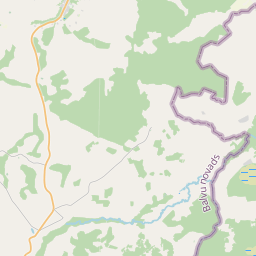
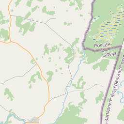
Building (cadastre designation: 38820050020009)
Cadastre designation: 38820050020009
Address: "Kudreva", Upīte, Šķilbēnu pagasts, Balvu novads, LV-4587
Cadastre designation of real estate | |
|---|---|
Cadastral object type | Cadastral object type: Building |
Address | Address: "Kudreva", Upīte, Šķilbēnu pagasts, Balvu novads, LV-4587 |
Address | |
|---|---|
Address ID | Address ID: 105811126 |
Companies registered at the address | Companies registered at the address: 0 |
Departments registered at the address | Departments registered at the address: 0 |
Institutions registered at the address | Institutions registered at the address: 0 |
Real estate registered at the address | |
Transactions with real estate at the address |
| Cadastral object type | Cadastre designation of the cadastral object | Person's property right status | Person status | Land Register |
|---|---|---|---|---|
| Cadastral object type: Building | 38820050020009 | Person's property right status: No data | Person status: No data | Land Register |
17.12.2024. State land service data
|
|
|
{"7201060210":{"name":"<div class='color_dot' style='background-color: #00ffff'><\/div><span>Specified land unit<\/span>","featureColor":"#00ffff","features":{"type":"FeatureCollection","features":[{"type":"Feature","geometry":{"type":"Polygon","coordinates":[[[27.703701121,57.031386961],[27.703902093,57.03136345],[27.704139145,57.031379842],[27.704550391,57.031426185],[27.705481914,57.03153905],[27.706326335,57.031636929],[27.707495489,57.031772004],[27.708307328,57.031864991],[27.709226455,57.031960636],[27.710415206,57.032077543],[27.70995142,57.032577064],[27.709012509,57.033570576],[27.706050187,57.033160916],[27.7043673,57.032918145],[27.704322873,57.032901901],[27.703717602,57.031444996],[27.703701121,57.031386961]]]},"crs":{"type":"name","properties":{"name":"urn:ogc:def:crs:EPSG:3059"}},"properties":{"style":{"color":"#00ffff","dashArray":"8,12","weight":1},"name":"Land","object_type":"Parcel","parcel_code":"38820060004","code":null,"surveyor":null,"address":"","ownership":"<span>Owner - Legal entity<br><\/span>","pro_cadastre_nr":"38820050020"}},{"type":"Feature","geometry":{"type":"Polygon","coordinates":[[[27.679531492,57.028535184],[27.679572379,57.027802392],[27.679463982,57.026904376],[27.679940734,57.026910443],[27.681266631,57.026866388],[27.681913311,57.026904867],[27.682719022,57.027003728],[27.683252759,57.027058932],[27.682628752,57.028103516],[27.682454601,57.028391196],[27.682072771,57.028979877],[27.686039465,57.030169108],[27.682780004,57.031581835],[27.681173539,57.030785203],[27.680667266,57.030536027],[27.680212733,57.030268424],[27.679789123,57.030132977],[27.680730854,57.028936623],[27.680570894,57.028568006],[27.679531492,57.028535184]]]},"crs":{"type":"name","properties":{"name":"urn:ogc:def:crs:EPSG:3059"}},"properties":{"style":{"color":"#00ffff","dashArray":"8,12","weight":1},"name":"Land","object_type":"Parcel","parcel_code":"38820050020","code":null,"surveyor":null,"address":"\"Kudreva\", Up\u012bte, \u0160\u0137ilb\u0113nu pag., Balvu nov., LV-4587","ownership":"<span>Owner - Legal entity<br><\/span>","pro_cadastre_nr":"38820050020"}}]}},"5201011310":{"name":"<div class='color_dot' style='background-color: #960096'><\/div><span>Vectorized building<\/span>","featureColor":"#960096","features":{"type":"FeatureCollection","features":[{"type":"Feature","geometry":{"type":"Polygon","coordinates":[[[27.681544277,57.026948512],[27.681421291,57.026929619],[27.681445325,57.026883093],[27.68156831,57.026901987],[27.681544277,57.026948512]]]},"crs":{"type":"name","properties":{"name":"urn:ogc:def:crs:EPSG:3059"}},"properties":{"style":{"color":"#960096","dashArray":"0","weight":2},"name":"Building","object_type":"Building","parcel_code":"38820050020","code":"38820050020006","surveyor":null,"address":"\"Kudreva\", Up\u012bte, \u0160\u0137ilb\u0113nu pag., Balvu nov., LV-4587","ownership":"<span>Owner - Legal entity<br><\/span>","pro_cadastre_nr":"38820050020"}},{"type":"Feature","geometry":{"type":"Polygon","coordinates":[[[27.681891813,57.027183521],[27.681851988,57.027229738],[27.68174873,57.027203278],[27.681788554,57.027157052],[27.681891813,57.027183521]]]},"crs":{"type":"name","properties":{"name":"urn:ogc:def:crs:EPSG:3059"}},"properties":{"style":{"color":"#960096","dashArray":"0","weight":2},"name":"Building","object_type":"Building","parcel_code":"38820050020","code":"38820050020003","surveyor":null,"address":"\"Kudreva\", Up\u012bte, \u0160\u0137ilb\u0113nu pag., Balvu nov., LV-4587","ownership":"<span>Owner - Legal entity<br><\/span>","pro_cadastre_nr":"38820050020"}},{"type":"Feature","geometry":{"type":"Polygon","coordinates":[[[27.68130123,57.027027721],[27.68152106,57.027097557],[27.681480984,57.027135078],[27.681392126,57.027106854],[27.681330441,57.027164594],[27.681199453,57.027122991],[27.68130123,57.027027721]]]},"crs":{"type":"name","properties":{"name":"urn:ogc:def:crs:EPSG:3059"}},"properties":{"style":{"color":"#960096","dashArray":"0","weight":2},"name":"Building","object_type":"Building","parcel_code":"38820050020","code":"38820050020001","surveyor":null,"address":"\"Kudreva\", Up\u012bte, \u0160\u0137ilb\u0113nu pag., Balvu nov., LV-4587","ownership":"<span>Owner - Legal entity<br><\/span>","pro_cadastre_nr":"38820050020"}},{"type":"Feature","geometry":{"type":"Polygon","coordinates":[[[27.681788554,57.027157052],[27.68174873,57.027203278],[27.681672114,57.027183641],[27.681711939,57.027137414],[27.681788554,57.027157052]]]},"crs":{"type":"name","properties":{"name":"urn:ogc:def:crs:EPSG:3059"}},"properties":{"style":{"color":"#960096","dashArray":"0","weight":2},"name":"Building","object_type":"Building","parcel_code":"38820050020","code":"38820050020004","surveyor":null,"address":"\"Kudreva\", Up\u012bte, \u0160\u0137ilb\u0113nu pag., Balvu nov., LV-4587","ownership":"<span>Owner - Legal entity<br><\/span>","pro_cadastre_nr":"38820050020"}},{"type":"Feature","geometry":{"type":"Polygon","coordinates":[[[27.681120498,57.02704873],[27.681039417,57.027036272],[27.681083499,57.026950927],[27.68116458,57.026963384],[27.681120498,57.02704873]]]},"crs":{"type":"name","properties":{"name":"urn:ogc:def:crs:EPSG:3059"}},"properties":{"style":{"color":"#960096","dashArray":"0","weight":2},"name":"Building","object_type":"Building","parcel_code":"38820050020","code":"38820050020010","surveyor":null,"address":"\"Kudreva\", Up\u012bte, \u0160\u0137ilb\u0113nu pag., Balvu nov., LV-4587","ownership":"<span>Owner - Legal entity<br><\/span>","pro_cadastre_nr":"38820050020"}},{"type":"Feature","geometry":{"type":"Polygon","coordinates":[[[27.681338852,57.026971067],[27.681265104,57.026959733],[27.681287462,57.02691644],[27.681361211,57.026927773],[27.681338852,57.026971067]]]},"crs":{"type":"name","properties":{"name":"urn:ogc:def:crs:EPSG:3059"}},"properties":{"style":{"color":"#960096","dashArray":"0","weight":2},"name":"Building","object_type":"Building","parcel_code":"38820050020","code":"38820050020009","surveyor":null,"address":"\"Kudreva\", Up\u012bte, \u0160\u0137ilb\u0113nu pag., Balvu nov., LV-4587","ownership":"<span>Owner - Legal entity<br><\/span>","pro_cadastre_nr":"38820050020"}},{"type":"Feature","geometry":{"type":"Polygon","coordinates":[[[27.681544277,57.026948512],[27.68156831,57.026901987],[27.681688649,57.026920463],[27.681664617,57.026966998],[27.681544277,57.026948512]]]},"crs":{"type":"name","properties":{"name":"urn:ogc:def:crs:EPSG:3059"}},"properties":{"style":{"color":"#960096","dashArray":"0","weight":2},"name":"Building","object_type":"Building","parcel_code":"38820050020","code":"38820050020005","surveyor":null,"address":"\"Kudreva\", Up\u012bte, \u0160\u0137ilb\u0113nu pag., Balvu nov., LV-4587","ownership":"<span>Owner - Legal entity<br><\/span>","pro_cadastre_nr":"38820050020"}},{"type":"Feature","geometry":{"type":"Polygon","coordinates":[[[27.681891813,57.027183521],[27.681979474,57.02720598],[27.681939633,57.027252198],[27.681851988,57.027229738],[27.681891813,57.027183521]]]},"crs":{"type":"name","properties":{"name":"urn:ogc:def:crs:EPSG:3059"}},"properties":{"style":{"color":"#960096","dashArray":"0","weight":2},"name":"Building","object_type":"Building","parcel_code":"38820050020","code":"38820050020002","surveyor":null,"address":"\"Kudreva\", Up\u012bte, \u0160\u0137ilb\u0113nu pag., Balvu nov., LV-4587","ownership":"<span>Owner - Legal entity<br><\/span>","pro_cadastre_nr":"38820050020"}},{"type":"Feature","geometry":{"type":"Polygon","coordinates":[[[27.681120498,57.02704873],[27.681039417,57.027036272],[27.681083499,57.026950927],[27.68116458,57.026963384],[27.681120498,57.02704873]]]},"crs":{"type":"name","properties":{"name":"urn:ogc:def:crs:EPSG:3059"}},"properties":{"style":{"color":"#960096","dashArray":"0","weight":2},"name":"Building","object_type":"Building","parcel_code":"38820050020","code":"38820050020010","surveyor":null,"address":"\"Kudreva\", Up\u012bte, \u0160\u0137ilb\u0113nu pag., Balvu nov., LV-4587","ownership":"<span>Owner - Legal entity<br><\/span>","pro_cadastre_nr":"38820050020"}},{"type":"Feature","geometry":{"type":"Polygon","coordinates":[[[27.681338852,57.026971067],[27.681265104,57.026959733],[27.681287462,57.02691644],[27.681361211,57.026927773],[27.681338852,57.026971067]]]},"crs":{"type":"name","properties":{"name":"urn:ogc:def:crs:EPSG:3059"}},"properties":{"style":{"color":"#960096","dashArray":"0","weight":2},"name":"Building","object_type":"Building","parcel_code":"38820050020","code":"38820050020009","surveyor":null,"address":"\"Kudreva\", Up\u012bte, \u0160\u0137ilb\u0113nu pag., Balvu nov., LV-4587","ownership":"<span>Owner - Legal entity<br><\/span>","pro_cadastre_nr":"38820050020"}},{"type":"Feature","geometry":{"type":"Polygon","coordinates":[[[27.681544277,57.026948512],[27.681421291,57.026929619],[27.681445325,57.026883093],[27.68156831,57.026901987],[27.681544277,57.026948512]]]},"crs":{"type":"name","properties":{"name":"urn:ogc:def:crs:EPSG:3059"}},"properties":{"style":{"color":"#960096","dashArray":"0","weight":2},"name":"Building","object_type":"Building","parcel_code":"38820050020","code":"38820050020006","surveyor":null,"address":"\"Kudreva\", Up\u012bte, \u0160\u0137ilb\u0113nu pag., Balvu nov., LV-4587","ownership":"<span>Owner - Legal entity<br><\/span>","pro_cadastre_nr":"38820050020"}},{"type":"Feature","geometry":{"type":"Polygon","coordinates":[[[27.681544277,57.026948512],[27.68156831,57.026901987],[27.681688649,57.026920463],[27.681664617,57.026966998],[27.681544277,57.026948512]]]},"crs":{"type":"name","properties":{"name":"urn:ogc:def:crs:EPSG:3059"}},"properties":{"style":{"color":"#960096","dashArray":"0","weight":2},"name":"Building","object_type":"Building","parcel_code":"38820050020","code":"38820050020005","surveyor":null,"address":"\"Kudreva\", Up\u012bte, \u0160\u0137ilb\u0113nu pag., Balvu nov., LV-4587","ownership":"<span>Owner - Legal entity<br><\/span>","pro_cadastre_nr":"38820050020"}},{"type":"Feature","geometry":{"type":"Polygon","coordinates":[[[27.681788554,57.027157052],[27.68174873,57.027203278],[27.681672114,57.027183641],[27.681711939,57.027137414],[27.681788554,57.027157052]]]},"crs":{"type":"name","properties":{"name":"urn:ogc:def:crs:EPSG:3059"}},"properties":{"style":{"color":"#960096","dashArray":"0","weight":2},"name":"Building","object_type":"Building","parcel_code":"38820050020","code":"38820050020004","surveyor":null,"address":"\"Kudreva\", Up\u012bte, \u0160\u0137ilb\u0113nu pag., Balvu nov., LV-4587","ownership":"<span>Owner - Legal entity<br><\/span>","pro_cadastre_nr":"38820050020"}},{"type":"Feature","geometry":{"type":"Polygon","coordinates":[[[27.681891813,57.027183521],[27.681851988,57.027229738],[27.68174873,57.027203278],[27.681788554,57.027157052],[27.681891813,57.027183521]]]},"crs":{"type":"name","properties":{"name":"urn:ogc:def:crs:EPSG:3059"}},"properties":{"style":{"color":"#960096","dashArray":"0","weight":2},"name":"Building","object_type":"Building","parcel_code":"38820050020","code":"38820050020003","surveyor":null,"address":"\"Kudreva\", Up\u012bte, \u0160\u0137ilb\u0113nu pag., Balvu nov., LV-4587","ownership":"<span>Owner - Legal entity<br><\/span>","pro_cadastre_nr":"38820050020"}},{"type":"Feature","geometry":{"type":"Polygon","coordinates":[[[27.681891813,57.027183521],[27.681979474,57.02720598],[27.681939633,57.027252198],[27.681851988,57.027229738],[27.681891813,57.027183521]]]},"crs":{"type":"name","properties":{"name":"urn:ogc:def:crs:EPSG:3059"}},"properties":{"style":{"color":"#960096","dashArray":"0","weight":2},"name":"Building","object_type":"Building","parcel_code":"38820050020","code":"38820050020002","surveyor":null,"address":"\"Kudreva\", Up\u012bte, \u0160\u0137ilb\u0113nu pag., Balvu nov., LV-4587","ownership":"<span>Owner - Legal entity<br><\/span>","pro_cadastre_nr":"38820050020"}},{"type":"Feature","geometry":{"type":"Polygon","coordinates":[[[27.68130123,57.027027721],[27.68152106,57.027097557],[27.681480984,57.027135078],[27.681392126,57.027106854],[27.681330441,57.027164594],[27.681199453,57.027122991],[27.68130123,57.027027721]]]},"crs":{"type":"name","properties":{"name":"urn:ogc:def:crs:EPSG:3059"}},"properties":{"style":{"color":"#960096","dashArray":"0","weight":2},"name":"Building","object_type":"Building","parcel_code":"38820050020","code":"38820050020001","surveyor":null,"address":"\"Kudreva\", Up\u012bte, \u0160\u0137ilb\u0113nu pag., Balvu nov., LV-4587","ownership":"<span>Owner - Legal entity<br><\/span>","pro_cadastre_nr":"38820050020"}}]}}}
[]
https://tile.openstreetmap.org/{z}/{x}/{y}.png|© OpenStreetMap contributors|minZoom: 7|maxZoom: 19
|
Building data updated: 28.12.2024.
Data source and license: Cadastre Information System open text and spatial data, Real Estate Market Database open data, open data license Creative Commons Attribution, OpenStreetMap

