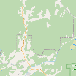
Building (cadastre designation: 38780030013006)
Cadastre designation: 38780030013006
Address: "Jaunpurviņi 1", Klāni, Susāju pagasts, Balvu novads, LV-4582
Cadastre designation of real estate | |
|---|---|
Cadastral object type | Cadastral object type: Building |
Address | Address: "Jaunpurviņi 1", Klāni, Susāju pagasts, Balvu novads, LV-4582 |
Address | |
|---|---|
Address ID | Address ID: 103959465 |
Companies registered at the address | |
Departments registered at the address | Departments registered at the address: 0 |
Institutions registered at the address | Institutions registered at the address: 0 |
Real estate registered at the address | |
Transactions with real estate at the address | Transactions with real estate at the address: 0 |
| No. | Cadastral object type | Cadastre designation of the cadastral object | Person's property right status | Person status | Land Register |
|---|---|---|---|---|---|
| 1 | No.:1 Cadastral object type: Building | 38780030013006 | Person's property right status: Owner | Person status: Natural person | Land Register |
| 2 | No.:2 Cadastral object type: Building | 38780030013006 | Person's property right status: Legal owner | Person status: Natural person | Land Register |
09.01.2025. State land service data
|
|
|
{"7201060210":{"name":"<div class='color_dot' style='background-color: #00ffff'><\/div><span>Specified land unit<\/span>","featureColor":"#00ffff","features":{"type":"FeatureCollection","features":[{"type":"Feature","geometry":{"type":"Polygon","coordinates":[[[27.553333214,57.209401066],[27.553676524,57.207034352],[27.555293468,57.207224394],[27.554867295,57.209644204],[27.553333214,57.209401066]]]},"crs":{"type":"name","properties":{"name":"urn:ogc:def:crs:EPSG:3059"}},"properties":{"style":{"color":"#00ffff","dashArray":"8,12","weight":1},"name":"Land","object_type":"Parcel","parcel_code":"38780030014","code":null,"surveyor":null,"address":"","ownership":"<span>Owner - Natural person<br><\/span>","pro_cadastre_nr":"38780030013"}},{"type":"Feature","geometry":{"type":"Polygon","coordinates":[[[27.550419264,57.206633588],[27.550956432,57.202392655],[27.55054081,57.202346982],[27.551306619,57.201588318],[27.552364994,57.20242996],[27.55449711,57.202880207],[27.55443168,57.203730957],[27.554312774,57.204405564],[27.554218049,57.204942922],[27.553676524,57.207034352],[27.550419264,57.206633588]]]},"crs":{"type":"name","properties":{"name":"urn:ogc:def:crs:EPSG:3059"}},"properties":{"style":{"color":"#00ffff","dashArray":"8,12","weight":1},"name":"Land","object_type":"Parcel","parcel_code":"38780030013","code":null,"surveyor":null,"address":"\"Jaunpurvi\u0146i 1\", Kl\u0101ni, Sus\u0101ju pag., Balvu nov., LV-4582","ownership":"<span>Owner - Natural person<br><\/span>","pro_cadastre_nr":"38780030013"}},{"type":"Feature","geometry":{"type":"Polygon","coordinates":[[[27.536131603,57.214964164],[27.536716097,57.21342461],[27.539158554,57.213543957],[27.546685225,57.213909996],[27.546687483,57.214351212],[27.54275411,57.214589161],[27.536131603,57.214964164]]]},"crs":{"type":"name","properties":{"name":"urn:ogc:def:crs:EPSG:3059"}},"properties":{"style":{"color":"#00ffff","dashArray":"8,12","weight":1},"name":"Land","object_type":"Parcel","parcel_code":"38780020081","code":null,"surveyor":null,"address":"","ownership":"<span>Owner - Natural person<br><\/span>","pro_cadastre_nr":"38780030013"}}]}},"5201011310":{"name":"<div class='color_dot' style='background-color: #960096'><\/div><span>Vectorized building<\/span>","featureColor":"#960096","features":{"type":"FeatureCollection","features":[{"type":"Feature","geometry":{"type":"Polygon","coordinates":[[[27.551297202,57.205370046],[27.550935706,57.205380281],[27.550929668,57.205317456],[27.551291162,57.205307222],[27.551297202,57.205370046]]]},"crs":{"type":"name","properties":{"name":"urn:ogc:def:crs:EPSG:3059"}},"properties":{"style":{"color":"#960096","dashArray":"0","weight":2},"name":"Building","object_type":"Building","parcel_code":"38780030013","code":"38780030013001","surveyor":null,"address":"\"Jaunpurvi\u0146i 1\", Kl\u0101ni, Sus\u0101ju pag., Balvu nov., LV-4582","ownership":"<span>Owner - Natural person<br><\/span>","pro_cadastre_nr":"38780030013"}},{"type":"Feature","geometry":{"type":"Polygon","coordinates":[[[27.551552501,57.205650248],[27.551545895,57.205581533],[27.551632663,57.205579076],[27.55163927,57.205647791],[27.551552501,57.205650248]]]},"crs":{"type":"name","properties":{"name":"urn:ogc:def:crs:EPSG:3059"}},"properties":{"style":{"color":"#960096","dashArray":"0","weight":2},"name":"Building","object_type":"Building","parcel_code":"38780030013","code":"38780030013003","surveyor":null,"address":"\"Jaunpurvi\u0146i 1\", Kl\u0101ni, Sus\u0101ju pag., Balvu nov., LV-4582","ownership":"<span>Owner - Natural person<br><\/span>","pro_cadastre_nr":"38780030013"}},{"type":"Feature","geometry":{"type":"Polygon","coordinates":[[[27.551354064,57.205659804],[27.551348213,57.205598943],[27.551471113,57.205595464],[27.551476964,57.205656324],[27.551354064,57.205659804]]]},"crs":{"type":"name","properties":{"name":"urn:ogc:def:crs:EPSG:3059"}},"properties":{"style":{"color":"#960096","dashArray":"0","weight":2},"name":"Building","object_type":"Building","parcel_code":"38780030013","code":"38780030013006","surveyor":null,"address":"\"Jaunpurvi\u0146i 1\", Kl\u0101ni, Sus\u0101ju pag., Balvu nov., LV-4582","ownership":"<span>Owner - Natural person<br><\/span>","pro_cadastre_nr":"38780030013"}},{"type":"Feature","geometry":{"type":"Polygon","coordinates":[[[27.551573722,57.205531523],[27.551349581,57.205537869],[27.551335992,57.205396512],[27.551560132,57.205390166],[27.551573722,57.205531523]]]},"crs":{"type":"name","properties":{"name":"urn:ogc:def:crs:EPSG:3059"}},"properties":{"style":{"color":"#960096","dashArray":"0","weight":2},"name":"Building","object_type":"Building","parcel_code":"38780030013","code":"38780030013002","surveyor":null,"address":"\"Jaunpurvi\u0146i 1\", Kl\u0101ni, Sus\u0101ju pag., Balvu nov., LV-4582","ownership":"<span>Owner - Natural person<br><\/span>","pro_cadastre_nr":"38780030013"}},{"type":"Feature","geometry":{"type":"Polygon","coordinates":[[[27.551144567,57.205667704],[27.551138716,57.205606843],[27.551305017,57.205602135],[27.551310868,57.205662996],[27.551144567,57.205667704]]]},"crs":{"type":"name","properties":{"name":"urn:ogc:def:crs:EPSG:3059"}},"properties":{"style":{"color":"#960096","dashArray":"0","weight":2},"name":"Building","object_type":"Building","parcel_code":"38780030013","code":"38780030013008","surveyor":null,"address":"\"Jaunpurvi\u0146i 1\", Kl\u0101ni, Sus\u0101ju pag., Balvu nov., LV-4582","ownership":"<span>Owner - Natural person<br><\/span>","pro_cadastre_nr":"38780030013"}},{"type":"Feature","geometry":{"type":"Polygon","coordinates":[[[27.551144567,57.205667704],[27.551138716,57.205606843],[27.551305017,57.205602135],[27.551310868,57.205662996],[27.551144567,57.205667704]]]},"crs":{"type":"name","properties":{"name":"urn:ogc:def:crs:EPSG:3059"}},"properties":{"style":{"color":"#960096","dashArray":"0","weight":2},"name":"Building","object_type":"Building","parcel_code":"38780030013","code":"38780030013008","surveyor":null,"address":"\"Jaunpurvi\u0146i 1\", Kl\u0101ni, Sus\u0101ju pag., Balvu nov., LV-4582","ownership":"<span>Owner - Natural person<br>Legal owner - Natural person<br><\/span>","pro_cadastre_nr":"38780030013"}},{"type":"Feature","geometry":{"type":"Polygon","coordinates":[[[27.551354064,57.205659804],[27.551348213,57.205598943],[27.551471113,57.205595464],[27.551476964,57.205656324],[27.551354064,57.205659804]]]},"crs":{"type":"name","properties":{"name":"urn:ogc:def:crs:EPSG:3059"}},"properties":{"style":{"color":"#960096","dashArray":"0","weight":2},"name":"Building","object_type":"Building","parcel_code":"38780030013","code":"38780030013006","surveyor":null,"address":"\"Jaunpurvi\u0146i 1\", Kl\u0101ni, Sus\u0101ju pag., Balvu nov., LV-4582","ownership":"<span>Legal owner - Natural person<br>Owner - Natural person<br><\/span>","pro_cadastre_nr":"38780030013"}},{"type":"Feature","geometry":{"type":"Polygon","coordinates":[[[27.551552501,57.205650248],[27.551545895,57.205581533],[27.551632663,57.205579076],[27.55163927,57.205647791],[27.551552501,57.205650248]]]},"crs":{"type":"name","properties":{"name":"urn:ogc:def:crs:EPSG:3059"}},"properties":{"style":{"color":"#960096","dashArray":"0","weight":2},"name":"Building","object_type":"Building","parcel_code":"38780030013","code":"38780030013003","surveyor":null,"address":"\"Jaunpurvi\u0146i 1\", Kl\u0101ni, Sus\u0101ju pag., Balvu nov., LV-4582","ownership":"<span>Owner - Natural person<br>Legal owner - Natural person<br><\/span>","pro_cadastre_nr":"38780030013"}},{"type":"Feature","geometry":{"type":"Polygon","coordinates":[[[27.551573722,57.205531523],[27.551349581,57.205537869],[27.551335992,57.205396512],[27.551560132,57.205390166],[27.551573722,57.205531523]]]},"crs":{"type":"name","properties":{"name":"urn:ogc:def:crs:EPSG:3059"}},"properties":{"style":{"color":"#960096","dashArray":"0","weight":2},"name":"Building","object_type":"Building","parcel_code":"38780030013","code":"38780030013002","surveyor":null,"address":"\"Jaunpurvi\u0146i 1\", Kl\u0101ni, Sus\u0101ju pag., Balvu nov., LV-4582","ownership":"<span>Owner - Natural person<br>Legal owner - Natural person<br><\/span>","pro_cadastre_nr":"38780030013"}},{"type":"Feature","geometry":{"type":"Polygon","coordinates":[[[27.551297202,57.205370046],[27.550935706,57.205380281],[27.550929668,57.205317456],[27.551291162,57.205307222],[27.551297202,57.205370046]]]},"crs":{"type":"name","properties":{"name":"urn:ogc:def:crs:EPSG:3059"}},"properties":{"style":{"color":"#960096","dashArray":"0","weight":2},"name":"Building","object_type":"Building","parcel_code":"38780030013","code":"38780030013001","surveyor":null,"address":"\"Jaunpurvi\u0146i 1\", Kl\u0101ni, Sus\u0101ju pag., Balvu nov., LV-4582","ownership":"<span>Owner - Natural person<br>Legal owner - Natural person<br><\/span>","pro_cadastre_nr":"38780030013"}}]}}}
[]
https://tile.openstreetmap.org/{z}/{x}/{y}.png|© OpenStreetMap contributors|minZoom: 7|maxZoom: 19
|
Building data updated: 11.01.2025.
Data source and license: Cadastre Information System open text and spatial data, Real Estate Market Database open data, open data license Creative Commons Attribution, OpenStreetMap

