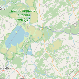
Building (cadastre designation: 38500020328005)
Cadastre designation: 38500020328005
Address: "Kraukļi", Bērzieši, Bērzpils pagasts, Balvu novads, LV-4576
Cadastre designation of real estate | |
|---|---|
Cadastral object type | Cadastral object type: Building |
Address | Address: "Kraukļi", Bērzieši, Bērzpils pagasts, Balvu novads, LV-4576 |
Address | |
|---|---|
Address ID | Address ID: 103303358 |
Companies registered at the address | Companies registered at the address: 0 |
Departments registered at the address | Departments registered at the address: 0 |
Institutions registered at the address | Institutions registered at the address: 0 |
Real estate registered at the address | |
Transactions with real estate at the address | Transactions with real estate at the address: 0 |
| Cadastral object type | Cadastre designation of the cadastral object | Person's property right status | Person status | Land Register |
|---|---|---|---|---|
| Cadastral object type: Building | 38500020328005 | Person's property right status: No data | Person status: No data | Land Register |
17.12.2024. State land service data
|
|
|
{"7201060210":{"name":"<div class='color_dot' style='background-color: #00ffff'><\/div><span>Specified land unit<\/span>","featureColor":"#00ffff","features":{"type":"FeatureCollection","features":[{"type":"Feature","geometry":{"type":"Polygon","coordinates":[[[27.124334849,56.858162373],[27.125474387,56.857666153],[27.125572833,56.857808609],[27.125741591,56.85803737],[27.126155847,56.858598904],[27.124700046,56.858961373],[27.124555519,56.858829877],[27.124341199,56.858169261],[27.124334849,56.858162373]]]},"crs":{"type":"name","properties":{"name":"urn:ogc:def:crs:EPSG:3059"}},"properties":{"style":{"color":"#00ffff","dashArray":"8,12","weight":1},"name":"Land","object_type":"Parcel","parcel_code":"38500030113","code":null,"surveyor":null,"address":"","ownership":"<span>Owner - Natural person<br><\/span>","pro_cadastre_nr":"38500020328"}},{"type":"Feature","geometry":{"type":"Polygon","coordinates":[[[27.056253014,56.847363425],[27.056331469,56.847349288],[27.058153155,56.847022662],[27.057164341,56.848855011],[27.056994035,56.848883813],[27.056927174,56.848719615],[27.056253014,56.847363425]]]},"crs":{"type":"name","properties":{"name":"urn:ogc:def:crs:EPSG:3059"}},"properties":{"style":{"color":"#00ffff","dashArray":"8,12","weight":1},"name":"Land","object_type":"Parcel","parcel_code":"38500020445","code":null,"surveyor":null,"address":"","ownership":"<span>Owner - Natural person<br><\/span>","pro_cadastre_nr":"38500020328"}},{"type":"Feature","geometry":{"type":"Polygon","coordinates":[[[27.031131596,56.831015465],[27.031180284,56.830770578],[27.03132477,56.83004382],[27.031409353,56.83002856],[27.032124316,56.829905466],[27.038370644,56.828924626],[27.038379333,56.828941008],[27.038934949,56.829775621],[27.038943306,56.829791129],[27.0336133,56.83065474],[27.032203363,56.83088281],[27.031214343,56.831004447],[27.031131596,56.831015465]]]},"crs":{"type":"name","properties":{"name":"urn:ogc:def:crs:EPSG:3059"}},"properties":{"style":{"color":"#00ffff","dashArray":"8,12","weight":1},"name":"Land","object_type":"Parcel","parcel_code":"38500020404","code":null,"surveyor":null,"address":"","ownership":"<span>Owner - Natural person<br><\/span>","pro_cadastre_nr":"38500020328"}},{"type":"Feature","geometry":{"type":"Polygon","coordinates":[[[27.062537981,56.845835556],[27.062631786,56.845821047],[27.067707035,56.845035796],[27.074069234,56.844051564],[27.080758524,56.842900838],[27.081018996,56.843131741],[27.078482096,56.843573293],[27.071109086,56.844876288],[27.063083816,56.84605309],[27.063019234,56.846085768],[27.062673837,56.84588077],[27.062537981,56.845835556]]]},"crs":{"type":"name","properties":{"name":"urn:ogc:def:crs:EPSG:3059"}},"properties":{"style":{"color":"#00ffff","dashArray":"8,12","weight":1},"name":"Land","object_type":"Parcel","parcel_code":"38500020339","code":null,"surveyor":null,"address":"","ownership":"<span>Owner - Natural person<br><\/span>","pro_cadastre_nr":"38500020328"}},{"type":"Feature","geometry":{"type":"Polygon","coordinates":[[[27.061344534,56.849608878],[27.061722329,56.848120814],[27.065334247,56.847523908],[27.065392671,56.847494356],[27.066644415,56.848237179],[27.067353705,56.84864695],[27.068300708,56.849194047],[27.068652084,56.849938701],[27.068573501,56.849951493],[27.066812978,56.850220173],[27.066821185,56.850231845],[27.066831295,56.850248927],[27.066387191,56.850327888],[27.066003903,56.850394458],[27.065972847,56.850351958],[27.065528099,56.849719614],[27.064951439,56.849826546],[27.062758414,56.850319376],[27.062444523,56.849690723],[27.061344534,56.849608878]]]},"crs":{"type":"name","properties":{"name":"urn:ogc:def:crs:EPSG:3059"}},"properties":{"style":{"color":"#00ffff","dashArray":"8,12","weight":1},"name":"Land","object_type":"Parcel","parcel_code":"38500020328","code":null,"surveyor":null,"address":"\"Krauk\u013ci\", B\u0113rzie\u0161i, B\u0113rzpils pag., Balvu nov., LV-4576","ownership":"<span>Owner - Natural person<br><\/span>","pro_cadastre_nr":"38500020328"}},{"type":"Feature","geometry":{"type":"Polygon","coordinates":[[[27.07743187,56.853275101],[27.07781594,56.853184773],[27.077818577,56.853184114],[27.077821159,56.853183395],[27.078133387,56.853091314],[27.078135403,56.853090689],[27.078137383,56.853090029],[27.078701662,56.852894361],[27.078701869,56.852894283],[27.078702093,56.852894215],[27.079430945,56.852637169],[27.079578698,56.852587464],[27.079769157,56.852817913],[27.079826767,56.853117908],[27.080119112,56.853835541],[27.079245574,56.853945398],[27.07799768,56.854147156],[27.07743187,56.853275101]]]},"crs":{"type":"name","properties":{"name":"urn:ogc:def:crs:EPSG:3059"}},"properties":{"style":{"color":"#00ffff","dashArray":"8,12","weight":1},"name":"Land","object_type":"Parcel","parcel_code":"38500020265","code":null,"surveyor":null,"address":"","ownership":"<span>Owner - Natural person<br><\/span>","pro_cadastre_nr":"38500020328"}}]}},"7114100000":{"name":"<div class='color_dot' style='background-color: #b40000'><\/div><span>Burdened access road servitude area<\/span>","featureColor":"#b40000","features":{"type":"FeatureCollection","features":[{"type":"Feature","geometry":{"type":"Polygon","coordinates":[[[27.073156661,56.844514062],[27.073042472,56.844210748],[27.073121117,56.844198483],[27.07323511,56.844500201],[27.073156661,56.844514062]]]},"crs":{"type":"name","properties":{"name":"urn:ogc:def:crs:EPSG:3059"}},"properties":{"style":{"color":"#b40000","dashArray":"4,2,1,2","weight":1},"name":"Burdened access road servitude area","object_type":"WayRestriction","parcel_code":"38500020339","code":"7315030100005","surveyor":null,"address":"","ownership":"<span>Owner - Natural person<br><\/span>","pro_cadastre_nr":"38500020328"}},{"type":"Feature","geometry":{"type":"Polygon","coordinates":[[[27.066821185,56.850231845],[27.066831295,56.850248927],[27.066387191,56.850327888],[27.066003903,56.850394458],[27.065992649,56.85037762],[27.066377179,56.850310786],[27.066821185,56.850231845]]]},"crs":{"type":"name","properties":{"name":"urn:ogc:def:crs:EPSG:3059"}},"properties":{"style":{"color":"#b40000","dashArray":"4,2,1,2","weight":1},"name":"Burdened access road servitude area","object_type":"WayRestriction","parcel_code":"38500020328","code":"7315030100001","surveyor":null,"address":"\"Krauk\u013ci\", B\u0113rzie\u0161i, B\u0113rzpils pag., Balvu nov., LV-4576","ownership":"<span>Owner - Natural person<br><\/span>","pro_cadastre_nr":"38500020328"}},{"type":"Feature","geometry":{"type":"Polygon","coordinates":[[[27.068451023,56.849969138],[27.068440521,56.849887787],[27.06830111,56.849597944],[27.068185075,56.849412021],[27.068102366,56.849279473],[27.067401492,56.848852331],[27.065186592,56.847548534],[27.065256303,56.847537041],[27.067449868,56.848828076],[27.068160067,56.849260904],[27.068247117,56.849400392],[27.068363908,56.849587536],[27.068505494,56.849881892],[27.068515471,56.84995923],[27.068451023,56.849969138]]]},"crs":{"type":"name","properties":{"name":"urn:ogc:def:crs:EPSG:3059"}},"properties":{"style":{"color":"#b40000","dashArray":"4,2,1,2","weight":1},"name":"Burdened access road servitude area","object_type":"WayRestriction","parcel_code":"38500020328","code":"7315030100009","surveyor":null,"address":"\"Krauk\u013ci\", B\u0113rzie\u0161i, B\u0113rzpils pag., Balvu nov., LV-4576","ownership":"<span>Owner - Natural person<br><\/span>","pro_cadastre_nr":"38500020328"}}]}},"5201011310":{"name":"<div class='color_dot' style='background-color: #960096'><\/div><span>Vectorized building<\/span>","featureColor":"#960096","features":{"type":"FeatureCollection","features":[{"type":"Feature","geometry":{"type":"Polygon","coordinates":[[[27.064915592,56.849503692],[27.064956441,56.849546815],[27.064866246,56.849572464],[27.064825414,56.849529341],[27.064915592,56.849503692]]]},"crs":{"type":"name","properties":{"name":"urn:ogc:def:crs:EPSG:3059"}},"properties":{"style":{"color":"#960096","dashArray":"0","weight":2},"name":"Building","object_type":"Building","parcel_code":"38500020328","code":"38500020328002","surveyor":null,"address":"\"Krauk\u013ci\", B\u0113rzie\u0161i, B\u0113rzpils pag., Balvu nov., LV-4576","ownership":"<span>Owner - Natural person<br><\/span>","pro_cadastre_nr":"38500020328"}},{"type":"Feature","geometry":{"type":"Polygon","coordinates":[[[27.06485287,56.849782926],[27.064809285,56.849709578],[27.064914949,56.84969073],[27.064958517,56.849764079],[27.06485287,56.849782926]]]},"crs":{"type":"name","properties":{"name":"urn:ogc:def:crs:EPSG:3059"}},"properties":{"style":{"color":"#960096","dashArray":"0","weight":2},"name":"Building","object_type":"Building","parcel_code":"38500020328","code":"38500020328005","surveyor":null,"address":"\"Krauk\u013ci\", B\u0113rzie\u0161i, B\u0113rzpils pag., Balvu nov., LV-4576","ownership":"<span>Owner - Natural person<br><\/span>","pro_cadastre_nr":"38500020328"}},{"type":"Feature","geometry":{"type":"Polygon","coordinates":[[[27.064809285,56.849709578],[27.064766174,56.849637],[27.064871822,56.849618153],[27.064914949,56.84969073],[27.064809285,56.849709578]]]},"crs":{"type":"name","properties":{"name":"urn:ogc:def:crs:EPSG:3059"}},"properties":{"style":{"color":"#960096","dashArray":"0","weight":2},"name":"Building","object_type":"Building","parcel_code":"38500020328","code":"38500020328004","surveyor":null,"address":"\"Krauk\u013ci\", B\u0113rzie\u0161i, B\u0113rzpils pag., Balvu nov., LV-4576","ownership":"<span>Owner - Natural person<br><\/span>","pro_cadastre_nr":"38500020328"}},{"type":"Feature","geometry":{"type":"Polygon","coordinates":[[[27.065144132,56.849696229],[27.06517132,56.849743409],[27.065057539,56.849763094],[27.065030366,56.849715904],[27.065144132,56.849696229]]]},"crs":{"type":"name","properties":{"name":"urn:ogc:def:crs:EPSG:3059"}},"properties":{"style":{"color":"#960096","dashArray":"0","weight":2},"name":"Building","object_type":"Building","parcel_code":"38500020328","code":"38500020328006","surveyor":null,"address":"\"Krauk\u013ci\", B\u0113rzie\u0161i, B\u0113rzpils pag., Balvu nov., LV-4576","ownership":"<span>Owner - Natural person<br><\/span>","pro_cadastre_nr":"38500020328"}},{"type":"Feature","geometry":{"type":"Polygon","coordinates":[[[27.065184174,56.849584718],[27.06529376,56.849560282],[27.065386861,56.849685627],[27.065277258,56.849710064],[27.065184174,56.849584718]]]},"crs":{"type":"name","properties":{"name":"urn:ogc:def:crs:EPSG:3059"}},"properties":{"style":{"color":"#960096","dashArray":"0","weight":2},"name":"Building","object_type":"Building","parcel_code":"38500020328","code":"38500020328001","surveyor":null,"address":"\"Krauk\u013ci\", B\u0113rzie\u0161i, B\u0113rzpils pag., Balvu nov., LV-4576","ownership":"<span>Owner - Natural person<br><\/span>","pro_cadastre_nr":"38500020328"}},{"type":"Feature","geometry":{"type":"Polygon","coordinates":[[[27.065144132,56.849696229],[27.06517132,56.849743409],[27.065057539,56.849763094],[27.065030366,56.849715904],[27.065144132,56.849696229]]]},"crs":{"type":"name","properties":{"name":"urn:ogc:def:crs:EPSG:3059"}},"properties":{"style":{"color":"#960096","dashArray":"0","weight":2},"name":"Building","object_type":"Building","parcel_code":"38500020328","code":"38500020328006","surveyor":null,"address":"\"Krauk\u013ci\", B\u0113rzie\u0161i, B\u0113rzpils pag., Balvu nov., LV-4576","ownership":"<span>Owner - Natural person<br><\/span>","pro_cadastre_nr":"38500020328"}},{"type":"Feature","geometry":{"type":"Polygon","coordinates":[[[27.06485287,56.849782926],[27.064809285,56.849709578],[27.064914949,56.84969073],[27.064958517,56.849764079],[27.06485287,56.849782926]]]},"crs":{"type":"name","properties":{"name":"urn:ogc:def:crs:EPSG:3059"}},"properties":{"style":{"color":"#960096","dashArray":"0","weight":2},"name":"Building","object_type":"Building","parcel_code":"38500020328","code":"38500020328005","surveyor":null,"address":"\"Krauk\u013ci\", B\u0113rzie\u0161i, B\u0113rzpils pag., Balvu nov., LV-4576","ownership":"<span>Owner - Natural person<br><\/span>","pro_cadastre_nr":"38500020328"}},{"type":"Feature","geometry":{"type":"Polygon","coordinates":[[[27.064809285,56.849709578],[27.064766174,56.849637],[27.064871822,56.849618153],[27.064914949,56.84969073],[27.064809285,56.849709578]]]},"crs":{"type":"name","properties":{"name":"urn:ogc:def:crs:EPSG:3059"}},"properties":{"style":{"color":"#960096","dashArray":"0","weight":2},"name":"Building","object_type":"Building","parcel_code":"38500020328","code":"38500020328004","surveyor":null,"address":"\"Krauk\u013ci\", B\u0113rzie\u0161i, B\u0113rzpils pag., Balvu nov., LV-4576","ownership":"<span>Owner - Natural person<br><\/span>","pro_cadastre_nr":"38500020328"}},{"type":"Feature","geometry":{"type":"Polygon","coordinates":[[[27.064915592,56.849503692],[27.064956441,56.849546815],[27.064866246,56.849572464],[27.064825414,56.849529341],[27.064915592,56.849503692]]]},"crs":{"type":"name","properties":{"name":"urn:ogc:def:crs:EPSG:3059"}},"properties":{"style":{"color":"#960096","dashArray":"0","weight":2},"name":"Building","object_type":"Building","parcel_code":"38500020328","code":"38500020328002","surveyor":null,"address":"\"Krauk\u013ci\", B\u0113rzie\u0161i, B\u0113rzpils pag., Balvu nov., LV-4576","ownership":"<span>Owner - Natural person<br><\/span>","pro_cadastre_nr":"38500020328"}},{"type":"Feature","geometry":{"type":"Polygon","coordinates":[[[27.065184174,56.849584718],[27.06529376,56.849560282],[27.065386861,56.849685627],[27.065277258,56.849710064],[27.065184174,56.849584718]]]},"crs":{"type":"name","properties":{"name":"urn:ogc:def:crs:EPSG:3059"}},"properties":{"style":{"color":"#960096","dashArray":"0","weight":2},"name":"Building","object_type":"Building","parcel_code":"38500020328","code":"38500020328001","surveyor":null,"address":"\"Krauk\u013ci\", B\u0113rzie\u0161i, B\u0113rzpils pag., Balvu nov., LV-4576","ownership":"<span>Owner - Natural person<br><\/span>","pro_cadastre_nr":"38500020328"}}]}}}
[]
https://tile.openstreetmap.org/{z}/{x}/{y}.png|© OpenStreetMap contributors|minZoom: 7|maxZoom: 19
|
Building data updated: 28.12.2024.
Data source and license: Cadastre Information System open text and spatial data, Real Estate Market Database open data, open data license Creative Commons Attribution, OpenStreetMap

