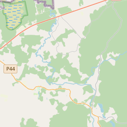
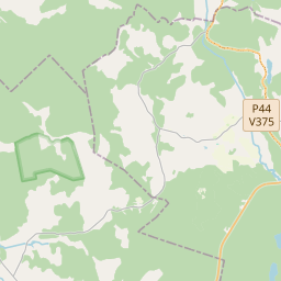
Building (cadastre designation: 36520010026001)
Cadastre designation: 36520010026001
Address: "Mežrozītes", Ilzenes pagasts, Alūksnes novads, LV-4344
Cadastre designation of real estate | |
|---|---|
Cadastral object type | Cadastral object type: Building |
Address | Address: "Mežrozītes", Ilzenes pagasts, Alūksnes novads, LV-4344 |
Address | |
|---|---|
Address ID | Address ID: 103659484 |
Companies registered at the address | |
Departments registered at the address | |
Institutions registered at the address | Institutions registered at the address: 0 |
Real estate registered at the address | |
Transactions with real estate at the address | Transactions with real estate at the address: 0 |
| Cadastral object type | Cadastre designation of the cadastral object | Person's property right status | Person status | Land Register |
|---|---|---|---|---|
| Cadastral object type: Building | 36520010026001 | Person's property right status: No data | Person status: No data | Land Register |
09.01.2025. State land service data
|
|
|
{"7201060210":{"name":"<div class='color_dot' style='background-color: #00ffff'><\/div><span>Specified land unit<\/span>","featureColor":"#00ffff","features":{"type":"FeatureCollection","features":[{"type":"Feature","geometry":{"type":"Polygon","coordinates":[[[26.639088727,57.378820891],[26.639168959,57.37850658],[26.639231875,57.378318962],[26.639161128,57.378315682],[26.639191602,57.376654922],[26.63919223,57.376581495],[26.639414762,57.376591108],[26.639606324,57.376598998],[26.640051101,57.376609143],[26.640810671,57.377161092],[26.640323377,57.37765395],[26.639917323,57.37834296],[26.639884514,57.378344834],[26.63991784,57.378431848],[26.639973164,57.378580445],[26.639994934,57.378604847],[26.640074702,57.378733349],[26.640132265,57.378798753],[26.640093283,57.378817284],[26.639575202,57.379048735],[26.639088727,57.378820891]]]},"crs":{"type":"name","properties":{"name":"urn:ogc:def:crs:EPSG:3059"}},"properties":{"style":{"color":"#00ffff","dashArray":"8,12","weight":1},"name":"Land","object_type":"Parcel","parcel_code":"36520040187","code":null,"surveyor":null,"address":"","ownership":"<span>Owner - Natural person<br><\/span>","pro_cadastre_nr":"36520010026"}},{"type":"Feature","geometry":{"type":"Polygon","coordinates":[[[26.612462827,57.397290115],[26.612800051,57.396988564],[26.612908612,57.396901044],[26.613251801,57.396595917],[26.614258496,57.395762094],[26.614817566,57.395285405],[26.61553242,57.394636335],[26.616246706,57.394076764],[26.616281134,57.394089223],[26.616342702,57.39411068],[26.622549107,57.395660913],[26.622654826,57.39577598],[26.623099817,57.396260295],[26.623937301,57.396945678],[26.624379068,57.397304868],[26.625582721,57.398352534],[26.626189052,57.398893227],[26.629614609,57.399572146],[26.62994426,57.399878417],[26.631603591,57.401419989],[26.631141761,57.40196011],[26.628417904,57.402542162],[26.626744791,57.40289215],[26.625674375,57.403384842],[26.623379601,57.403094016],[26.622588028,57.40246632],[26.622430261,57.402469543],[26.622461499,57.402419294],[26.622465083,57.402368821],[26.622443349,57.402272764],[26.622340166,57.402200655],[26.619429716,57.401069513],[26.619961561,57.399732346],[26.620066874,57.399468466],[26.619497673,57.398507241],[26.619390943,57.398488747],[26.61257395,57.397305891],[26.612462827,57.397290115]],[[26.626860449,57.401742366],[26.627222688,57.401936473],[26.627589646,57.402132035],[26.627907586,57.40230005],[26.627976709,57.402335579],[26.62801971,57.402304863],[26.629612529,57.401070518],[26.627915361,57.400478626],[26.626893973,57.401704613],[26.626860449,57.401742366]]]},"crs":{"type":"name","properties":{"name":"urn:ogc:def:crs:EPSG:3059"}},"properties":{"style":{"color":"#00ffff","dashArray":"8,12","weight":1},"name":"Land","object_type":"Parcel","parcel_code":"36520010026","code":null,"surveyor":null,"address":"\"Me\u017eroz\u012btes\", Ilzenes pag., Al\u016bksnes nov., LV-4344","ownership":"<span>Owner - Natural person<br><\/span>","pro_cadastre_nr":"36520010026"}}]}},"7114100000":{"name":"<div class='color_dot' style='background-color: #b40000'><\/div><span>Burdened access road servitude area<\/span>","featureColor":"#b40000","features":{"type":"FeatureCollection","features":[{"type":"Feature","geometry":{"type":"Polygon","coordinates":[[[26.625666863,57.403383632],[26.625656242,57.403382263],[26.625677345,57.403347026],[26.625715311,57.403298945],[26.626253091,57.403073733],[26.62672458,57.402867517],[26.627285522,57.402733402],[26.628319953,57.402527213],[26.628427545,57.402460153],[26.628494479,57.402422584],[26.629090134,57.402225709],[26.629288954,57.40212955],[26.629360589,57.402064678],[26.629437287,57.401943623],[26.629518003,57.401513964],[26.62948209,57.401374806],[26.629388774,57.401245394],[26.629424916,57.401216573],[26.629526982,57.401378632],[26.629567344,57.40150995],[26.629486958,57.401946288],[26.629407887,57.402073261],[26.629322258,57.402149614],[26.629123438,57.402245773],[26.628520598,57.402445548],[26.62833723,57.402552483],[26.627305733,57.402758036],[26.626744791,57.40289215],[26.62628362,57.403095043],[26.625755701,57.403315447],[26.625721443,57.403362759],[26.625674375,57.403384842],[26.625666863,57.403383632]]]},"crs":{"type":"name","properties":{"name":"urn:ogc:def:crs:EPSG:3059"}},"properties":{"style":{"color":"#b40000","dashArray":"4,2,1,2","weight":1},"name":"Burdened access road servitude area","object_type":"WayRestriction","parcel_code":"36520010026","code":"7315030100003","surveyor":null,"address":"\"Me\u017eroz\u012btes\", Ilzenes pag., Al\u016bksnes nov., LV-4344","ownership":"<span>Owner - Natural person<br><\/span>","pro_cadastre_nr":"36520010026"}},{"type":"Feature","geometry":{"type":"Polygon","coordinates":[[[26.616315649,57.394101977],[26.6156039,57.394659285],[26.614887824,57.395309423],[26.613322891,57.396619218],[26.612979703,57.396924345],[26.612871252,57.397011774],[26.612546965,57.39730167],[26.612462827,57.397290115],[26.612908612,57.396901044],[26.613251801,57.396595917],[26.614258496,57.395762094],[26.614817566,57.395285405],[26.61553242,57.394636335],[26.616246706,57.394076764],[26.616315649,57.394101977]]]},"crs":{"type":"name","properties":{"name":"urn:ogc:def:crs:EPSG:3059"}},"properties":{"style":{"color":"#b40000","dashArray":"4,2,1,2","weight":1},"name":"Burdened access road servitude area","object_type":"WayRestriction","parcel_code":"36520010026","code":"7315030100006","surveyor":null,"address":"\"Me\u017eroz\u012btes\", Ilzenes pag., Al\u016bksnes nov., LV-4344","ownership":"<span>Owner - Natural person<br><\/span>","pro_cadastre_nr":"36520010026"}},{"type":"Feature","geometry":{"type":"Polygon","coordinates":[[[26.628256207,57.400483202],[26.628550069,57.399948891],[26.628841443,57.399419231],[26.628887571,57.399428495],[26.62859793,57.399956537],[26.628301949,57.400496123],[26.628256207,57.400483202]]]},"crs":{"type":"name","properties":{"name":"urn:ogc:def:crs:EPSG:3059"}},"properties":{"style":{"color":"#b40000","dashArray":"4,2,1,2","weight":1},"name":"Burdened access road servitude area","object_type":"WayRestriction","parcel_code":"36520010026","code":"7315030100004","surveyor":null,"address":"\"Me\u017eroz\u012btes\", Ilzenes pag., Al\u016bksnes nov., LV-4344","ownership":"<span>Owner - Natural person<br><\/span>","pro_cadastre_nr":"36520010026"}}]}},"5201011310":{"name":"<div class='color_dot' style='background-color: #960096'><\/div><span>Vectorized building<\/span>","featureColor":"#960096","features":{"type":"FeatureCollection","features":[{"type":"Feature","geometry":{"type":"Polygon","coordinates":[[[26.627129201,57.400783988],[26.627192995,57.400689813],[26.627453796,57.400741302],[26.627390002,57.400835477],[26.627129201,57.400783988]]]},"crs":{"type":"name","properties":{"name":"urn:ogc:def:crs:EPSG:3059"}},"properties":{"style":{"color":"#960096","dashArray":"0","weight":2},"name":"Building","object_type":"Building","parcel_code":"36520010026","code":"36520010026001","surveyor":null,"address":"\"Me\u017eroz\u012btes\", Ilzenes pag., Al\u016bksnes nov., LV-4344","ownership":"<span>Owner - Natural person<br><\/span>","pro_cadastre_nr":"36520010026"}},{"type":"Feature","geometry":{"type":"Polygon","coordinates":[[[26.628291979,57.400596553],[26.628366645,57.400538215],[26.628802447,57.400700721],[26.628727782,57.400759059],[26.628291979,57.400596553]]]},"crs":{"type":"name","properties":{"name":"urn:ogc:def:crs:EPSG:3059"}},"properties":{"style":{"color":"#960096","dashArray":"0","weight":2},"name":"Building","object_type":"Building","parcel_code":"36520010026","code":"36520010026002","surveyor":null,"address":"\"Me\u017eroz\u012btes\", Ilzenes pag., Al\u016bksnes nov., LV-4344","ownership":"<span>Owner - Natural person<br><\/span>","pro_cadastre_nr":"36520010026"}},{"type":"Feature","geometry":{"type":"Polygon","coordinates":[[[26.627231865,57.40029641],[26.627285937,57.400236661],[26.627468228,57.400284738],[26.627414156,57.400344487],[26.627231865,57.40029641]]]},"crs":{"type":"name","properties":{"name":"urn:ogc:def:crs:EPSG:3059"}},"properties":{"style":{"color":"#960096","dashArray":"0","weight":2},"name":"Building","object_type":"Building","parcel_code":"36520010026","code":"36520010026003","surveyor":null,"address":"\"Me\u017eroz\u012btes\", Ilzenes pag., Al\u016bksnes nov., LV-4344","ownership":"<span>Owner - Natural person<br><\/span>","pro_cadastre_nr":"36520010026"}},{"type":"Feature","geometry":{"type":"Polygon","coordinates":[[[26.627231865,57.40029641],[26.627285937,57.400236661],[26.627468228,57.400284738],[26.627414156,57.400344487],[26.627231865,57.40029641]]]},"crs":{"type":"name","properties":{"name":"urn:ogc:def:crs:EPSG:3059"}},"properties":{"style":{"color":"#960096","dashArray":"0","weight":2},"name":"Building","object_type":"Building","parcel_code":"36520010026","code":"36520010026003","surveyor":null,"address":"\"Me\u017eroz\u012btes\", Ilzenes pag., Al\u016bksnes nov., LV-4344","ownership":"<span>Owner - Natural person<br><\/span>","pro_cadastre_nr":"36520010026"}},{"type":"Feature","geometry":{"type":"Polygon","coordinates":[[[26.628291979,57.400596553],[26.628366645,57.400538215],[26.628802447,57.400700721],[26.628727782,57.400759059],[26.628291979,57.400596553]]]},"crs":{"type":"name","properties":{"name":"urn:ogc:def:crs:EPSG:3059"}},"properties":{"style":{"color":"#960096","dashArray":"0","weight":2},"name":"Building","object_type":"Building","parcel_code":"36520010026","code":"36520010026002","surveyor":null,"address":"\"Me\u017eroz\u012btes\", Ilzenes pag., Al\u016bksnes nov., LV-4344","ownership":"<span>Owner - Natural person<br><\/span>","pro_cadastre_nr":"36520010026"}},{"type":"Feature","geometry":{"type":"Polygon","coordinates":[[[26.627129201,57.400783988],[26.627192995,57.400689813],[26.627453796,57.400741302],[26.627390002,57.400835477],[26.627129201,57.400783988]]]},"crs":{"type":"name","properties":{"name":"urn:ogc:def:crs:EPSG:3059"}},"properties":{"style":{"color":"#960096","dashArray":"0","weight":2},"name":"Building","object_type":"Building","parcel_code":"36520010026","code":"36520010026001","surveyor":null,"address":"\"Me\u017eroz\u012btes\", Ilzenes pag., Al\u016bksnes nov., LV-4344","ownership":"<span>Owner - Natural person<br><\/span>","pro_cadastre_nr":"36520010026"}}]}}}
[]
https://tile.openstreetmap.org/{z}/{x}/{y}.png|© OpenStreetMap contributors|minZoom: 7|maxZoom: 19
|
Building data updated: 11.01.2025.
Data source and license: Cadastre Information System open text and spatial data, Real Estate Market Database open data, open data license Creative Commons Attribution, OpenStreetMap

